
United States.
The United States rewards a regional itinerary. Historic Atlantic towns, Great Lakes islands, western coastal cities, desert parks, Alaska and Hawaiʻi offer very different journeys. Pick a main region and a few connected bases before adding distant stops; a line on a map may represent a full travel day or a separate flight.
Photo credits1
A little closer to United States
Geography, regions and practical details from the country guide. Go straight to a chapter, or browse every destination below.
Go straight to the destinationsThe United States rewards a regional itinerary. Historic Atlantic towns, Great Lakes islands, western coastal cities, desert parks, Alaska and Hawaiʻi offer very different journeys. Pick a main region and a few connected bases before adding distant stops; a line on a map may represent a full travel day or a separate flight.
For a coastal trip, distinguish the city from the exact dock and the island from its arrival harbour. Some ferries are local transport, others are seasonal excursions or long voyages. A country guide helps choose the region, while the current operator instructions determine how you actually reach a particular destination.
Geography
The country has 50 states and Washington, D.C., its capital district. The contiguous 48 states form the main connected area, while Alaska lies separately in northwestern North America and Hawaiʻi is an archipelago in the Pacific. Do not treat Alaska or Hawaiʻi as nearby additions to a short mainland itinerary.
Atlantic and Pacific coasts, the Great Lakes, mountains and desert landscapes call for different preparation. The Great Lakes are inland freshwater destinations with their own islands and port towns. Washington state, on the Pacific side, is a different destination from Washington, D.C., on the eastern side of the country.
Regions to explore
In New England, Boston combines museums and Revolutionary-era history with coastal excursions. Cape Cod, Martha's Vineyard and Nantucket offer different mainland and island stays; choose the actual ferry gateway before choosing accommodation. In the Great Lakes region, Michigan's Mackinac Island and Wisconsin's Door County suit waterfront journeys, while cities such as Detroit and Milwaukee add museums and urban culture.
On the Pacific side, Seattle's waterfront and Pike Place Market provide a city base, while a longer coastal itinerary can continue through Oregon and California. The Southwest offers a different landscape: desert visits such as Joshua Tree need planning around heat and conditions, not just driving distance. Louisiana adds food traditions and a distinct cultural stop in the South.
Alaska's coastal routes and its interior are different travel experiences, and road approaches from the lower states pass through Canada. In Hawaiʻi, Oʻahu, Maui, Kauaʻi, the island of Hawaiʻi, Lānaʻi and Molokaʻi have separate arrival and accommodation arrangements. Allow time for an interisland transfer instead of treating the whole state as one resort area.
Languages
English was designated the official language of the United States in March 2025. For travel, check the language of your specific tour, attraction or assistance service rather than assuming translation everywhere. Save the street address, state abbreviation and exact terminal name: several towns and ports share similar names across different states.
Money
The currency is the US dollar, USD. Read the total payable price carefully: applicable state or local taxes may be added to displayed prices, and rates differ by location and purchase. Tipping is customary in table-service restaurants and for some other services; check whether gratuity is already included before adding another amount. Confirm card acceptance and any deposit requirements with accommodation and transport providers, and use your bank's current exchange information.
Local culture
Regional food is part of the journey. New England coastal itineraries feature seafood, while Louisiana gumbo comes in different versions, including seafood or chicken and sausage, often served with rice. Ask about the actual ingredients rather than expecting one national recipe. A local market visit can also reveal produce and cooking traditions specific to the place.
American history is not a single story. Indigenous heritage, African American history and migration have distinct local expressions. Choose museums and community-led interpretation that explain the place you are visiting; follow each community's rules for photography and access. In New England, for example, a coastal itinerary can include both maritime history and Native Wampanoag perspectives.
Practical information
There is no single best season for the whole country. Check the specific park and coast: desert summer heat can change what is sensible outdoors, while the official Atlantic hurricane season runs June through November, with storms possible outside it. Before a national-park visit, check current access notices, reservations and equipment requirements on that park's own page.
Amtrak connects major Northeast cities including Boston, New York, Philadelphia and Washington, D.C. Compare the complete journey with flying or driving. Ferry arrangements are local: Alaska Marine Highway schedules vary by date and port, and the current Maui–Lānaʻi operator publishes Māʻalaea–Mānele terminals. Confirm pedestrian or vehicle rules, onward transport and the final return before travelling. For international entry, check CBP requirements for your passport and circumstances. ESTA applies to eligible Visa Waiver Program travel; it is not a visa and does not guarantee admission.
Good to know before you go
Can I use Washington and Washington, D.C. interchangeably?
No. Washington is a western state; Washington, D.C. is the national capital district in the east. Verify the full destination and airport or terminal.
Are all American ferries car ferries?
No. Rules depend on the operator and vessel. Confirm whether your service accepts vehicles, pedestrians and your luggage before booking.
Is ESTA the right document for every visitor?
No. It concerns eligible Visa Waiver Program travellers. Other circumstances may require a visa; check official entry guidance for your passport and history.
Can I plan a national-park visit from a photograph alone?
No. Check the park’s current access, weather, reservations and activity requirements, then choose accommodation with a practical route to the entrance.
Sources & references
These references support the guide. Confirm opening hours, access and travel services before you go.
- 01USGS: definitions of the United States
- 02US Census: country geography
- 03Brand USA: Massachusetts and coastal islands
- 04Brand USA: Great Lakes regions
- 05Brand USA: Pacific coast destinations
- 06Hawaii Tourism Authority: distinct Hawaiian islands
- 07Travel Alaska: land and sea routes
- 08USAGov: official language
- 09Federal Reserve Bank of St Louis: US dollar
- 10Choose Chicago: tipping and visitor information
- 11Rhode Island Tourism: visitor payment and tax information
- 12Louisiana Tourism: gumbo traditions
- 13Brand USA: Indigenous heritage
- 14National Park Service: planning a visit
- 15Joshua Tree National Park: summer conditions
- 16NOAA: tropical cyclone seasons
- 17Amtrak: Northeast routes
- 18Alaska Marine Highway: schedules by date and port
- 19Expeditions: current Maui and Lānaʻi terminals
- 20US Customs and Border Protection: ESTA scope
Find your place in United States
Open the guides, get a feel for the differences between places, and find the ones that fit your plans.
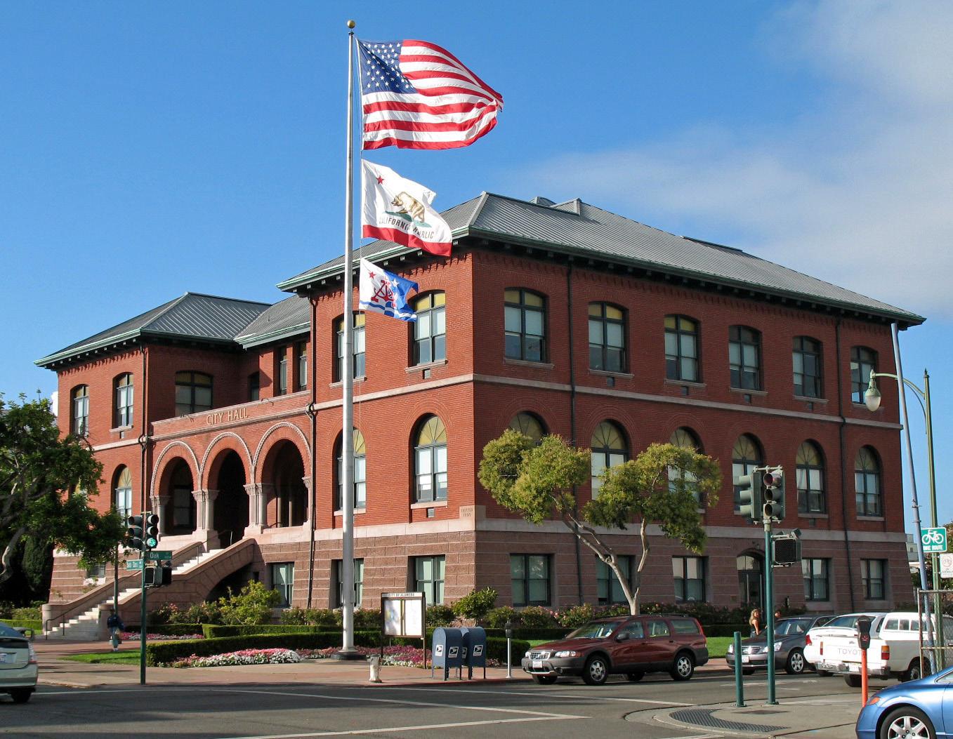 Alameda city overview — City Hall
Alameda (Harbor Bay)
Harbor Bay is Alameda’s ferry landing on Bay Farm Island, a different location from Main Street Alameda and Seaplane Lagoon. The terminal serves a waterfront neighbourhood and the nearby business area. Its setting suits a shoreline walk with views across San Francisco Bay, rather than arriving straight into Alameda’s historic shopping streets.
Read the field guideAlameda
Alameda offers a quieter East Bay counterpoint to San Francisco: historic shopping streets, a long bayside beach and the former naval air station at Alameda Point. This is the city in San Francisco Bay, not a neighbourhood of Long Beach. Its waterfront attractions are spread across the island, so choose the part you want to explore before selecting a ferry terminal.
Read the field guide
Anacortes
Anacortes is a town on road-connected Fidalgo Island, with a working waterfront and enough forest, coastal viewpoints and local history to justify a stay before a San Juan Islands sailing. Commercial Avenue gives visitors a useful town centre, while Cap Sante rises above the marina and Washington Park opens onto the island channels farther west.
Read the field guide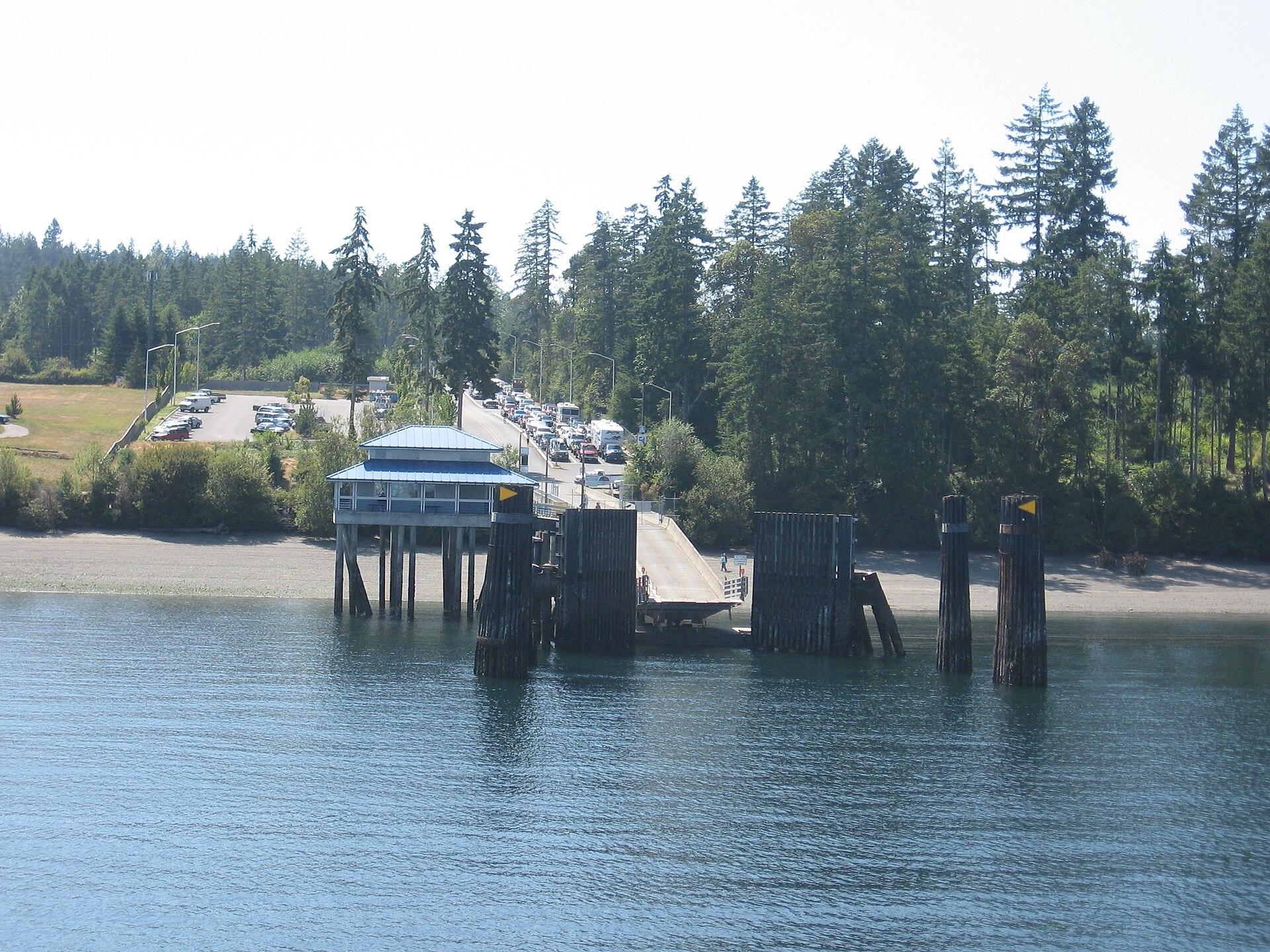
Anderson Island
Anderson Island is a wooded residential island in southern Puget Sound, reached by Pierce County ferry from Steilacoom. Its best reasons to visit are forest paths, saltwater coves and the Johnson Farm’s rural history. Plan a few distinct stops with transport between them; this is not a compact resort town gathered around the ferry dock.
Read the field guide
Atlantic Highlands
Atlantic Highlands combines a working marina with a walkable First Avenue centre and wooded hills above Sandy Hook Bay. It suits a slower shore day: watch the harbour, choose a section of the bayside trail, then head up to a viewpoint if you have transport and energy for the climb.
Read the field guide Area near Atlantique
Atlantique
Atlantique brings together a small Fire Island residential community, a substantial public marina and a short connection between Great South Bay and the Atlantic. It suits visitors whose day revolves around a boat, the beach and unhurried outdoor time. The marina and the houses are related parts of the destination, but they have different access and overnight arrangements.
Read the field guide
Avalon
Avalon is Catalina Island’s principal town, a compact harbour settlement with a curved waterfront, small public beaches and hills rising behind the streets. It is the right island base for visitors who want museums, restaurants and an evening promenade alongside time on the water. Two Harbors, on Catalina’s western end, is a different destination rather than another Avalon neighbourhood.
Read the field guide
Bainbridge Island
Bainbridge Island pairs a ferry-linked town centre with wooded roads, gardens and shores on Puget Sound. Winslow is the natural starting point for a car-free visit: shops, food and the art museum sit close to the Seattle ferry arrival. The rest of the island is more dispersed, with a different pace from the busy crossing.
Read the field guide
Bar Harbor
Bar Harbor combines a working waterfront, a compact town centre and ready access to the landscapes of Acadia on Mount Desert Island. It is a good base for a trip that alternates forest and mountain outings with museums, seafood and a walk above Frenchman Bay. The town is larger than its downtown streets, so accommodation addresses matter.
Read the field guide
Bay Shore, New York
Bay Shore sits on Long Island's mainland South Shore, facing Great South Bay and the western communities of Fire Island. Its Main Street dining scene and restored performance venue make it useful for more than a hurried transfer. A walk along Maple Avenue also brings local history into a route many visitors know only as the way to the ferry.
Read the field guide
Bayside Marketplace, Miami
Bayside Marketplace combines waterfront views, shops, restaurants and boat-tour departures in Downtown Miami. It is a lively marina-side stop for a meal, shopping or a trip across Biscayne Bay, with the city skyline around you rather than a swimming beach.
Read the field guide
Beaufort
Beaufort in North Carolina combines a historic waterfront with the tidal islands of the Rachel Carson Reserve just across Taylor's Creek. Front Street makes a practical centre for a day of maritime history, a boat outing and a seafood meal. It is a town visit and a nature trip in close proximity, not one continuous beach resort.
Read the field guide Area near Belford (Middletown), New Jersey
Belford (Middletown), New Jersey
Belford is a practical Bayshore arrival in Middletown, with a ferry terminal, seafood trade and nearby marsh-and-bay landscapes. It works best as the starting point for a small Monmouth County itinerary, combining a meal with a coastal stop or a garden visit inland.
Read the field guide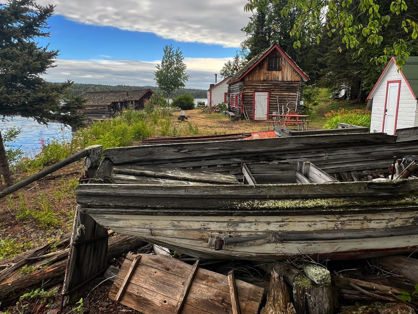 Isle Royale National Park area overview
Belle Isle (Isle Royale)
Belle Isle is an island and boat-in camping destination in the Isle Royale National Park network on Lake Superior, Michigan. Its appeal is a quiet stay beside the water, with the journey and the practicalities of island camping forming part of the experience. Choose it for an independently prepared overnight visit, with transport, food and camping arrangements settled before departure.
Read the field guide Area near Bellevue, Talbot County, Maryland (Oxford–Bellevue Ferry landing)
Bellevue, Talbot County, Maryland (Oxford–Bellevue Ferry landing)
Bellevue is a small waterfront community in Talbot County, Maryland, reached along Bellevue Road or by the seasonal ferry from Oxford. Its appeal is the Tred Avon setting and an African American community history that is easy to miss if the landing is treated only as a shortcut.
Read the field guideBeaufort, NC — mainland gateway townBird Shoal Beach
Bird Shoal is a sandy part of the Rachel Carson Reserve near Beaufort, North Carolina, facing the waters around Beaufort Inlet. It suits a self-sufficient day of beach walking, bird observation and time beside the water, reached by boat rather than by road.
Read the field guide Area near Blaine
Blaine
Blaine is Washington’s small waterfront city beside the Canadian border, where the Peace Arch, a working fishing harbour and a walkable downtown make a worthwhile stop beyond the highway. Its setting faces Drayton Harbor and Semiahmoo Bay, with mountain views when the weather clears. Allow time to leave the border-bound traffic and enjoy the shoreline at a slower pace.
Read the field guide
Block Island
Block Island's signature landscapes include the Mohegan Bluffs, two very different lighthouses, protected open space and broad beaches. Old Harbor gives an easy first taste of the island through waterfront buildings, small shops and food stops, while inland lanes lead to ponds, rolling ground and walking preserves. A full visit should leave time beyond the ferry-to-beach circuit.
Read the field guide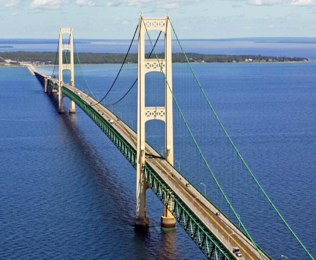 Straits of Mackinac overview — Mackinac Bridge
Bois Blanc Island
Bois Blanc Island lies in Michigan’s Straits of Mackinac, with wooded roads, Lake Huron shores and a small resident community around Pointe aux Pins. Locally its name is pronounced roughly “Bob-low.” The appeal is a quiet nature stay, with the mainland ferry journey setting a slower pace before you arrive.
Read the field guide Area near The Tall Ship — East Boston
The Tall Ship — East Boston
The Tall Ship is a particular floating hospitality venue on Pier One in East Boston, at 1 East Pier Drive. It is not the Sail Boston festival, a general tall-ships sightseeing circuit or an overnight sailing vessel. The attraction is the moored ship and its waterfront setting, with the city skyline across the harbour.
Read the field guide Boston area overview
Boston waterfront
Boston's waterfront links historic downtown piers, commuter boats and the newer Seaport through a varied harbour itinerary. This guide covers the shoreline around Rowes Wharf, Sargent's Wharf and Fan Pier as separate places, not a single interchangeable terminal. A walk can connect museums, a seafood meal and views, provided the actual boarding point remains clear.
Read the field guideBoston
Boston combines a historic walking city with working harbour districts, major art museums and neighbourhoods that reward separate outings. A first visit can link the Freedom Trail, North End and downtown waterfront, then leave another day for Back Bay and the Museum of Fine Arts. Trying to fit every district into one ferry stop makes the city feel smaller on a map than it is on foot.
Read the field guide
Bradenton Beach
Bradenton Beach occupies the southern part of Anna Maria Island, with Gulf beaches on one side and a bay-facing pier and restaurants on the other. Bridge Street provides a compact centre for a ferry arrival, a meal and browsing local shops before walking toward the coast.
Read the field guide
Bradenton
Bradenton's downtown faces the Manatee River, with a public Riverwalk, a science museum and restaurants clustered near the waterfront. It offers a mainland base for culture and nature as well as a ferry departure toward Anna Maria Island.
Read the field guide
Bremerton
Bremerton is a working waterfront city on the Kitsap Peninsula, shaped by the naval shipyard and the water routes across Puget Sound. Arriving near the boardwalk puts maritime history, public spaces and downtown food within a compact first outing. The city offers more than a place to change ferries.
Read the field guide
Bridgeport
Bridgeport combines a working Long Island Sound waterfront with public art, science attractions and a substantial coastal park. Its ferry terminal is close to the railway and downtown streets, making a cultural stop possible between journeys. Yet the zoo, Discovery science centre and Black Rock neighbourhood are separate outings rather than sights clustered beside the boat.
Read the field guide
Camden Waterfront
Camden's Delaware River waterfront brings together a museum battleship, an aquarium and open views towards Philadelphia. It is a focused day-trip district rather than an ocean resort: choose a main attraction, leave time for the promenade and keep the river crossing separate from your admission plans.
Read the field guideBeaufort, NC — mainland gateway townCarrot Island & Beaufort
Carrot Island is part of the Rachel Carson Reserve across Taylor's Creek from Beaufort, North Carolina. Salt marsh, shrub thickets and tidal water replace the town's shops and historic houses almost immediately after leaving the waterfront. Come for a careful nature visit, with the mainland as your base.
Read the field guide Area overview: Catawba Island area
Catawba Island Dock
Catawba Island Dock is the mainland Miller Ferry terminal at the northern end of Ohio Route 53. It is a transport gateway within the Catawba area, not a separate offshore island destination. A Port Clinton postal address does not place it at downtown Port Clinton’s waterfront.
Read the field guide Sandusky area overview
Cedar Point / Sandusky
Cedar Point is the amusement-park and resort peninsula beside Sandusky, with roller coasters on one side of the experience and a long Lake Erie beach on the other. Its lakeside setting gives a park visit a holiday character: a beach break or an overnight stay can change the pace of a ride-focused day.
Read the field guide Area overview: Charleston Harbor region
Charleston
Charleston combines a compact historic waterfront with a much wider harbour landscape. Around the French Quarter, a walking day can connect old streets, museums, galleries and the water; Daniel Island and Mount Pleasant need their own transport plan. Choose a base and a small cluster of visits before adding a boat journey.
Read the field guide Area near Cheboygan
Cheboygan
Cheboygan stands where its river reaches Lake Huron, combining a working port with a small downtown and access to northern Michigan’s inland lakes. It is the mainland departure point for Bois Blanc Island, but also a worthwhile base for river walks, local culture and short nature outings.
Read the field guide
Chelan
Chelan is the lively town at the lower end of its long mountain lake, with an older shopping centre, accessible public beaches and a landscape of orchards and vineyards. It works well as a base for relaxed lake days and more deliberate journeys into the surrounding valley. Start by distinguishing the town from the much larger Lake Chelan region: a lakeside address can be far from downtown.
Read the field guide
Clinton, Whidbey Island
Clinton is the southern ferry gateway to Whidbey Island, with a small waterfront arrival area, shops uphill on State Route 525 and a much wider rural hinterland. Its appeal lies in slowing down after the crossing: a beach pause, locally made food, a farm stop or a woodland walk can turn the landing into part of the holiday.
Read the field guide
Coupeville, Whidbey Island
Coupeville is the historic Penn Cove town at the heart of Ebey’s Landing National Historical Reserve. Its compact waterfront, old commercial buildings and public wharf make a gentle base for exploring Central Whidbey. The surrounding reserve adds working farms, coastal bluffs and military landscapes, so the town can anchor more than a quick ferry stop.
Read the field guide
Cumberland Island National Seashore
Cumberland Island National Seashore is a boat-access coastal landscape of maritime forest, salt marsh, dunes and long Atlantic beaches off southern Georgia. A first visit usually works best around the southern landings, with time for both natural habitats and the Dungeness historic district. Arrive prepared to walk and carry the day's supplies.
Read the field guide
Dana Point Harbor
Dana Point Harbor sits beneath the coastal bluffs of southern Orange County, combining marinas, public waterfront space and departure points for Catalina and marine-life excursions. It is a mainland harbour within Dana Point, not an island destination. A good visit links time by the boats with nearby beaches or a walk above the coastline.
Read the field guide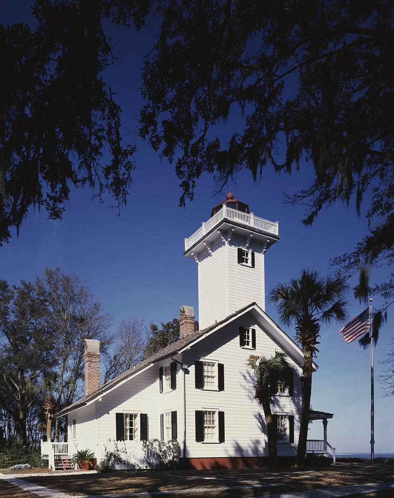
Daufuskie Island
Daufuskie Island's character comes from its maritime landscape, Gullah heritage, historic sites, artists and beaches. There is no bridge to the mainland, so arrival is part of the experience. Plan transport, food and return passage before setting out rather than expecting a conventional resort town after the boat lands.
Read the field guide
Dauphin Island
Dauphin Island is an Alabama barrier island at the western entrance to Mobile Bay, with a small-town centre, Gulf shoreline and a strong maritime identity. Its eastern end groups the ferry, Fort Gaines and the Alabama Aquarium, while beaches and residential areas extend farther west.
Read the field guide
Edgartown
Edgartown is a harbour town on the eastern side of Martha's Vineyard, with a compact historic centre, maritime architecture and a distinctly different setting from the island's ferry gateway at Vineyard Haven. Main Street, the waterfront and the lighthouse shore make a rewarding walking circuit; the town also reaches beyond its centre towards Katama's open Atlantic coast.
Read the field guide
Edmonds
Edmonds sits on the eastern shore of Puget Sound, with a ferry landing, railway station and walkable arts-and-shopping centre close together. It makes a rewarding stop in its own right: spend time with Northwest art, shore habitats and a meal downtown rather than treating the town only as a queue for Kingston.
Read the field guide
Fair Harbor
Fair Harbor combines a compact bayfront shopping area with residential walks and an Atlantic beach on western Fire Island. The ferry dock is also a natural place to watch the evening light across Great South Bay. It offers a useful balance for a beach stay: supplies and a meal close at hand, without the larger commercial centre of Ocean Beach.
Read the field guide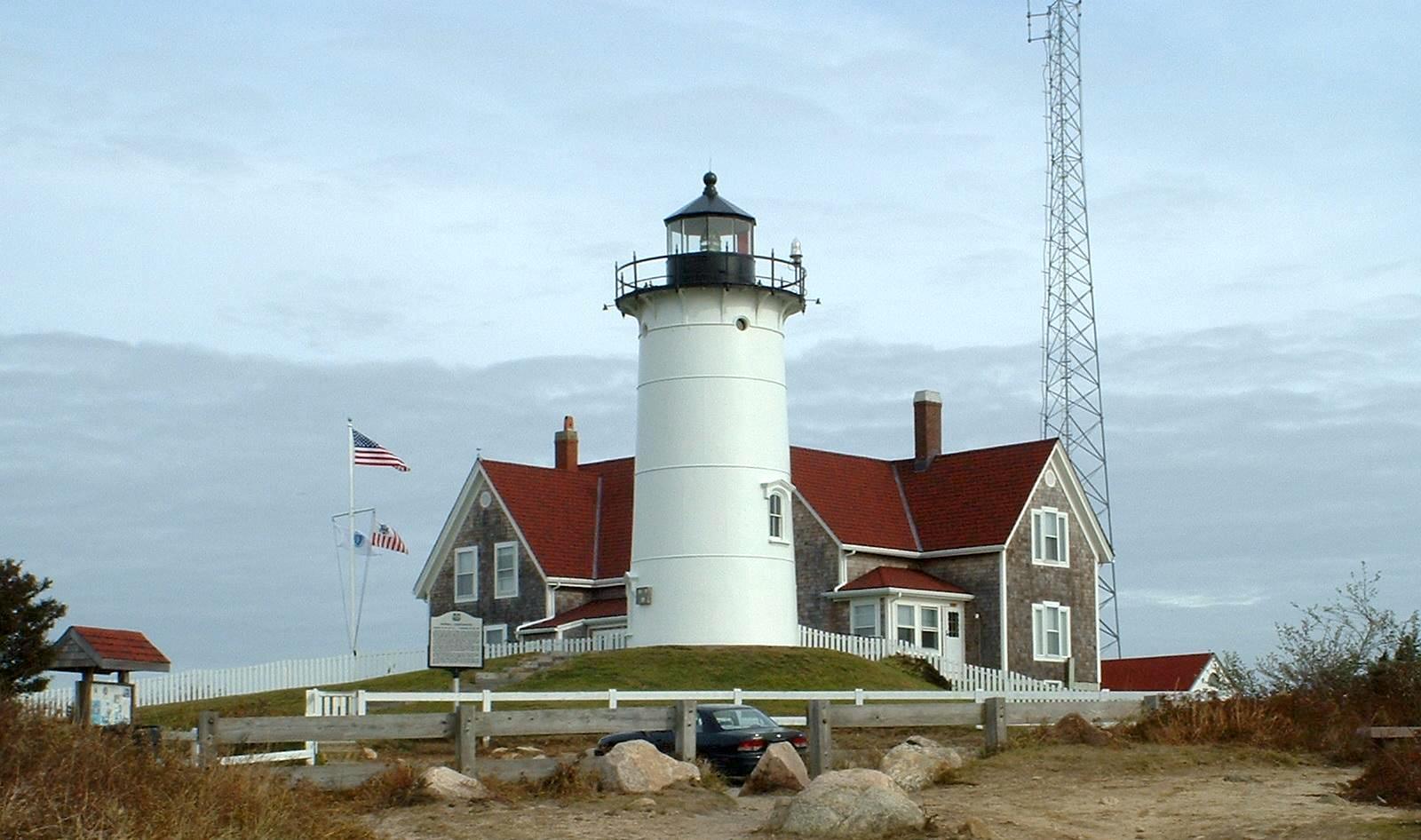
Falmouth
Falmouth is a mainland Cape Cod town with eight villages, a walkable Main Street, beach districts and a strong maritime and scientific identity. Its centre and Village Green suit a history-and-food day; Woods Hole, North Falmouth and the other villages add separate coast and countryside outings. A Falmouth address can cover much more ground than the compact shopping centre suggests.
Read the field guide Area near Fire Island / Dunewood
Fire Island / Dunewood
Dunewood is a small residential community on Fire Island, between Fair Harbor and Lonelyville. Its character comes from houses, sailing and the two shores of the barrier island rather than a shopping street. The island association describes a ninety-nine-home neighbourhood developed by Murray Barbash, with no commercially zoned property.
Read the field guide
Fort George Island
Fort George Island combines maritime forest, tidal scenery and difficult chapters of Florida history near the mouth of the St. Johns River. Ribault Club and Kingsley Plantation provide different ways into that history, from a twentieth-century resort landscape to the lives of enslaved people and plantation owners.
Read the field guide
Fort Lauderdale
Fort Lauderdale combines a beach city with a major cruise and ferry gateway. Its visitor core links the ocean promenade, Las Olas Boulevard, Riverwalk and the New River, offering different ways to spend a day beyond a ship or airport transfer.
Read the field guide Area near Fort Morgan
Fort Morgan
Fort Morgan occupies the long Alabama peninsula between Mobile Bay and the Gulf coast, west of Gulf Shores. The name refers both to the historic fort near its tip and the wider beach community along Highway 180. A holiday address on the peninsula is therefore not necessarily beside the fort or ferry dock.
Read the field guide
Friday Harbor
Friday Harbor is the walkable ferry town on San Juan Island, with a harbourfront, small shops and museums close enough to explore after arriving on foot. It is a useful base for a first island visit because meals and accommodation are concentrated near the landing, while countryside and exposed coastal viewpoints can be added as separate outings.
Read the field guide
Gee's Bend
Gee's Bend, also known as Boykin, is a rural Alabama River community whose quiltmakers have made an important contribution to American art. Its patchwork traditions belong to families, working artists and the history of Black life in Alabama; this is a living community rather than a single museum complex.
Read the field guide Area near Georges Island / Boston
Georges Island / Boston
Georges Island is the Boston Harbor island dominated by Fort Warren, a granite coastal fort overlooking important approaches to the city. The boat journey places Boston's waterfront in a wider setting of channels and islands. This is a destination for military history, harbour views and a picnic, not a city neighbourhood or a beach resort.
Read the field guide
Governors Island
Governors Island places lawns, former military buildings and harbour views a short ferry crossing from Lower Manhattan. The Lenape knew it as Paggank, or Nut Island; later Army and Coast Guard occupation shaped the historic buildings that now sit beside public landscapes and cultural spaces.
Read the field guide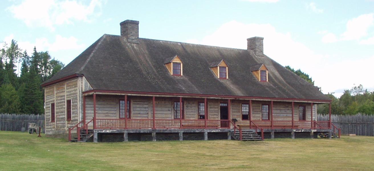
Grand Portage
Grand Portage sits beside Lake Superior in northeastern Minnesota, within the homeland and contemporary community of the Grand Portage Band of Lake Superior Chippewa. Its shoreline monument tells a story of Anishinaabe knowledge, canoe travel and the fur trade; the community deserves time beyond a hurried ferry check-in.
Read the field guide
Great Cranberry Island
Great Cranberry Island lies off Mount Desert Island, with a year-round community whose daily life continues beyond the summer visitor season. The town dock opens onto Cranberry Road, leading past homes and community buildings towards woodland and shore paths. This is an inhabited island for unhurried exploration, not an extension of Acadia's road loop.
Read the field guide
Greenpoint
Greenpoint is Brooklyn's northern waterfront neighbourhood, where Polish food traditions, residential streets and an industrial past sit alongside new riverfront buildings. It rewards a slower visit than a quick ferry photograph: walk inland from India Street to see shops, churches and the varied architecture of the older streets.
Read the field guide
Haines
Haines brings a small waterfront town together with the broad Chilkat Valley and the mountain scenery of northern Lynn Canal. It is a useful place to slow down: local museums, the former military district and a harbour walk can fill a day before you add river wildlife or a longer trail. Unlike many Southeast Alaska ports, it also connects to the continental road network.
Read the field guide
Highlands
Highlands sits where the hills of the Navesink shore meet Sandy Hook Bay. Its appeal is the contrast between a low waterfront of boats and seafood restaurants and the lighthouse and woodland above. Combine a short harbour visit with one larger outing, rather than treating the hills and Sandy Hook as steps from the ferry.
Read the field guide
Hilton Head Island
Hilton Head Island combines Atlantic beaches, salt-marsh waterways and a network of leisure paths with established resort neighbourhoods. It works well as a base for cycling, a beach holiday or a more varied Lowcountry visit. Leave room for its cultural and natural history alongside time by the sea.
Read the field guide
Hingham
Hingham combines a historic South Shore town centre with a harbour, a redeveloped shipyard and coastal conservation landscapes. A ferry arrival is a useful beginning, but the terminal at Hewitts Cove is not the same place as the old Main Street centre. Build the day around a few connected stops rather than assuming everything is beside the landing.
Read the field guide Area overview: Prince of Wales Island, Alaska
Hollis
Hollis is the quiet ferry gateway on the eastern side of Prince of Wales Island, with its terminal in Clark Bay on Twelve Mile Arm. It is a small residential community with a mining and logging history, rather than a compact resort town. Forest, river and sheltered-water scenery form the setting for an arrival that often continues elsewhere on the island.
Read the field guide Area near Homer
Homer
Homer faces Kachemak Bay from the southwestern Kenai Peninsula, with mountains across the water and a long spit reaching out from the town. Fishing remains central to its identity, but this is also a place for art, gardens and coastal natural history. Give the town itself some time before treating it only as a departure point for a boat trip.
Read the field guide Area near Hunters Point South / Long Island City
Hunters Point South / Long Island City
Hunters Point South is the southern waterfront of Long Island City in Queens, facing Midtown Manhattan across the East River. Its parks combine reused industrial structures, tidal planting and broad skyline views, with a residential neighbourhood and contemporary art inland. This is part of New York City, not a separate excursion to the beach towns farther east on Long Island.
Read the field guide
Hyannis
Hyannis is a harbour village in Barnstable on Cape Cod's south side. Its compact centre runs from Main Street towards the waterfront, so visitors can combine shops, cafés, museums, public art and walks without treating the stop as merely a ferry transfer. Kennedy history and the working harbour give the village two distinct themes.
Read the field guideIsle Royale National Park
Isle Royale National Park is a forested archipelago in Lake Superior, belonging to Michigan but reached across open water from mainland gateways in Michigan and Minnesota. Its long central ridge, inland lakes and rocky coves reward walking and paddling rather than driving. Select the actual landing before booking: the park's name does not identify one universal passenger terminal.
Read the field guide
Islesford
Islesford is the village on Little Cranberry Island, a boat-access community off Mount Desert Island. Fishing, boatbuilding and island art give the waterfront its character. It is a different destination from Great Cranberry Island, even when both stops appear on the same ferry timetable.
Read the field guide Area near Jersey City (Warren Street waterfront)
Jersey City (Warren Street waterfront)
The Warren Street waterfront is a small Jersey City landing beside the former Morris Canal basin, with residential streets and harbour history close at hand. It is a useful starting point for a quiet walk, a meal in Paulus Hook or a crossing to Liberty State Park.
Read the field guide
Jersey City
Jersey City is a city of its own across the Hudson, with harbour landscapes, transport history and neighbourhood food traditions worth a visit beyond a Manhattan commute. Liberty State Park offers its broadest open-water views, while downtown brings restaurants, markets and streets that feel different from the great lawns.
Read the field guide
Kelleys Island
Kelleys Island combines a small southern village with an unusually visible geological past. Glacial grooves, limestone quarries and shoreline rock formations help explain how this Ohio island in western Lake Erie took shape. Historic houses and the island museum add a human story of quarrying, shipping and winemaking.
Read the field guide
Ketchikan
Ketchikan is an island city shaped by fishing, rainforest and the living cultures of Southeast Alaska. Its busiest waterfront faces the Tongass Narrows, with homes climbing the slopes behind it and Creek Street’s wooden buildings standing over the creek. Indigenous art and the working harbour deserve as much attention as the familiar waterfront photograph.
Read the field guide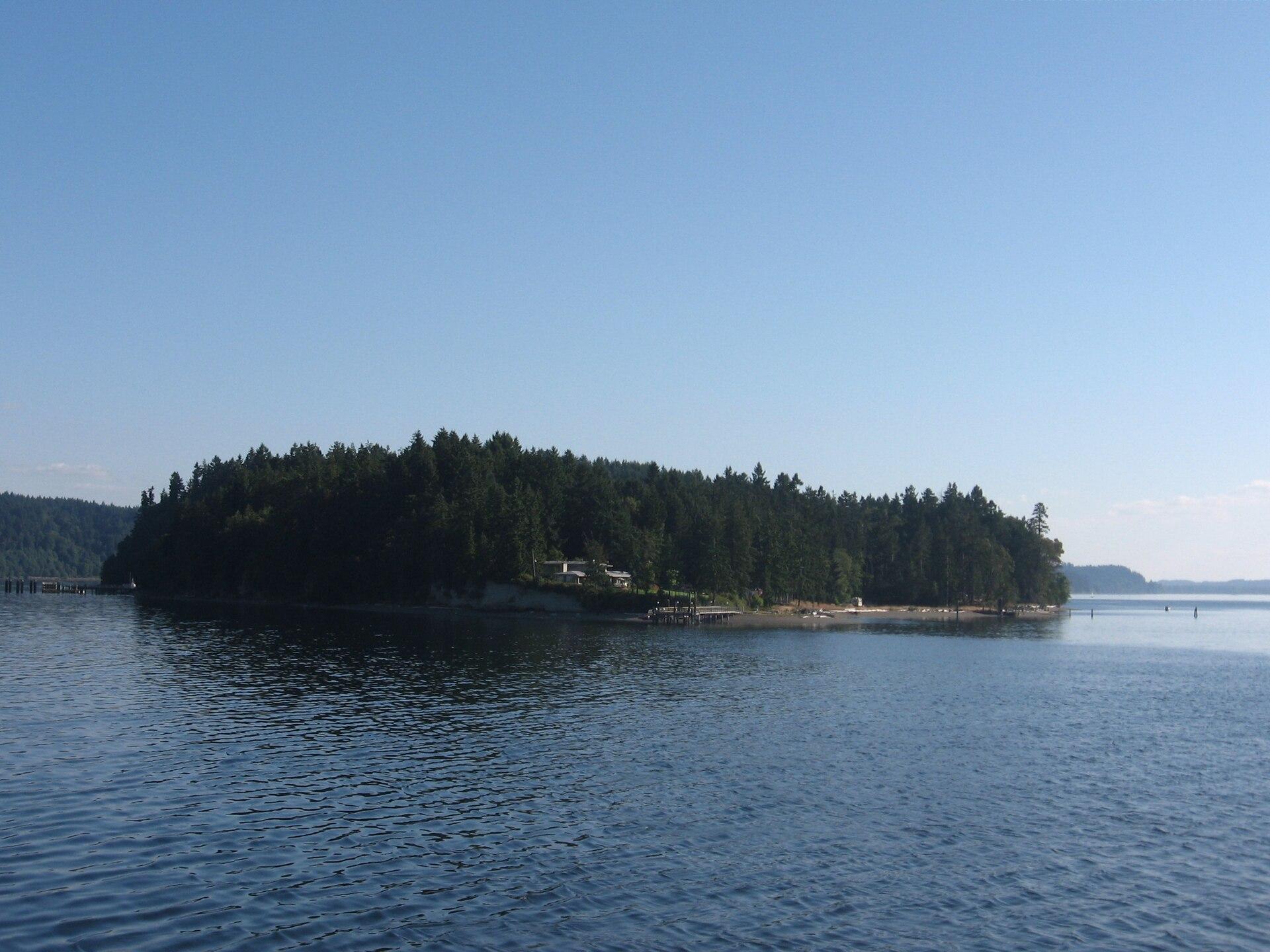
Ketron Island
Ketron is a small, mostly wooded island off Steilacoom in southern Puget Sound. Pierce County describes a sparse residential community concentrated toward its northern end. Its ferry connection is valuable transport for residents and their visitors, but a stop on the route does not make the island a developed sightseeing destination.
Read the field guide
Kingston
Kingston is a small harbour town on Appletree Cove and a useful eastern gateway to the Kitsap Peninsula. Its waterfront combines a working ferry landing, a marina and Mike Wallace Park. A short visit can centre on the shore and downtown shops; longer stays open up the wooded northern peninsula.
Read the field guide Area near Kismet
Kismet
Kismet is Fire Island's westernmost community, beside the national seashore's lighthouse tract and across Great South Bay from Bay Shore. Its small bayfront commercial area gives way to residential walks and the Atlantic beach. A visit can combine a meal near the ferry dock, time on the sand and a separate walk towards the lighthouse.
Read the field guide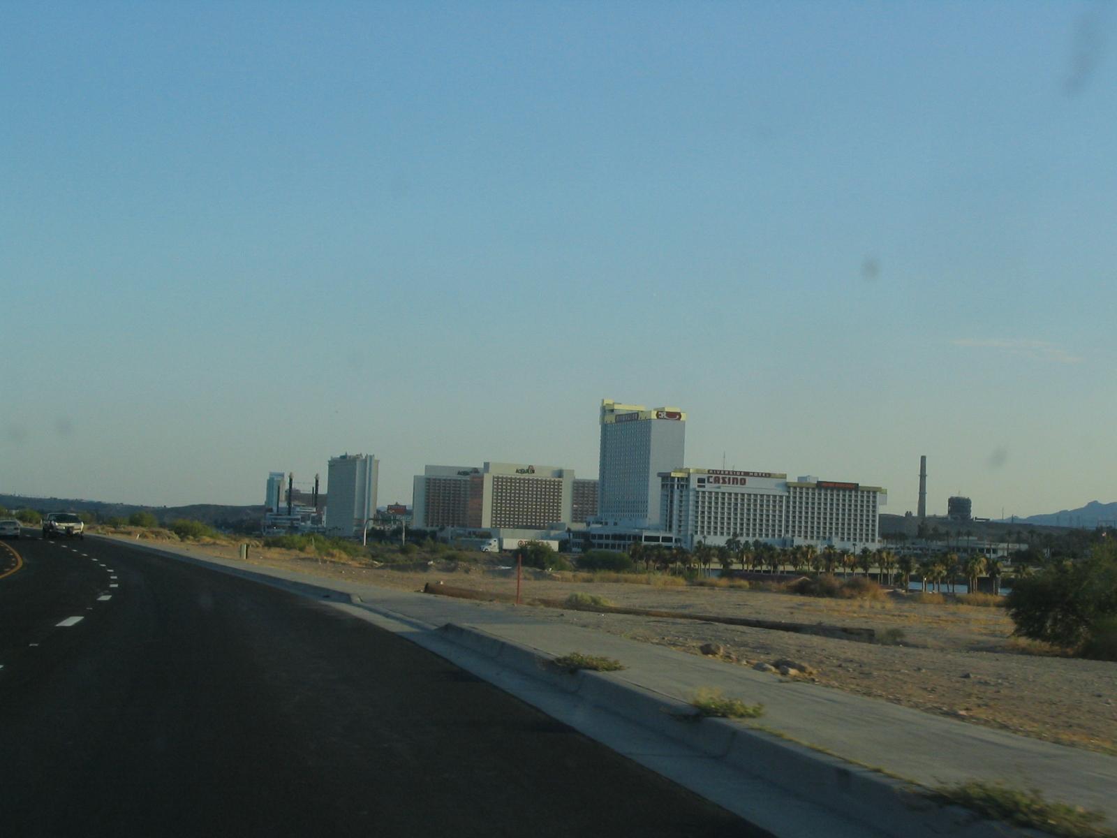
Laughlin, Nevada (The New Pioneer)
The New Pioneer is a particular riverfront hotel and water-taxi stop in Laughlin, Nevada, at 2200 South Casino Drive. Its western-themed buildings and River Rick neon cowboy help distinguish it from the other properties along the Colorado River. This guide concerns that specific stop and its immediate visitor setting, rather than a separate town called Pioneer.
Read the field guideLaughlin
Laughlin occupies the Nevada bank of the Colorado River, facing Bullhead City in Arizona near the meeting point with California. Its visitor centre is the resort corridor along Casino Drive, where river views, restaurants and entertainment sit against the Mojave Desert landscape.
Read the field guide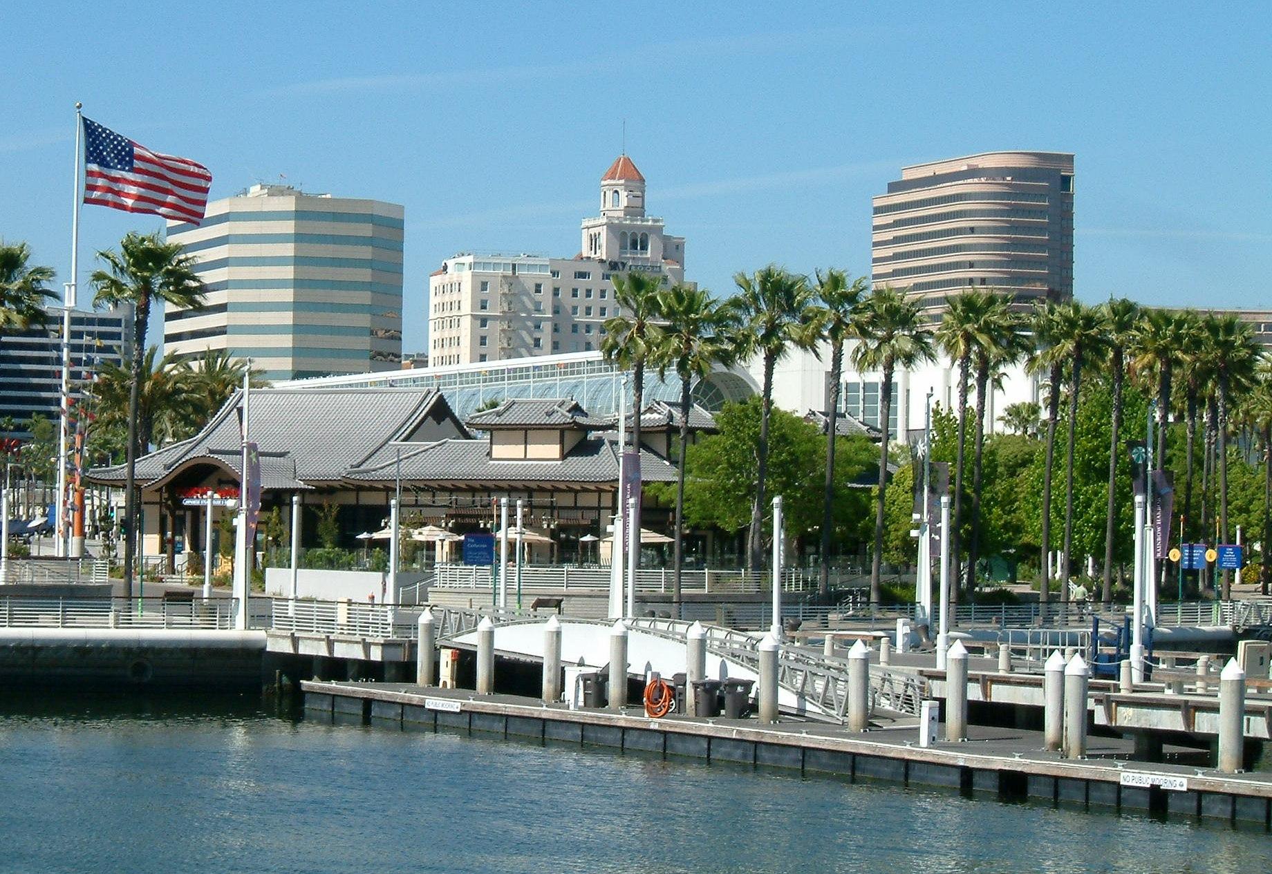
Long Beach
Long Beach combines a working Pacific port with an urban waterfront, art museums and neighbourhoods that deserve time beyond a ferry connection. The aquarium and Queen Mary are major landmarks, but Cambodia Town, Belmont Shore and Naples reveal different sides of the city. San Pedro and the Port of Los Angeles are nearby, yet their terminals are separate.
Read the field guide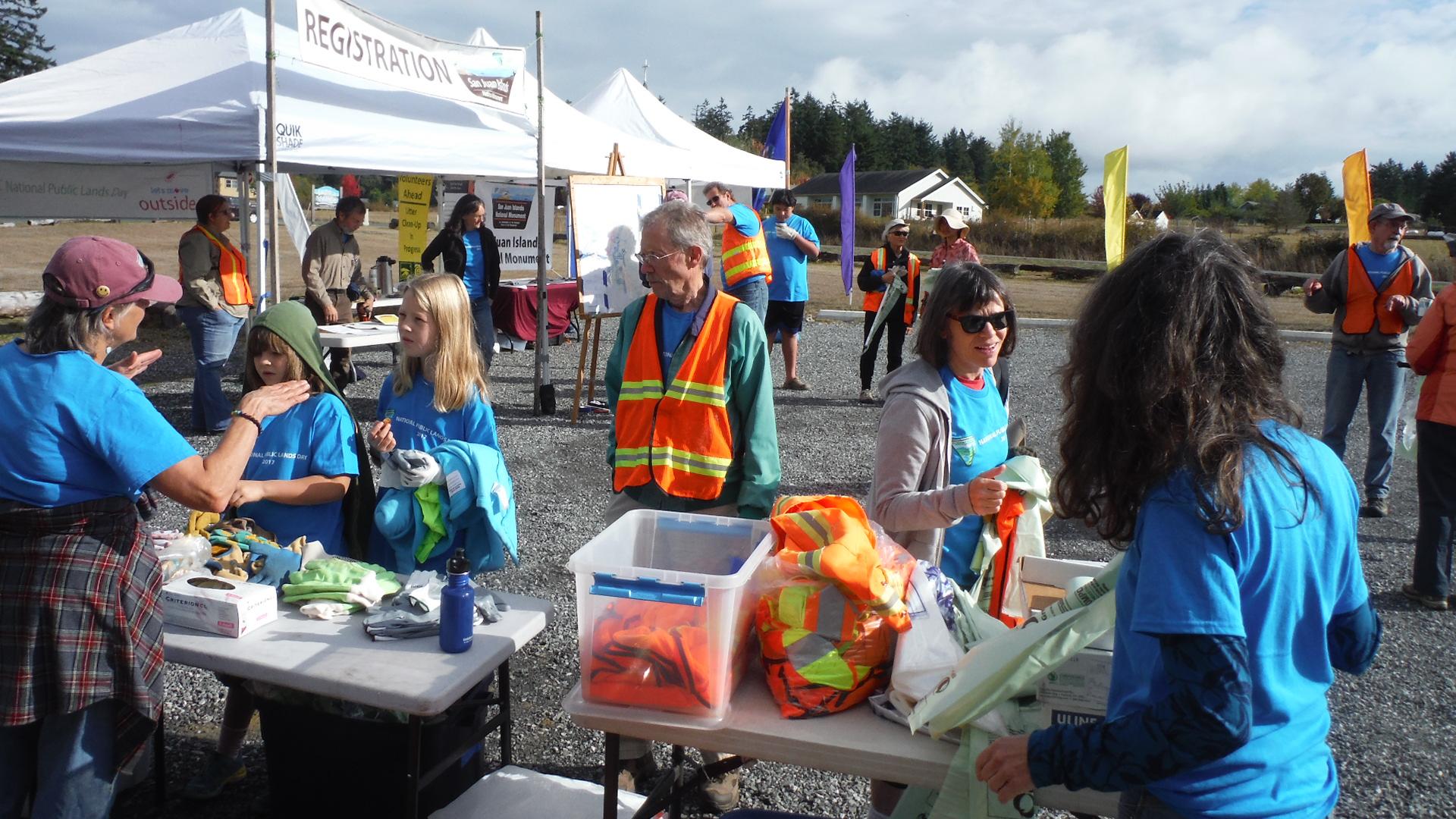
Lopez Island
Lopez Island combines rolling farmland, a small village on Fisherman Bay and a varied coast of beaches, wooded points and exposed bluffs. Its quieter roads attract cyclists, but this is still a rural island with distances between services. A satisfying visit can revolve around a village meal, the history museum and one coastal walk rather than trying to circle every shore in a day.
Read the field guide Area near Ludington
Ludington
Ludington combines a working Lake Michigan harbour with a walkable downtown, a broad town beach and a much larger dune landscape to the north. The cross-lake car ferry is part of its identity, but the town also makes a useful overnight stop for maritime history and relaxed waterfront walks.
Read the field guide
Maalaea
Māʻalaea combines a working boat harbour with marine-life attractions on Maui’s southern coastline. It is a useful place to understand the island’s connection to the sea: aquarium exhibits, boat departures, shoreline walks and a nearby wetland refuge offer quite different ways to spend a day. The harbour district is compact, but the wider bay is not a single walkable resort.
Read the field guideIsle Royale National Park area overviewMalone Bay
Malone Bay is a remote landing and campground on the southern shore of Isle Royale in Lake Superior. This is a forest-and-water destination for equipped walkers, paddlers and boat passengers, with no village centre, road approach or restaurant strip. The bay's role is as a backcountry stop, not a conventional ferry-port town.
Read the field guide
Manele
Mānele is the small-boat harbour and coastal arrival area on southern Lānaʻi, not the island’s main town. The neighbouring bays bring together a working landing, a public beach park and a protected marine environment. It is a good starting point for a day focused on the coast, provided you leave time for the return journey.
Read the field guide Area near Manitowoc
Manitowoc
Manitowoc sits on Lake Michigan’s western shore, where a working river mouth meets a compact downtown and a long lakeside walking route. Shipbuilding history gives the city its strongest theme, but art, Wisconsin food traditions and accessible waterfront outings make it more than a ferry stop.
Read the field guide
Martha's Vineyard (Vineyard Haven)
Martha's Vineyard is an island of distinct towns, and Vineyard Haven is the harbour village within Tisbury that provides its year-round mainland ferry gateway. It deserves more than a transfer: a working waterfront, independent shops, cultural venues and the island museum sit within a manageable local visit. Tisbury and Vineyard Haven are often used interchangeably, but the village name is not a synonym for the whole island.
Read the field guide Mayport riverfront overview — St. Johns River
Mayport Village
Mayport Village is a working fishing community near the mouth of the St. Johns River, where shrimp boats, seafood businesses and a vehicle ferry shape the waterfront. Come for a dockside meal and a close look at a maritime neighbourhood rather than expecting a long resort promenade.
Read the field guideIsle Royale National Park area overviewMccargoe Cove
McCargoe Cove cuts into Isle Royale's northern shore, bringing walkers and boat passengers into a sheltered-looking inlet surrounded by forest. Its campground and landing are gateways to the Minong Ridge and the Chickenbone Lake area. There is no road-connected settlement, shopping street or hotel district behind the dock.
Read the field guide
Metlakatla
Metlakatla is a Tsimshian community on the Annette Islands Reserve, south of Ketchikan in Alaska’s Inside Passage. Fishing and seafood processing remain part of everyday life, alongside cultural work and tourism. Visit with an interest in the people who live here: this is a self-governing community, not simply an excursion backdrop.
Read the field guide Area near Miami Beach Marina
Miami Beach Marina
Miami Beach Marina is a working boating base at 300 Alton Road, close to Government Cut and the southern end of South Beach. Its docks, waterfront restaurants and boat excursions make it useful for a half-day combining the bay side of the island with South Pointe Park and the ocean.
Read the field guide
Middle Bass Island
Middle Bass Island offers a quieter Lake Erie stay than nearby Put-in-Bay, with vineyard history, nature preserves and a marina around its southern shore. The former Lonz Winery gives the state park its distinctive landmark, while wooded island lanes lead to small protected habitats and open-water views.
Read the field guide
Monhegan Island
Monhegan lies offshore from midcoast Maine, combining a compact village with forest paths and exposed rocky headlands. Artists and a working waterfront shape its identity. The island rewards slow observation: light across the harbour, woodland details and the contrast between sheltered village lanes and the open Atlantic coast.
Read the field guide
Montauk
Montauk occupies the eastern end of Long Island's South Fork, with an ocean-facing centre, a working fishing harbour and a headland marked by its historic lighthouse. The appeal changes across these settings: beach time near downtown, boats and seafood around Lake Montauk, and walks through exposed coastal parks farther east. A harbour arrival does not place you directly at either the lighthouse or the main ocean beach.
Read the field guide Local overview of Mount Pleasant (Charleston Harbor Fish House)
Mount Pleasant (Charleston Harbor Fish House)
This destination identifies the Charleston Harbor Fish House and neighbouring resort-marina waterfront in Mount Pleasant, South Carolina. The setting looks across the harbour toward Charleston, with the USS Yorktown nearby and boat traffic passing the marina. It suits a waterfront meal, a harbour crossing or a stay on this side of the water.
Read the field guide
Mukilteo
Mukilteo combines a mainland ferry gateway with a compact historic waterfront and a separate aviation district near Paine Field. A visit can be as simple as a lighthouse-park walk and seafood meal, or as focused as an aerospace museum outing. The ferry to Clinton is one part of the town’s appeal rather than its whole identity.
Read the field guide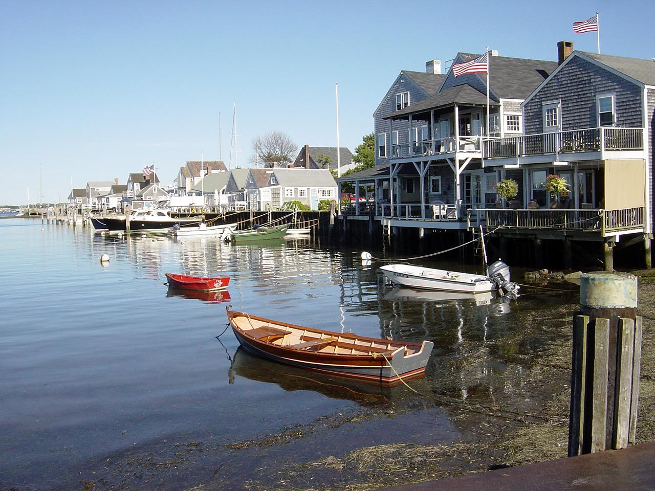
Nantucket
Nantucket works best as a place to alternate between a compact historic town and separate island excursions. The harbour brings you into a setting of museums, wharves and small streets, while the broader island offers conservation trails, beaches and the eastern village of Sconset. Choose a town day or an island day rather than treating everything as one quick waterfront walk.
Read the field guide
New Bedford
New Bedford is a working Massachusetts port with a compact historic downtown, a major whaling museum and strong Portuguese and Cape Verdean cultural connections. Its maritime story includes global trade and migration, but also abolitionism, families and the dangerous labour of seafarers. Spend time on the streets above the harbour rather than treating the city only as an island-ferry departure point.
Read the field guide
New London
New London's waterfront identity is matched by a compact cultural core of museums, restaurants and performance spaces. The Thames River shapes the city, from working ferry docks to maritime collections and the stone defences of Fort Trumbull. It is worth leaving time between connections for Bank Street and the Custom House rather than seeing the city only through a terminal window.
Read the field guideNew York City area overviewNew York City (Lower Manhattan and Brooklyn)
The Battery and Bay Ridge show two different faces of New York Harbor. At Manhattan's southern tip, garden paths surround Castle Clinton and boats leave for the Statue of Liberty. Across the harbour in Brooklyn, Bay Ridge offers a residential waterfront, community gardens and neighbourhood restaurants beyond the busiest sightseeing circuit.
Read the field guide Area near New York City / Manhattan–Brooklyn
New York City / Manhattan–Brooklyn
Wall Street and Sunset Park make a revealing harbour pairing: the financial city's historic streets on one shore, and Brooklyn's working waterfront on the other. The ferry ride connects places shaped by trade, but the neighbourhoods deserve time on foot rather than being reduced to views from a boat.
Read the field guideNew York City waterfront
Brookfield Place and Brooklyn Bridge Park's Pier 6 offer two different waterfront days: an indoor garden, food and museums on Manhattan's Hudson side, and lawns, play areas and harbour views at Brooklyn's Atlantic Avenue end. The pleasure is in choosing a modest area and spending time there, not chasing every skyline photograph in one afternoon.
Read the field guideNew York City
New York rewards a neighbourhood plan. A ferry arrival can lead to a restored carousel beneath the bridges, immigrant family histories on Orchard Street or an aircraft carrier museum beside the Hudson. Choose one of those areas as the heart of the day; the city is far larger than the skyline seen from a boat.
Read the field guide
Newport Beach
Newport Beach is an Orange County harbour-and-beach destination, with residential islands, oceanfront promenades and coastal wetlands within the same city. Its different districts reward separate visits: a peninsula beach afternoon feels quite different from a walk beside the boats on Balboa Island or birdwatching around the Back Bay.
Read the field guideNew York City area overviewNorth Williamsburg
North Williamsburg is a lively part of Brooklyn's East River waterfront, organised around the North 6th Street ferry landing, Kent Avenue and the streets leading towards Bedford Avenue. Converted industrial buildings, newer hotels, music venues and waterfront parks make it a good place to combine a city walk with an evening out.
Read the field guide
Northeast Harbor
Northeast Harbor is a village in the town of Mount Desert, on the southern side of Mount Desert Island. The marina, Main Street and hillside gardens create a compact base for shore walks, horticulture and visits to the Cranberry Isles. It is a different place from Bar Harbor and Southwest Harbor, despite the similar names.
Read the field guide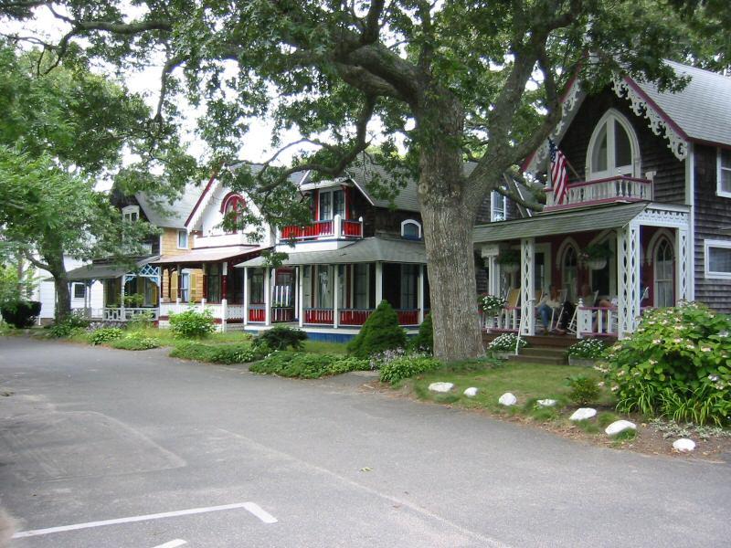
Oak Bluffs
Oak Bluffs is a distinct town on the northeast side of Martha's Vineyard, with a compact harbour, a lively commercial centre and colourful cottages around a historic religious campground. Its strongest experiences are architectural and cultural as much as beach-oriented: slow down for the cottage streets, the carousel and the town's African American heritage.
Read the field guide
Oakland
Oakland stretches from the working waterfront at Jack London Square to Lake Merritt and the wooded hills. The ferry places you in a useful waterfront district, with restaurants and public spaces nearby, but the city’s art, food and neighbourhood life extend well beyond the landing.
Read the field guide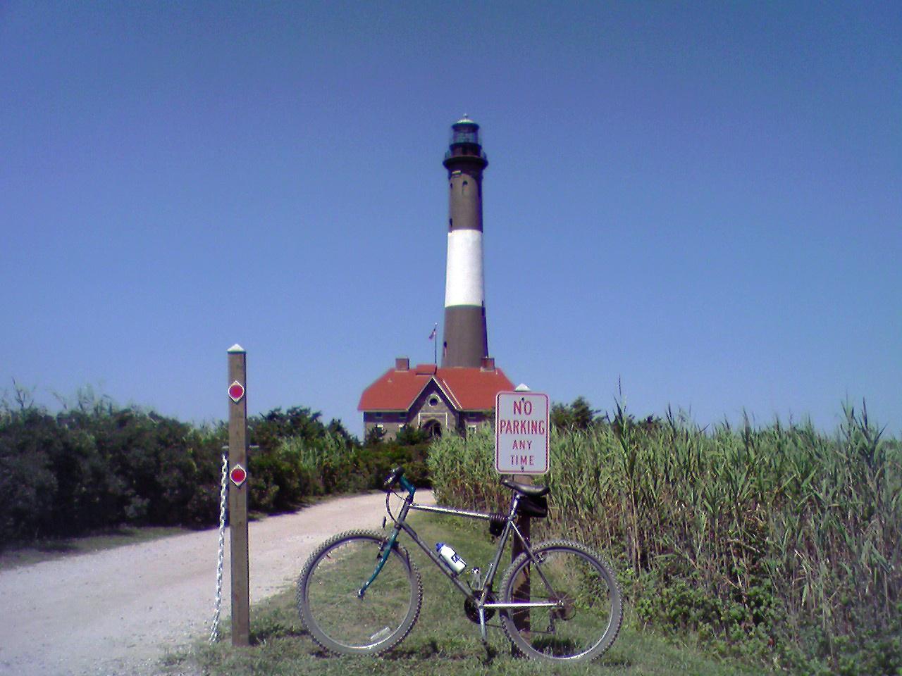 Area overview: Fire Island
Ocean Bay Park
Ocean Bay Park is a small Fire Island hamlet in the Town of Brookhaven, with residential walks running between Great South Bay and the Atlantic. Its modest Bay Walk commercial strip and summer waterfront venues give it a more social side, while family homes and returning residents remain central to the community.
Read the field guide
Ocean Beach
Ocean Beach is one of Fire Island's main visitor centres, with restaurants, small shops and places to stay around a walkable village between Great South Bay and the Atlantic. Incorporated in 1921, it combines a busy summer waterfront with residential walks leading towards the beach. It offers more services than many neighbouring communities, while retaining an arrival shaped by passenger boats.
Read the field guide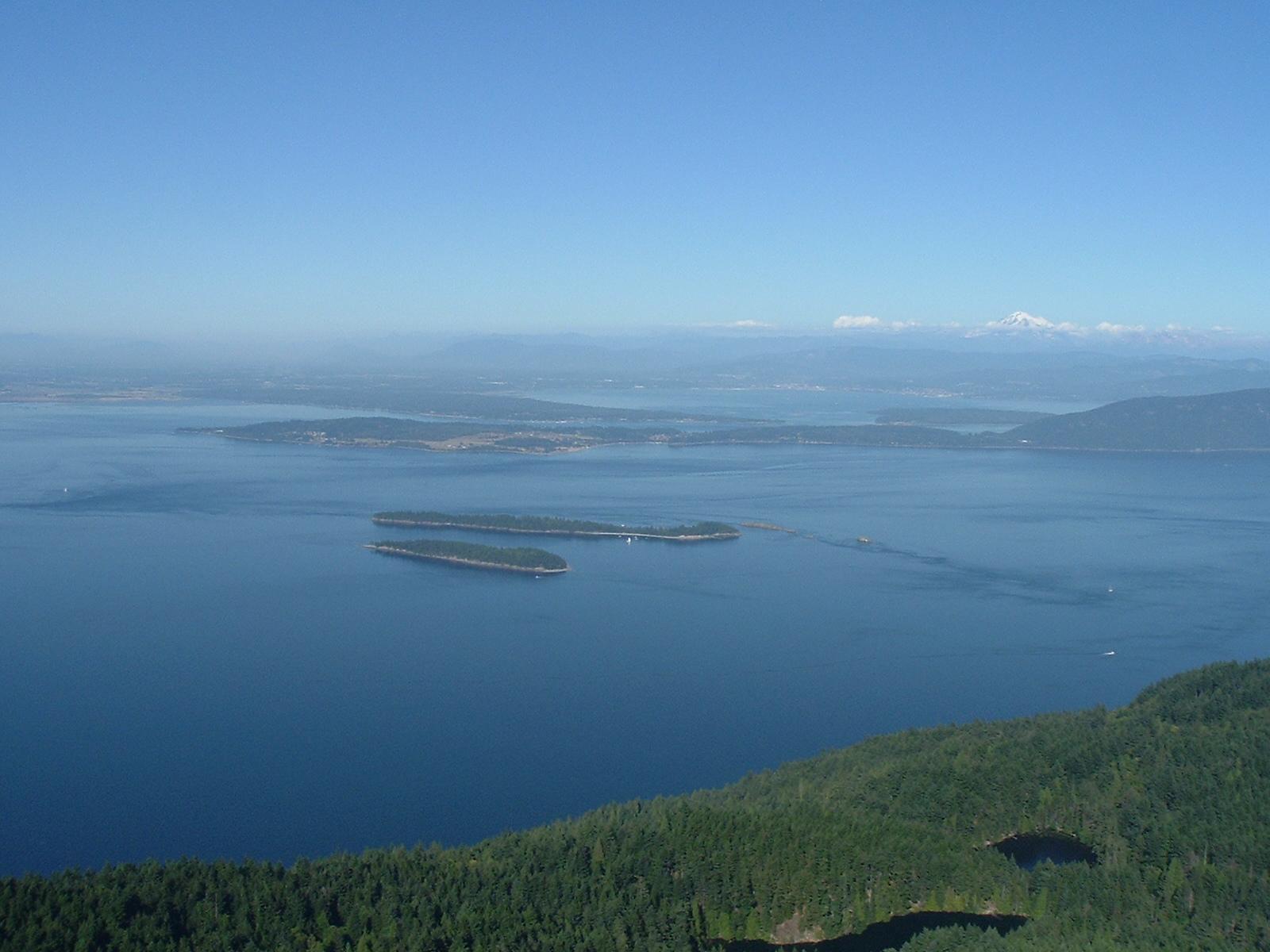
Orcas Island
Orcas Island is a hilly, horseshoe-shaped landscape of forests, lakes and scattered coastal communities. It rewards a slower visit that combines Eastsound’s shops and food with a woodland trail or a separate trip toward Olga and the eastern shore. Distances and bends matter here: a place that looks close across the water may require a much longer road journey.
Read the field guide
Oxford
Oxford is a small Maryland Eastern Shore town where the Tred Avon River, boatyards and a compact historic centre set the pace. A visit works well around a museum, a waterfront walk and a meal or picnic, with enough time to watch the river rather than hurry through a checklist.
Read the field guide
Patriot's Point
Patriots Point is a naval and maritime museum destination in Mount Pleasant, across Charleston Harbor from downtown Charleston. Its aircraft carrier and destroyer make this a substantial visit in their own right, with land exhibits adding another perspective. Plan time for the museum rather than using the name only as a ferry stop.
Read the field guide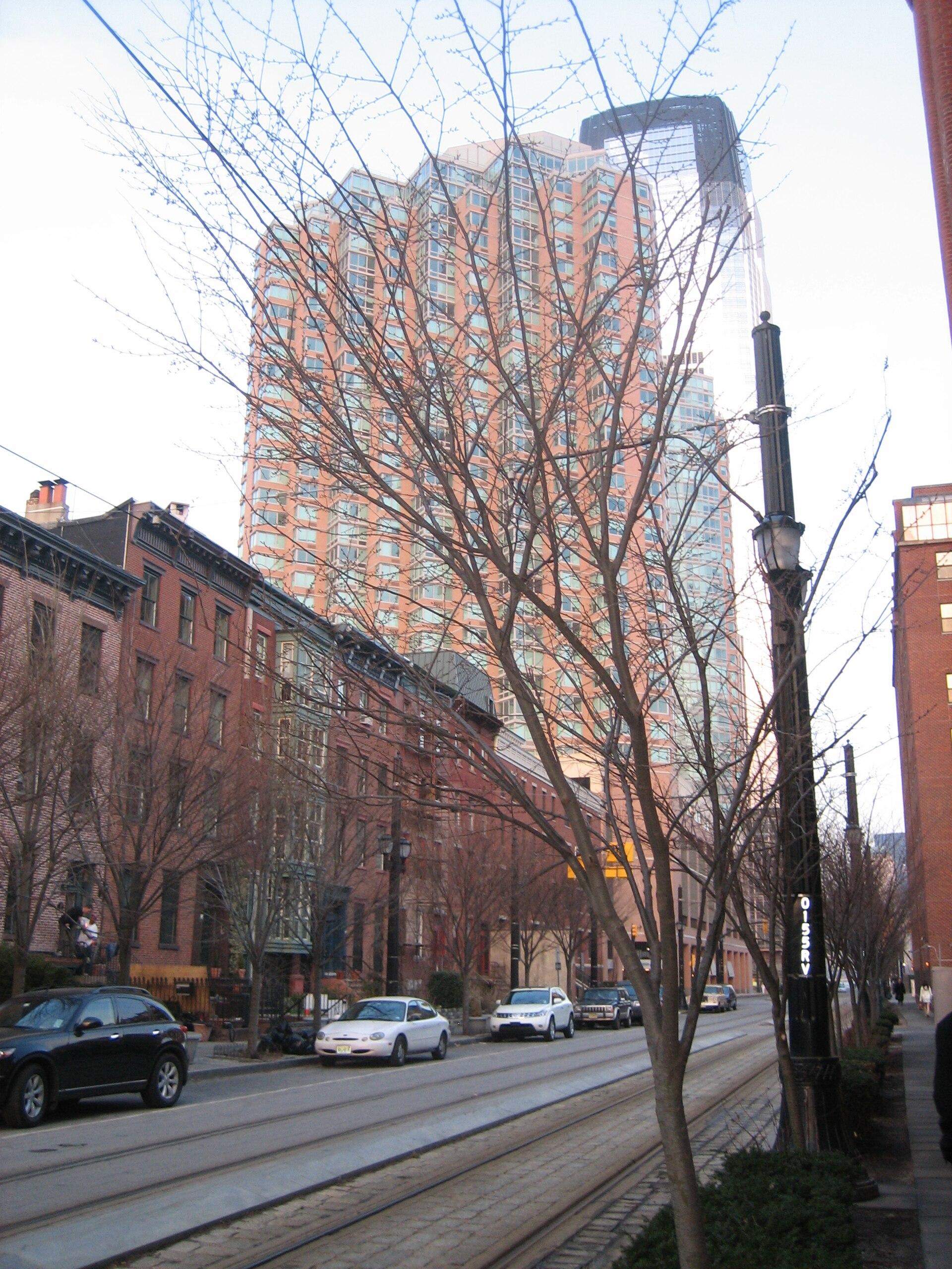
Paulus Hook
Paulus Hook offers a compact Jersey City day of nineteenth-century residential streets, small parks and an open Hudson waterfront. The Manhattan skyline is the backdrop, but the neighbourhood's own canal, railway and industrial history gives the walk its substance.
Read the field guide
Peddocks Island
Peddocks Island offers a larger, more varied landscape than a quick city waterfront stop: wooded paths, low shore connections and the remains of Fort Andrews. It lies in Hingham Bay between Hull and Quincy. A visit combines coastal nature with military and community history, including a Portuguese fishing settlement that moved within the island as the fort developed.
Read the field guide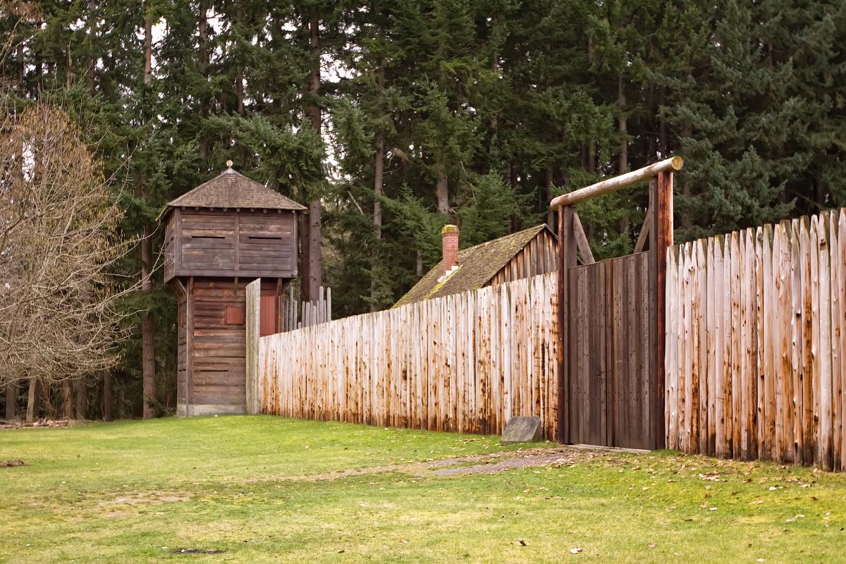 Area near Point Defiance
Point Defiance
Point Defiance is Tacoma’s wooded northern peninsula, where a ferry landing, gardens, a zoo and aquarium, historic interpretation and public shoreline sit within a much larger park landscape. It works as a destination in its own right, not simply a waiting area for the boat. Choose one major attraction and leave time for the waterfront or a forest trail.
Read the field guide
Port Angeles
Port Angeles sits between the Strait of Juan de Fuca and the Olympic Mountains, combining a working harbour, a walkable downtown and a useful base for national-park trips. Its waterfront has enough art, food and marine interpretation to deserve time of its own. A pier walk and a museum visit can make a good first afternoon before a separate day in the hills.
Read the field guide
Port Clinton
Port Clinton is a mainland Lake Erie city with a working waterfront, fishing culture and a compact historic centre. Its identity is strongly tied to walleye, marinas and island travel, but the shoreline parks, lighthouse and nearby aviation museum give it reasons to stay beyond a ferry connection.
Read the field guide Area near Port Clyde
Port Clyde
Port Clyde sits at the end of the St George Peninsula, where fishing boats, granite shore and a small ferry dock shape the visit. It is a working harbour with a maritime identity, not simply a waiting area for Monhegan. Allow time for the village and nearby Marshall Point before rushing offshore.
Read the field guide Local overview of Port Jefferson
Port Jefferson
Port Jefferson is a North Shore harbour village where shipbuilding history, a public waterfront and a working Connecticut ferry share a small centre. Main Street and the Broadway streets offer a convenient starting point for a walk, a seafood meal or an evening performance. The village is a destination in its own right rather than simply the Long Island end of a crossing.
Read the field guide
Port Townsend
Port Townsend combines a working maritime culture with a compact historic town on the northeastern Olympic Peninsula. Water Street offers waterfront buildings, shops and cafés, while Uptown adds another layer of residential streets and views. It makes a rewarding overnight stop for travellers who want museums, shore walks and local food alongside their ferry crossing.
Read the field guide Area overview: Lake Chelan
Fields Point Landing (Lake Chelan)
Fields Point Landing is a passenger-boat departure point on Lake Chelan in Washington. Its purpose is straightforward: reach the lakeshore by road, leave the car at the correct parking area and continue towards Stehekin or another confirmed upper-lake stop. The carrier gives its address as 17100 South Lakeshore Road, Chelan. The water, slopes and view up the lake make the wait part of the journey.
Read the field guide
Provincetown
Provincetown sits at the tip of Cape Cod, where a compact, expressive town meets dunes and open water. Its appeal is cultural as much as scenic: galleries, performance, LGBTQ+ history, seafood and a working waterfront share the same small centre. The museum above town and the art galleries give that identity depth beyond a beach-day visit.
Read the field guide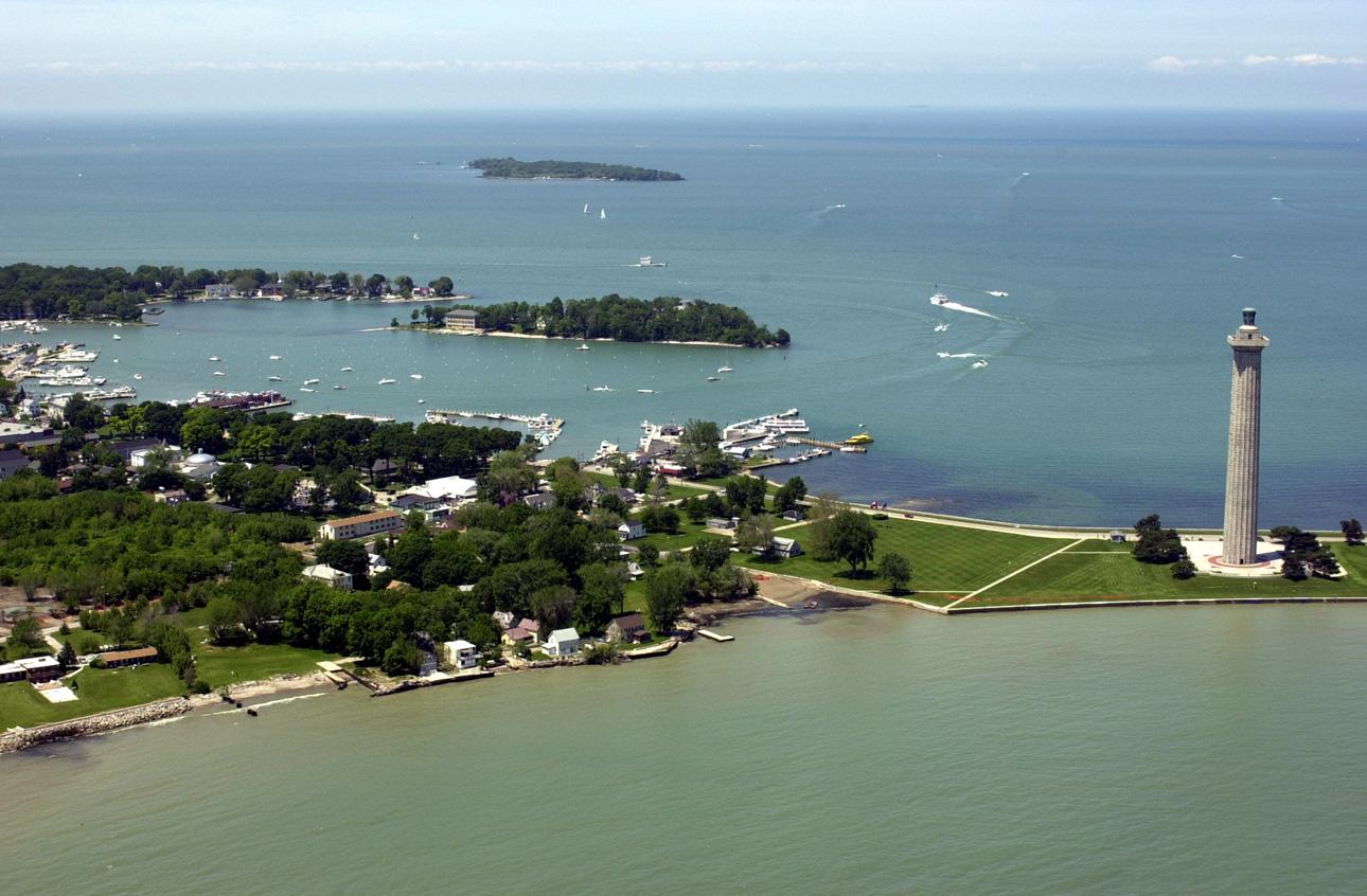
Put-in-Bay
Put-in-Bay is the lively village and harbour on South Bass Island in Lake Erie. Its summer character mixes waterfront dining, entertainment and family attractions, while quieter woods and shoreline parks lie away from the central streets. The island’s history includes winemaking and the War of 1812, not only its modern nightlife.
Read the field guide
Red Hook, Brooklyn
Red Hook is a Brooklyn waterfront neighbourhood where working docks, residential streets and former industrial buildings remain close together. Van Brunt Street provides a useful spine for food and independent businesses, while the harbour edge offers maritime history, art and views across Upper New York Bay. It rewards a few connected stops rather than a hurried ferry turnaround.
Read the field guide Area near ReelHouse, East Boston
ReelHouse, East Boston
ReelHouse East Boston is a waterfront restaurant and nearby boat landing at 6 New Street, within The Eddy apartment building. This entry covers that specific destination, not an independent town or every ReelHouse location. It suits a meal with harbour views followed by a walk through the residential waterfront.
Read the field guide Area near Richmond
Richmond
Richmond is an industrial and residential Bay city with a long shoreline. The ferry terminal at Ford Point is not the whole city: it is a gateway to the bay, while Richmond’s history and neighbourhoods extend inland. This is Richmond in California’s East Bay, not San Francisco’s Richmond District.
Read the field guide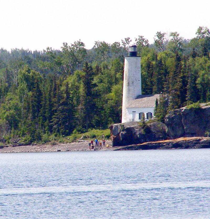
Rock Harbor
Plan Rock Harbor as a self-contained national-park stay: ferries and seaplanes are seasonal, vehicles do not travel to Isle Royale, and weather can change a crossing. The reward is rocky shoreline, forest and a trail network beginning near the dock. This northeastern gateway gives visitors the island's broadest cluster of developed facilities without removing its wilderness setting.
Read the field guide Area near Rockaway
Rockaway
Rockaway brings an Atlantic beach landscape into Queens: ocean sand and a boardwalk on one side of the peninsula, Jamaica Bay on the other, and residential streets between them. The ferry arrives on the bay side at Beach 108th Street, so seeing the water from the boat is not the same as reaching the ocean beach.
Read the field guide
Salem
Salem rewards a visit for its layered history as well as its Halloween identity. The harbour, Derby Street, Essex Street and Peabody Essex Museum make a substantial cultural route, with maritime trade, literature and art alongside the history of the 1692 witch trials. The memorials deserve a different mood from the city's entertainment attractions.
Read the field guideArea near SaltaireSaltaire
Saltaire is a residential village on western Fire Island, where a ferry arrival on Great South Bay leads to quiet walks, community recreation and the Atlantic shore. Founded in 1911, it remains a place built around homes and shared local life. Choose it for a slower beach stay rather than a long commercial waterfront.
Read the field guide
San Francisco
Begin at the Embarcadero, where ferries, piers and the Bay frame an easy first walk. From there, steep streets lead to distinctive neighbourhoods, viewpoints and museums. The Ferry Building is a useful starting point, but Alcatraz departures and the Golden Gate Bridge require their own journeys.
Read the field guide
San Pedro
San Pedro rewards visitors who separate port logistics from sightseeing. The Los Angeles cruise terminal and Catalina Express use different berths, while downtown, Cabrillo and Point Fermin supply the cultural and coastal day. This harbour community belongs to the City of Los Angeles; neighbouring Long Beach is a separate destination.
Read the field guideSandusky
Sandusky combines a major amusement-park peninsula with a historic city and working waterfront. Downtown is a useful base for its museums, bay views and seasonal island departures; Port Clinton is a separate mainland ferry town. Cedar Point belongs to Sandusky but has its own arrival, admission and resort arrangements.
Read the field guide Area near Savannah
Savannah
Savannah is a river city of public squares, historic houses and a busy commercial waterfront. Start with a walk through the Historic District, make time for a museum and continue toward Forsyth Park or River Street. A short ferry crossing adds another view of the city without turning the day into a long excursion.
Read the field guide
Waterfront Park (Charleston)
Waterfront Park is a useful starting point for Charleston's harbour edge and the streets around Vendue Range. Charleston Water Taxi identifies its park stop at 1 Vendue Range, close to the historic district and Market Street. Plan time on shore as well as any boat outing: the park, nearby streets and passenger-boat stop make a compact visit with several different ways to continue.
Read the field guide
Seattle
Seattle’s hills rise above Elliott Bay, with public markets, neighbourhood dining and a working ferry waterfront giving the city much of its character. Begin around Pike Place and the water, then branch out to Seattle Center, Capitol Hill or Ballard. Each area offers a different experience, so a city visit benefits from more than a single waterfront stop.
Read the field guideArea near SeaviewSeaview
Seaview is a residential Fire Island community between Ocean Beach and Ocean Bay Park. Its market and boat basin sit on the Great South Bay side, while quiet walks lead towards the Atlantic. The location gives house-based visitors access to the neighbouring commercial centres without making Seaview itself a nightlife district.
Read the field guide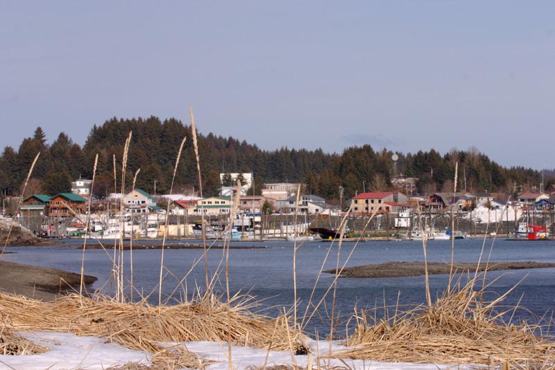
Seldovia
Seldovia is a small community on the south side of Kachemak Bay, reached by sea or air rather than by driving from Homer. Harbour activity, wooded slopes and a surviving stretch of historic boardwalk give it a very different rhythm from a highway stop. It rewards a slow visit centred on local culture and the shore.
Read the field guide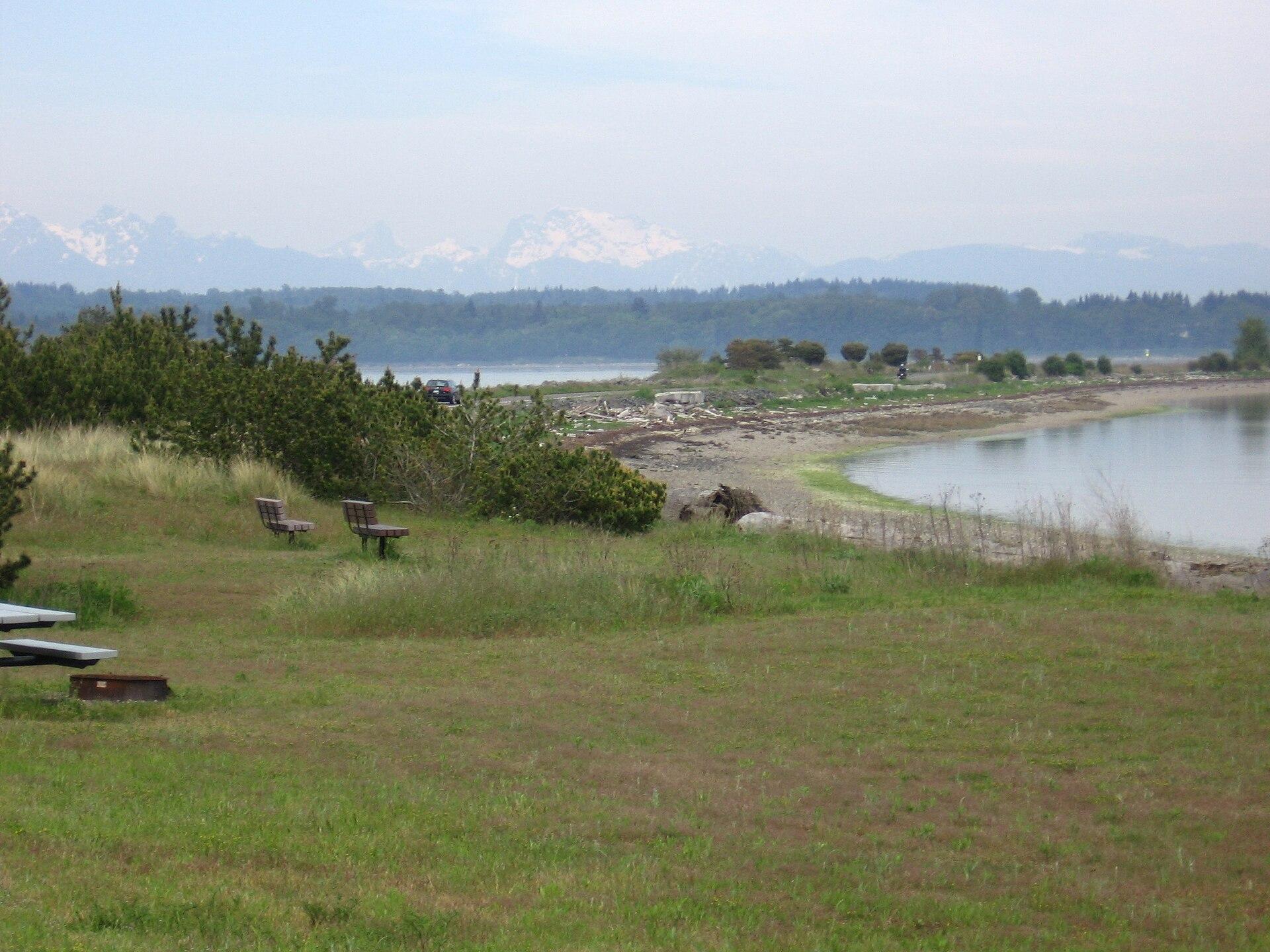
Semiahmoo / Blaine
Semiahmoo is the narrow spit and resort area across Drayton Harbor from central Blaine, near Washington’s Canadian border. One shore faces the sheltered harbour, while the other looks across Semiahmoo Bay. The combination of coastal paths, birdlife and surviving cannery buildings makes it more than a hotel address, although its amenities and public spaces should be distinguished carefully.
Read the field guide
Shaw Island
Shaw is a small, largely residential island in the San Juan archipelago, suited to a quiet beach picnic, a woodland walk and an encounter with community history. The ferry landing and its general store form a modest arrival point. The attraction is the scale of island life, not a long list of shops or organised entertainment.
Read the field guide
Skagway
Skagway sits at the head of Taiya Inlet, where a compact port town meets the steep approaches to White Pass. Broadway’s restored gold-rush buildings provide the familiar first impression, but the surrounding landscape tells a longer story of Tlingit trade routes, the Taiya Valley and transport between the coast and the interior. A good visit combines town history with one carefully chosen outdoor excursion.
Read the field guide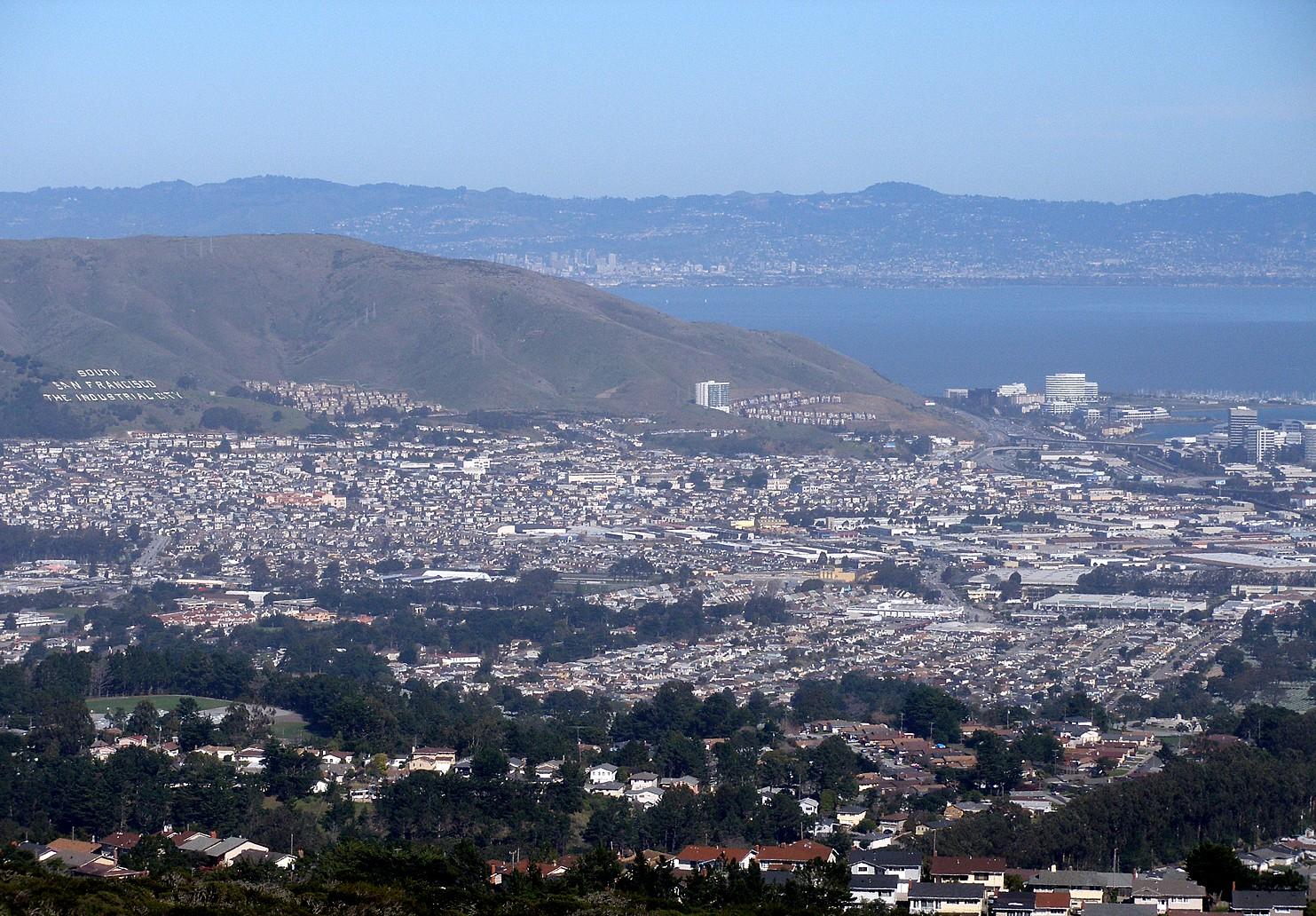
South San Francisco
South San Francisco is a separate Peninsula city north of SFO, often called South City. Its industrial past survives in the hillside lettering above town, while biotechnology campuses shape Oyster Point. The ferry landing belongs to that bayside business district, not San Francisco’s Embarcadero or downtown waterfront.
Read the field guide
South Williamsburg
South Williamsburg combines the East River waterfront with the streets around the Williamsburg Bridge and the Southside, also known as Los Sures. It is a lived-in part of Brooklyn with a history of industry, community organising and arts, alongside the major redevelopment of the former Domino sugar works.
Read the field guide Area near Southworth
Southworth
Southworth is an eastern South Kitsap ferry gateway, useful for reaching the peninsula’s shore communities and rural roads. Its terminal is the starting point for trips towards Harper, Manchester, Port Orchard and Olalla. Treat it as a small arrival community with regional outings, rather than expecting a dense sightseeing centre beside the ramp.
Read the field guide
Spectacle Island
Spectacle Island is a Boston Harbor park island for skyline views, hillside walks and a summer beach visit. Its open landscape feels different from the granite fortifications of Georges Island. A ferry journey and a walk above the shore can make a full excursion without needing an ambitious island-hopping plan.
Read the field guide Area near St. George, Staten Island
St. George, Staten Island
St. George is Staten Island's ferry gateway and a neighbourhood worth entering after the harbour crossing. Maritime exhibits, the ornate St. George Theatre and the waterfront memorial give a short visit more substance than simply riding straight back to Manhattan. The streets rise inland from the water, so allow for slopes when choosing a walking route.
Read the field guide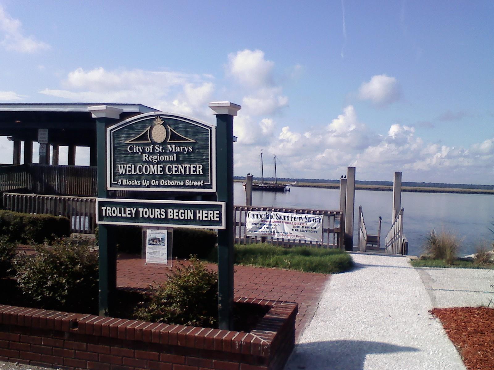 St. Marys town overview — waterfront gazebo
St. Marys, Georgia
St. Marys, Georgia, is the mainland gateway for the public Cumberland Island ferry and a worthwhile waterfront stop of its own. A small downtown around Osborne Street combines maritime museums, places to eat and a riverfront history walk. Staying here makes an early ferry check-in easier without requiring every day to be an island excursion.
Read the field guideStehekin, Washington
Stehekin sits at the head of Lake Chelan, where a small inhabited valley meets the mountains of the North Cascades. The journey across the lake is part of its character: there is no road from Chelan to the village. Its appeal lies in the contrast between the landing, scattered cabins, an old orchard and the steep country beyond.
Read the field guide
Steilacoom, Washington
Steilacoom is a small South Puget Sound town whose historic streets descend toward a working ferry landing and views across the water. Its appeal is a combination of older buildings, modest museums, neighbourhood food and two public shoreline parks. A slow walk through the centre can be worthwhile even when you are not continuing to an island.
Read the field guide
Treasure Island, San Francisco
Treasure Island is an artificial island neighbourhood in San Francisco Bay, connected to the natural, hillier Yerba Buena Island. Created for the 1939–40 Golden Gate International Exposition, it later became a naval station. Today its historic buildings, new homes and waterfront public spaces sit within a continuing redevelopment project.
Read the field guide
Two Harbors, Catalina Island
Two Harbors is Catalina’s small west-end settlement on the narrow isthmus between Isthmus Cove and Catalina Harbor. Its appeal is outdoor time: walking between two shores, paddling, snorkelling and nights close to the landscape. It offers a quieter, smaller-scale alternative to Avalon, with fewer services and a very different rhythm.
Read the field guide
Vallejo / Mare Island
Mare Island is the former naval shipyard district across the channel from central Vallejo. Founded in 1854, the yard built and repaired ships until its closure in 1996. Dry docks, cranes, officers’ residences and mature trees still shape the landscape, alongside new businesses and an active redevelopment project.
Read the field guide
Vallejo
Vallejo is a waterfront city in Solano County, where the Napa River meets the northern reaches of San Francisco Bay. Its downtown, ferry landing and former naval shipyard on Mare Island offer a different Bay Area day from San Francisco’s central sights. City history, working waterfronts and neighbourhood food are the main reasons to linger.
Read the field guide
Vashon Island
Vashon is a rural Puget Sound island where a trip can move between small-town cafés, farm produce, woodland paths and a lighthouse shore. The useful unit for planning is Vashon-Maury: Point Robinson lies on Maury Island, while the main town and the northern ferry landing are elsewhere. An attractive photograph of the lighthouse is not a promise that it sits beside your arrival dock.
Read the field guideIsle Royale National Park area overviewWindigo, Isle Royale National Park
Windigo feels remote from the first minute. There are no car ferries, mainland road or conventional resort strip. Arrive by passenger boat, seaplane or suitable private vessel and use the seasonal visitor centre to understand the southwest of Isle Royale. Washington Harbor provides a sheltered setting, but Lake Superior crossings still depend on weather.
Read the field guide
Winter Harbor
Winter Harbor is a small coastal town beside the mainland section of Acadia National Park. Its working harbour and village arts scene form a useful contrast to the exposed granite of nearby Schoodic Point. Mount Desert Island lies across the water; this is a separate base, not another neighbourhood of Bar Harbor.
Read the field guide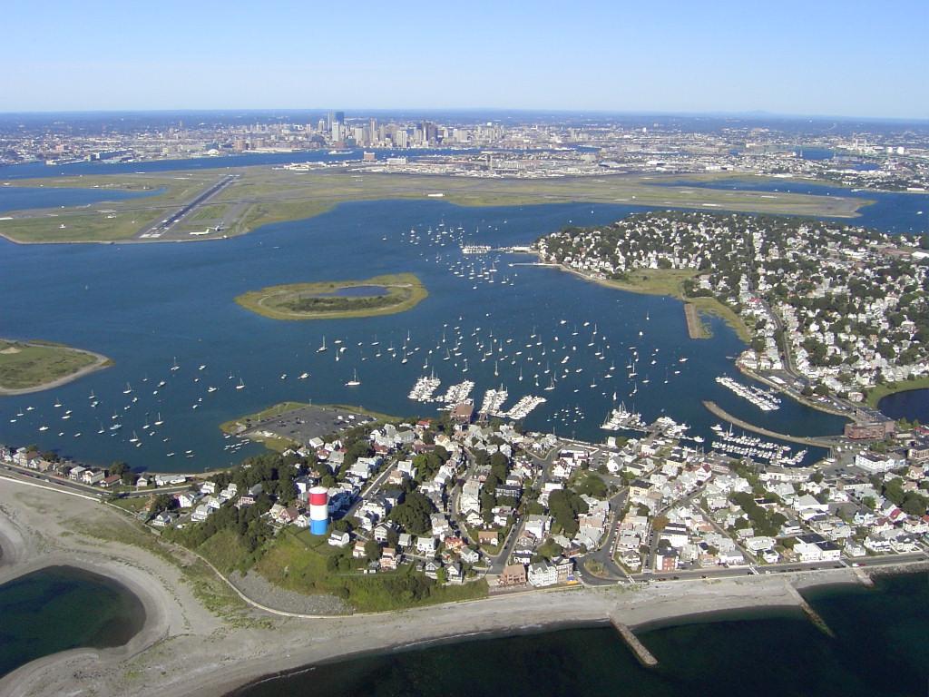
Winthrop
Winthrop is a coastal town beside Boston Harbor, with residential streets between an ocean-facing beach, sheltered water and salt marsh. The ferry landing is at the southern end on Shirley Street; it is a starting point for exploring, not the town centre or a beach resort complex. Choose a shoreline walk, local meal and one longer outdoor stop for an unhurried day.
Read the field guide
Woods Hole
Woods Hole is a village within Falmouth on mainland Cape Cod, not a town on Martha's Vineyard. Ferries, marine research and a compact waterfront give it a distinctive character. Water Street links cafés and scientific institutions, while the harbour and the end of the Shining Sea Bikeway provide a reason to linger before or after a crossing.
Read the field guidePhoto credits137
- Area image: Alameda City Hall, Alameda, CaliforniaAlameda City Hall (Alameda, CA) 2. Author: Sanfranman59. Credit: Own work. License: CC BY-SA 3.0 (https://creativecommons.org/licenses/by-sa/3.0). Source: https://commons.wikimedia.org/wiki/File:Alameda_City_Hall_(Alameda,_CA)_2.JPGCropped to fit the display.
- Depicts: AnacortesAnacortes from Cap Sante. Author: JXthemeteorologist. Credit: Own work. License: CC0 (https://creativecommons.org/publicdomain/zero/1.0/). Source: https://commons.wikimedia.org/wiki/File:Anacortes_from_Cap_Sante.jpg
- Depicts: Anderson IslandYomandock. Author: Drums600 at English Wikipedia. Credit: Transferred from en.wikipedia to Commons.. License: Public domain (https://creativecommons.org/publicdomain/mark/1.0/). Source: https://commons.wikimedia.org/wiki/File:Yomandock.jpg
- Depicts: Atlantic HighlandsTHE TOWERS, MONMOUTH COUNTY, NJ. Author: JERRYE & ROY KLOTZ M.D.. Credit: Own work. License: CC BY-SA 4.0 (https://creativecommons.org/licenses/by-sa/4.0). Source: https://commons.wikimedia.org/wiki/File:THE_TOWERS,_MONMOUTH_COUNTY,_NJ.jpgCropped to fit the display.
- Area image: Ocean Beach, NY 11770, USA — Area near AtlantiqueOcean Beach, NY 11770, USA - panoramio (1). Author: dans362. Credit: https://web.archive.org/web/20161102201153/http://www.panoramio.com/photo/43763554. License: CC BY 3.0 (https://creativecommons.org/licenses/by/3.0). Source: https://commons.wikimedia.org/wiki/File:Ocean_Beach,_NY_11770,_USA_-_panoramio_(1).jpgCropped to fit the display.
- Depicts: AvalonAvalon Catalina Island California by Don Ramey Logan. Author: Don Ramey Logan. Credit: Own work. License: CC BY-SA 4.0 (https://creativecommons.org/licenses/by-sa/4.0). Source: https://commons.wikimedia.org/wiki/File:Avalon_Catalina_Island_California_by_Don_Ramey_Logan.jpgCropped to fit the display.
- Depicts: Bainbridge IslandEagle Island at Bainbridge Ferry Aerial (50802490188). Author: formulanone. Credit: Eagle Island at Bainbridge Ferry Aerial. License: CC BY-SA 2.0 (https://creativecommons.org/licenses/by-sa/2.0). Source: https://commons.wikimedia.org/wiki/File:Eagle_Island_at_Bainbridge_Ferry_Aerial_(50802490188).jpgCropped to fit the display.
- Depicts: Bar HarborBar Harbor, ME. Author: Quintin Soloviev. Credit: Own work. License: CC BY 4.0 (https://creativecommons.org/licenses/by/4.0). Source: https://commons.wikimedia.org/wiki/File:Bar_Harbor,_ME.jpgCropped to fit the display.
- Depicts: Bay Shore, New YorkBayshore Marina. Author: Praiseandworship (Transfered by Bobby122 ). Credit: Original uploaded on en.wikipedia. License: CC BY 3.0 (https://creativecommons.org/licenses/by/3.0). Source: https://commons.wikimedia.org/wiki/File:Bayshore_Marina.JPGCropped to fit the display.
- Depicts: Bayside Marketplace, MiamiChurroland Bayside Marketplace Miami FL 2 Oct 2025. Author: Phillip Pessar. Credit: https://www.flickr.com/photos/southbeachcars/54827366832/. License: CC BY 4.0 (https://creativecommons.org/licenses/by/4.0). Source: https://commons.wikimedia.org/wiki/File:Churroland_Bayside_Marketplace_Miami_FL_2_Oct_2025.jpgCropped to fit the display.
- Depicts: BeaufortDowntown Beaufort NC. Author: Aurora30 at English Wikipedia. Credit: Transferred from en.wikipedia to Commons.. License: Public domain (https://creativecommons.org/publicdomain/mark/1.0/). Source: https://commons.wikimedia.org/wiki/File:Downtown_Beaufort_NC.jpg
- Area image: Belford Harbour, NJ — Area near Belford (Middletown), New Jersey931 Belford Harbour, NJ. Author: LittleGun. Credit: Own work. License: CC BY-SA 3.0 (https://creativecommons.org/licenses/by-sa/3.0). Source: https://commons.wikimedia.org/wiki/File:931_Belford_Harbour,_NJ.JPGCropped to fit the display.
- Area image: Isle Royale National Park — Isle Royale National Park area overviewEdisen Fishery at IRNP. Author: William Wadas. Credit: Own work. License: CC BY-SA 4.0 (https://creativecommons.org/licenses/by-sa/4.0). Source: https://commons.wikimedia.org/wiki/File:Edisen_Fishery_at_IRNP.jpgCropped to fit the display.
- Area image: The Tred Avon River from the Oxford-Bellvue Ferry at Oxford, Maryland , USA — Area near Bellevue, Talbot County, Maryland (Oxford–Bellevue Ferry landing)Tred Avon River at Oxford MD1. Author: Acroterion. Credit: Own work. License: CC BY-SA 4.0 (https://creativecommons.org/licenses/by-sa/4.0). Source: https://commons.wikimedia.org/wiki/File:Tred_Avon_River_at_Oxford_MD1.jpgCropped to fit the display.
- Area image: Entering Blaine, Washington — Area near BlaineEntering Blaine, Washington - panoramio. Author: Larry LaRose. Credit: https://web.archive.org/web/20161016162921/http://www.panoramio.com/photo/47197334. License: CC BY-SA 3.0 (https://creativecommons.org/licenses/by-sa/3.0). Source: https://commons.wikimedia.org/wiki/File:Entering_Blaine,_Washington_-_panoramio.jpgCropped to fit the display.
- Depicts: Block IslandHiRes BlockIsland Aerial 7-23-2015. Author: Timothy J. Quill. Credit: Timothy J. Quill. License: CC BY-SA 4.0 (https://creativecommons.org/licenses/by-sa/4.0). Source: https://commons.wikimedia.org/wiki/File:HiRes_BlockIsland_Aerial_7-23-2015.jpgCropped to fit the display.
- Area image: Mackinac Bridge over the Straits of MackinacMackinac Bridge from the air4. Author: Justin Billau. Credit: Flickr : Mackinac Bridge. License: CC BY 2.0 (https://creativecommons.org/licenses/by/2.0). Source: https://commons.wikimedia.org/wiki/File:Mackinac_Bridge_from_the_air4.jpgCropped to fit the display.
- Area image: Three-segment panorama of Boston skyline, from East Boston . — Area near The Tall Ship — East BostonBoston skyline from East Boston November 2016 panorama 5. Author: King of Hearts. Credit: Own work. License: CC BY-SA 4.0 (https://creativecommons.org/licenses/by-sa/4.0). Source: https://commons.wikimedia.org/wiki/File:Boston_skyline_from_East_Boston_November_2016_panorama_5.jpgCropped to fit the display.
- Area image: Boston — Boston area overviewISH WC Boston4. Author: Ian Howard. Credit: Own work. License: CC BY 2.5 (https://creativecommons.org/licenses/by/2.5). Source: https://commons.wikimedia.org/wiki/File:ISH_WC_Boston4.jpgCropped to fit the display.
- Depicts: Bradenton BeachBradenton Beach, Florida. Author: Mr. Usaji. Credit: Bradenton Beach. License: CC BY 2.0 (https://creativecommons.org/licenses/by/2.0). Source: https://commons.wikimedia.org/wiki/File:Bradenton_Beach,_Florida.jpgCropped to fit the display.
- Depicts: BradentonBradenton FL Iron Block03. Author: Ebyabe. Credit: Own work. License: CC BY-SA 3.0 (https://creativecommons.org/licenses/by-sa/3.0). Source: https://commons.wikimedia.org/wiki/File:Bradenton_FL_Iron_Block03.jpgCropped to fit the display.
- Depicts: BremertonAerial view of Bremerton 2. Author: Dcoetzee. Credit: Own work. License: Public domain (https://creativecommons.org/publicdomain/mark/1.0/). Source: https://commons.wikimedia.org/wiki/File:Aerial_view_of_Bremerton_2.jpg
- Depicts: BridgeportBridgeport, Connecticut. Author: Quintin Soloviev. Credit: Own work. License: CC BY 4.0 (https://creativecommons.org/licenses/by/4.0). Source: https://commons.wikimedia.org/wiki/File:Bridgeport,_Connecticut.jpgCropped to fit the display.
- Depicts: Camden Waterfront2025-04-12 10 16 21 View west across the Delaware River towards Center City Philadelphia from the Camden Waterfront in Camden, Camden County, New Jersey. Author: Famartin. Credit: Own work. License: CC BY-SA 4.0 (https://creativecommons.org/licenses/by-sa/4.0). Source: https://commons.wikimedia.org/wiki/File:2025-04-12_10_16_21_View_west_across_the_Delaware_River_towards_Center_City_Philadelphia_from_the_Camden_Waterfront_in_Camden,_Camden_County,_New_Jersey.jpgCropped to fit the display.
- Area image: Catawba Island area — Area overview: Catawba Island areaCatawba Island from the air. Author: Nyttend. Credit: Own work. License: Public domain (https://creativecommons.org/publicdomain/mark/1.0/). Source: https://commons.wikimedia.org/wiki/File:Catawba_Island_from_the_air.jpg
- Area image: Sandusky — Sandusky area overviewOsborne School in Sandusky. Author: Nyttend. Credit: Own work. License: Public domain (https://creativecommons.org/publicdomain/mark/1.0/). Source: https://commons.wikimedia.org/wiki/File:Osborne_School_in_Sandusky.jpg
- Area image: Charleston Harbor region — Area overview: Charleston Harbor regionCharleston-harbor-sc1. Author: Brian Stansberry. Credit: Own work. License: CC BY 3.0 (https://creativecommons.org/licenses/by/3.0). Source: https://commons.wikimedia.org/wiki/File:Charleston-harbor-sc1.jpgCropped to fit the display.
- Area image: In Cheboygan, MI — Area near CheboyganNorth Main Street at night (53882785849). Author: Chris Rycroft from Madison, Wisconsin, United States. Credit: North Main Street at night. License: CC BY 2.0 (https://creativecommons.org/licenses/by/2.0). Source: https://commons.wikimedia.org/wiki/File:North_Main_Street_at_night_(53882785849).jpgCropped to fit the display.
- Depicts: ChelanChelan, WA - Campbell's. Author: Joe Mabel. Credit: Photo by Joe Mabel. License: CC BY-SA 3.0 (https://creativecommons.org/licenses/by-sa/3.0/). Source: https://commons.wikimedia.org/wiki/File:Chelan,_WA_-_Campbell%27s.jpgCropped to fit the display.
- Depicts: Clinton, Whidbey IslandThis Photo was taken by Timothy A. Gonsalves . Feel free to use my photos, but please mention me as the author. I would much appreciate if you send me an email tagooty@yahoo.com or write on my talk page , for my information. Please contact me before commercial use. Please do not upload an edited image here without consulting me. I would like to make corrections only at my own source to ensure that the changes improve the image and are preserved. Otherwise you may upload an edited image with a new name. Please use one of the templates derivative or extract .Wikimedia CommonsCC BY-SA 4.0Clinton Shore Front Whidbey Mar23 R16 07087. Author: This Photo was taken by Timothy A. Gonsalves . Feel free to use my photos, but please mention me as the author. I would much appreciate if you send me an email tagooty@yahoo.com or write on my talk page , for my information. Please contact me before commercial use. Please do not upload an edited image here without consulting me. I would like to make corrections only at my own source to ensure that the changes improve the image and are preserved. Otherwise you may upload an edited image with a new name. Please use one of the templates derivative or extract .. Credit: Own work. License: CC BY-SA 4.0 (https://creativecommons.org/licenses/by-sa/4.0). Source: https://commons.wikimedia.org/wiki/File:Clinton_Shore_Front_Whidbey_Mar23_R16_07087.jpgCropped to fit the display.
- Depicts: Coupeville, Whidbey IslandCoupeville and Penn Cove, Whidbey Island - 2707429941. Author: brewbooks. Credit: https://www.flickr.com/photos/93452909@N00/2707429941/. License: CC BY-SA 2.0 (https://creativecommons.org/licenses/by-sa/2.0). Source: https://commons.wikimedia.org/wiki/File:Coupeville_and_Penn_Cove,_Whidbey_Island_-_2707429941.jpgCropped to fit the display.
- Depicts: Cumberland Island National SeashoreBlackened grass. Author: NPS Photo. Credit: NPGallery. License: Public domain (https://creativecommons.org/publicdomain/mark/1.0/). Source: https://commons.wikimedia.org/wiki/File:Blackened_grass_(6bbd5109-ce9b-453c-a500-9f873ca9e9d9).jpg
- Depicts: Dana Point HarborDana Point a city in southern Orange County CA Photo Don Ramey Logan. Author: Don Ramey Logan. Credit: Own work. License: CC BY-SA 3.0 (https://creativecommons.org/licenses/by-sa/3.0). Source: https://commons.wikimedia.org/wiki/File:Dana_Point_a_city_in_southern_Orange_County_CA_Photo_Don_Ramey_Logan.jpgCropped to fit the display.
- Depicts: Daufuskie IslandHaig Point Lighthouse, Daufuskie, South Carolina. Author: Carol M. Highsmith. Credit: http://lcweb2.loc.gov/service/pnp/highsm/12100/12126v.jpg. License: Public domain (https://creativecommons.org/publicdomain/mark/1.0/). Source: https://commons.wikimedia.org/wiki/File:Haig_Point_Lighthouse,_Daufuskie,_South_Carolina.jpg
- Depicts: Dauphin IslandFort Gaines 06May2010. Author: Altairisfar (Jeffrey Reed). Credit: Own work. License: CC BY-SA 3.0 (https://creativecommons.org/licenses/by-sa/3.0). Source: https://commons.wikimedia.org/wiki/File:Fort_Gaines_06May2010.JPGCropped to fit the display.
- Depicts: EdgartownEdgartown Harbor by Don Ramey Logan. Author: Don Ramey Logan. Credit: Own work. License: CC BY-SA 4.0 (https://creativecommons.org/licenses/by-sa/4.0). Source: https://commons.wikimedia.org/wiki/File:Edgartown_Harbor_by_Don_Ramey_Logan.jpgCropped to fit the display.
- Depicts: EdmondsBeautiful Sunset (Explored N° 296 ) - Flickr - Jitabebe. Author: Rachel Samanyi from Seattle.WA, USA. Credit: Beautiful Sunset [Explored N° 296 ]. License: CC BY 2.0 (https://creativecommons.org/licenses/by/2.0). Source: https://commons.wikimedia.org/wiki/File:Beautiful_Sunset_(Explored_N%C2%B0_296_)_-_Flickr_-_Jitabebe.jpgCropped to fit the display.
- Depicts: Fair HarborFair Harbor FD East Side 2. Author: ContinueWithCaution. Credit: Own work. License: CC BY-SA 4.0 (https://creativecommons.org/licenses/by-sa/4.0). Source: https://commons.wikimedia.org/wiki/File:Fair_Harbor_FD_East_Side_2.jpgCropped to fit the display.
- Depicts: FalmouthNobska Lighthouse 1. Author: T.S. Custadio aka ToddC4176 at en.wikipedia. Credit: self-made. License: CC BY-SA 3.0 (https://creativecommons.org/licenses/by-sa/3.0/). Source: https://commons.wikimedia.org/wiki/File:Nobska_Lighthouse_1.jpgCropped to fit the display.
- Area image: Fire Island, NY, USA — Area near Fire Island / DunewoodFire Island, NY, USA - panoramio (4). Author: dans362. Credit: https://web.archive.org/web/20161017234644/http://www.panoramio.com/photo/46657664. License: CC BY 3.0 (https://creativecommons.org/licenses/by/3.0). Source: https://commons.wikimedia.org/wiki/File:Fire_Island,_NY,_USA_-_panoramio_(4).jpgCropped to fit the display.
- Depicts: Fort George IslandFort George Island Historical Marker. Author: Deisenbe. Credit: Own work. License: CC BY-SA 4.0 (https://creativecommons.org/licenses/by-sa/4.0). Source: https://commons.wikimedia.org/wiki/File:Fort_George_Island_Historical_Marker.jpgCropped to fit the display.
- Depicts: Fort LauderdaleSkyline of Fort Lauderdale, Nov-15. Author: KeanoManu. Credit: Own work Previously published: Flickr. License: CC BY-SA 4.0 (https://creativecommons.org/licenses/by-sa/4.0). Source: https://commons.wikimedia.org/wiki/File:Skyline_of_Fort_Lauderdale,_Nov-15.jpgCropped to fit the display.
- Area image: Fort Morgan Quarters — Area near Fort MorganFort Morgan Quarters - panoramio. Author: Matthew Nichols. Credit: https://web.archive.org/web/20161031075243/http://www.panoramio.com/photo/124778799. License: CC BY-SA 3.0 (https://creativecommons.org/licenses/by-sa/3.0). Source: https://commons.wikimedia.org/wiki/File:Fort_Morgan_Quarters_-_panoramio.jpgCropped to fit the display.
- Depicts: Friday HarborFriday Harbor, WA - boats in harbor 03 (20020267924). Author: Joe Mabel (on Flickr as Joe Mabel from Seattle, US). Credit: Friday Harbor, WA - boats in harbor 03. License: CC BY-SA 3.0 (https://creativecommons.org/licenses/by-sa/3.0). Source: https://commons.wikimedia.org/wiki/File:Friday_Harbor,_WA_-_boats_in_harbor_03_(20020267924).jpgCropped to fit the display.
- Depicts: Gee's BendPettway Plantation Gees Bend Alabama. Author: Arthur Rothstein. Credit: This image is available from the United States Library of Congress 's Prints and Photographs division under the digital ID fsa.8b35963 . This tag does not indicate the copyright status of the attached work. A normal copyright tag is still required. See Commons:Licensing .. License: Public domain (https://creativecommons.org/publicdomain/mark/1.0/). Source: https://commons.wikimedia.org/wiki/File:Pettway_Plantation_Gees_Bend_Alabama.jpg
- Area image: Fort Warren Gatehouse — Area near Georges Island / BostonFort Warren Gatehouse (19398180931). Author: Eric Kilby from Somerville, MA, USA. Credit: Fort Warren Gatehouse. License: CC BY-SA 2.0 (https://creativecommons.org/licenses/by-sa/2.0). Source: https://commons.wikimedia.org/wiki/File:Fort_Warren_Gatehouse_(19398180931).jpgCropped to fit the display.
- Depicts: Governors IslandGovernors Island from One World Observatory 2017. Author: Antony-22. Credit: Own work. License: CC BY-SA 4.0 (https://creativecommons.org/licenses/by-sa/4.0). Source: https://commons.wikimedia.org/wiki/File:Governors_Island_from_One_World_Observatory_2017.jpgCropped to fit the display.
- Depicts: Grand Portage050820 GrandPortageNationalMonument. Author: Rufus Sarsaparilla on wikipédia en. Credit: http://en.wikipedia.org/wiki/Image:050820_GrandPortageNationalMonument.jpg. License: Public domain (https://creativecommons.org/publicdomain/mark/1.0/). Source: https://commons.wikimedia.org/wiki/File:050820_GrandPortageNationalMonument.jpg
- Depicts: Great Cranberry IslandTown Dock - Great Cranberry Island, Maine - DSC03775. Author: Daderot. Credit: Own work. License: CC0 (https://creativecommons.org/publicdomain/zero/1.0/). Source: https://commons.wikimedia.org/wiki/File:Town_Dock_-_Great_Cranberry_Island,_Maine_-_DSC03775.jpg
- Depicts: GreenpointHunters Point South Pk td (2019-04-14) 252 - Terrace, The Greenpoint. Author: Tdorante10. Credit: Own work. License: CC BY-SA 4.0 (https://creativecommons.org/licenses/by-sa/4.0). Source: https://commons.wikimedia.org/wiki/File:Hunters_Point_South_Pk_td_(2019-04-14)_252_-_Terrace,_The_Greenpoint.jpgCropped to fit the display.
- Depicts: HainesGlaciar Davidson, Haines, Alaska, Estados Unidos, 2017-08-18, DD 75. Author: Diego Delso. Credit: Own work. License: CC BY-SA 4.0 (https://creativecommons.org/licenses/by-sa/4.0). Source: https://commons.wikimedia.org/wiki/File:Glaciar_Davidson,_Haines,_Alaska,_Estados_Unidos,_2017-08-18,_DD_75.jpgCropped to fit the display.
- Depicts: HighlandsThe Twin Lights. Author: Jared Kofsky/PlaceNJ.com Media. Credit: Own work. License: CC BY-SA 3.0 (https://creativecommons.org/licenses/by-sa/3.0). Source: https://commons.wikimedia.org/wiki/File:The_Twin_Lights.JPGCropped to fit the display.
- Depicts: Hilton Head IslandHilton Head Island Lighthouse June 2026. Author: Locust member. Credit: Own work. License: CC BY 4.0 (https://creativecommons.org/licenses/by/4.0). Source: https://commons.wikimedia.org/wiki/File:Hilton_Head_Island_Lighthouse_June_2026.pngCropped to fit the display.
- Depicts: HinghamHingham, Massachusetts. Author: Quintin Soloviev. Credit: Own work. License: CC BY 4.0 (https://creativecommons.org/licenses/by/4.0). Source: https://commons.wikimedia.org/wiki/File:Hingham,_Massachusetts.jpgCropped to fit the display.
- Area image: Prince of Wales Island, Alaska — Area overview: Prince of Wales Island, AlaskaKasaan Peninsula pano. Author: Jsayre64. Credit: Own work. License: CC BY-SA 3.0 (https://creativecommons.org/licenses/by-sa/3.0). Source: https://commons.wikimedia.org/wiki/File:Kasaan_Peninsula_pano.JPGCropped to fit the display.
- Area image: View towards the ocean of St John the Baptist Catholic Church in Homer, Alaska — Area near HomerArriving at St John the Baptist Church, Homer. Author: Haydn Blackey. Credit: https://www.flickr.com/photos/haydn/48541723782/. License: CC BY-SA 2.0 (https://creativecommons.org/licenses/by-sa/2.0). Source: https://commons.wikimedia.org/wiki/File:Arriving_at_St_John_the_Baptist_Church,_Homer.jpgCropped to fit the display.
- Area image: The potted plant wall on the inland (east) side of the cafe terrace next to the pavilion of Hunter's Point South Park, on the east river at Center Boulevard and Borden Avenue in Hunters Point, Long Island City, Queens. — Area near Hunters Point South / Long Island CityHunters Point South Pk td (2019-06-08) 038 - Cafe Terrace. Author: Tdorante10. Credit: Own work. License: CC BY-SA 4.0 (https://creativecommons.org/licenses/by-sa/4.0). Source: https://commons.wikimedia.org/wiki/File:Hunters_Point_South_Pk_td_(2019-06-08)_038_-_Cafe_Terrace.jpgCropped to fit the display.
- Depicts: HyannisHyannis, Barnstable, MA 02601, USA - panoramio (2). Author: bynyalcin. Credit: https://web.archive.org/web/20161030171521/http://www.panoramio.com/photo/126029510. License: CC BY 3.0 (https://creativecommons.org/licenses/by/3.0). Source: https://commons.wikimedia.org/wiki/File:Hyannis,_Barnstable,_MA_02601,_USA_-_panoramio_(2).jpgCropped to fit the display.
- Depicts: IslesfordSun + Fog + Church in Islesford, Maine. Author: H.L.I.T.. Credit: Flickr : Sun + Fog + Church. License: CC BY 2.0 (https://creativecommons.org/licenses/by/2.0). Source: https://commons.wikimedia.org/wiki/File:Sun_%2B_Fog_%2B_Church_in_Islesford,_Maine.jpgCropped to fit the display.
- Area image: Looking northeast, full zoom, at Liberty State Park station on a cloudy midday. I-78 in background. — Area near Jersey City (Warren Street waterfront)Lib St Park HBLR jeh. Author: Jim.henderson. Credit: Own work. License: CC0 (https://creativecommons.org/publicdomain/zero/1.0/). Source: https://commons.wikimedia.org/wiki/File:Lib_St_Park_HBLR_jeh.jpg
- Depicts: Jersey CityJournal Square Jersey City November 2021 003. Author: King of Hearts. Credit: Own work. License: CC BY-SA 4.0 (https://creativecommons.org/licenses/by-sa/4.0). Source: https://commons.wikimedia.org/wiki/File:Journal_Square_Jersey_City_November_2021_003.jpgCropped to fit the display.
- Depicts: Kelleys IslandLake-erie-kelleys-island. Author: Derek Jensen ( Tysto ). Credit: Self-photographed. License: Public domain (https://creativecommons.org/publicdomain/mark/1.0/). Source: https://commons.wikimedia.org/wiki/File:Lake-erie-kelleys-island.jpg
- Depicts: KetchikanKetchikan, Alaska, Estados Unidos, 2017-08-16, DD 43. Author: Diego Delso. Credit: Own work. License: CC BY-SA 4.0 (https://creativecommons.org/licenses/by-sa/4.0). Source: https://commons.wikimedia.org/wiki/File:Ketchikan,_Alaska,_Estados_Unidos,_2017-08-16,_DD_43.jpgCropped to fit the display.
- Depicts: Ketron IslandKetronIsland. Author: Drums600 at English Wikipedia. Credit: Transferred from en.wikipedia to Commons.. License: Public domain (https://creativecommons.org/publicdomain/mark/1.0/). Source: https://commons.wikimedia.org/wiki/File:KetronIsland.jpg
- Depicts: KingstonKingston, Washington ferry dock 01. Author: Joe Mabel. Credit: Photo by Joe Mabel. License: CC BY-SA 3.0 (https://creativecommons.org/licenses/by-sa/3.0). Source: https://commons.wikimedia.org/wiki/File:Kingston,_Washington_ferry_dock_01.jpgCropped to fit the display.
- Area image: Leaving the beach house and heading back to the car. — Area near KismetFire Island Kismet 10. Author: Peter Dutton from Forest Hills, Queens, USA. Credit: Heading Out. License: CC BY 2.0 (https://creativecommons.org/licenses/by/2.0). Source: https://commons.wikimedia.org/wiki/File:Fire_Island_Kismet_10.jpgCropped to fit the display.
- Depicts: Laughlin, Nevada (The New Pioneer)Approaching Laughlin, Nevada (2639401545). Author: Ken Lund from Reno, Nevada, USA. Credit: Approaching Laughlin, Nevada. License: CC BY-SA 2.0 (https://creativecommons.org/licenses/by-sa/2.0). Source: https://commons.wikimedia.org/wiki/File:Approaching_Laughlin,_Nevada_(2639401545).jpgCropped to fit the display.
- Depicts: Long BeachLong Beach 06. Author: Christophe.Finot. Credit: Own work. License: CC BY-SA 2.5 (https://creativecommons.org/licenses/by-sa/2.5). Source: https://commons.wikimedia.org/wiki/File:Long_Beach_06.jpgCropped to fit the display.
- Depicts: Lopez IslandBureau of Land Management Oregon and Washington from Portland, AmericaWikimedia CommonsPublic domainNational Public Lands Day 2017 at Lopez Island (36767732454). Author: Bureau of Land Management Oregon and Washington from Portland, America. Credit: National Public Lands Day 2017 at Lopez Island. License: Public domain (https://creativecommons.org/publicdomain/mark/1.0/). Source: https://commons.wikimedia.org/wiki/File:National_Public_Lands_Day_2017_at_Lopez_Island_(36767732454).jpg
- Area image: SS Badger Ludington, Mi — Area near LudingtonSS Badger Ludington, Mi - panoramio. Author: papadakp. Credit: https://web.archive.org/web/20161027071608/http://www.panoramio.com/photo/72092249. License: CC BY-SA 3.0 (https://creativecommons.org/licenses/by-sa/3.0). Source: https://commons.wikimedia.org/wiki/File:SS_Badger_Ludington,_Mi_-_panoramio.jpgCropped to fit the display.
- Depicts: MaalaeaCoast Guard sailors greet a NOAA officer aboard his NOAA patrol boat - 200215-G-KE614-1012. Author: Petty Officer 3rd Class Benjamin Berkow. Credit: https://www.dvidshub.net/image/6104548/us-coast-guard-participates-operation-kohola-guardian. License: Public domain (https://creativecommons.org/publicdomain/mark/1.0/). Source: https://commons.wikimedia.org/wiki/File:Coast_Guard_sailors_greet_a_NOAA_officer_aboard_his_NOAA_patrol_boat_-_200215-G-KE614-1012.jpg
- Depicts: ManeleLanai-Puupehe-from-ManeleBay-golf-clubhouse. Author: Joel Bradshaw. Credit: Own work. License: Public domain (https://creativecommons.org/publicdomain/mark/1.0/). Source: https://commons.wikimedia.org/wiki/File:Lanai-Puupehe-from-ManeleBay-golf-clubhouse.JPG
- Area image: The Manitowoc County Courthouse at 1110 South 8th Street in Manitowoc, Wisconsin. — Area near ManitowocManitowoc County Courthouse Wisconsin (31754727350). Author: Tony Webster from Minneapolis, Minnesota. Credit: Manitowoc County Courthouse. License: CC BY-SA 2.0 (https://creativecommons.org/licenses/by-sa/2.0). Source: https://commons.wikimedia.org/wiki/File:Manitowoc_County_Courthouse_Wisconsin_(31754727350).jpgCropped to fit the display.
- Depicts: Martha's Vineyard (Vineyard Haven)Marthasvineyard-Aquinnah-cliffs-summer. Author: Alex Wilcox Cheek. Credit: Own work. License: CC BY-SA 4.0 (https://creativecommons.org/licenses/by-sa/4.0). Source: https://commons.wikimedia.org/wiki/File:Marthasvineyard-Aquinnah-cliffs-summer.jpegCropped to fit the display.
- Area image: St. Johns River at Mayport, viewed from the Mayport FerryMayport FL St Johns from ferry03. Author: Ebyabe. Credit: Own work. License: CC BY-SA 3.0 (https://creativecommons.org/licenses/by-sa/3.0). Source: https://commons.wikimedia.org/wiki/File:Mayport_FL_St_Johns_from_ferry03.jpgCropped to fit the display.
- Depicts: MetlakatlaView of Metlakahtla, Alaska.. Author: Unknown author Unknown author or not provided. Credit: U.S. National Archives and Records Administration. License: Public domain (https://creativecommons.org/publicdomain/mark/1.0/). Source: https://commons.wikimedia.org/wiki/File:View_of_Metlakahtla,_Alaska._-_NARA_-_297857.jpg
- Area image: Miami Beach, Florida — Area near Miami Beach Marina- panoramio (3945). Author: cuchillo emilio. Credit: https://web.archive.org/web/20161014113402/http://www.panoramio.com/photo/26546280. License: CC BY-SA 3.0 (https://creativecommons.org/licenses/by-sa/3.0). Source: https://commons.wikimedia.org/wiki/File:-_panoramio_(3945).jpgCropped to fit the display.
- Depicts: Middle Bass IslandLakeErieIslands. Author: Lake Erie Coastal Ohio, Inc.. Credit: http://www.fhwa.dot.gov/byways/photos/60169. License: Public domain (https://creativecommons.org/publicdomain/mark/1.0/). Source: https://commons.wikimedia.org/wiki/File:LakeErieIslands.JPG
- Depicts: Monhegan IslandBlackhead, the harbor, Monhegan Island, Maine LCCN99401004. Author: Miscellaneous Items in High Demand, PPOC, Library of Congress. Credit: Library of Congress Catalog: https://lccn.loc.gov/99401004 Image download: https://cdn.loc.gov/service/pnp/cph/3c20000/3c21000/3c21600/3c21698v.jpg Original url: https://www.loc.gov/pictures/item/99401004/. License: Public domain (https://creativecommons.org/publicdomain/mark/1.0/). Source: https://commons.wikimedia.org/wiki/File:Blackhead,_the_harbor,_Monhegan_Island,_Maine_LCCN99401004.jpg
- Depicts: MontaukMontauk Lighthouse National Historic Site. Author: Anthony Montemurro. Credit: Own work. License: CC BY-SA 3.0 (https://creativecommons.org/licenses/by-sa/3.0). Source: https://commons.wikimedia.org/wiki/File:Montauk_Lighthouse_National_Historic_Site.JPGCropped to fit the display.
- Area image: Boardwalk at the Palmetto Islands County Park in Mount Pleasant, South Carolina, United States — local overview of Mount Pleasant (Charleston Harbor Fish House).Palmetto Islands Park Boardwalk 2. Author: Brian Stansberry. Credit: Own work. License: CC BY 3.0 (https://creativecommons.org/licenses/by/3.0). Source: https://commons.wikimedia.org/wiki/File:Palmetto_Islands_Park_Boardwalk_2.jpgCropped to fit the display.
- Depicts: MukilteoOfficial U.S. Navy Page from United States of America MC1 Nathan Lockwood/U.S. NavyWikimedia CommonsPublic domainUSS Nimitz arrives at homeport. (11422215434). Author: Official U.S. Navy Page from United States of America MC1 Nathan Lockwood/U.S. Navy. Credit: USS Nimitz arrives at homeport.. License: Public domain (https://creativecommons.org/publicdomain/mark/1.0/). Source: https://commons.wikimedia.org/wiki/File:USS_Nimitz_arrives_at_homeport._(11422215434).jpg
- Depicts: NantucketNantucket-08-2004. Author: The original uploader was Bobak at English Wikipedia .. Credit: Transferred from en.wikipedia to Commons.. License: CC BY-SA 2.5 (https://creativecommons.org/licenses/by-sa/2.5). Source: https://commons.wikimedia.org/wiki/File:Nantucket-08-2004.jpgCropped to fit the display.
- Depicts: New BedfordDepartment of Defense. Department of the Army. U.S. Army Corps of Engineers. North Atlantic Division. U.S. Army Engineer District, New England. 6/14/1979Wikimedia CommonsPublic domainBuilding T-3 Arms Room, U.S. Army Reserve Center, Fort Rodman, New Bedford, Massachusetts. Author: Department of Defense. Department of the Army. U.S. Army Corps of Engineers. North Atlantic Division. U.S. Army Engineer District, New England. 6/14/1979. Credit: This file was contributed to Wikimedia Commons by National Archives and Records Administration as part of a cooperation project. The donation was facilitated by the Digital Public Library of America , via its partner Digital Public Library of America . Record in source catalog DPLA identifier: 6bbf67e5618cc242a52f9bae1fa668a5 National Archives Identifier: 134673890. License: Public domain (https://creativecommons.org/publicdomain/mark/1.0/). Source: https://commons.wikimedia.org/wiki/File:Building_T-3_Arms_Room,_U.S._Army_Reserve_Center,_Fort_Rodman,_New_Bedford,_Massachusetts_-_DPLA_-_6bbf67e5618cc242a52f9bae1fa668a5.jpg
- Depicts: New LondonNew London County Courthouse Connecticut Superior Court. Author: Beyond My Ken. Credit: Own work. License: CC BY-SA 4.0 (https://creativecommons.org/licenses/by-sa/4.0). Source: https://commons.wikimedia.org/wiki/File:New_London_County_Courthouse_Connecticut_Superior_Court.jpgCropped to fit the display.
- Area image: New York City
- Area image: 500px provided description: Far Away [#city ,#tower ,#cityscape ,#town ,#skyline ,#skyscraper ,#city life ,#building exterior ,#downtown district ,#townscape ,#city break ,#incidental people] — Area near New York City / Manhattan–BrooklynFar Away. Author: Kailash U. Credit: Imported from 500px ( archived version ) by the Archive Team . ( detail page ). License: CC0 (https://creativecommons.org/publicdomain/zero/1.0/). Source: https://commons.wikimedia.org/wiki/File:Far_Away_(256838545).jpeg
- Depicts: Newport BeachThe City of Newport Beach July 2014 photo Don Ramey Logan. Author: Don Ramey Logan. Credit: Own work. License: CC BY-SA 4.0 (https://creativecommons.org/licenses/by-sa/4.0). Source: https://commons.wikimedia.org/wiki/File:The_City_of_Newport_Beach_July_2014_photo_Don_Ramey_Logan.jpgCropped to fit the display.
- Depicts: Northeast HarborBoats docked at Northeast Harbor, ME IMG 2154. Author: Billy Hathorn. Credit: Own work. License: CC BY 3.0 (https://creativecommons.org/licenses/by/3.0). Source: https://commons.wikimedia.org/wiki/File:Boats_docked_at_Northeast_Harbor,_ME_IMG_2154.JPGCropped to fit the display.
- Depicts: Oak BluffsOakBluffs1. Author: Elkman at en.wikipedia. Credit: Transferred from en.wikipedia to Commons by User:Phansen .. License: CC BY-SA 3.0 (https://creativecommons.org/licenses/by-sa/3.0/). Source: https://commons.wikimedia.org/wiki/File:OakBluffs1.jpgCropped to fit the display.
- Depicts: OaklandLake Merritt 2022-06-16. Author: Robert Hsiao. Credit: Own work. License: CC BY-SA 4.0 (https://creativecommons.org/licenses/by-sa/4.0). Source: https://commons.wikimedia.org/wiki/File:Lake_Merritt_2022-06-16.pngCropped to fit the display.
- Area image: Fire Island — Area overview: Fire IslandFireIslandLighthouse 080507. Author: Paul Costello. Credit: Own work. License: Public domain (https://creativecommons.org/publicdomain/mark/1.0/). Source: https://commons.wikimedia.org/wiki/File:FireIslandLighthouse_080507.jpg
- Depicts: Ocean BeachOcean Beach, NY 11770, USA - panoramio. Author: dans362. Credit: https://web.archive.org/web/20161016124210/http://www.panoramio.com/photo/43763086. License: CC BY 3.0 (https://creativecommons.org/licenses/by/3.0). Source: https://commons.wikimedia.org/wiki/File:Ocean_Beach,_NY_11770,_USA_-_panoramio.jpgCropped to fit the display.
- Depicts: Orcas IslandMountConstitutionView. Author: Shayborg. Credit: self-made (digital camera photograph), http://en.wikipedia.org/wiki/Image:MountConstitutionView.JPG. License: Public domain (https://creativecommons.org/publicdomain/mark/1.0/). Source: https://commons.wikimedia.org/wiki/File:MountConstitutionView.jpg
- Depicts: OxfordOxford Maryland shops. Author: Wikipedian1234. Credit: Own work. License: CC BY-SA 3.0 (https://creativecommons.org/licenses/by-sa/3.0). Source: https://commons.wikimedia.org/wiki/File:Oxford_Maryland_shops.jpgCropped to fit the display.
- Depicts: Patriot's PointUSS Yorktown (CVS-10) at Patriots Point 2006. Author: Proctorg76 at English Wikipedia. Credit: Transferred from en.wikipedia to Commons by Cobatfor .. License: Public domain (https://creativecommons.org/publicdomain/mark/1.0/). Source: https://commons.wikimedia.org/wiki/File:USS_Yorktown_(CVS-10)_at_Patriots_Point_2006.jpg
- Depicts: Paulus HookPaulusHook. Author: A1% at English Wikipedia. Credit: Own work. License: Public domain (https://creativecommons.org/publicdomain/mark/1.0/). Source: https://commons.wikimedia.org/wiki/File:PaulusHook.JPG
- Depicts: Peddocks IslandMiddle Head and East Head of Peddocks Island. Author: Doc Searls from Santa Barbara, USA. Credit: 2008_05_18_bos-sfo_022 Uploaded by Ekabhishek. License: CC BY-SA 2.0 (https://creativecommons.org/licenses/by-sa/2.0). Source: https://commons.wikimedia.org/wiki/File:Middle_Head_and_East_Head_of_Peddocks_Island.jpgCropped to fit the display.
- Area image: Fort Nisqually bastion and extra entrance — Area near Point DefianceFort Nisqually bastion and extra entrance. Author: Steven Pavlov. Credit: Own work. License: CC BY-SA 3.0 (https://creativecommons.org/licenses/by-sa/3.0). Source: https://commons.wikimedia.org/wiki/File:Fort_Nisqually_bastion_and_extra_entrance.jpgCropped to fit the display.
- Depicts: Port AngelesPort Angeles S. Author: Sea Cow. Credit: Own work. License: CC BY-SA 4.0 (https://creativecommons.org/licenses/by-sa/4.0). Source: https://commons.wikimedia.org/wiki/File:Port_Angeles_S.jpgCropped to fit the display.
- Depicts: Port ClintonDowntown Port Clinton from the air. Author: Nyttend. Credit: Own work. License: Public domain (https://creativecommons.org/publicdomain/mark/1.0/). Source: https://commons.wikimedia.org/wiki/File:Downtown_Port_Clinton_from_the_air.jpg
- Area image: n 1857, work began on the present tower. The lower half of the twenty-four-foot-tall, cylindrical tower was built of granite, and the upper half of brick. The lantern was made of cast iron and housed a fifth-order Fresnel lens showing a fixed white light. The lighthouse was featured in the movie Forest Gump featuring Tom Hanks, concluded his cross-country run on the runway of Marshall Point Lighthouse. — Area near Port ClydeMaine-00024 - Marshall Point Lighthouse. Author: Dennis G. Jarvis. Credit: https://www.flickr.com/photos/22490717@N02/52422576319/. License: CC BY-SA 2.0 (https://creativecommons.org/licenses/by-sa/2.0). Source: https://commons.wikimedia.org/wiki/File:Maine-00024_-_Marshall_Point_Lighthouse.jpgCropped to fit the display.
- Area image: Aerial View of the Inc. Village of Port Jefferson, NY and its surroundings on October 14, 2018, looking east. The downtown section of the Inc. Village of Port Jefferson and Port Jefferson Harbor are visible at center – just below the Inc. Village of Belle Terre. The Port Jefferson Power Station's smokestacks are just out of view to the photo's bottom-left. The water visible above (just east) Belle Terre is the Long Island Sound. The large, tan building seen towards the center-right, surrounded by trees, is St. Charles Hospital. This image was taken from an altitude of roughly 2,000–3,000 feet — local overview of Port Jefferson.Aerial View of Port Jefferson, NY October 14, 2018. Author: Infrastorian. Credit: Own work. License: CC0 (https://creativecommons.org/publicdomain/zero/1.0/). Source: https://commons.wikimedia.org/wiki/File:Aerial_View_of_Port_Jefferson,_NY_October_14,_2018.png
- Depicts: Port TownsendPt. Townsend, WA shoreline 01. Author: Joe Mabel. Credit: Photo by Joe Mabel. License: CC BY-SA 3.0 (https://creativecommons.org/licenses/by-sa/3.0/). Source: https://commons.wikimedia.org/wiki/File:Pt._Townsend,_WA_shoreline_01.jpgCropped to fit the display.
- Area image: Lake Chelan — Area overview: Lake ChelanStehekin Chelan. Author: David Ansley. Credit: Own work. License: CC BY 2.5 (https://creativecommons.org/licenses/by/2.5). Source: https://commons.wikimedia.org/wiki/File:Stehekin_Chelan.JPGCropped to fit the display.
- Depicts: ProvincetownView of Provincetown from Pilgrim Monument looking east, MA, USA - Sept, 2013. Author: WestportWiki. Credit: Own work. License: CC BY-SA 3.0 (https://creativecommons.org/licenses/by-sa/3.0). Source: https://commons.wikimedia.org/wiki/File:View_of_Provincetown_from_Pilgrim_Monument_looking_east,_MA,_USA_-_Sept,_2013.jpgCropped to fit the display.
- Depicts: Put-in-BayPerry's Victory and International Peace Memorial (4663688070). Author: NOAA's National Ocean Service. Credit: Perry's Victory and International Peace Memorial. License: CC BY 2.0 (https://creativecommons.org/licenses/by/2.0). Source: https://commons.wikimedia.org/wiki/File:Perry%27s_Victory_and_International_Peace_Memorial_(4663688070).jpgCropped to fit the display.
- Depicts: Red Hook, BrooklynRH Houses East Lorraine eve jeh. Author: Jim.henderson. Credit: Own work. License: CC0 (https://creativecommons.org/publicdomain/zero/1.0/). Source: https://commons.wikimedia.org/wiki/File:RH_Houses_East_Lorraine_eve_jeh.jpg
- Area image: Three-segment panorama of Boston skyline, from LoPresti Park, East Boston . — Area near ReelHouse, East BostonBoston skyline from East Boston November 2016 panorama 1. Author: King of Hearts. Credit: Own work. License: CC BY-SA 4.0 (https://creativecommons.org/licenses/by-sa/4.0). Source: https://commons.wikimedia.org/wiki/File:Boston_skyline_from_East_Boston_November_2016_panorama_1.jpgCropped to fit the display.
- Area image: The gangway at Richmond Ferry Terminal in March 2021 — Area near RichmondGangway at Richmond Ferry Terminal, March 2021. Author: Pi.1415926535. Credit: Own work. License: CC BY-SA 4.0 (https://creativecommons.org/licenses/by-sa/4.0). Source: https://commons.wikimedia.org/wiki/File:Gangway_at_Richmond_Ferry_Terminal,_March_2021.jpgCropped to fit the display.
- Depicts: Rock HarborIsle Royale lighthouse. Author: © 2006 Todd VerBeek. Credit: Own work. License: CC BY-SA 4.0 (https://creativecommons.org/licenses/by-sa/4.0). Source: https://commons.wikimedia.org/wiki/File:Isle_Royale_lighthouse.jpgCropped to fit the display.
- Area image: Fare-Free H Shuttle replaces portion of Line in Rockaways With the prospect of Rockaway Line service being disabled for the next several months due to the destructive force of Hurricane Sandy, the MTA took the unprecedented action of moving subway cars by flatbed truck onto the Rockaway Peninsula and setting up a temporary train shuttle service. The H Shuttle runs between the Far Rockaway-Mott Av. station and Beach 90 St making all intermediate stops. Service will operate every 15 minutes, between 4 a.m. to 12:00 a.m. from Mott Av, and between 4:30 a.m. to 12:30 a.m. from Beach 90 St. Click he — Area near RockawayRockaway photos 068 (8242743726). Author: Metropolitan Transportation Authority of the State of New York. Credit: Rockaway photos 068 Uploaded by tm. License: CC BY 2.0 (https://creativecommons.org/licenses/by/2.0). Source: https://commons.wikimedia.org/wiki/File:Rockaway_photos_068_(8242743726).jpgCropped to fit the display.
- Depicts: SalemFederal Street District. Author: Fletcher6. Credit: Own work. License: CC BY-SA 3.0 (https://creativecommons.org/licenses/by-sa/3.0). Source: https://commons.wikimedia.org/wiki/File:Federal_Street_District.jpgCropped to fit the display.
- Depicts: San FranciscoZeppelin-ride-020100925-195 (5029394846). Author: Craig Howell from San Carlos, CA, USA. Credit: zeppelin-ride-020100925-195. License: CC BY 2.0 (https://creativecommons.org/licenses/by/2.0). Source: https://commons.wikimedia.org/wiki/File:Zeppelin-ride-020100925-195_(5029394846).jpgCropped to fit the display.
- Depicts: San PedroHarbor View House (San Pedro, CA). Author: Los Angeles. Credit: Own work. License: CC BY-SA 3.0 (https://creativecommons.org/licenses/by-sa/3.0). Source: https://commons.wikimedia.org/wiki/File:Harbor_View_House_(San_Pedro,_CA).jpgCropped to fit the display.
- Area image: Street Of Savannah — Area near SavannahStreet Of Savannah - panoramio (1). Author: ---=XEON=---. Credit: https://web.archive.org/web/20161028205126/http://www.panoramio.com/photo/97933155. License: CC BY 3.0 (https://creativecommons.org/licenses/by/3.0). Source: https://commons.wikimedia.org/wiki/File:Street_Of_Savannah_-_panoramio_(1).jpgCropped to fit the display.
- Depicts: Waterfront Park (Charleston)Charleston-SC-pineapple-fountain. Author: JonathanLamb. Credit: Own work. License: CC BY 3.0 (https://creativecommons.org/licenses/by/3.0). Source: https://commons.wikimedia.org/wiki/File:Charleston-SC-pineapple-fountain.jpgCropped to fit the display.
- Depicts: SeattleSeattle Center as night falls. Author: Jeffery Hayes. Credit: Jeffery Hayes. License: CC BY-SA 3.0 (https://creativecommons.org/licenses/by-sa/3.0). Source: https://commons.wikimedia.org/wiki/File:Seattle_Center_as_night_falls.jpgCropped to fit the display.
- Depicts: SeldoviaSeldovia. Author: AlaskaTrekker at English Wikipedia. Credit: Transferred from en.wikipedia to Commons.. License: CC BY 2.5 (https://creativecommons.org/licenses/by/2.5). Source: https://commons.wikimedia.org/wiki/File:Seldovia.jpgCropped to fit the display.
- Depicts: Semiahmoo / BlaineSpring 015. Author: Ienjoysalmon. Credit: Own work. License: Public domain (https://creativecommons.org/publicdomain/mark/1.0/). Source: https://commons.wikimedia.org/wiki/File:Spring_015.jpg
- Depicts: Shaw IslandHarbor near Shaw Island ferry dock. Author: Joe Mabel. Credit: Photo by Joe Mabel. License: CC BY-SA 3.0 (https://creativecommons.org/licenses/by-sa/3.0/). Source: https://commons.wikimedia.org/wiki/File:Harbor_near_Shaw_Island_ferry_dock.jpgCropped to fit the display.
- Depicts: SkagwaySkagway aerial view. Author: Christopher Michel from San Francisco, USA. Credit: skagway, alaska Uploaded by Aconcagua. License: CC BY 2.0 (https://creativecommons.org/licenses/by/2.0). Source: https://commons.wikimedia.org/wiki/File:Skagway_aerial_view.jpgCropped to fit the display.
- Depicts: South San FranciscoSouthsanfrancisco. Author: Coolcaesar at English Wikipedia. Credit: Photographed on February 19, 2007 by user Coolcaesar.. License: CC BY-SA 3.0 (https://creativecommons.org/licenses/by-sa/3.0/). Source: https://commons.wikimedia.org/wiki/File:Southsanfrancisco.jpgCropped to fit the display.
- Depicts: South WilliamsburgWilliamsburg Charm (5918810751). Author: Alex Proimos from Sydney, Australia. Credit: Williamsburg Charm. License: CC BY 2.0 (https://creativecommons.org/licenses/by/2.0). Source: https://commons.wikimedia.org/wiki/File:Williamsburg_Charm_(5918810751).jpgCropped to fit the display.
- Area image: Potted plants on a windowsill overlooking a pier, at the Southworth ferry terminal, Kitsap County, Washington. — Area near SouthworthPotted plants on a windowsill overlooking a pier, Southworth ferry terminal area, Washington. Author: Z3lvs. Credit: Own work. License: CC0 (https://creativecommons.org/publicdomain/zero/1.0/). Source: https://commons.wikimedia.org/wiki/File:Potted_plants_on_a_windowsill_overlooking_a_pier,_Southworth_ferry_terminal_area,_Washington.jpg
- Depicts: Spectacle IslandSpectacle Island USGS 2013-04-15. Author: U.S. Geological Survey. Credit: Stiched from tiles acquired from https://earthexplorer.usgs.gov/ , entity IDs 2965385_19TCG345860, 2965386_19TCG345875, 2965888_19TCG360875, and 2966383_19TCG360860. License: Public domain (https://creativecommons.org/publicdomain/mark/1.0/). Source: https://commons.wikimedia.org/wiki/File:Spectacle_Island_USGS_2013-04-15.jpg
- Area image: Looking northeast, zoomed, down Hyatt Street at the uphill side of Boro Hall, Staten Island on a sunny late afternoon. ZIP 10301. — Area near St. George, Staten IslandStaten Island Boro Hall Hyatt Street jeh. Author: Jim.henderson. Credit: Own work. License: Public domain (https://creativecommons.org/publicdomain/mark/1.0/). Source: https://commons.wikimedia.org/wiki/File:Staten_Island_Boro_Hall_Hyatt_Street_jeh.jpg
- Area image: St. Marys, Georgia waterfront gazeboSt Marys Waterfront 3. Author: Legohead. Credit: Own work. License: CC BY-SA 3.0 (https://creativecommons.org/licenses/by-sa/3.0). Source: https://commons.wikimedia.org/wiki/File:St_Marys_Waterfront_3.JPGCropped to fit the display.
- Depicts: Steilacoom, WashingtonSteilacoom, Washington aerial view in 2024. Author: Quintin Soloviev. Credit: Own work. License: CC BY 4.0 (https://creativecommons.org/licenses/by/4.0). Source: https://commons.wikimedia.org/wiki/File:Steilacoom,_Washington_aerial_view_in_2024.jpgCropped to fit the display.
- Depicts: Treasure Island, San FranciscoTreasure Island Shoreline Sunset - 2025 (2). Author: 9yz. Credit: Own work. License: CC BY 4.0 (https://creativecommons.org/licenses/by/4.0). Source: https://commons.wikimedia.org/wiki/File:Treasure_Island_Shoreline_Sunset_-_2025_(2).jpgCropped to fit the display.
- Depicts: Two Harbors, Catalina IslandTwo Harbors Catalina Island photo Don Ramey Logan. Author: Don Ramey Logan. Credit: Own work. License: CC BY 4.0 (https://creativecommons.org/licenses/by/4.0). Source: https://commons.wikimedia.org/wiki/File:Two_Harbors_Catalina_Island_photo_Don_Ramey_Logan.jpgCropped to fit the display.
- Depicts: Vallejo / Mare IslandUSA-Vallejo-Mare Island Naval Shipyard-Dry Dock-1. Author: Eugene Zelenko. Credit: Own work. License: CC BY-SA 4.0 (https://creativecommons.org/licenses/by-sa/4.0). Source: https://commons.wikimedia.org/wiki/File:USA-Vallejo-Mare_Island_Naval_Shipyard-Dry_Dock-1.jpgCropped to fit the display.
- Depicts: VallejoMare Island Brewing Co. – Ferry Taproom - Sarah Stierch 2021-09-16. Author: Missvain. Credit: Own work. License: CC BY 4.0 (https://creativecommons.org/licenses/by/4.0). Source: https://commons.wikimedia.org/wiki/File:Mare_Island_Brewing_Co._%E2%80%93_Ferry_Taproom_-_Sarah_Stierch_2021-09-16.jpgCropped to fit the display.
- Depicts: Vashon IslandMaury Island meets Vashon Island. Author: Dicklyon. Credit: Own work. License: CC BY-SA 4.0 (https://creativecommons.org/licenses/by-sa/4.0). Source: https://commons.wikimedia.org/wiki/File:Maury_Island_meets_Vashon_Island.jpgCropped to fit the display.
- Depicts: Winter HarborAerial View Winter Harbor, Maine. Author: MICHAEL KAGDIS. Credit: MICHAEL KAGDIS. License: CC BY-SA 3.0 (https://creativecommons.org/licenses/by-sa/3.0). Source: https://commons.wikimedia.org/wiki/File:Aerial_View_Winter_Harbor,_Maine.jpgCropped to fit the display.
- Depicts: WinthropWinthrop ma. Author: Sean 2015 at English Wikipedia. Credit: Own work. License: Public domain (https://creativecommons.org/publicdomain/mark/1.0/). Source: https://commons.wikimedia.org/wiki/File:Winthrop_ma.jpg
- Depicts: Woods HoleMarine Biological Laboratory, Woods Hole by Pam Wilmot. Author: Diana Kenney created file; Pam Wilmot took the photo. Credit: Marine Biological Laboratory. License: CC0 (https://creativecommons.org/publicdomain/zero/1.0/). Source: https://commons.wikimedia.org/wiki/File:Marine_Biological_Laboratory,_Woods_Hole_by_Pam_Wilmot.jpg
