
Fort George Island.
Fort George Island combines maritime forest, tidal scenery and difficult chapters of Florida history near the mouth of the St. Johns River. Ribault Club and Kingsley Plantation provide different ways into that history, from a twentieth-century resort landscape to the lives of enslaved people and plantation owners.
Photo credits1
- Depicts: Fort George IslandFort George Island Historical Marker. Author: Deisenbe. Credit: Own work. License: CC BY-SA 4.0 (https://creativecommons.org/licenses/by-sa/4.0). Source: https://commons.wikimedia.org/wiki/File:Fort_George_Island_Historical_Marker.jpgCropped to fit the display.
Make your way to Fort George Island
Choose a tool and your dates to check the options for your trip.
More ways to explore
- Country
- United States
- Currency
- USD
- Time zone
- America/New York
Fort George Island combines maritime forest, tidal scenery and difficult chapters of Florida history near the mouth of the St. Johns River. Ribault Club and Kingsley Plantation provide different ways into that history, from a twentieth-century resort landscape to the lives of enslaved people and plantation owners.
The ferry landing carrying the island's name is on Heckscher Drive. It is a transport entrance to the area, not the visitor centre or a dock beside every attraction. Allow an onward journey, and plan the historical sites around their separate opening days rather than treating the whole island as one museum.
When to go
Woodland shade does not remove the need to plan for heat, insects and sudden rain. The park's birding information highlights spring and summer nesting activity, so watch quietly and keep clear of colonies. Current NPS information lists Kingsley visitor facilities Wednesday through Sunday, with major holiday closures; the contact station closes before the grounds. Ribault Club's visitor-centre hours are also distinct from the wider state park's daylight access. Recheck these separate schedules for your date.
Getting there
From Mayport, use JTA's St. Johns River Ferry to the Fort George landing on Heckscher Drive. The service carries vehicles, cyclists and pedestrians, but arrival on foot still leaves the onward trip to historic sites to organise. The area also has a road approach from Jacksonville and along the coastal route from the north, so the ferry is not the only access. Follow current JTA notices and each site's signed approach rather than driving to a generic island pin.
Getting around
A car or arranged ride is practical for combining the ferry, Ribault Club and Kingsley Plantation. Walking and cycling are useful inside designated park routes, with a mix of paved, gravel and natural surfaces. A trail link toward the plantation is not evidence that every route is suitable for wheelchairs or a tight ferry connection. Ribault Club offers accessible indoor facilities; ask staff separately about grounds, trail surface and the particular historical buildings you intend to visit.
Local food
Bring a picnic and drinking water for the historical sites and trails; the state park lists a picnic pavilion behind Ribault Club beside the marsh. A private event at the clubhouse does not imply a public restaurant. For a seafood meal, cross to Mayport Village, where Safe Harbor's dockside restaurant serves a different purpose from its separate fish market. Check its kitchen schedule, currently excluding Mondays, and allow for the return ferry before lingering over lunch.
What to see
At Kingsley Plantation, visit the surviving tabby quarters and interpretive grounds as well as the planter's house, kitchen and barn. The National Park Service explains how archaeology and other evidence recover the lives of people who were denied the ability to record their own histories. Anna Kingsley's story includes enslavement, freedom, property ownership and her own slaveholding; it should not be reduced to a romantic plantation tale. Building entry depends on current access arrangements.
Towns and neighbourhoods
Kingsley Plantation is at 11676 Palmetto Avenue. Ribault Club, the restored former resort clubhouse within the state park, is at 11241 Fort George Road. Its exhibits place Indigenous history, colonial settlement, plantation life and later recreation in a wider island context. These are separate destinations from the JTA ferry slip at 9618 Heckscher Drive. Use each site's actual destination when arranging transport and keep enough time for the road between them.
Coast and outdoors
The state park's interior trails cross a former golf-course landscape returning to maritime forest. Point Isabel and the tidal shore give opportunities to watch birds, while an unimproved launch behind Ribault Club suits small paddle craft with appropriate preparation. Check tides, wind and your own experience before launching. For an ocean-beach outing, nearby Huguenot Memorial Park is a separate city property with admission rules, nesting closures and possible tide-related restrictions; the ferry slip is not a swimming destination.
Where to stay
Plan accommodation outside the historic sites. NPS explicitly states that it does not operate a campground in Timucuan Preserve, although state and city campgrounds exist within the wider preserve boundary. Nearby Huguenot Memorial Park provides a city-run camping option, subject to reservation and access rules. Staying south of the river near Hanna Park is another approach, but it adds a crossing to an island morning. Confirm campsite facilities and arrival arrangements before booking.
Useful before you go
Keep the histories and management boundaries clear: an open state park does not guarantee that an NPS building is open. Respect the tabby remains and interpretive barriers; do not climb historic fabric. In the state park, leashed dogs are allowed on designated roads and trails but not inside buildings or on the shoreline. Huguenot has its own stricter day-visitor dog rules. Carry water and a route map, and leave a margin for a return trip affected by weather or ferry queues.
Good to know before you go
Is Ribault Club the same place as Kingsley Plantation?
No. The former resort clubhouse belongs to the state-park visit, while Kingsley Plantation is a separate NPS historical site.
Does the ferry unload at Kingsley Plantation?
No. JTA uses the slip at 9618 Heckscher Drive, followed by an onward journey to the plantation.
Is Kingsley open every day?
Current NPS information lists Wednesday through Sunday with specified holiday closures; check the individual facility's closing time.
Can I camp at the NPS plantation?
NPS does not operate a campground in the preserve. Use an authorised city or state campground with its own reservation.
Is the old golf course still the main attraction?
The state park describes former fairways returning to maritime forest, with trails for present-day exploration.
Can a dog follow me everywhere?
No. State-park buildings and shoreline have restrictions, and neighbouring properties apply their own rules.
Sources & references
These references support the guide. Confirm opening hours, access and travel services before you go.
- 01State park: trails, launches, Ribault Club and pet restrictions
- 02Park partner: island park location, Ribault Club and recreation
- 03NPS: Ribault Club visitor centre and layered island history
- 04NPS: Kingsley Plantation address, buildings and opening days
- 05NPS: tabby quarters and the enslaved community
- 06NPS: Anna Kingsley, freedom and slaveholding history
- 07NPS: visitor facilities and grounds have different closing times
- 08JTA: Fort George ferry slip and current river crossing
- 09City: neighbouring coast, camping and closure rules
- 10Restaurant owner: seafood on opposite riverbank
- 11NPS: camping operated by state and local agencies rather than the preserve
Where could the journey go next?
More guides in United States. Compare the places and check actual connections before combining stops.
 Mayport riverfront overview — St. Johns River
Mayport Village
Mayport Village is a working fishing community near the mouth of the St. Johns River, where shrimp boats, seafood businesses and a vehicle ferry shape the waterfront. Come for a dockside meal and a close look at a maritime neighbourhood rather than expecting a long resort promenade.
Get to know the place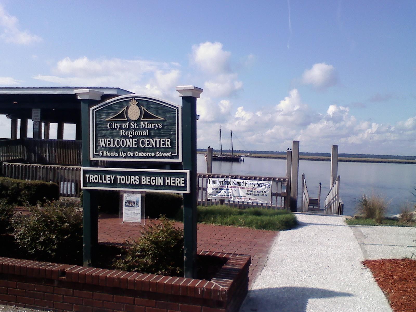 St. Marys town overview — waterfront gazebo
St. Marys, Georgia
St. Marys, Georgia, is the mainland gateway for the public Cumberland Island ferry and a worthwhile waterfront stop of its own. A small downtown around Osborne Street combines maritime museums, places to eat and a riverfront history walk. Staying here makes an early ferry check-in easier without requiring every day to be an island excursion.
Get to know the place
Cumberland Island National Seashore
Cumberland Island National Seashore is a boat-access coastal landscape of maritime forest, salt marsh, dunes and long Atlantic beaches off southern Georgia. A first visit usually works best around the southern landings, with time for both natural habitats and the Dungeness historic district. Arrive prepared to walk and carry the day's supplies.
Get to know the place Area near Savannah
Savannah
Savannah is a river city of public squares, historic houses and a busy commercial waterfront. Start with a walk through the Historic District, make time for a museum and continue toward Forsyth Park or River Street. A short ferry crossing adds another view of the city without turning the day into a long excursion.
Get to know the placePhoto credits4
- Area image: St. Johns River at Mayport, viewed from the Mayport FerryMayport FL St Johns from ferry03. Author: Ebyabe. Credit: Own work. License: CC BY-SA 3.0 (https://creativecommons.org/licenses/by-sa/3.0). Source: https://commons.wikimedia.org/wiki/File:Mayport_FL_St_Johns_from_ferry03.jpgCropped to fit the display.
- Area image: St. Marys, Georgia waterfront gazeboSt Marys Waterfront 3. Author: Legohead. Credit: Own work. License: CC BY-SA 3.0 (https://creativecommons.org/licenses/by-sa/3.0). Source: https://commons.wikimedia.org/wiki/File:St_Marys_Waterfront_3.JPGCropped to fit the display.
- Depicts: Cumberland Island National SeashoreBlackened grass. Author: NPS Photo. Credit: NPGallery. License: Public domain (https://creativecommons.org/publicdomain/mark/1.0/). Source: https://commons.wikimedia.org/wiki/File:Blackened_grass_(6bbd5109-ce9b-453c-a500-9f873ca9e9d9).jpg
- Area image: Street Of Savannah — Area near SavannahStreet Of Savannah - panoramio (1). Author: ---=XEON=---. Credit: https://web.archive.org/web/20161028205126/http://www.panoramio.com/photo/97933155. License: CC BY 3.0 (https://creativecommons.org/licenses/by/3.0). Source: https://commons.wikimedia.org/wiki/File:Street_Of_Savannah_-_panoramio_(1).jpgCropped to fit the display.
