Alameda (Harbor Bay).
Harbor Bay is Alameda’s ferry landing on Bay Farm Island, a different location from Main Street Alameda and Seaplane Lagoon. The terminal serves a waterfront neighbourhood and the nearby business area. Its setting suits a shoreline walk with views across San Francisco Bay, rather than arriving straight into Alameda’s historic shopping streets.
Photo credits1
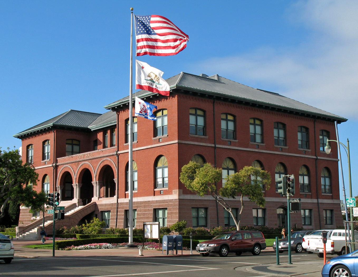
- Area image: Alameda City Hall, Alameda, CaliforniaAlameda City Hall (Alameda, CA) 2. Author: Sanfranman59. Credit: Own work. License: CC BY-SA 3.0 (https://creativecommons.org/licenses/by-sa/3.0). Source: https://commons.wikimedia.org/wiki/File:Alameda_City_Hall_(Alameda,_CA)_2.JPGCropped to fit the display.
Make your way to Alameda (Harbor Bay)
Choose a tool and your dates to check the options for your trip.
More ways to explore
- Country
- United States
- Currency
- USD
- Time zone
- America/Los Angeles
Harbor Bay is Alameda’s ferry landing on Bay Farm Island, a different location from Main Street Alameda and Seaplane Lagoon. The terminal serves a waterfront neighbourhood and the nearby business area. Its setting suits a shoreline walk with views across San Francisco Bay, rather than arriving straight into Alameda’s historic shopping streets.
Use this guide for the Harbor Bay arrival itself and for deciding what to do next. A short visit can stay along the Bay Trail; the USS Hornet, Crab Cove and Park Street require onward travel. The published ferry pattern is weekday service, so a weekend plan needs its own transport solution instead of an assumed boat connection.
When to go
Choose the walk according to wind, rain and tide conditions rather than assuming sheltered water means mild weather. The city identifies coastal storms and king tides as causes of flooding and erosion along the north shore. Carry a layer for the exposed path and ferry deck, and shorten the outing if barriers or weather make the intended route unsuitable.
Getting there
San Francisco Bay Ferry publishes a Harbor Bay–downtown San Francisco route with limited midday departures on weekdays. Check the timetable for the actual date and both directions. The airport at Oakland provides another regional arrival option, followed by ground transport; Harbor Bay is not an airport ferry terminal. Use the full street address for a prearranged pickup.
Getting around
Walking and cycling connect the landing with the local shoreline. The operator lists AC Transit line 31 at the terminal for selected commute departures, so check the bus connection rather than assuming it meets every ferry. Bicycles are carried subject to space. If you continue to the main island, allow enough time to return to this particular terminal.
Local food
A ferry landing is not the same as a dining district. Park and Webster Streets offer a broader Alameda food stop with neighbourhood businesses and outdoor parklets, but need an onward journey from Harbor Bay. For a simple waterfront picnic, bring supplies and use permitted park areas. Check a specific venue’s opening time before relying on breakfast or a late meal around the crossing.
What to see
Shoreline Park wraps around the outer edge of Bay Farm Island, with paved paths and views of the San Francisco skyline. The experience is the changing bay landscape, not a single ticketed monument. For a substantial museum visit elsewhere in Alameda, the USS Hornet offers naval and Apollo recovery history; check the route and its opening days before adding it to a Harbor Bay arrival.
Towns and neighbourhoods
The terminal’s address is 215 Adelphian Way. Bay Farm’s residential waterfront and business district differ from Alameda’s Park and Webster Street commercial corridors. Main Street and Seaplane Lagoon are separate ferry choices on the main island. Keep these names in your itinerary so a driver or navigation app takes you to the correct landing.
Coast and outdoors
The immediate attraction is a shoreline trail with bay views. For a sandy beach outing, plan a separate trip to Crown Memorial State Beach and Crab Cove on Alameda’s main island. There, consult water-quality notices and protected-habitat rules. Around Bay Farm, obey local barriers or diversions: the city documents erosion and restoration needs along parts of the northern shoreline.
Where to stay
A Bay Farm address can suit this landing or nearby business commitments. Park Street and Webster Street provide a different base for meals and town visits, while a San Francisco stay fits a city itinerary. Compare the precise property location and the first and last usable connections; a short distance across the bay is not a late-night transport guarantee.
Useful before you go
The operator lists paid parking through the city’s system and prohibits overnight parking. Follow current signs instead of an old price quoted elsewhere. Toilets are available aboard ferries. Check shoreline-work notices, keep cycle and walking paths clear, and confirm access needs with the transport operator before travelling. Leave a return alternative if your day extends beyond the published service.
Good to know before you go
Is Harbor Bay the same as Main Street Alameda?
No. Harbor Bay is on Bay Farm Island at 215 Adelphian Way; Main Street is a separate Alameda terminal.
Can I assume a weekend Harbor Bay ferry?
No. The reviewed operator page describes weekday service. Check your date and arrange another route if necessary.
Is the USS Hornet beside Harbor Bay?
No. The museum is elsewhere in Alameda and requires an onward journey.
Can I leave a car overnight at the terminal?
The reviewed operator page says overnight parking is not allowed. Check city signs for current parking conditions.
Sources & references
These references support the guide. Confirm opening hours, access and travel services before you go.
- 01San Francisco Bay Ferry: Harbor Bay exact terminal and service pattern
- 02City of Alameda: Shoreline Park
- 03City of Alameda: Bay Farm shoreline and erosion
- 04City of Alameda: local walking, bicycle and transit links
- 05City of Alameda: Park and Webster dining corridors
- 06East Bay Regional Park District: Crown Beach
- 07East Bay Regional Park District: Crab Cove
- 08USS Hornet museum: collection and location
- 09Oakland airport: ground transport
Where could the journey go next?
More guides in United States. Compare the places and check actual connections before combining stops.
Alameda
Alameda offers a quieter East Bay counterpoint to San Francisco: historic shopping streets, a long bayside beach and the former naval air station at Alameda Point. This is the city in San Francisco Bay, not a neighbourhood of Long Beach. Its waterfront attractions are spread across the island, so choose the part you want to explore before selecting a ferry terminal.
Get to know the place
Oakland
Oakland stretches from the working waterfront at Jack London Square to Lake Merritt and the wooded hills. The ferry places you in a useful waterfront district, with restaurants and public spaces nearby, but the city’s art, food and neighbourhood life extend well beyond the landing.
Get to know the place
Treasure Island, San Francisco
Treasure Island is an artificial island neighbourhood in San Francisco Bay, connected to the natural, hillier Yerba Buena Island. Created for the 1939–40 Golden Gate International Exposition, it later became a naval station. Today its historic buildings, new homes and waterfront public spaces sit within a continuing redevelopment project.
Get to know the place
San Francisco
Begin at the Embarcadero, where ferries, piers and the Bay frame an easy first walk. From there, steep streets lead to distinctive neighbourhoods, viewpoints and museums. The Ferry Building is a useful starting point, but Alcatraz departures and the Golden Gate Bridge require their own journeys.
Get to know the placePhoto credits4
- Depicts: AlamedaAlameda City Hall (Alameda, CA) 2. Author: Sanfranman59. Credit: Own work. License: CC BY-SA 3.0 (https://creativecommons.org/licenses/by-sa/3.0). Source: https://commons.wikimedia.org/wiki/File:Alameda_City_Hall_(Alameda,_CA)_2.JPGCropped to fit the display.
- Depicts: OaklandLake Merritt 2022-06-16. Author: Robert Hsiao. Credit: Own work. License: CC BY-SA 4.0 (https://creativecommons.org/licenses/by-sa/4.0). Source: https://commons.wikimedia.org/wiki/File:Lake_Merritt_2022-06-16.pngCropped to fit the display.
- Depicts: Treasure Island, San FranciscoTreasure Island Shoreline Sunset - 2025 (2). Author: 9yz. Credit: Own work. License: CC BY 4.0 (https://creativecommons.org/licenses/by/4.0). Source: https://commons.wikimedia.org/wiki/File:Treasure_Island_Shoreline_Sunset_-_2025_(2).jpgCropped to fit the display.
- Depicts: San FranciscoZeppelin-ride-020100925-195 (5029394846). Author: Craig Howell from San Carlos, CA, USA. Credit: zeppelin-ride-020100925-195. License: CC BY 2.0 (https://creativecommons.org/licenses/by/2.0). Source: https://commons.wikimedia.org/wiki/File:Zeppelin-ride-020100925-195_(5029394846).jpgCropped to fit the display.
