
The Tall Ship — East Boston.
The Tall Ship is a particular floating hospitality venue on Pier One in East Boston, at 1 East Pier Drive. It is not the Sail Boston festival, a general tall-ships sightseeing circuit or an overnight sailing vessel. The attraction is the moored ship and its waterfront setting, with the city skyline across the harbour.
Photo credits1
- Area image: Three-segment panorama of Boston skyline, from East Boston . — Area near The Tall Ship — East BostonBoston skyline from East Boston November 2016 panorama 5. Author: King of Hearts. Credit: Own work. License: CC BY-SA 4.0 (https://creativecommons.org/licenses/by-sa/4.0). Source: https://commons.wikimedia.org/wiki/File:Boston_skyline_from_East_Boston_November_2016_panorama_5.jpgCropped to fit the display.
Make your way to The Tall Ship — East Boston
Choose a tool and your dates to check the options for your trip.
More ways to explore
- Country
- United States
- Currency
- USD
- Time zone
- America/New York
The Tall Ship is a particular floating hospitality venue on Pier One in East Boston, at 1 East Pier Drive. It is not the Sail Boston festival, a general tall-ships sightseeing circuit or an overnight sailing vessel. The attraction is the moored ship and its waterfront setting, with the city skyline across the harbour.
As checked on 30 October 2026, the summer venue and its restaurant boat shuttle are closed for the season. Its winter counterpart, The Rink at The Tall Ship, announces a return on 27 November. Treat that as an upcoming opening announcement, not evidence that skating or food stands are available today.
When to go
Summer entertainment and winter skating have separate calendars. The current winter announcement specifies 27 November, which is more precise than the summer website's generic December-to-March wording. Confirm that the announced opening has actually occurred before travelling for skating. Outdoor sessions and waterfront events can also change with conditions; check the specific event or session rather than treating every season's facilities as simultaneously available.
Getting there
For arrival by land, use 1 East Pier Drive, East Boston. Boston Launch Company identifies Lewis Dock at Lewis Street and East Pier Drive as the corresponding shuttle stop, but currently announces seasonal closure. Boston Water Taxi separately lists a Tall Ship stop. Arrange that operator's exact pickup and landing in advance; a water-taxi listing does not establish that the venue itself is open.
Getting around
Combine a public waterfront walk with the neighbourhood around the venue, then plan any harbour crossing separately. On-demand water taxis do not follow a consistent published timetable and can change stops with conditions. Keep a land-based return option for an evening event. Ask about boarding assistance and the venue's accessible route directly when mobility needs make steps, slopes or floating docks important.
Local food
The summer venue centres on an oyster bar, drinks and pier-side food vendors. The winter site describes seasonal food stands and bars as part of its separate programme. Neither description guarantees current service during the closure. Elsewhere in East Boston, the city highlights a broad immigrant food culture; nearby ReelHouse is a separate restaurant with its own menu, reservations and opening arrangements.
What to see
When operating, the venue combines a vessel converted into an oyster bar with activities on the adjoining pier. The public neighbourhood offers a separate outing: LoPresti Park has a section of Harborwalk, courts and play space. East Boston's former shipbuilding role gives context to the harbour view, but this entertainment venue should not be described as a maritime museum or historic-vessel tour.
Towns and neighbourhoods
Use East Pier Drive for this stop. ReelHouse on New Street and the Logan airport dock are distinct locations, even though they also appear on harbour transport lists. East Boston is across the water from downtown Boston; a nearby-looking hotel or attraction on the opposite shore still requires a crossing. Keep the venue entrance, boat landing and accommodation address as three separate planning points.
Coast and outdoors
The immediate outing is a pier and urban waterfront walk, not a beach day. Use public portions of the shoreline and respect gates around commercial or residential areas. LoPresti offers an alternative outdoor stop when the venue is shut. For a longer route, inspect the Mary Ellen Welch Greenway's construction notice first: its closed sections prevent assuming an uninterrupted neighbourhood trail.
Where to stay
The Tall Ship is an event and dining destination, not accommodation aboard a ship. East Boston's airport-side hotels provide one possible base; a downtown stay offers another but adds a cross-harbour journey. The Hyatt near Logan has its own waterfront address and transport arrangements, separate from East Pier Drive. Check the property and the last return connection before choosing a late event.
Useful before you go
Check the correct season's owner page, then the particular event's admission, age and reservation conditions. The winter site recommends advance skating tickets because space is limited, but its future opening notice remains the key planning constraint today. Keep dining, admission and transport confirmations separate. Do not infer a scheduled ferry, public access through a closed venue or sailing excursion from the Tall Ship name.
Good to know before you go
Is this the Sail Boston tall-ships festival?
No. It is the moored Tall Ship hospitality venue at 1 East Pier Drive in East Boston.
Is it open on the guide's review date?
On 30 October 2026 the summer venue and its shuttle are closed. The winter site announces a 27 November return; that is a future opening.
Can I sleep aboard the ship?
The operator describes a dining and event venue, not overnight passenger accommodation.
Does a water-taxi stop prove the venue is open?
No. Transport access and venue opening are separate. Confirm both before arranging a visit.
Is ReelHouse the same boarding location?
No. ReelHouse uses New Street, while the Tall Ship shuttle stop is identified at Lewis Dock beside East Pier Drive.
Sources & references
These references support the guide. Confirm opening hours, access and travel services before you go.
- 01Venue owner: floating oyster bar, East Boston address and seasonal closure
- 02Winter venue owner: announced November 27 return
- 03Boat operator: Lewis Dock geography and current seasonal closure
- 04Boat operator: exact meeting points and variable pickup arrangements
- 05Water taxi operator: distinct Tall Ship, ReelHouse and airport stops
- 06Water taxi operator: on-demand reservations and pickup information
- 07Boston parks: LoPresti public recreation and Harborwalk
- 08City: East Boston shipbuilding, homes and immigrant food traditions
- 09Local Greenway organisation: current construction closures
- 10Hotel operator: airport-side accommodation geography
- 11Separate East Boston restaurant: location and dining
Where could the journey go next?
More guides in United States. Compare the places and check actual connections before combining stops.
 Area near ReelHouse, East Boston
ReelHouse, East Boston
ReelHouse East Boston is a waterfront restaurant and nearby boat landing at 6 New Street, within The Eddy apartment building. This entry covers that specific destination, not an independent town or every ReelHouse location. It suits a meal with harbour views followed by a walk through the residential waterfront.
Get to know the place Boston area overview
Boston waterfront
Boston's waterfront links historic downtown piers, commuter boats and the newer Seaport through a varied harbour itinerary. This guide covers the shoreline around Rowes Wharf, Sargent's Wharf and Fan Pier as separate places, not a single interchangeable terminal. A walk can connect museums, a seafood meal and views, provided the actual boarding point remains clear.
Get to know the placeBoston
Boston combines a historic walking city with working harbour districts, major art museums and neighbourhoods that reward separate outings. A first visit can link the Freedom Trail, North End and downtown waterfront, then leave another day for Back Bay and the Museum of Fine Arts. Trying to fit every district into one ferry stop makes the city feel smaller on a map than it is on foot.
Get to know the place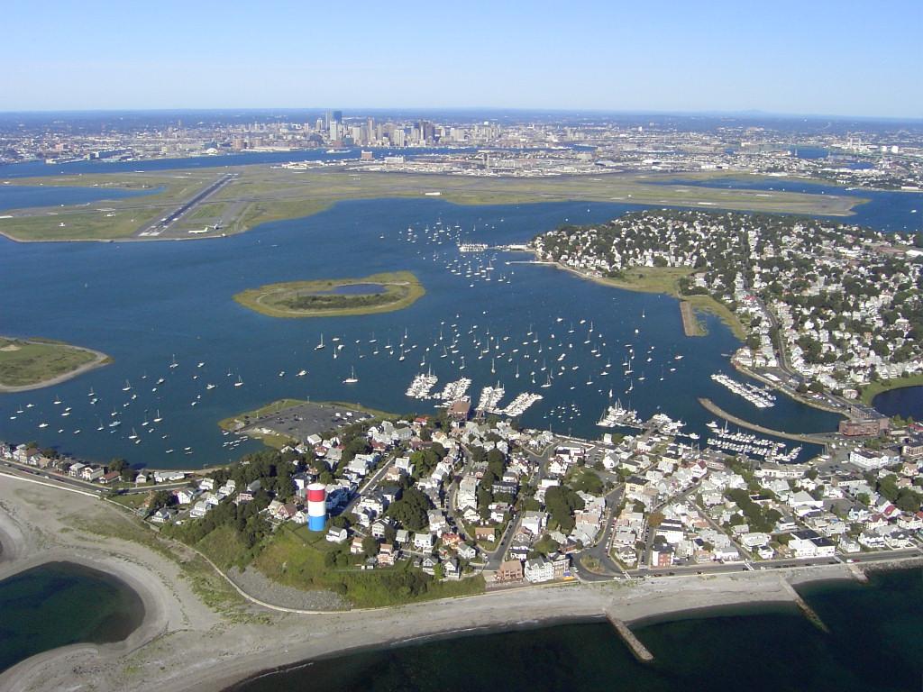
Winthrop
Winthrop is a coastal town beside Boston Harbor, with residential streets between an ocean-facing beach, sheltered water and salt marsh. The ferry landing is at the southern end on Shirley Street; it is a starting point for exploring, not the town centre or a beach resort complex. Choose a shoreline walk, local meal and one longer outdoor stop for an unhurried day.
Get to know the placePhoto credits3
- Area image: Three-segment panorama of Boston skyline, from LoPresti Park, East Boston . — Area near ReelHouse, East BostonBoston skyline from East Boston November 2016 panorama 1. Author: King of Hearts. Credit: Own work. License: CC BY-SA 4.0 (https://creativecommons.org/licenses/by-sa/4.0). Source: https://commons.wikimedia.org/wiki/File:Boston_skyline_from_East_Boston_November_2016_panorama_1.jpgCropped to fit the display.
- Area image: Boston — Boston area overviewISH WC Boston4. Author: Ian Howard. Credit: Own work. License: CC BY 2.5 (https://creativecommons.org/licenses/by/2.5). Source: https://commons.wikimedia.org/wiki/File:ISH_WC_Boston4.jpgCropped to fit the display.
- Depicts: WinthropWinthrop ma. Author: Sean 2015 at English Wikipedia. Credit: Own work. License: Public domain (https://creativecommons.org/publicdomain/mark/1.0/). Source: https://commons.wikimedia.org/wiki/File:Winthrop_ma.jpg
