
Maalaea.
Māʻalaea combines a working boat harbour with marine-life attractions on Maui’s southern coastline. It is a useful place to understand the island’s connection to the sea: aquarium exhibits, boat departures, shoreline walks and a nearby wetland refuge offer quite different ways to spend a day. The harbour district is compact, but the wider bay is not a single walkable resort.
Photo credits1
- Depicts: MaalaeaCoast Guard sailors greet a NOAA officer aboard his NOAA patrol boat - 200215-G-KE614-1012. Author: Petty Officer 3rd Class Benjamin Berkow. Credit: https://www.dvidshub.net/image/6104548/us-coast-guard-participates-operation-kohola-guardian. License: Public domain (https://creativecommons.org/publicdomain/mark/1.0/). Source: https://commons.wikimedia.org/wiki/File:Coast_Guard_sailors_greet_a_NOAA_officer_aboard_his_NOAA_patrol_boat_-_200215-G-KE614-1012.jpg
Make your way to Maalaea
Choose a tool and your dates to check the options for your trip.
More ways to explore
- Country
- United States
- Currency
- USD
- Time zone
- Pacific/Honolulu
Māʻalaea combines a working boat harbour with marine-life attractions on Maui’s southern coastline. It is a useful place to understand the island’s connection to the sea: aquarium exhibits, boat departures, shoreline walks and a nearby wetland refuge offer quite different ways to spend a day. The harbour district is compact, but the wider bay is not a single walkable resort.
Plan around a specific interest. Families can allow time for Maui Ocean Center; birdwatchers can add Keālia’s separate viewing areas; visitors joining a boat should prioritise their exact check-in location. Kīhei lies farther along the coast and offers a larger town base. A place with Māʻalaea in its name is not necessarily beside the harbour.
When to go
Winter and spring are particularly interesting for marine wildlife. NOAA describes humpback season as generally November through May, with the highest abundance usually January to March; sightings remain uncertain. Keālia also attracts migratory birds, with shorebirds arriving from late summer and more waterfowl in autumn. In any season, choose boat outings according to current sea conditions and keep an indoor aquarium visit as a separate option.
Getting there
Road access is via Honoapiʻilani Highway, with connections from central Maui and the Kīhei side. For the Lānaʻi ferry, verify the Maui harbour directly: on 29 October 2026 the operator’s homepage listed Māʻalaea–Mānele, but its directional page listed Lāhainā and said Māʻalaea was temporarily suspended. These conflicting pages do not establish a reliable departure point. Use your confirmed booking instructions before travelling to either harbour.
Getting around
Walking works around the aquarium and harbour businesses, while beach and refuge visits need a separate plan. Maui Bus serves Māʻalaea Harbor Village, but check current routes and the last useful connection for your outing. The county’s central transfer point is Kahului Transit Center, not the old Queen Kaʻahumanu Center stop. Allow road-transfer time and a margin for check-in rather than matching a bus arrival exactly to a sailing.
Local food
Look for island ingredients such as local fish, pineapple and Maui-grown or roasted products. Maui Ocean Center’s September 2026 dining update lists a loco moco breakfast, pineapple bowl and locally roasted coffee alongside its lunch service. Harbour Village provides other meal options. Plan food around the actual departure: a morning menu does not establish early pre-ferry availability, and a leisurely lunch needs enough time before check-in.
What to see
Maui Ocean Center focuses on Hawaiian marine habitats, including living coral exhibits and the Humpbacks of Hawaiʻi Sphere experience. This is a screen-based whale presentation, not a live whale enclosure. Nearby harbour businesses provide a different view of working marine tourism. Keālia Pond National Wildlife Refuge adds wetland wildlife, including Hawaiian stilts and coots; its visitor centre and coastal boardwalk have separate entrances.
Towns and neighbourhoods
Māʻalaea Harbor Village groups shops and restaurants close to the boat basin. Hauʻoli Street follows the residential shore toward Haycraft Beach Park. Farther east, the Keālia coastal boardwalk is accessed from North Kīhei Road, while the refuge visitor centre is reached from Maui Veterans Highway. Keep those locations separate when arranging a pickup or calculating the time available before a boat departure.
Coast and outdoors
Haycraft Beach Park provides shoreline access, picnic space and a place for a coastal walk at the end of Hauʻoli Street. The county states that no lifeguard is on duty, so a pleasant beach view should not be read as approval to swim in any conditions. Keālia’s boardwalk offers a land-based alternative for wildlife observation. Stay on permitted routes and respect restoration areas and nesting habitat.
Where to stay
The Hauʻoli Street shoreline includes condominium buildings, while Kīhei offers a broader choice of small hotels, cottages and apartments along its beach road. Choose by the exact address and the outings you intend to make. Verify that the particular property accepts your intended stay and has suitable transport access. A Kīhei accommodation marketed with a bay or Māʻalaea name should not be assumed to be walking distance from the harbour.
Useful before you go
Check the name of the harbour, operator and departure point together; Maui has several distinct boat bases. Follow wildlife-viewing guidance and give turtles, dolphins, seals and whales space rather than trying to approach them for photographs. At Keālia, pets, drones and collecting are prohibited, and gates have published closing arrangements. Carry sun protection and drinking water, and leave time to return from separate shore or wetland stops.
Good to know before you go
Is the Lānaʻi ferry definitely departing from Māʻalaea?
Not established by the conflicting operator pages checked on 29 October 2026. Confirm the actual Maui departure harbour directly.
Are Keālia’s boardwalk and visitor centre at the same entrance?
No. The boardwalk is off North Kīhei Road; the main visitor area is reached from Maui Veterans Highway.
Does Haycraft Beach Park have a lifeguard?
The county facility page states that no lifeguard is on duty.
When is humpback viewing most promising?
NOAA identifies January to March as the usual peak within a broader November-to-May season, without guaranteeing sightings.
Can I use public transport?
Maui Bus serves Māʻalaea Harbor Village; check the current route, connections and sufficient time before a boat trip.
Sources & references
These references support the guide. Confirm opening hours, access and travel services before you go.
- 01State tourism: Hawaiian aquarium exhibits and Sphere
- 02State tourism: separate Kihei area and lodging
- 03USFWS: distinct Kealia entrances, wildlife and rules
- 04Maui County: Haycraft park location and no lifeguard
- 05State tourism: Maalaea harbour district
- 06Aquarium operator: September 2026 island-ingredient menu update
- 07NOAA: humpback season and peak
- 08Ferry operator homepage: Maalaea claim, conflicts with directional page
- 09Ferry operator directional page: Lahaina claim and Maalaea suspension
- 10Ferry operator: road approach to Maalaea
- 11Maui County: current transit hub and Harbor Village service
- 12Condominium association: Hauoli Street location
- 13NOAA: responsible wildlife observation
Where could the journey go next?
More guides in United States. Compare the places and check actual connections before combining stops.

Manele
Mānele is the small-boat harbour and coastal arrival area on southern Lānaʻi, not the island’s main town. The neighbouring bays bring together a working landing, a public beach park and a protected marine environment. It is a good starting point for a day focused on the coast, provided you leave time for the return journey.
Get to know the place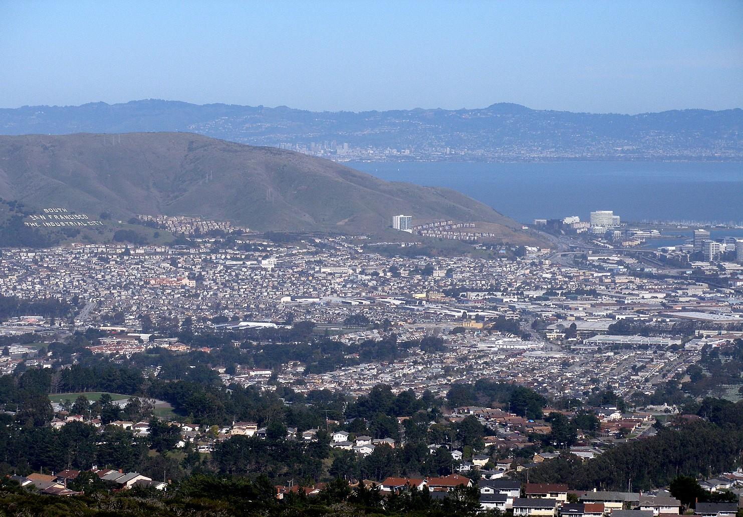
South San Francisco
South San Francisco is a separate Peninsula city north of SFO, often called South City. Its industrial past survives in the hillside lettering above town, while biotechnology campuses shape Oyster Point. The ferry landing belongs to that bayside business district, not San Francisco’s Embarcadero or downtown waterfront.
Get to know the place
San Francisco
Begin at the Embarcadero, where ferries, piers and the Bay frame an easy first walk. From there, steep streets lead to distinctive neighbourhoods, viewpoints and museums. The Ferry Building is a useful starting point, but Alcatraz departures and the Golden Gate Bridge require their own journeys.
Get to know the place
Treasure Island, San Francisco
Treasure Island is an artificial island neighbourhood in San Francisco Bay, connected to the natural, hillier Yerba Buena Island. Created for the 1939–40 Golden Gate International Exposition, it later became a naval station. Today its historic buildings, new homes and waterfront public spaces sit within a continuing redevelopment project.
Get to know the placePhoto credits4
- Depicts: ManeleLanai-Puupehe-from-ManeleBay-golf-clubhouse. Author: Joel Bradshaw. Credit: Own work. License: Public domain (https://creativecommons.org/publicdomain/mark/1.0/). Source: https://commons.wikimedia.org/wiki/File:Lanai-Puupehe-from-ManeleBay-golf-clubhouse.JPG
- Depicts: South San FranciscoSouthsanfrancisco. Author: Coolcaesar at English Wikipedia. Credit: Photographed on February 19, 2007 by user Coolcaesar.. License: CC BY-SA 3.0 (https://creativecommons.org/licenses/by-sa/3.0/). Source: https://commons.wikimedia.org/wiki/File:Southsanfrancisco.jpgCropped to fit the display.
- Depicts: San FranciscoZeppelin-ride-020100925-195 (5029394846). Author: Craig Howell from San Carlos, CA, USA. Credit: zeppelin-ride-020100925-195. License: CC BY 2.0 (https://creativecommons.org/licenses/by/2.0). Source: https://commons.wikimedia.org/wiki/File:Zeppelin-ride-020100925-195_(5029394846).jpgCropped to fit the display.
- Depicts: Treasure Island, San FranciscoTreasure Island Shoreline Sunset - 2025 (2). Author: 9yz. Credit: Own work. License: CC BY 4.0 (https://creativecommons.org/licenses/by/4.0). Source: https://commons.wikimedia.org/wiki/File:Treasure_Island_Shoreline_Sunset_-_2025_(2).jpgCropped to fit the display.
