
Boston waterfront.
Boston's waterfront links historic downtown piers, commuter boats and the newer Seaport through a varied harbour itinerary. This guide covers the shoreline around Rowes Wharf, Sargent's Wharf and Fan Pier as separate places, not a single interchangeable terminal. A walk can connect museums, a seafood meal and views, provided the actual boarding point remains clear.
Photo credits1
- Area image: Boston — Boston area overviewISH WC Boston4. Author: Ian Howard. Credit: Own work. License: CC BY 2.5 (https://creativecommons.org/licenses/by/2.5). Source: https://commons.wikimedia.org/wiki/File:ISH_WC_Boston4.jpgCropped to fit the display.
Make your way to Boston waterfront
Choose a tool and your dates to check the options for your trip.
More ways to explore
- Country
- United States
- Currency
- USD
- Time zone
- America/New York
Boston's waterfront links historic downtown piers, commuter boats and the newer Seaport through a varied harbour itinerary. This guide covers the shoreline around Rowes Wharf, Sargent's Wharf and Fan Pier as separate places, not a single interchangeable terminal. A walk can connect museums, a seafood meal and views, provided the actual boarding point remains clear.
Rowes Wharf sits beside the Boston Harbor Hotel downtown, Sargent's Wharf is on the North End side, and Fan Pier belongs to the Seaport. Charlestown is another district across the water, not the location of Sargent's Wharf. Build a route around the shore you are visiting rather than relying on a generic Boston waterfront label.
When to go
Museums and town-side restaurants give the waterfront uses beyond summer, but their own closing days still matter. Island excursions and museum shuttles have different seasons from commuter ferries. In particular, the ICA Watershed is a summer art space across the harbour, separate from the Seaport museum. The October 2026 ferry extension applies to named commuter routes through December 31; it does not extend every sightseeing or island boat.
Getting there
Use the exact berth named by your operator. Rowes Wharf has Hingham commuter service, while Seaport routes use their specified docks and other services depart from Long Wharf. For downtown public transport, Aquarium station serves Central Wharf; the ICA directs visitors to Courthouse or World Trade Center on the Silver Line. A hotel address or nearby attraction is a landmark, not an automatic substitute for the ferry check-in point.
Getting around
Walk manageable stretches between wharves and use public transport for longer city connections. Boston Water Taxi works on demand rather than to a consistent published timetable; request the named dock and confirm conditions. The Seaport commuter shuttle has its own weekday commuting pattern, distinct from casual water-taxi service. For accessibility, check both the street route and vessel boarding: an accessible museum does not guarantee a step-free boat.
Local food
Fort Point offers seafood dining, including The Barking Crab, whose operator describes lobster-roll roots and a year-round restaurant with different summer and winter settings. The North End gives another direction for pasta, Italian pastries and coffee. The ICA has its own coffee-and-wine bar for a shorter museum stop. Use current menus and opening notices, and avoid assuming a waterfront table comes with a boat reservation.
What to see
The New England Aquarium at Central Wharf gives the downtown stretch a substantial indoor stop; its harbour seals are temporarily off exhibit during habitat improvements. Across Fort Point Channel, Boston Children's Museum offers play-focused exhibits for families. Farther into Seaport, the ICA adds contemporary art and waterfront architecture. These attractions have separate tickets and closure days, so choose one main interior visit instead of treating a walking route as admission to all.
Towns and neighbourhoods
Downtown and Rowes Wharf suit a harbour arrival combined with the Financial District and Aquarium area. Northward, Sargent's Wharf connects with the North End's historic streets and food stops. Across the channel, Fort Point and Seaport lead toward Fan Pier and the ICA. A water-taxi stop, commuter-ferry berth and a venue's street entrance can be close together without sharing the same boarding instructions.
Coast and outdoors
Harborwalk is a near-continuous public shoreline route linking different districts, with gaps and local access arrangements. Select a section that matches your walking time and check signs where a path turns through a development. The central piers are a working urban waterfront, not a beach outing. Trips to harbour-island paths and beaches require separate seasonal ferry planning and sufficient time for the last return.
Where to stay
Staying downtown at Rowes Wharf can place a traveller beside the harbour and close to the Aquarium area; the Boston Harbor Hotel confirms its address at 70 Rowes Wharf. That hotel entrance remains different from the water-taxi office and boarding berth. A Seaport base suits the ICA and contemporary waterfront venues but changes the walk to the North End. Select accommodation by the itinerary and exact dock, not the shared harbour name.
Useful before you go
Keep admission times and transport tickets separate, and leave space between a museum visit and boarding. The Children's Museum recommends advance tickets, while the ICA requires advance tickets even for its free Thursday-evening admission. Check venue rules for bags and children before arrival. On public paths, follow posted access and detours; private terraces and marina berths are not automatically part of the public Harborwalk.
Good to know before you go
Are Rowes Wharf and Fan Pier the same terminal?
No. Rowes Wharf is downtown, while Fan Pier is in Seaport across Fort Point Channel. Follow the address on your operator's ticket.
Is Sargent's Wharf in Charlestown?
No. The current water-taxi operator places it in the North End. Charlestown stops are separate.
Can I use one ticket for the waterfront museums?
Do not assume so. The Aquarium, Children's Museum and ICA have separate admission arrangements.
Is the ICA Watershed the Seaport museum?
No. The Watershed is a summer art space in East Boston, across the harbour, with separate access arrangements.
Do water taxis follow a regular ferry timetable?
No. Their operator arranges on-demand pickups around bookings and conditions. Scheduled commuter ferries are a different service.
Sources & references
These references support the guide. Confirm opening hours, access and travel services before you go.
- 01Harborwalk organisation: district connections and incomplete sections
- 02Transport operator: separate Rowes, Sargents and Fan Pier locations
- 03Transport operator: Sargents Wharf in North End and distinct harbour stops
- 04Transport operator: on-demand service and pickup arrangements
- 05Aquarium: Central Wharf location, public transport and exhibit notice
- 06ICA: Seaport art, access and current visitor arrangements
- 07Childrens Museum: Fort Point location and family visit guidance
- 08Restaurant operator: Fort Point seafood dining and seasonal setting
- 09Official tourism body: North End culinary traditions
- 10Hotel owner: Rowes Wharf accommodation geography
- 11Local transportation management association: Seaport commuter and on-demand boats
- 12October28 2026 statement: commuter ferry service calendars
- 13Park partnership: separate seasonal island sailings
- 14ICA: separate summer East Boston art space and shuttle access limits
Where could the journey go next?
More guides in United States. Compare the places and check actual connections before combining stops.
Boston
Boston combines a historic walking city with working harbour districts, major art museums and neighbourhoods that reward separate outings. A first visit can link the Freedom Trail, North End and downtown waterfront, then leave another day for Back Bay and the Museum of Fine Arts. Trying to fit every district into one ferry stop makes the city feel smaller on a map than it is on foot.
Get to know the place Area near The Tall Ship — East Boston
The Tall Ship — East Boston
The Tall Ship is a particular floating hospitality venue on Pier One in East Boston, at 1 East Pier Drive. It is not the Sail Boston festival, a general tall-ships sightseeing circuit or an overnight sailing vessel. The attraction is the moored ship and its waterfront setting, with the city skyline across the harbour.
Get to know the place Area near ReelHouse, East Boston
ReelHouse, East Boston
ReelHouse East Boston is a waterfront restaurant and nearby boat landing at 6 New Street, within The Eddy apartment building. This entry covers that specific destination, not an independent town or every ReelHouse location. It suits a meal with harbour views followed by a walk through the residential waterfront.
Get to know the place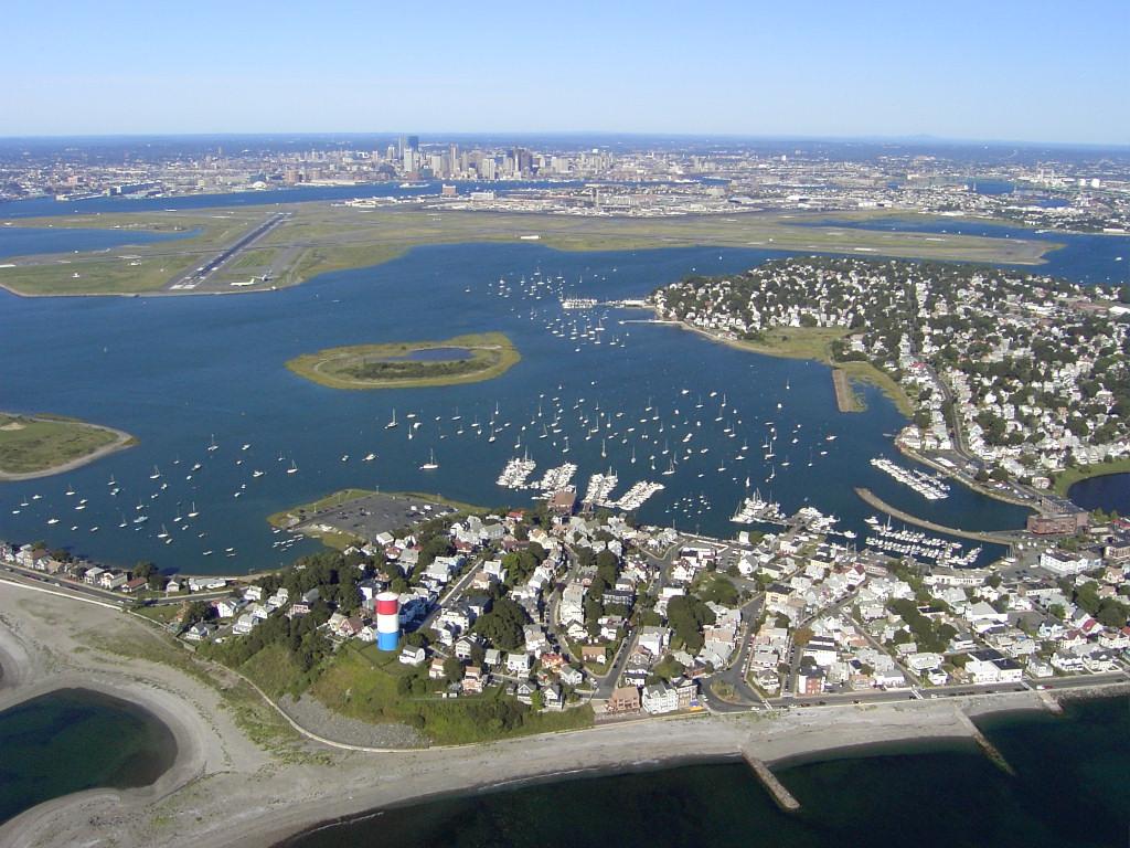
Winthrop
Winthrop is a coastal town beside Boston Harbor, with residential streets between an ocean-facing beach, sheltered water and salt marsh. The ferry landing is at the southern end on Shirley Street; it is a starting point for exploring, not the town centre or a beach resort complex. Choose a shoreline walk, local meal and one longer outdoor stop for an unhurried day.
Get to know the placePhoto credits4
- Depicts: BostonISH WC Boston4. Author: Ian Howard. Credit: Own work. License: CC BY 2.5 (https://creativecommons.org/licenses/by/2.5). Source: https://commons.wikimedia.org/wiki/File:ISH_WC_Boston4.jpgCropped to fit the display.
- Area image: Three-segment panorama of Boston skyline, from East Boston . — Area near The Tall Ship — East BostonBoston skyline from East Boston November 2016 panorama 5. Author: King of Hearts. Credit: Own work. License: CC BY-SA 4.0 (https://creativecommons.org/licenses/by-sa/4.0). Source: https://commons.wikimedia.org/wiki/File:Boston_skyline_from_East_Boston_November_2016_panorama_5.jpgCropped to fit the display.
- Area image: Three-segment panorama of Boston skyline, from LoPresti Park, East Boston . — Area near ReelHouse, East BostonBoston skyline from East Boston November 2016 panorama 1. Author: King of Hearts. Credit: Own work. License: CC BY-SA 4.0 (https://creativecommons.org/licenses/by-sa/4.0). Source: https://commons.wikimedia.org/wiki/File:Boston_skyline_from_East_Boston_November_2016_panorama_1.jpgCropped to fit the display.
- Depicts: WinthropWinthrop ma. Author: Sean 2015 at English Wikipedia. Credit: Own work. License: Public domain (https://creativecommons.org/publicdomain/mark/1.0/). Source: https://commons.wikimedia.org/wiki/File:Winthrop_ma.jpg
