
Guatemala.
Guatemala combines volcanic highlands, Maya heritage, tropical forests and two very different coastlines. A journey through Antigua and Lake Atitlán has a different rhythm from a stay beside the Río Dulce or a visit to the archaeological landscapes of Petén. Choose a few regions and allow the journeys between them to shape the itinerary.
Photo credits1
- Depicts: Guatemala
A little closer to Guatemala
Geography, regions and practical details from the country guide. Go straight to a chapter, or browse every destination below.
Go straight to the destinationsGuatemala combines volcanic highlands, Maya heritage, tropical forests and two very different coastlines. A journey through Antigua and Lake Atitlán has a different rhythm from a stay beside the Río Dulce or a visit to the archaeological landscapes of Petén. Choose a few regions and allow the journeys between them to shape the itinerary.
For travellers using boats, the Caribbean side around Izabal deserves particular attention. Río Dulce/Fronteras, Livingston and Puerto Barrios are separate places, with different onward transport. A boat ride through the river landscape can be part of the visit itself, rather than simply the quickest route to a beach.
Geography
Guatemala lies in Central America, with Mexico to the north and west, Belize and the Caribbean side to the east, and Honduras and El Salvador to the southeast. The Pacific coast lies south of the mountain and volcanic highlands. Elevation helps explain why coastal and upland stays need different clothing.
Lake Izabal drains through the Río Dulce towards the Caribbean. The river corridor and its canyon link forest scenery with the coast around Livingston; this is a different setting from the volcanic-sand beaches of the Pacific.
Regions to explore
Antigua offers historic streets, churches and craft workshops, while the highlands around Lake Atitlán call for time in individual communities rather than a rapid tour of every shore. Petén is a separate northern region associated with Maya archaeological sites, including Tikal.
For a Caribbean itinerary, choose a base around Río Dulce or Livingston and arrange the necessary boat legs. Castillo de San Felipe and the river canyon provide different reasons to stop. In the Verapaces, Cobán, cloud forests and cave landscapes offer another inland direction. Avoid squeezing all these regions into a short coastal visit.
Languages
Spanish is the official language. Guatemala also has 22 Maya languages, alongside Xinka and Garifuna; the linguistic variety is part of everyday life, not merely a museum topic. Keep destination names and accommodation directions in Spanish, and ask before assuming English assistance. A greeting learned from a local host is more respectful than treating different communities as culturally interchangeable.
Money
The currency is the quetzal, GTQ. Some tourist businesses accept US dollars, but local currency is useful for everyday purchases and smaller transfers. Agree the currency, passenger count and total with a boat operator or driver before departing. Carry manageable cash for places where a card is not accepted, and check the final bill rather than relying on a remembered exchange rate.
Local culture
Food reflects regional traditions. Pepián is a richly seasoned stew with different local versions; kak'ik is associated with Q'eqchi' cooking in Alta Verapaz and traditionally uses turkey. Ask about the preparation and ingredients rather than assuming every stew has the same meat or seasoning.
Livingston offers a distinct Garifuna cultural setting. Tapado combines coconut milk, plantain, vegetables and seafood, and community-led visits can introduce music, food and language in context. Ask permission for photographs and let the people presenting their culture set the terms of participation.
Practical information
The broad seasonal pattern is a drier period around November–April and a wetter one around May–October, but altitude and region matter. Carry rain protection and an extra layer for upland stays. Check local weather, access and volcanic activity guidance before choosing a mountain excursion.
Combine road and boat transport deliberately: a ticket to Río Dulce does not itself deliver you to accommodation near Livingston. Confirm the actual landing, return arrangement and luggage space, and avoid planning a remote boat arrival immediately before an international flight. Check passport and entry conditions through official channels. INGUAT's ASISTUR service provides tourist assistance and destination information; save its current contact details before leaving reliable connectivity.
Good to know before you go
Is Livingston the same as Río Dulce/Fronteras?
No. Livingston is at the Caribbean mouth of the river, while Río Dulce/Fronteras is a different inland transport and accommodation base.
Does a coastal packing list work for the highlands?
Not necessarily. Upland temperatures differ from the tropical coast; bring layers as well as rain protection.
Is Spanish the only language spoken?
No. Alongside Spanish, Maya languages, Xinka and Garifuna form part of Guatemala’s linguistic heritage and daily life.
Can I use US dollars everywhere?
No. Some tourist businesses accept them, but quetzales are useful for smaller purchases and transfers. Confirm the currency before agreeing a price.
Sources & references
These references support the guide. Confirm opening hours, access and travel services before you go.
- 01Guatemala Convention Bureau: regional geography
- 02INGUAT: official 2025 tourist map
- 03INGUAT ASISTUR: visitor information
- 04INGUAT: protected areas guide
- 05INGUAT Visit Guatemala: traditional dishes
- 06Guatemala Cultural Information System: tapado
- 07Dibasei Garifuna: community-led Livingston information
- 08ASISTUR: tourist information
Find your place in Guatemala
Open the guides, get a feel for the differences between places, and find the ones that fit your plans.

Livingston
Livingston sits where the Río Dulce reaches Amatique Bay on Guatemala's Caribbean coast. Its Garífuna heritage is central to the visit, alongside the Q'eqchi' communities of the surrounding region. Come for the town's food, language and cultural life as well as excursions on the river and coast. An overnight gives these experiences more room than a hurried stop between boats.
Read the field guide
Puerto Barrios
Puerto Barrios is a working Caribbean port city and the departmental capital of Izabal. It is useful for road arrivals, local services and onward boats to Livingston, but its own food and waterfront deserve time too. Garífuna influence appears in coconut-based cooking and bread, alongside the commercial life of a city built around maritime trade.
Read the field guide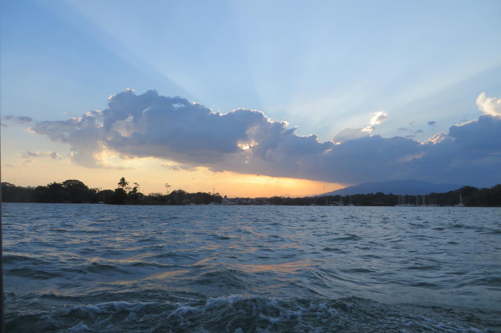 Area overview: Río Dulce river region
Río Dulce / Fronteras
Río Dulce links Lake Izabal with Guatemala's Caribbean coast through a landscape of broad water, tropical forest and a wooded canyon. Fronteras is the road-access town used as a gateway to this river country. Come for a lodge by the water, boat journeys and nature outings, while using the town for transport and practical services.
Read the field guidePhoto credits3
- Depicts: LivingstonLivingston, Izabal - Guatemala. Author: Exploraguate. Credit: Own work. License: CC BY-SA 4.0 (https://creativecommons.org/licenses/by-sa/4.0). Source: https://commons.wikimedia.org/wiki/File:Livingston,_Izabal_-_Guatemala.jpgCropped to fit the display.
- Depicts: Puerto BarriosCiudad de Puerto Barrios de noche. Author: Robert338950. Credit: Own work. License: CC BY-SA 4.0 (https://creativecommons.org/licenses/by-sa/4.0). Source: https://commons.wikimedia.org/wiki/File:Ciudad_de_Puerto_Barrios_de_noche.jpgCropped to fit the display.
- Area image: Río Dulce river region — Area overview: Río Dulce river regionRioDulce1. Author: BBCLCD. Credit: Own work. License: CC BY-SA 4.0 (https://creativecommons.org/licenses/by-sa/4.0). Source: https://commons.wikimedia.org/wiki/File:RioDulce1.jpgCropped to fit the display.
