
Hollis.
Hollis is the quiet ferry gateway on the eastern side of Prince of Wales Island, with its terminal in Clark Bay on Twelve Mile Arm. It is a small residential community with a mining and logging history, rather than a compact resort town. Forest, river and sheltered-water scenery form the setting for an arrival that often continues elsewhere on the island.
Photo credits1
- Area image: Prince of Wales Island, Alaska — Area overview: Prince of Wales Island, AlaskaKasaan Peninsula pano. Author: Jsayre64. Credit: Own work. License: CC BY-SA 3.0 (https://creativecommons.org/licenses/by-sa/3.0). Source: https://commons.wikimedia.org/wiki/File:Kasaan_Peninsula_pano.JPGCropped to fit the display.
Make your way to Hollis
Choose a tool and your dates to check the options for your trip.
More ways to explore
- Country
- United States
- Currency
- USD
- Time zone
- America/Sitka
Hollis is the quiet ferry gateway on the eastern side of Prince of Wales Island, with its terminal in Clark Bay on Twelve Mile Arm. It is a small residential community with a mining and logging history, rather than a compact resort town. Forest, river and sheltered-water scenery form the setting for an arrival that often continues elsewhere on the island.
Give Hollis its own place in the itinerary without confusing it with all of Prince of Wales. A cabin near the landing suits an early departure or a slower local stay; Craig, Klawock and other communities are separate onward destinations. Arrange transport before stepping off the ferry, especially if your plan combines a forest walk with shopping or a cultural visit farther west.
When to go
Summer makes longer outdoor days and cabin trips easier to organise, but rain gear remains essential in the Tongass rainforest. The island visitor authority describes wetter winter conditions and more substantial snow at higher elevations. Keep a road and weather margin for the ferry rather than planning to reach check-in at the last moment. Reserve accommodation early for busy summer travel and check individual seasonal opening dates.
Getting there
The Inter-Island Ferry Authority links Ketchikan with Hollis for passengers and vehicles. Its Hollis terminal is at Mile 31 of the Klawock–Hollis Highway in Clark Bay. Current policy requires passengers and vehicles to be ticketed and ready at least one hour before departure, with reservations strongly recommended. Flying first to Ketchikan adds a separate airport-ferry crossing and transfer to the IFA terminal; allow time for every stage.
Getting around
A reserved vehicle or confirmed transfer is useful for the dispersed island settlements. IFA lists an on-call Craig Tribal Association bus to the ferry terminal but expressly says it is not always available. Local taxi and rental listings also offer ferry collection; arrange the actual trip in advance. Do not count on finding an unbooked waiting shuttle or assume that a vehicle reservation includes passengers automatically.
Local food
Plan food around the wider island’s actual services. The chamber directory places grocery stores in Craig and Klawock and describes local salmon products, bakeries and cafés, including Filipino takeaway food in Craig. These are onward options, not a promised restaurant row at Hollis. For a cabin stay, obtain groceries before settling in and ask the host what cooking equipment is supplied. Match any restaurant stop to its current opening.
What to see
The Harris River area is a rewarding local introduction to the landscape, with riverside paths and interpretation of habitat restoration. Hollis’s public library and nearby small public dock offer a quieter community stop when open. For a more substantial cultural outing, travel onward to Klawock’s totem park, where restored and replicated poles preserve stories associated with Tuxekan. That park is not an attraction beside the Hollis terminal.
Towns and neighbourhoods
Clark Bay is the practical arrival area. The road inland leads toward the Klawock crossroads, with Craig farther south on the western side of the island. Hydaburg and Kasaan are additional, distinct community visits rather than neighbourhoods of Hollis. Plan one geographic group at a time: the road network makes exploration possible, but the existence of a road does not make every island attraction a short detour.
Coast and outdoors
Around Hollis, river and forest outings are more clearly established than a conventional beach day. The Twentymile Spur follows the Harris River toward beaver ponds, while a short boardwalk at Harris River Campground introduces muskeg wetland vegetation. Follow the marked route and current conditions rather than venturing onto saturated ground. The coastal docks remain working access points; do not treat a boat ramp or private shoreline as a swimming beach.
Where to stay
A Hollis cabin keeps you close to the arrival community and makes sense before an early ferry. Klawock provides a crossroads base, while Craig offers another settlement with more dining and shopping choices. Harris River Campground is about ten miles from the terminal and has basic sites without hookups. Check its current reservation arrangements and your vehicle size: the official listing warns that narrow parking spurs can challenge large RVs.
Useful before you go
Bring your required identification and keep luggage with you at the terminal; IFA does not allow unattended baggage storage. Download maps and save your pickup details before travelling into the forest. Harris River is bear country, and the campground requires appropriate secure storage of food and rubbish. Keep cultural visits respectful, follow local access guidance and leave private homes, working facilities and school grounds outside an uninvited sightseeing route.
Good to know before you go
Is Hollis the same as Prince of Wales Island?
No. It is one small community and the principal IFA ferry arrival point on the island.
Can I drive to Hollis from Ketchikan?
There is no road link between the islands. Reserve the vehicle ferry if you want to bring a car.
Is there a guaranteed connecting bus?
No. IFA describes the local on-call service as subject to availability; arrange a confirmed transfer.
Can I shop for a cabin stay at the ferry dock?
Plan your supplies in advance. The island directory lists substantial grocery options in Craig and Klawock.
Is Harris River Campground at the terminal?
No. It is about ten miles away along the highway and offers basic camping without hookups.
Sources & references
These references support the guide. Confirm opening hours, access and travel services before you go.
- 01Island chamber: exact Hollis geography, history and private cabins
- 02Island chamber: distinct Klawock crossroads and cultural sites
- 03Island chamber: separate island communities
- 04Island chamber: Twentymile Spur and seasonal preparation
- 05US Forest Service federal campground page: exact location, riverside walks, facilities and bear storage
- 06Island chamber: Harris River setting and wet seasonal climate
- 07Island chamber: actual groceries, seafood and dining towns
- 08IFA: independent airport and island-ferry transfers
- 09IFA: terminal location
- 10IFA: current check-in policy
- 11IFA: connecting transport is not guaranteed
- 12Island chamber: local ferry-transfer options
- 13Island chamber: Harris River camping geography
- 14IFA: no unattended baggage
- 15Island chamber: living Tlingit and Haida cultural sites
Where could the journey go next?
More guides in United States. Compare the places and check actual connections before combining stops.

Ketchikan
Ketchikan is an island city shaped by fishing, rainforest and the living cultures of Southeast Alaska. Its busiest waterfront faces the Tongass Narrows, with homes climbing the slopes behind it and Creek Street’s wooden buildings standing over the creek. Indigenous art and the working harbour deserve as much attention as the familiar waterfront photograph.
Get to know the place
Metlakatla
Metlakatla is a Tsimshian community on the Annette Islands Reserve, south of Ketchikan in Alaska’s Inside Passage. Fishing and seafood processing remain part of everyday life, alongside cultural work and tourism. Visit with an interest in the people who live here: this is a self-governing community, not simply an excursion backdrop.
Get to know the place
Haines
Haines brings a small waterfront town together with the broad Chilkat Valley and the mountain scenery of northern Lynn Canal. It is a useful place to slow down: local museums, the former military district and a harbour walk can fill a day before you add river wildlife or a longer trail. Unlike many Southeast Alaska ports, it also connects to the continental road network.
Get to know the place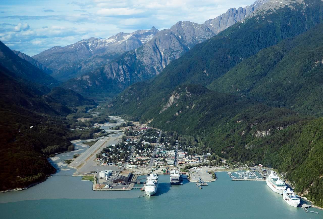
Skagway
Skagway sits at the head of Taiya Inlet, where a compact port town meets the steep approaches to White Pass. Broadway’s restored gold-rush buildings provide the familiar first impression, but the surrounding landscape tells a longer story of Tlingit trade routes, the Taiya Valley and transport between the coast and the interior. A good visit combines town history with one carefully chosen outdoor excursion.
Get to know the placePhoto credits4
- Depicts: KetchikanKetchikan, Alaska, Estados Unidos, 2017-08-16, DD 43. Author: Diego Delso. Credit: Own work. License: CC BY-SA 4.0 (https://creativecommons.org/licenses/by-sa/4.0). Source: https://commons.wikimedia.org/wiki/File:Ketchikan,_Alaska,_Estados_Unidos,_2017-08-16,_DD_43.jpgCropped to fit the display.
- Depicts: MetlakatlaView of Metlakahtla, Alaska.. Author: Unknown author Unknown author or not provided. Credit: U.S. National Archives and Records Administration. License: Public domain (https://creativecommons.org/publicdomain/mark/1.0/). Source: https://commons.wikimedia.org/wiki/File:View_of_Metlakahtla,_Alaska._-_NARA_-_297857.jpg
- Depicts: HainesGlaciar Davidson, Haines, Alaska, Estados Unidos, 2017-08-18, DD 75. Author: Diego Delso. Credit: Own work. License: CC BY-SA 4.0 (https://creativecommons.org/licenses/by-sa/4.0). Source: https://commons.wikimedia.org/wiki/File:Glaciar_Davidson,_Haines,_Alaska,_Estados_Unidos,_2017-08-18,_DD_75.jpgCropped to fit the display.
- Depicts: SkagwaySkagway aerial view. Author: Christopher Michel from San Francisco, USA. Credit: skagway, alaska Uploaded by Aconcagua. License: CC BY 2.0 (https://creativecommons.org/licenses/by/2.0). Source: https://commons.wikimedia.org/wiki/File:Skagway_aerial_view.jpgCropped to fit the display.
