
Treasure Island, San Francisco.
Treasure Island is an artificial island neighbourhood in San Francisco Bay, connected to the natural, hillier Yerba Buena Island. Created for the 1939–40 Golden Gate International Exposition, it later became a naval station. Today its historic buildings, new homes and waterfront public spaces sit within a continuing redevelopment project.
Photo credits1
- Depicts: Treasure Island, San FranciscoTreasure Island Shoreline Sunset - 2025 (2). Author: 9yz. Credit: Own work. License: CC BY 4.0 (https://creativecommons.org/licenses/by/4.0). Source: https://commons.wikimedia.org/wiki/File:Treasure_Island_Shoreline_Sunset_-_2025_(2).jpgCropped to fit the display.
Make your way to Treasure Island, San Francisco
Choose a tool and your dates to check the options for your trip.
More ways to explore
- Country
- United States
- Currency
- USD
- Time zone
- America/Los Angeles
Treasure Island is an artificial island neighbourhood in San Francisco Bay, connected to the natural, hillier Yerba Buena Island. Created for the 1939–40 Golden Gate International Exposition, it later became a naval station. Today its historic buildings, new homes and waterfront public spaces sit within a continuing redevelopment project.
Arrive by ferry for skyline views, then combine Cityside Park with the museum in Building One and a food stop. Yerba Buena’s higher viewpoints make a separate extension. Paths, access and facilities are changing as construction progresses, so use current visitor information rather than assuming every feature on a development drawing is already open.
When to go
Carry layers for a Bay crossing and an exposed waterfront walk; San Francisco’s summer fog means a calendar season alone does not predict warmth. A museum visit can balance outdoor time, subject to its holiday calendar. The announced winter lawn maintenance affects where you can sit or play, while the wider park remains outside that closure. Check event dates separately from ordinary ferry service.
Getting there
Treasure Island Ferry publishes service from Gate B at San Francisco’s Ferry Building to the island landing. It is a separate service with its own tickets: the operator currently says it does not accept Clipper. SFMTA’s 25 Treasure Island bus connects the islands with Salesforce Transit Center via the Bay Bridge. Check the particular departure and return instead of assuming an East Bay commuter ferry stops here.
Getting around
Walk between the landing and nearby waterfront destinations, then consider the island bus stops or a longer walk for farther points. SFMTA warns that construction routing can affect its timetable. Bicycle space on the ferry is limited and offered first come, first served. For Yerba Buena’s elevated parks, review the access route and slope rather than applying Treasure Island’s relatively flat geography.
Local food
The island’s published visitor directory includes a garden café, waterfront seasonal cooking, grab-and-go market food, an urban winery using California grapes and a whiskey tasting room. Plan a specific stop around its own opening information. For a picnic, Cityside Park has reservable barbecue areas; use the park authority’s current reservation rules rather than relying on older descriptions of first-come access.
What to see
Treasure Island Museum’s gallery in historic Building One explores the islands’ history, including the exposition, aviation and naval years. Cityside Park frames the San Francisco skyline and contains Ned Kahn’s suspended Canopy of Sky artwork. Across on Yerba Buena Island, Panorama Park includes Hiroshi Sugimoto’s Point of Infinity sculpture. Allow extra walking and climbing for that extension rather than treating it as the ferry plaza.
Towns and neighbourhoods
The western Treasure Island waterfront includes the landing and Cityside Park along Avenue of the Palms. Building One preserves an earlier layer of island life, while housing and community streets continue farther across the reclaimed land. The causeway connects to Yerba Buena Island, with slopes and elevated parks. These two connected islands have different terrain despite often appearing together in visitor listings.
Coast and outdoors
Choose shoreline paths and park views for an easy outdoor visit. Clipper Cove lies between the islands and is listed as a sheltered waterfront area, but that is not a guarantee of safe swimming or unrestricted access. As checked on 29 October 2026, TIDA announces closure of Cityside Park’s main lawn from 3 November 2026 to 31 March 2027; the rest of the park is excluded from that notice.
Where to stay
A San Francisco waterfront base can make Treasure Island an excursion with a clear ferry return. For a late event, compare the bus connection at Salesforce Transit Center with your actual accommodation address. If considering an island property, verify that it is visitor accommodation with confirmed booking and access arrangements; residential development and new apartment names do not establish hotel availability.
Useful before you go
Respect construction fencing and the dated Cityside lawn closure. The park’s picnic areas have specific reservation and equipment rules, and street parking is extremely limited. The museum notes that street, parking and transit patterns remain in flux during redevelopment. Check accessibility and the return connection before setting out, and do not use a residential or worksite shortcut to reach the water.
Good to know before you go
Are Treasure Island and Yerba Buena Island the same island?
No. Treasure Island is reclaimed land; Yerba Buena is the connected natural island with hillier terrain.
Can I pay the Treasure Island ferry with Clipper?
The operator currently says no. Use its own published ticket options and check the current terms before travel.
Is all of Cityside Park closing for winter?
No. TIDA’s notice covers only the main lawn from 3 November 2026 to 31 March 2027, not the remainder of the park.
Are picnic tables simply first come, first served?
The current park authority page lists reservable picnic areas with specific rules. Check availability and conditions before planning a group picnic.
Is there an alternative to the ferry?
The 25 Treasure Island bus connects with Salesforce Transit Center. Check construction-related routing and the correct downtown boarding location.
Sources & references
These references support the guide. Confirm opening hours, access and travel services before you go.
- 01Treasure Island Community Development: current attractions and food
- 02Treasure Island Ferry: boarding, tickets and transport conditions
- 03SFMTA: route 25 and construction routing
- 04Treasure Island Museum: visiting and changing access
- 05Treasure Island Museum: island history
- 06San Francisco Recreation and Parks: current Cityside picnic reservations
- 07TIDA official agency notice: Cityside lawn closure, November 2026–March 2027
- 08San Francisco Travel: Bay weather and clothing
Where could the journey go next?
More guides in United States. Compare the places and check actual connections before combining stops.

San Francisco
Begin at the Embarcadero, where ferries, piers and the Bay frame an easy first walk. From there, steep streets lead to distinctive neighbourhoods, viewpoints and museums. The Ferry Building is a useful starting point, but Alcatraz departures and the Golden Gate Bridge require their own journeys.
Get to know the place
Oakland
Oakland stretches from the working waterfront at Jack London Square to Lake Merritt and the wooded hills. The ferry places you in a useful waterfront district, with restaurants and public spaces nearby, but the city’s art, food and neighbourhood life extend well beyond the landing.
Get to know the place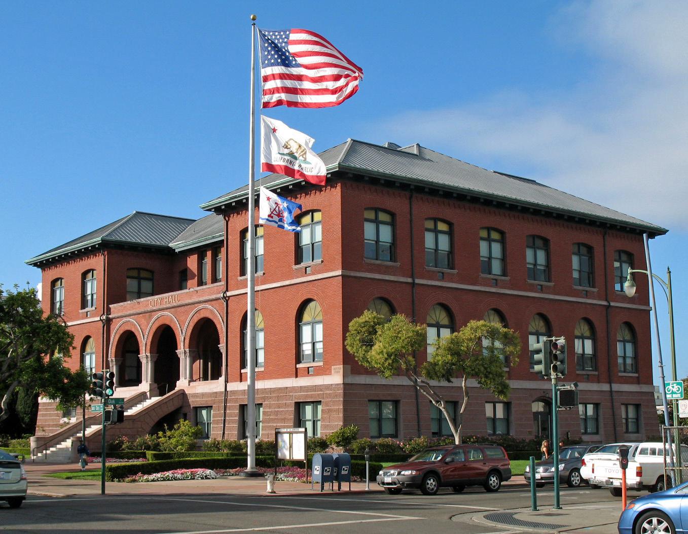 Alameda city overview — City Hall
Alameda (Harbor Bay)
Harbor Bay is Alameda’s ferry landing on Bay Farm Island, a different location from Main Street Alameda and Seaplane Lagoon. The terminal serves a waterfront neighbourhood and the nearby business area. Its setting suits a shoreline walk with views across San Francisco Bay, rather than arriving straight into Alameda’s historic shopping streets.
Get to know the placeAlameda
Alameda offers a quieter East Bay counterpoint to San Francisco: historic shopping streets, a long bayside beach and the former naval air station at Alameda Point. This is the city in San Francisco Bay, not a neighbourhood of Long Beach. Its waterfront attractions are spread across the island, so choose the part you want to explore before selecting a ferry terminal.
Get to know the placePhoto credits3
- Depicts: San FranciscoZeppelin-ride-020100925-195 (5029394846). Author: Craig Howell from San Carlos, CA, USA. Credit: zeppelin-ride-020100925-195. License: CC BY 2.0 (https://creativecommons.org/licenses/by/2.0). Source: https://commons.wikimedia.org/wiki/File:Zeppelin-ride-020100925-195_(5029394846).jpgCropped to fit the display.
- Depicts: OaklandLake Merritt 2022-06-16. Author: Robert Hsiao. Credit: Own work. License: CC BY-SA 4.0 (https://creativecommons.org/licenses/by-sa/4.0). Source: https://commons.wikimedia.org/wiki/File:Lake_Merritt_2022-06-16.pngCropped to fit the display.
- Area image: Alameda City Hall, Alameda, CaliforniaAlameda City Hall (Alameda, CA) 2. Author: Sanfranman59. Credit: Own work. License: CC BY-SA 3.0 (https://creativecommons.org/licenses/by-sa/3.0). Source: https://commons.wikimedia.org/wiki/File:Alameda_City_Hall_(Alameda,_CA)_2.JPGCropped to fit the display.
