
Provincetown.
Provincetown sits at the tip of Cape Cod, where a compact, expressive town meets dunes and open water. Its appeal is cultural as much as scenic: galleries, performance, LGBTQ+ history, seafood and a working waterfront share the same small centre. The museum above town and the art galleries give that identity depth beyond a beach-day visit.
Photo credits1
- Depicts: ProvincetownView of Provincetown from Pilgrim Monument looking east, MA, USA - Sept, 2013. Author: WestportWiki. Credit: Own work. License: CC BY-SA 3.0 (https://creativecommons.org/licenses/by-sa/3.0). Source: https://commons.wikimedia.org/wiki/File:View_of_Provincetown_from_Pilgrim_Monument_looking_east,_MA,_USA_-_Sept,_2013.jpgCropped to fit the display.
Make your way to Provincetown
Choose a tool and your dates to check the options for your trip.
More ways to explore
- Country
- United States
- Currency
- USD
- Time zone
- America/New York
Provincetown sits at the tip of Cape Cod, where a compact, expressive town meets dunes and open water. Its appeal is cultural as much as scenic: galleries, performance, LGBTQ+ history, seafood and a working waterfront share the same small centre. The museum above town and the art galleries give that identity depth beyond a beach-day visit.
Arriving at MacMillan Pier places you beside Commercial Street, but the National Seashore beaches are a separate outing. Combine a town walk with one museum or coastal excursion rather than trying to fit every landscape into a ferry day. Transport, beach services and cultural venues have different seasonal calendars, especially once the main summer season ends.
When to go
Summer brings the strongest beach-and-nightlife focus; autumn retains cultural events while transport reduces. Bay State publishes limited Friday-to-Sunday ferry service from 23 October to 15 November 2026, with selected special departures. The town lists the other Boston operator's 2026 season ending on 12 October. The beach shuttle's published season ended on 11 October, despite its page's generic operating banner. Check the dated calendar, not a summer headline.
Getting there
Boston ferry passengers must choose the correct departure terminal: Bay State uses 200 Seaport Boulevard, while Boston Harbor City Cruises uses Long Wharf. Both serve MacMillan Wharf in Provincetown within their own seasons. The regional FLEX bus provides an overland route through Outer Cape towns and connections farther south. Its current autumn-winter timetable runs Monday through Saturday after the short September–October Sunday-service period ends. Confirm all connections before buying a timed return.
Getting around
Walk for the central street and museum circuit, then plan a bicycle or separate transfer for the Seashore. The art museum warns that cars travel westbound on Commercial Street but bicycles may travel both ways, so check both directions when crossing. FLEX and the seasonal North Truro beach shuttle are different services. Do not depend on the latter in late October or assume a vehicle-free ferry trip automatically includes beach transport.
Local food
Seafood and Portuguese baking are useful starting points. The town's tourism office highlights lobster rolls, shellfish and traditions connected with Portuguese fishing families. At 299 Commercial Street, the Portuguese Bakery describes malassadas, custard pastries and sweet bread among its offerings. Build a bakery stop or harbour meal around the rest of your day, checking opening times directly. A restaurant listing does not establish a current table, menu price or dietary guarantee.
What to see
The Pilgrim Monument and Provincetown Museum interprets Wampanoag history, the Mayflower arrival, maritime life, theatre and the town's LGBTQ+ legacy. Check the current visiting calendar before planning a climb. In the East End, Provincetown Art Association and Museum presents changing displays of regional art in several galleries. A whale-watch trip is a separate timed excursion: Dolphin Fleet boards at MacMillan Pier, while its Commercial Street ticket office is another location.
Towns and neighbourhoods
Commercial Street is the central walking route for shops, food and the waterfront. Around MacMillan Pier, allow room for arriving passengers and commercial harbour work. The East End has the art museum at 460 Commercial Street, about a six-tenths-mile walk from the pier according to the museum. The Province Lands extend beyond this built-up centre: their trails, dunes and beaches need dedicated time rather than a quick detour between shops.
Coast and outdoors
Herring Cove and Race Point are the two National Seashore beach choices close to Provincetown, with different coastlines and access arrangements. For a land-based outing, the 2026 NPS guide describes the one-mile Beech Forest loop and the longer Province Lands bicycle circuit. Beach wheelchairs, access mats and staffed facilities are seasonal. Read posted ocean and shark advisories; an attractive photograph or calm harbour does not establish safe swimming conditions elsewhere.
Where to stay
Central Commercial Street suits a short stay focused on dining, performance and the pier. East End addresses suit an art-museum day with a longer walk back to the ferry. Check the specific property's arrival, age and parking rules: Lotus, for example, describes an adults-only central property without parking. An inn's waterfront description does not mean private ferry boarding. For an early departure, choose access and luggage arrangements alongside the room itself.
Useful before you go
MacMillan is a working pier. Keep loading areas and gangways clear; the town prohibits bicycles on floating docks and gangways. On Seashore trails, follow marked access and protected-area rules rather than cutting across dunes. Museum access also differs: PAAM describes accessible galleries, while the monument climb is a separate physical activity. Leave a buffer before your ferry, especially when returning from an outdoor excursion outside the town centre.
Good to know before you go
Do the Boston ferries use one terminal?
No. Bay State uses the Seaport waterfront and Boston Harbor City Cruises uses Long Wharf. Check the operator on your ticket.
Is the beach shuttle still running in late October 2026?
Its dated 2026 season ended 11 October. FLEX has a separate autumn-winter timetable and should not be confused with the beach shuttle.
Can I explore without a car?
The central town is walkable. Beaches and Province Lands trails need their own bicycle or transport plan, particularly outside summer.
Where do whale-watch boats depart?
Dolphin Fleet boards at MacMillan Pier. Its 307 Commercial Street ticket office is not the boarding gangway.
Are the beaches staffed year-round?
No. NPS describes lifeguards and many access facilities as summer services. Follow current signs and conditions.
What should I try locally?
Seafood and Portuguese pastries offer two distinct parts of the local food tradition. Check the bakery or restaurant's current opening before setting out.
Sources & references
These references support the guide. Confirm opening hours, access and travel services before you go.
- 01Town tourism office: arts, LGBTQ+ culture and seasonal identity
- 02Museum: Wampanoag, maritime, theatre and LGBTQ+ interpretation
- 03Museum operator: current visiting calendar
- 04Art museum: East End location, collections, walking and accessibility
- 05NPS 2026 guide: Province Lands trails, beaches and landscape
- 06NPS: seasonal beach facilities and safety guidance
- 07Bakery owner: Portuguese pastries and Commercial Street location
- 08Town tourism office: seafood and Portuguese food traditions
- 09Ferry operator: dated 2026 late-autumn service and distinct dock addresses
- 10Town tourism office: separate Boston operators and 2026 seasons
- 11Transit authority: autumn-winter 2026 route and calendar
- 12Transit authority: seasonal beach shuttle ends October11 2026
- 13Whale-watch operator: pier boarding versus Commercial Street ticket office
- 14Town pier authority: working-pier and gangway rules
- 15Lodging operator: central Commercial Street location and no on-site parking
- 16NPS: protected landscapes, route and overnight-use rules
Where could the journey go next?
More guides in United States. Compare the places and check actual connections before combining stops.

Hyannis
Hyannis is a harbour village in Barnstable on Cape Cod's south side. Its compact centre runs from Main Street towards the waterfront, so visitors can combine shops, cafés, museums, public art and walks without treating the stop as merely a ferry transfer. Kennedy history and the working harbour give the village two distinct themes.
Get to know the place
Hingham
Hingham combines a historic South Shore town centre with a harbour, a redeveloped shipyard and coastal conservation landscapes. A ferry arrival is a useful beginning, but the terminal at Hewitts Cove is not the same place as the old Main Street centre. Build the day around a few connected stops rather than assuming everything is beside the landing.
Get to know the place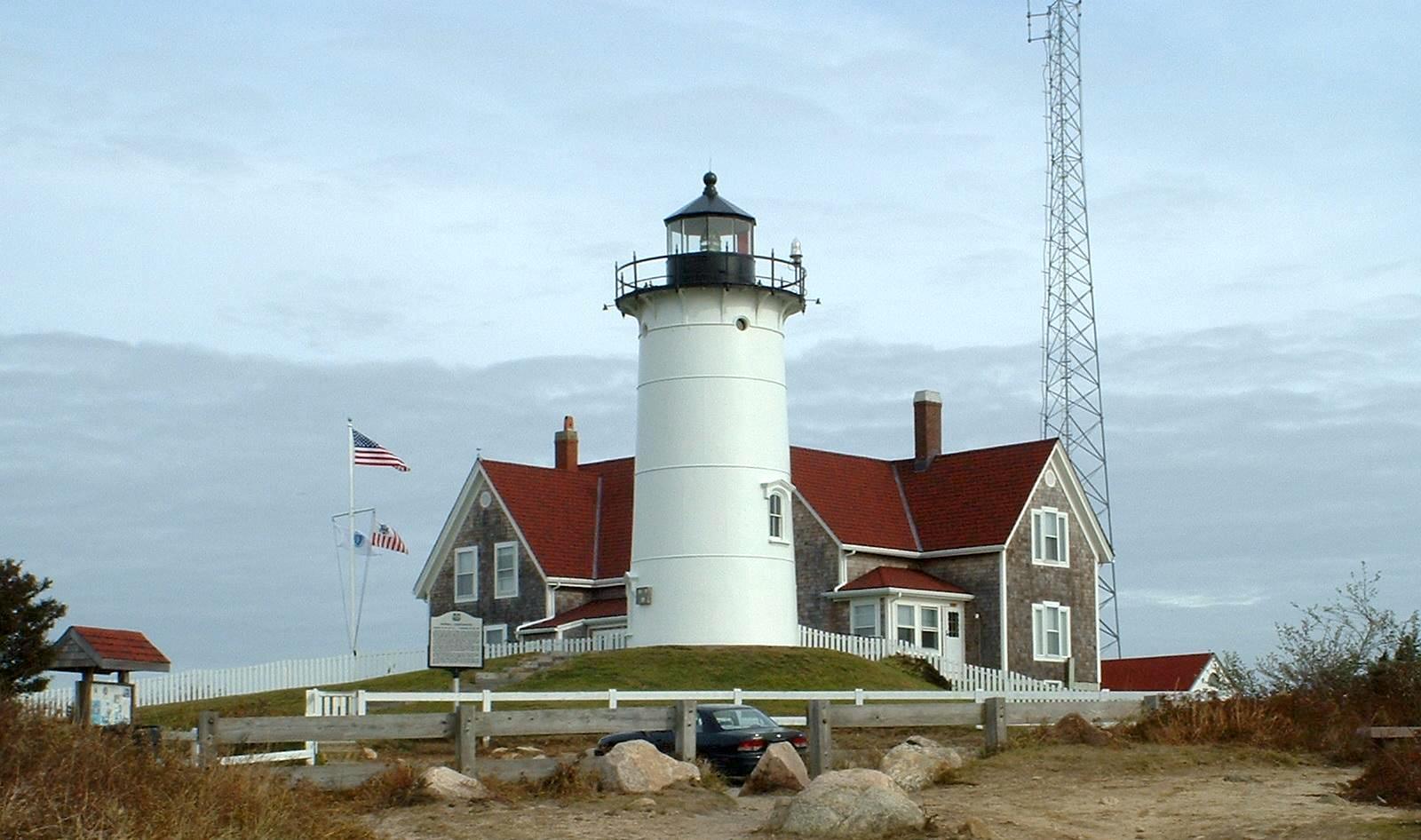
Falmouth
Falmouth is a mainland Cape Cod town with eight villages, a walkable Main Street, beach districts and a strong maritime and scientific identity. Its centre and Village Green suit a history-and-food day; Woods Hole, North Falmouth and the other villages add separate coast and countryside outings. A Falmouth address can cover much more ground than the compact shopping centre suggests.
Get to know the place
Peddocks Island
Peddocks Island offers a larger, more varied landscape than a quick city waterfront stop: wooded paths, low shore connections and the remains of Fort Andrews. It lies in Hingham Bay between Hull and Quincy. A visit combines coastal nature with military and community history, including a Portuguese fishing settlement that moved within the island as the fort developed.
Get to know the placePhoto credits4
- Depicts: HyannisHyannis, Barnstable, MA 02601, USA - panoramio (2). Author: bynyalcin. Credit: https://web.archive.org/web/20161030171521/http://www.panoramio.com/photo/126029510. License: CC BY 3.0 (https://creativecommons.org/licenses/by/3.0). Source: https://commons.wikimedia.org/wiki/File:Hyannis,_Barnstable,_MA_02601,_USA_-_panoramio_(2).jpgCropped to fit the display.
- Depicts: HinghamHingham, Massachusetts. Author: Quintin Soloviev. Credit: Own work. License: CC BY 4.0 (https://creativecommons.org/licenses/by/4.0). Source: https://commons.wikimedia.org/wiki/File:Hingham,_Massachusetts.jpgCropped to fit the display.
- Depicts: FalmouthNobska Lighthouse 1. Author: T.S. Custadio aka ToddC4176 at en.wikipedia. Credit: self-made. License: CC BY-SA 3.0 (https://creativecommons.org/licenses/by-sa/3.0/). Source: https://commons.wikimedia.org/wiki/File:Nobska_Lighthouse_1.jpgCropped to fit the display.
- Depicts: Peddocks IslandMiddle Head and East Head of Peddocks Island. Author: Doc Searls from Santa Barbara, USA. Credit: 2008_05_18_bos-sfo_022 Uploaded by Ekabhishek. License: CC BY-SA 2.0 (https://creativecommons.org/licenses/by-sa/2.0). Source: https://commons.wikimedia.org/wiki/File:Middle_Head_and_East_Head_of_Peddocks_Island.jpgCropped to fit the display.
