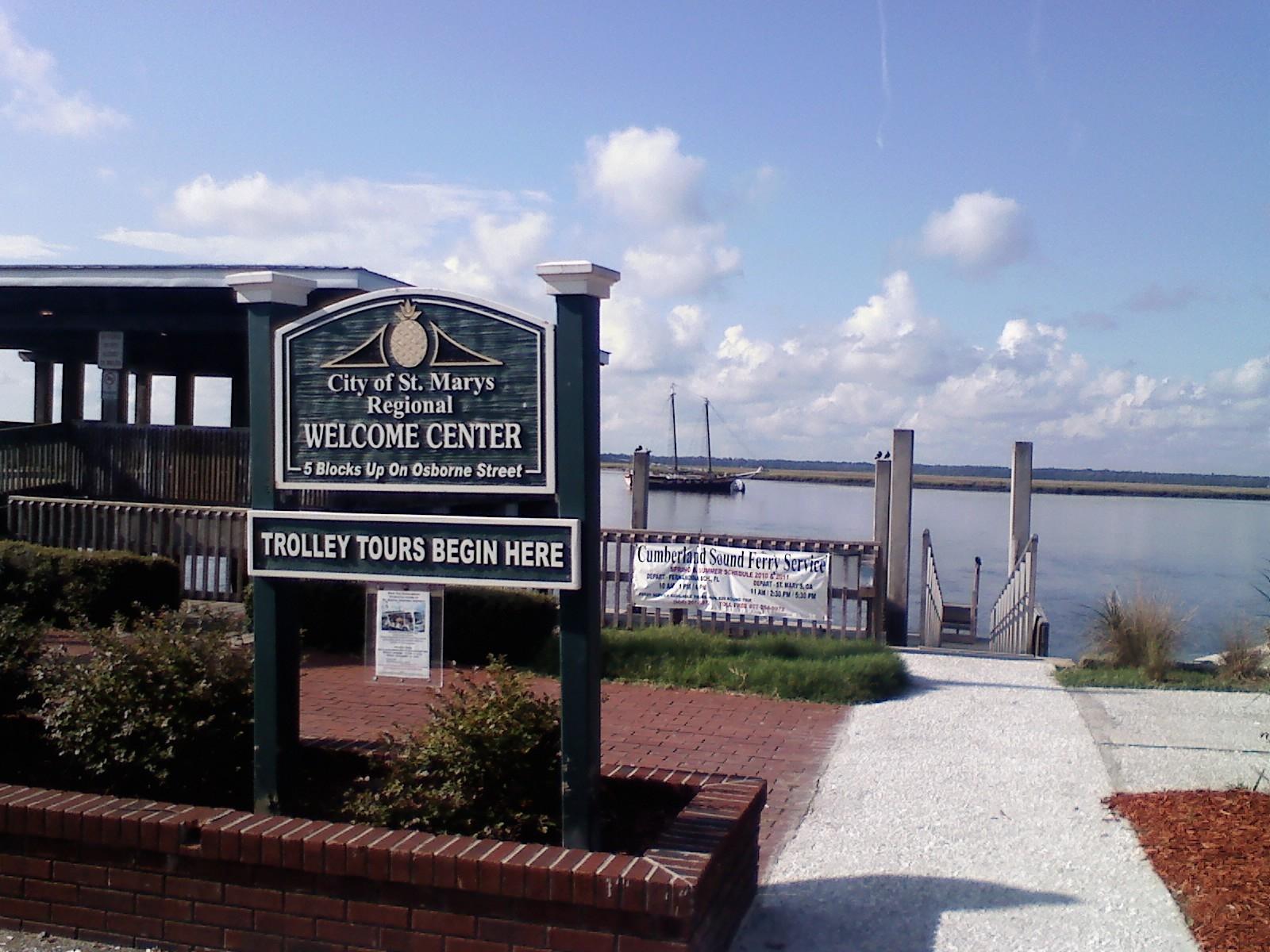
St. Marys, Georgia.
St. Marys, Georgia, is the mainland gateway for the public Cumberland Island ferry and a worthwhile waterfront stop of its own. A small downtown around Osborne Street combines maritime museums, places to eat and a riverfront history walk. Staying here makes an early ferry check-in easier without requiring every day to be an island excursion.
Photo credits1
- Area image: St. Marys, Georgia waterfront gazeboSt Marys Waterfront 3. Author: Legohead. Credit: Own work. License: CC BY-SA 3.0 (https://creativecommons.org/licenses/by-sa/3.0). Source: https://commons.wikimedia.org/wiki/File:St_Marys_Waterfront_3.JPGCropped to fit the display.
Make your way to St. Marys, Georgia
Choose a tool and your dates to check the options for your trip.
More ways to explore
- Country
- United States
- Currency
- USD
- Time zone
- America/New York
St. Marys, Georgia, is the mainland gateway for the public Cumberland Island ferry and a worthwhile waterfront stop of its own. A small downtown around Osborne Street combines maritime museums, places to eat and a riverfront history walk. Staying here makes an early ferry check-in easier without requiring every day to be an island excursion.
Keep the mainland town separate from Cumberland Island National Seashore. St. Marys has roads, accommodation and shops; the island requires boat travel and careful preparation. Crooked River State Park is another mainland outing, not a campground beside the Cumberland ferry landing.
When to go
The public ferry publishes daily service in its spring-through-autumn pattern and no Tuesday or Wednesday departures in its winter pattern. Check the actual date before booking a room around a sailing. Local museums also close on selected weekdays, holidays or maintenance breaks. For island plans in late autumn, consult the NPS managed-hunt calendar: the 2026–27 schedule includes 3–5 November, affecting specified northern areas rather than establishing a closure of the entire mainland town.
Getting there
For the Cumberland boat, head to the mainland visitor centre on West St. Marys Street and arrive an hour before your booked departure. The concession asks passengers to purchase both outward and return journeys together; park entry is separate from the ferry fare. The boat carries passengers rather than cars. Bring food and refillable water bottles before checking in, and confirm the island landing and return instructions rather than treating the trip as an unrestricted shuttle.
Getting around
The compact waterfront suits walking between museums, food and the History Walk. The town's accessibility guide notes broad sidewalks and crossing cutouts but also occasional uneven surfaces from roots. Check the approach to your chosen building if you use a mobility aid. A car or arranged ride helps with midtown accommodation and Crooked River State Park. For Cumberland, discuss ferry and sandy-trail access separately; accessible mainland streets do not establish easy island movement.
Local food
Downtown choices include Kraken Coffee Kitchen on Osborne Street, Locals Dockside on West St. Marys Street and Seagle's at the Riverview Hotel. The hotel advertises prepared lunches for island visitors, including sandwiches, fruit and drinks; arrange collection around check-in and ask about dietary needs. The tourism directory lists Brackish Beer Company as a brewery without food service, so do not rely on it for dinner. Confirm actual kitchen hours before or after a long island day.
What to see
The St. Marys Submarine Museum at 102 West St. Marys Street displays naval objects, photographs and models and has a working periscope. The Cumberland Island National Seashore Museum at 129 Osborne Street is a different museum, with island history and a War of 1812 display. The History Walk and Bi-National Heritage Peace Garden near Bartlett and West St. Marys streets offer an outdoor introduction to the town. Confirm opening days before leaving a museum until your last afternoon.
Towns and neighbourhoods
Use the waterfront and lower Osborne Street as the main walking cluster. The NPS mainland visitor centre, where ferry passengers check in, is at 113 West St. Marys Street; the Osborne Street museum is not the same building. Midtown accommodation sits farther along the road network and needs a transfer to the waterfront. Kingsland has its own attractions and should be treated as a neighbouring town rather than another downtown street.
Coast and outdoors
For an easy mainland outdoor day, Crooked River State Park offers maritime forest, salt-marsh views, nature trails and a nature centre. It is a separate drive from downtown St. Marys. For Atlantic sand, Cumberland Island is a planned boat excursion with its own walking routes and return reservation. The waterfront history walk and river views in town do not imply a supervised swimming beach beside the ferry dock.
Where to stay
A downtown room near Osborne Street is convenient for the ferry and evening food. Riverview Hotel at 105 Osborne Street is one named waterfront option; confirm stairs, room type and parking directly. Midtown hotels suit travellers with a car and a broader coastal itinerary. Crooked River offers cottages and campsites under its own reservation system. A mainland campsite does not include an island camping permit or a reserved ferry seat.
Useful before you go
Make the ferry reservation before shaping a tightly timed day, and save its check-in instructions. Keep enough margin for parking, luggage and the pre-departure orientation. Check food pickup and museum hours independently of the boat timetable. Pack sun and rain protection for the island and bring back all rubbish. If weather disrupts the crossing, use the town's separate museums or a suitable mainland park visit instead of assuming another boat will immediately replace it.
Good to know before you go
Are St. Marys and Cumberland Island the same destination?
No. St. Marys is the mainland town; Cumberland is reached separately by boat.
Where do I check in for the island ferry?
At the NPS mainland visitor centre, 113 West St. Marys Street, following the concession's one-hour lead time.
Is the Osborne Street NPS museum the ferry check-in building?
No. The museum at 129 Osborne Street and the waterfront visitor centre are different buildings.
Can I take my car on the public ferry?
No. It is a passenger service; leave the car on the mainland under the local parking arrangements.
Does a Crooked River campsite include Cumberland camping?
No. They are separate parks with separate reservations and access.
Does Brackish Beer Company serve dinner?
The town's current dining directory identifies it as a brewery without food service.
Sources & references
These references support the guide. Confirm opening hours, access and travel services before you go.
- 01Town tourism: heritage walk, Peace Garden and separate museums
- 02Museum owner: working periscope, waterfront address and visiting days
- 03NPS: separate mainland visitor centre and museum addresses
- 04Concession: ferry seasons, one-hour check-in and separate park entry
- 05State park: mainland forests, salt marsh, nature centre and accommodation
- 06Town tourism: named downtown restaurants, coffee and brewery distinction
- 07Hotel owner: waterfront lodging, restaurant and prepared island lunches
- 08Town tourism: downtown versus midtown lodging
- 09Town tourism: central sidewalks, tree-root unevenness and access planning
- 10NPS: dated 2026–27 managed-hunt area restrictions
- 11NPS: boat-only island and self-sufficient day visit
Where could the journey go next?
More guides in United States. Compare the places and check actual connections before combining stops.

Cumberland Island National Seashore
Cumberland Island National Seashore is a boat-access coastal landscape of maritime forest, salt marsh, dunes and long Atlantic beaches off southern Georgia. A first visit usually works best around the southern landings, with time for both natural habitats and the Dungeness historic district. Arrive prepared to walk and carry the day's supplies.
Get to know the place
Fort George Island
Fort George Island combines maritime forest, tidal scenery and difficult chapters of Florida history near the mouth of the St. Johns River. Ribault Club and Kingsley Plantation provide different ways into that history, from a twentieth-century resort landscape to the lives of enslaved people and plantation owners.
Get to know the place Mayport riverfront overview — St. Johns River
Mayport Village
Mayport Village is a working fishing community near the mouth of the St. Johns River, where shrimp boats, seafood businesses and a vehicle ferry shape the waterfront. Come for a dockside meal and a close look at a maritime neighbourhood rather than expecting a long resort promenade.
Get to know the place Area near Savannah
Savannah
Savannah is a river city of public squares, historic houses and a busy commercial waterfront. Start with a walk through the Historic District, make time for a museum and continue toward Forsyth Park or River Street. A short ferry crossing adds another view of the city without turning the day into a long excursion.
Get to know the placePhoto credits4
- Depicts: Cumberland Island National SeashoreBlackened grass. Author: NPS Photo. Credit: NPGallery. License: Public domain (https://creativecommons.org/publicdomain/mark/1.0/). Source: https://commons.wikimedia.org/wiki/File:Blackened_grass_(6bbd5109-ce9b-453c-a500-9f873ca9e9d9).jpg
- Depicts: Fort George IslandFort George Island Historical Marker. Author: Deisenbe. Credit: Own work. License: CC BY-SA 4.0 (https://creativecommons.org/licenses/by-sa/4.0). Source: https://commons.wikimedia.org/wiki/File:Fort_George_Island_Historical_Marker.jpgCropped to fit the display.
- Area image: St. Johns River at Mayport, viewed from the Mayport FerryMayport FL St Johns from ferry03. Author: Ebyabe. Credit: Own work. License: CC BY-SA 3.0 (https://creativecommons.org/licenses/by-sa/3.0). Source: https://commons.wikimedia.org/wiki/File:Mayport_FL_St_Johns_from_ferry03.jpgCropped to fit the display.
- Area image: Street Of Savannah — Area near SavannahStreet Of Savannah - panoramio (1). Author: ---=XEON=---. Credit: https://web.archive.org/web/20161028205126/http://www.panoramio.com/photo/97933155. License: CC BY 3.0 (https://creativecommons.org/licenses/by/3.0). Source: https://commons.wikimedia.org/wiki/File:Street_Of_Savannah_-_panoramio_(1).jpgCropped to fit the display.
