
Haines.
Haines brings a small waterfront town together with the broad Chilkat Valley and the mountain scenery of northern Lynn Canal. It is a useful place to slow down: local museums, the former military district and a harbour walk can fill a day before you add river wildlife or a longer trail. Unlike many Southeast Alaska ports, it also connects to the continental road network.
Photo credits1
- Depicts: HainesGlaciar Davidson, Haines, Alaska, Estados Unidos, 2017-08-18, DD 75. Author: Diego Delso. Credit: Own work. License: CC BY-SA 4.0 (https://creativecommons.org/licenses/by-sa/4.0). Source: https://commons.wikimedia.org/wiki/File:Glaciar_Davidson,_Haines,_Alaska,_Estados_Unidos,_2017-08-18,_DD_75.jpgCropped to fit the display.
Make your way to Haines
Choose a tool and your dates to check the options for your trip.
More ways to explore
- Country
- United States
- Currency
- USD
- Time zone
- America/Juneau
Haines brings a small waterfront town together with the broad Chilkat Valley and the mountain scenery of northern Lynn Canal. It is a useful place to slow down: local museums, the former military district and a harbour walk can fill a day before you add river wildlife or a longer trail. Unlike many Southeast Alaska ports, it also connects to the continental road network.
The landscape has several distinct directions. The town faces Portage Cove; Lutak Road leads toward the ferry and Chilkoot Lake; the Haines Highway follows the Chilkat Valley toward Canada. Choose outings by their actual location, leaving room for weather and wildlife rather than trying to cover every branch in one short port call.
When to go
Summer supports the widest choice of visitor trips, but late autumn has a different attraction: bald eagles gather along the Chilkat River to feed on salmon. The preserve identifies late fall and early winter as its largest concentration period; sightings and numbers still vary. Winter planning needs shorter outdoor days and confirmed services. On 29 October 2026 the state’s status page listed both Chilkat and Chilkoot Lake campgrounds closed.
Getting there
Haines can be reached by road via Haines Junction in Yukon, by regional air connection or by sea. Driving via Canada requires separate border planning. Alaska Marine Highway uses a terminal on Lutak Road about four miles from town. The Haines–Skagway Fast Ferry is a seasonal passenger option, distinct from a vehicle ferry. Confirm the service, boarding place and dates, especially for a same-day connection.
Getting around
The downtown and Fort Seward areas allow a rewarding visit on foot, but the lake, eagle-viewing pullouts and outlying trails need additional transport. The visitor bureau lists local car and bicycle rentals, taxis and tours. Shuttle availability around cruise calls does not guarantee a transfer for every state-ferry arrival. Arrange your pickup in advance and allow enough return time from the valley to the correct terminal.
Local food
Local menus often feature salmon, halibut and seafood chowder, alongside seasonal vegetables and herbs from area growers. Haines also has locally roasted coffee and small brewing or distilling businesses. A meal in town fits naturally between museums or after a park outing. In winter, the visitor bureau warns of reduced restaurant hours, so check dinner plans before driving out to a remote cabin or returning late from the valley.
What to see
The Sheldon Museum interprets the history, art and culture of the Chilkat Valley. The Hammer Museum takes a more specialised approach to the history of a familiar hand tool. Around Fort Seward, historic buildings and an outdoor sculpture garden give another perspective on the town. For a separate cultural excursion, Klukwan’s Jilkaat Kwaan Cultural Center presents the heritage of the Chilkat Tlingit; arrange your visit to that community directly.
Towns and neighbourhoods
Downtown suits museum visits and meals, while Fort Seward is a distinct historic district close to the waterfront. Lutak Road is the approach to the state-ferry terminal and continues toward Chilkoot Lake. Southward, Mud Bay Road reaches Chilkat State Park. Klukwan is farther up the Haines Highway, not a central neighbourhood. Avoid confusing Chilkoot Lake and the Chilkat River: they anchor different outings.
Coast and outdoors
Portage Cove offers a nearby shore view across Chilkoot Inlet. Battery Point Trail starts in forest and reaches the beach, while Chilkat State Park provides views toward Rainbow and Davidson glaciers across the inlet. These are viewpoints, not a walk onto a glacier. At Chilkoot River, follow the designated viewing areas and leave the far bank to wildlife; salmon attract bears, and proximity should never be the aim of a visit.
Where to stay
Hotels around downtown and Fort Seward suit a visit focused on culture and evening meals. Cabins and lodges extend along the Haines Highway, Lutak Road, Mud Bay Road and Beach Road, so choose the road that matches your plans. Ask about winter access and cooking facilities. State-park camping is a separate seasonal choice; an attractive campsite description does not override a current closure notice.
Useful before you go
In the eagle preserve, use designated pullouts and paths and keep a respectful distance from resting or feeding birds. At Chilkoot River, park without blocking traffic and secure food and rubbish; an ordinary cooler is not bear-proof. Carry suitable layers and check road and park conditions. If combining Haines with Canada or Skagway, save the route and transport details before departure and verify every separate connection.
Good to know before you go
Is the state-ferry terminal downtown?
No. Alaska Marine Highway lists it on Lutak Road, about four miles from town.
Are Chilkoot and Chilkat the same place?
No. Chilkoot Lake and River are reached toward Lutak; the Chilkat Valley and eagle preserve follow the Haines Highway.
When is the main eagle gathering?
The preserve identifies late autumn and early winter, but wildlife sightings and numbers cannot be guaranteed.
Can I see glacier scenery without a glacier trek?
Chilkat State Park has views across the inlet toward Rainbow and Davidson glaciers; these are distant viewpoints.
Can I count on camping in late October?
No. The state status page checked on 29 October 2026 listed Chilkat and Chilkoot Lake campgrounds closed.
Sources & references
These references support the guide. Confirm opening hours, access and travel services before you go.
- 01Borough visitor bureau: local museums and Fort Seward
- 02Alaska DOT: actual terminal outside town
- 03State Parks: Portage Cove shore setting
- 04State Parks: coast trails and distant glacier views
- 05State Parks: Chilkoot Lake geography and salmon/bear season
- 06State Parks: eagle preserve, season and viewing areas
- 07State Parks: current Chilkoot corridor visitor guidance
- 08Borough visitor bureau: local food, coffee and producers
- 09Borough visitor bureau: reduced winter dining hours
- 10Borough visitor bureau: actual local transport options
- 11Borough visitor bureau: cabins on distinct roads
- 12Borough visitor bureau: central hotel areas
- 13Borough visitor bureau: air, sea and road access
- 14Borough visitor bureau: Canadian road connection
- 15Borough visitor bureau: distinct seasonal passenger and vehicle ferry options
- 16Borough visitor bureau: distinct Klukwan community and cultural centre
- 17State Parks: October 2026 campground closure status
Where could the journey go next?
More guides in United States. Compare the places and check actual connections before combining stops.
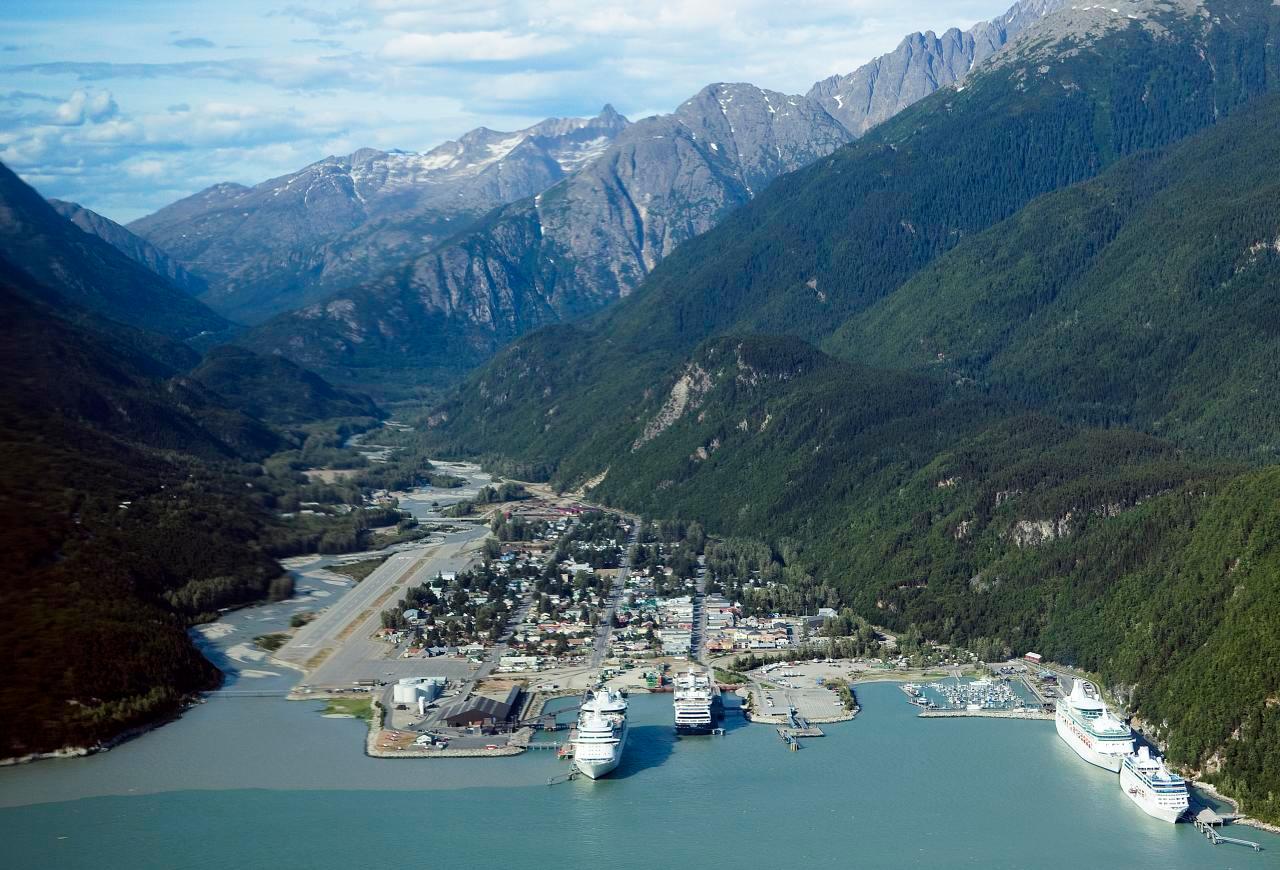
Skagway
Skagway sits at the head of Taiya Inlet, where a compact port town meets the steep approaches to White Pass. Broadway’s restored gold-rush buildings provide the familiar first impression, but the surrounding landscape tells a longer story of Tlingit trade routes, the Taiya Valley and transport between the coast and the interior. A good visit combines town history with one carefully chosen outdoor excursion.
Get to know the place Area overview: Prince of Wales Island, Alaska
Hollis
Hollis is the quiet ferry gateway on the eastern side of Prince of Wales Island, with its terminal in Clark Bay on Twelve Mile Arm. It is a small residential community with a mining and logging history, rather than a compact resort town. Forest, river and sheltered-water scenery form the setting for an arrival that often continues elsewhere on the island.
Get to know the place
Ketchikan
Ketchikan is an island city shaped by fishing, rainforest and the living cultures of Southeast Alaska. Its busiest waterfront faces the Tongass Narrows, with homes climbing the slopes behind it and Creek Street’s wooden buildings standing over the creek. Indigenous art and the working harbour deserve as much attention as the familiar waterfront photograph.
Get to know the place
Metlakatla
Metlakatla is a Tsimshian community on the Annette Islands Reserve, south of Ketchikan in Alaska’s Inside Passage. Fishing and seafood processing remain part of everyday life, alongside cultural work and tourism. Visit with an interest in the people who live here: this is a self-governing community, not simply an excursion backdrop.
Get to know the placePhoto credits4
- Depicts: SkagwaySkagway aerial view. Author: Christopher Michel from San Francisco, USA. Credit: skagway, alaska Uploaded by Aconcagua. License: CC BY 2.0 (https://creativecommons.org/licenses/by/2.0). Source: https://commons.wikimedia.org/wiki/File:Skagway_aerial_view.jpgCropped to fit the display.
- Area image: Prince of Wales Island, Alaska — Area overview: Prince of Wales Island, AlaskaKasaan Peninsula pano. Author: Jsayre64. Credit: Own work. License: CC BY-SA 3.0 (https://creativecommons.org/licenses/by-sa/3.0). Source: https://commons.wikimedia.org/wiki/File:Kasaan_Peninsula_pano.JPGCropped to fit the display.
- Depicts: KetchikanKetchikan, Alaska, Estados Unidos, 2017-08-16, DD 43. Author: Diego Delso. Credit: Own work. License: CC BY-SA 4.0 (https://creativecommons.org/licenses/by-sa/4.0). Source: https://commons.wikimedia.org/wiki/File:Ketchikan,_Alaska,_Estados_Unidos,_2017-08-16,_DD_43.jpgCropped to fit the display.
- Depicts: MetlakatlaView of Metlakahtla, Alaska.. Author: Unknown author Unknown author or not provided. Credit: U.S. National Archives and Records Administration. License: Public domain (https://creativecommons.org/publicdomain/mark/1.0/). Source: https://commons.wikimedia.org/wiki/File:View_of_Metlakahtla,_Alaska._-_NARA_-_297857.jpg
