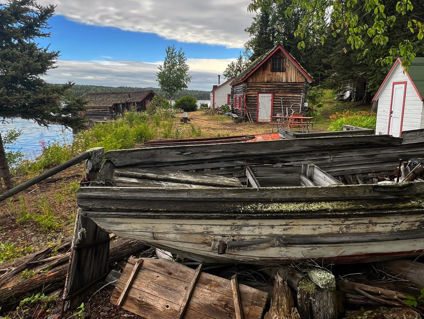
Windigo, Isle Royale National Park.
Windigo feels remote from the first minute. There are no car ferries, mainland road or conventional resort strip. Arrive by passenger boat, seaplane or suitable private vessel and use the seasonal visitor centre to understand the southwest of Isle Royale. Washington Harbor provides a sheltered setting, but Lake Superior crossings still depend on weather.
Photo credits1
- Area image: Isle Royale National Park — Isle Royale National Park area overviewEdisen Fishery at IRNP. Author: William Wadas. Credit: Own work. License: CC BY-SA 4.0 (https://creativecommons.org/licenses/by-sa/4.0). Source: https://commons.wikimedia.org/wiki/File:Edisen_Fishery_at_IRNP.jpgCropped to fit the display.
Make your way to Windigo, Isle Royale National Park
Choose a tool and your dates to check the options for your trip.
More ways to explore
- Country
- United States
- Currency
- USD
- Time zone
- America/Detroit
Windigo feels remote from the first minute. There are no car ferries, mainland road or conventional resort strip. Arrive by passenger boat, seaplane or suitable private vessel and use the seasonal visitor centre to understand the southwest of Isle Royale. Washington Harbor provides a sheltered setting, but Lake Superior crossings still depend on weather.
For a short visit, explore the Nature Trail and waterfront rather than attempting an island traverse. An overnight can combine Washington Creek campground or a reserved seasonal camper cabin with a more ambitious walk. NPS now also uses the name Ozaagaateng for this gateway; it refers to this west-end area, not another distant terminal.
When to go
Plan the most straightforward first visit within the actual summer transport and concession calendars. The 2026 camper-cabin and store season ended in early September, with passenger day trips finishing later that month. The park itself closes from 1 November through 15 April. Autumn access requires exceptional self-sufficiency and should not be inferred from a campground's nominal opening season.
Getting there
Grand Portage, Minnesota is the mainland base for Sea Hunter III and Voyageur II service to Windigo. Seasonal seaplane access is another option, with separate terms and departure points. Reserve both outward and return travel. Grand Portage's boat operator publishes Central Time while Isle Royale follows Eastern Time; confirm which clock governs your meeting and pickup.
Getting around
Walk from the dock to local facilities and trailheads. Grace Creek Overlook follows the Feldtmann Lake Trail before a signed spur; rocks, roots and climbing mean it is not a paved waterfront stroll. Longer Minong Ridge routes need navigation skills and substantial preparation. Boat rentals are subject to operating-area restrictions and cannot be assumed available for an overnight crossing.
Local food
Washington Harbor Store's seasonal offer includes groceries, grab-and-go food and a small quick-service menu. It is a limited provisioning point, not a collection of restaurants. Bring essential meals and any dietary necessities from the mainland. At the 29 October 2026 review the store was closed, so its summer menu cannot be treated as food available today.
What to see
The visitor centre introduces the island's natural history and supplies orientation during its operating season. The 1.2-mile Nature Trail passes through different forest environments, including cedar lowlands and hardwoods. For a longer outing, Grace Creek Overlook is about 3.6 miles return from Windigo, with a rocky viewpoint over the creek, Grace Harbor and the lake.
Towns and neighbourhoods
The main dock, visitor facilities and Washington Harbor Store form a small service area. Washington Creek campground lies along the nearby trail system, while Washington Harbor is the surrounding body of water. Rock Harbor sits at the opposite end of the island and requires a separately planned boat journey or multi-day walk, not a local shuttle.
Coast and outdoors
Choose between the forest paths and an appropriately equipped outing on Washington Harbor. Seasonal rentals include canoes and kayaks, subject to the concession's rules and weather. Huginnin Cove is a strenuous 9.4-mile walking loop, so it suits a full hiking day rather than a brief ferry call. Lake water remains cold even when the land feels warm.
Where to stay
Washington Creek provides the nearby camping base, with permits and seasonal stay limits. The concession also operates two rustic camper cabins, furnished for a simple stay with nearby shared outdoor facilities rather than hotel-style private bathrooms. Book cabins separately from transport. Rock Harbor Lodge is a different location at the island's eastern end and is not Windigo accommodation.
Useful before you go
The current late-season notice lists Windigo's potable water, visitor centre, store and other services as unavailable or closed. Bring water-treatment equipment and check fresh conditions before any later visit. Use designated food lockers or approved hard-sided containers for food and scented items; backpack holding areas are not animal-proof food storage. Keep wildlife at a distance and plan without relying on mobile reception.
Good to know before you go
Are Windigo and Ozaagaateng different stops?
NPS uses both names for the west-end gateway described here. Verify the operator's exact landing label when booking.
What fits a short day visit?
The local waterfront and Nature Trail are sensible starting points. Decide on Grace Creek Overlook only if your available time and walking ability allow the return.
Does Windigo have a hotel?
It has primitive camping and seasonal rustic camper cabins. The main Rock Harbor Lodge is elsewhere on the island.
Can I buy food throughout the park's open season?
No. The seasonal store has a shorter calendar; it was closed at the October 2026 review.
Can I drive across to Rock Harbor?
No. There is no island road transfer. The two gateways require a planned water journey or a multi-day hiking itinerary.
Sources & references
These references support the guide. Confirm opening hours, access and travel services before you go.
- 01NPS: Windigo facilities and southwest location
- 02NPS: Windigo area guide
- 03NPS: Grace Creek Overlook trail
- 04NPS: camping permits and small-party versus group arrangements
- 05NPS: 2026 Greenstone park guide and service calendar
- 06NPS: lodging, cabins and seasonal concession services
- 07NPS: current conditions, updated 30 September 2026
- 08Grand Portage Isle Royale Transportation: dated 2026 schedule
- 09NPS: fall self-sufficiency and reduced services
- 10NPS: Voyageur II route and Central/Eastern time distinction
- 11NPS: Minong Ridge trailhead at McCargoe Cove
- 12NPS: current food storage requirements
- 13NPS: drinking water and harmful algal blooms
Where could the journey go next?
More guides in United States. Compare the places and check actual connections before combining stops.
Isle Royale National Park
Isle Royale National Park is a forested archipelago in Lake Superior, belonging to Michigan but reached across open water from mainland gateways in Michigan and Minnesota. Its long central ridge, inland lakes and rocky coves reward walking and paddling rather than driving. Select the actual landing before booking: the park's name does not identify one universal passenger terminal.
Get to know the placeIsle Royale National Park area overviewMalone Bay
Malone Bay is a remote landing and campground on the southern shore of Isle Royale in Lake Superior. This is a forest-and-water destination for equipped walkers, paddlers and boat passengers, with no village centre, road approach or restaurant strip. The bay's role is as a backcountry stop, not a conventional ferry-port town.
Get to know the place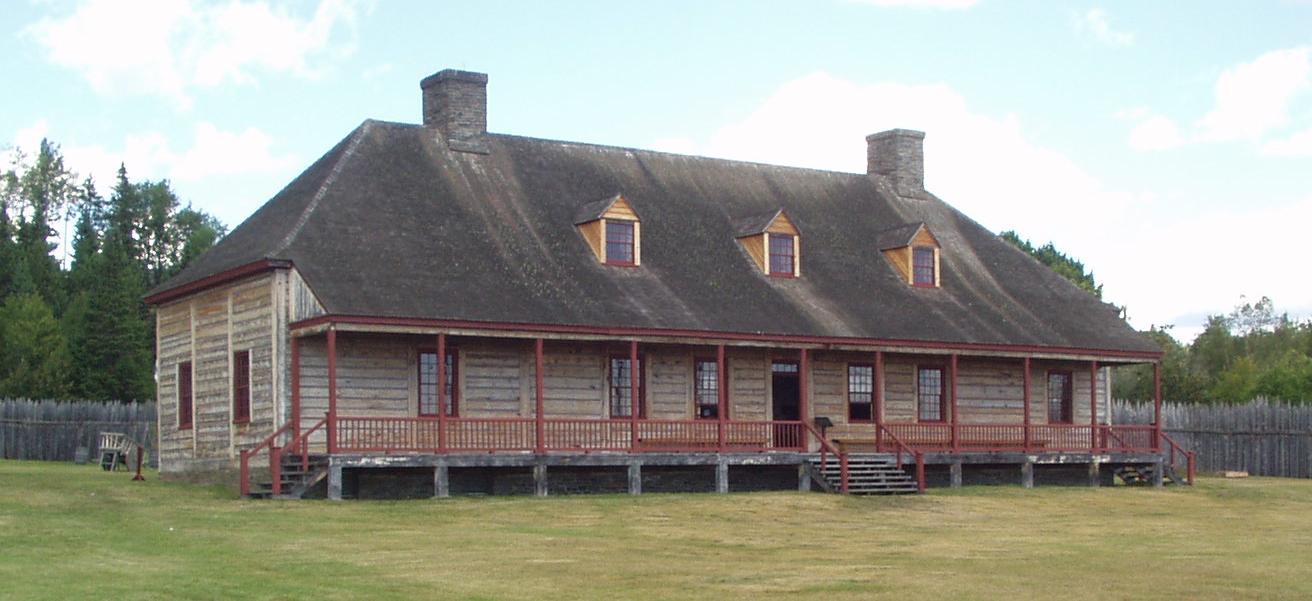
Grand Portage
Grand Portage sits beside Lake Superior in northeastern Minnesota, within the homeland and contemporary community of the Grand Portage Band of Lake Superior Chippewa. Its shoreline monument tells a story of Anishinaabe knowledge, canoe travel and the fur trade; the community deserves time beyond a hurried ferry check-in.
Get to know the placeIsle Royale National Park area overviewMccargoe Cove
McCargoe Cove cuts into Isle Royale's northern shore, bringing walkers and boat passengers into a sheltered-looking inlet surrounded by forest. Its campground and landing are gateways to the Minong Ridge and the Chickenbone Lake area. There is no road-connected settlement, shopping street or hotel district behind the dock.
Get to know the placePhoto credits2
- Depicts: Isle Royale National ParkEdisen Fishery at IRNP. Author: William Wadas. Credit: Own work. License: CC BY-SA 4.0 (https://creativecommons.org/licenses/by-sa/4.0). Source: https://commons.wikimedia.org/wiki/File:Edisen_Fishery_at_IRNP.jpgCropped to fit the display.
- Depicts: Grand Portage050820 GrandPortageNationalMonument. Author: Rufus Sarsaparilla on wikipédia en. Credit: http://en.wikipedia.org/wiki/Image:050820_GrandPortageNationalMonument.jpg. License: Public domain (https://creativecommons.org/publicdomain/mark/1.0/). Source: https://commons.wikimedia.org/wiki/File:050820_GrandPortageNationalMonument.jpg
