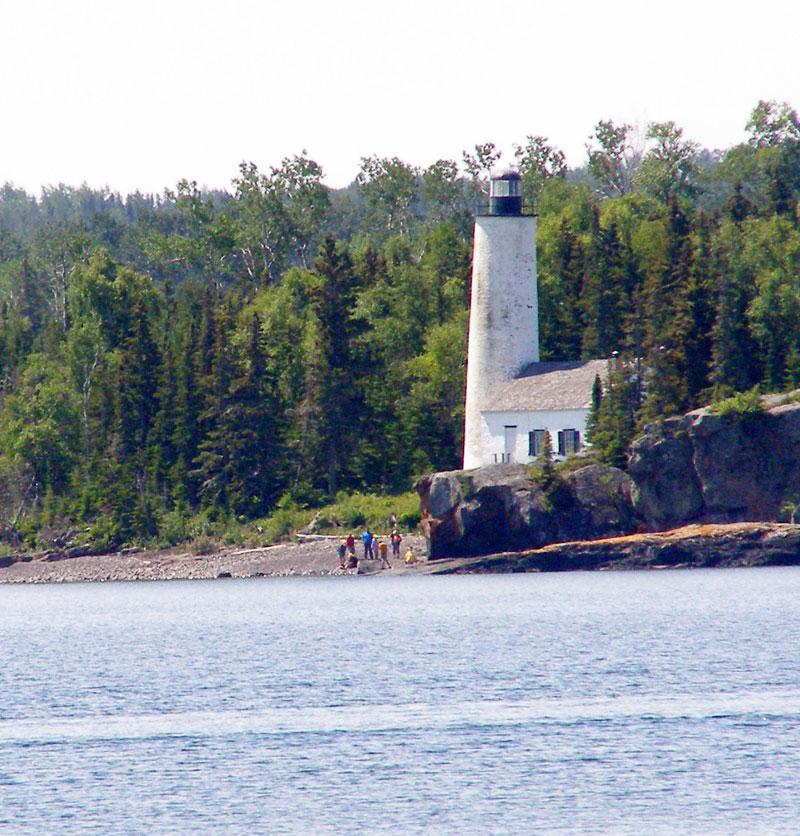
Rock Harbor.
Plan Rock Harbor as a self-contained national-park stay: ferries and seaplanes are seasonal, vehicles do not travel to Isle Royale, and weather can change a crossing. The reward is rocky shoreline, forest and a trail network beginning near the dock. This northeastern gateway gives visitors the island's broadest cluster of developed facilities without removing its wilderness setting.
Photo credits1
- Depicts: Rock HarborIsle Royale lighthouse. Author: © 2006 Todd VerBeek. Credit: Own work. License: CC BY-SA 4.0 (https://creativecommons.org/licenses/by-sa/4.0). Source: https://commons.wikimedia.org/wiki/File:Isle_Royale_lighthouse.jpgCropped to fit the display.
Make your way to Rock Harbor
Choose a tool and your dates to check the options for your trip.
More ways to explore
- Country
- United States
- Currency
- USD
- Time zone
- America/Detroit
Plan Rock Harbor as a self-contained national-park stay: ferries and seaplanes are seasonal, vehicles do not travel to Isle Royale, and weather can change a crossing. The reward is rocky shoreline, forest and a trail network beginning near the dock. This northeastern gateway gives visitors the island's broadest cluster of developed facilities without removing its wilderness setting.
The visitor centre, lodge, marina, rentals and campground help organise a short stay or a longer backpacking trip. They are seasonal facilities, not a promise of services throughout the park's opening period. Leave contingency time and match accommodation, meals and transport to the same dates before finalising your itinerary.
When to go
Summer gives the fullest choice of lodge stays, rentals and ranger services. At the 29 October 2026 review, the lodge and visitor centre were closed for the season. The island closes from 1 November through 15 April. Late-season private access requires substantial self-reliance and should not be treated as an extension of the summer visitor experience.
Getting there
The principal passenger ferry approaches are Ranger III from Houghton and Isle Royale Queen IV from Copper Harbor. Voyageur II connects from Grand Portage on its round-island route, with a different journey pattern; seasonal seaplanes offer another approach. All require checking the actual service calendar and booking terms. These are passenger journeys, with vehicles left on the mainland.
Getting around
Move through the developed area on foot and use marked trails for longer trips. Scheduled excursions, reserved water taxis and permitted rentals are separate services with their own availability. There is no island bus to Windigo. Some dock faces are reserved for working vessels, so a visible pier is not automatically a public mooring or an approved pickup point.
Local food
The Greenstone Grill and Lighthouse Restaurant provide the developed area's seasonal dining, while the dockside shop stocks groceries and backpacking supplies. Their service dates and meal periods differ. For the 2026 season the restaurant, grill and shop schedules ended in September; carry food for onward camping and do not expect October dining simply because the park has not yet closed.
What to see
The Stoll Memorial Trail explores contrasting shores: wooded Tobin Harbor on one side and more exposed Rock Harbor on the other. Its longest option reaches Scoville Point on an approximately 4.2-mile circuit; shorter loops are available. The final rocky ground and slippery surfaces after rain require care. Suzy's Cave is another named eastern-end walking objective, with route information available from NPS.
Towns and neighbourhoods
Rock Harbor and Tobin Harbor lie on opposite sides of the narrow developed area. The main passenger dock and lakeside lodge belong to Rock Harbor; the area map places seaplane facilities and housekeeping cabins towards Tobin Harbor. Use the map supplied for your arrival rather than assuming every boat and aircraft unloads at one interchangeable point.
Coast and outdoors
This is a landscape of rocky shore, coves and forest walks, not a broad serviced swimming beach. Canoes, kayaks and small boats can be rented in the concession season under its operating rules. Keep exposed-lake conditions separate from sheltered-harbor plans. A longer walk towards Mount Franklin needs a dedicated hiking day and supplies rather than being added casually before departure.
Where to stay
Choose between lakeside lodge rooms, housekeeping cabins and permitted camping, according to the kind of trip you want. Cabins and rooms require accommodation reservations; a ferry ticket does not supply them. The nearby campground has short seasonal stay limits, making it unsuitable as an assumed unlimited camping base. Backcountry camps require a route and overnight permit appropriate to the party.
Useful before you go
Current food rules require food, rubbish and scented items to be in designated lockers or approved animal-resistant hard-sided containers, not tents or shelters. Backpack holding areas are separate from food storage. The 2026 east-end camping restrictions affected tent and hammock use at several other campgrounds, so check the entire onward route. The Rock Harbor lighthouse tower is currently listed closed; do not promise a climb.
Good to know before you go
Can I bring a car?
No. Isle Royale's public transport does not carry visitor cars, and Rock Harbor has no road network for touring the island.
Which hike is closest to the main facilities?
The Stoll Memorial Trail begins in the Rock Harbor area and offers different-length circuits. Choose a route that fits your ability and return departure.
Are the seaplane and ferry arrivals identical?
No. The official map distinguishes Tobin Harbor seaplane facilities from the Rock Harbor passenger waterfront; use your operator's meeting details.
Are meals available in October?
The published 2026 dining and shop seasons ended in September. Confirm a new season's dates and carry provisions for any visit outside them.
Is the lighthouse tower open?
The current NPS notice lists the Rock Harbor lighthouse tower as closed. Check for a specific reopening before including an interior visit.
Sources & references
These references support the guide. Confirm opening hours, access and travel services before you go.
- 01NPS: Stoll Memorial Trail and Scoville Point
- 02NPS: eastern and western day hikes including Suzy’s Cave
- 03NPS: Rock Harbor area guide and map
- 04NPS: Rock Harbor facilities
- 05NPS: lodging, cabins and seasonal concession services
- 06NPS: 2026 Greenstone park guide and service calendar
- 07NPS: current conditions, updated 30 September 2026
- 08NPS: park access and seasonal closure
- 09NPS: fall self-sufficiency and reduced services
- 10NPS: ferry gateways and passenger-only transport
- 11NPS: Voyageur II route and Central/Eastern time distinction
- 12NPS: current compendium, dock and food storage restrictions
- 13NPS: camping permits and small-party versus group arrangements
- 14NPS: current food storage requirements
- 15NPS: 28 August 2026 closure order through 31 October
Where could the journey go next?
More guides in United States. Compare the places and check actual connections before combining stops.
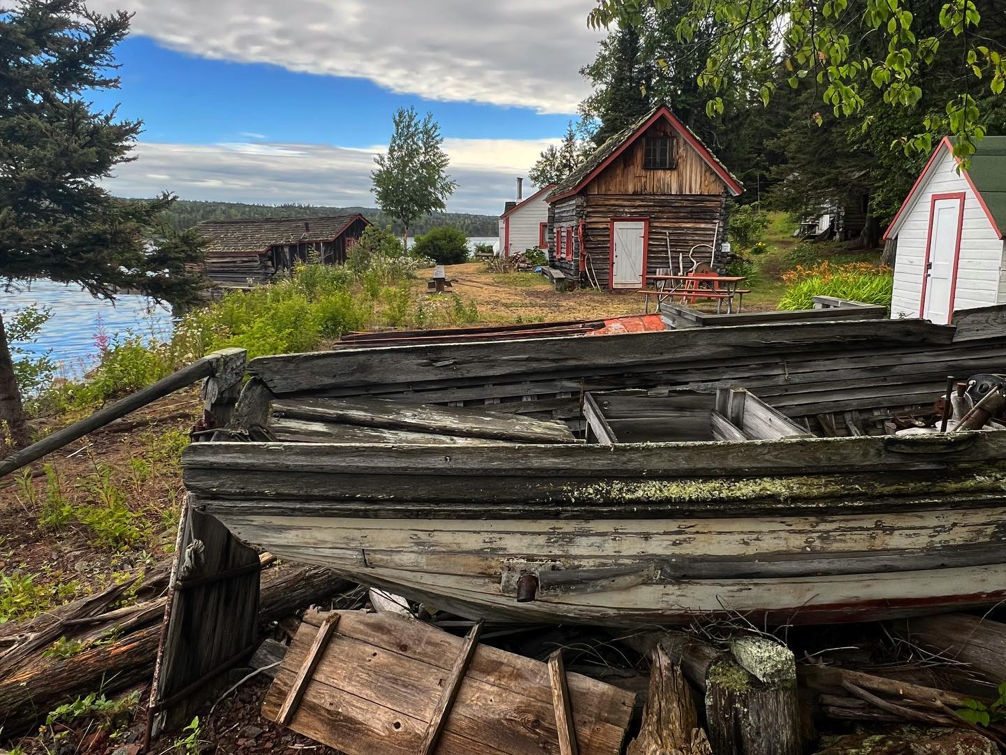 Isle Royale National Park area overview
Belle Isle (Isle Royale)
Belle Isle is an island and boat-in camping destination in the Isle Royale National Park network on Lake Superior, Michigan. Its appeal is a quiet stay beside the water, with the journey and the practicalities of island camping forming part of the experience. Choose it for an independently prepared overnight visit, with transport, food and camping arrangements settled before departure.
Get to know the placeIsle Royale National Park area overviewMccargoe Cove
McCargoe Cove cuts into Isle Royale's northern shore, bringing walkers and boat passengers into a sheltered-looking inlet surrounded by forest. Its campground and landing are gateways to the Minong Ridge and the Chickenbone Lake area. There is no road-connected settlement, shopping street or hotel district behind the dock.
Get to know the placeIsle Royale National Park area overviewMalone Bay
Malone Bay is a remote landing and campground on the southern shore of Isle Royale in Lake Superior. This is a forest-and-water destination for equipped walkers, paddlers and boat passengers, with no village centre, road approach or restaurant strip. The bay's role is as a backcountry stop, not a conventional ferry-port town.
Get to know the placeIsle Royale National Park
Isle Royale National Park is a forested archipelago in Lake Superior, belonging to Michigan but reached across open water from mainland gateways in Michigan and Minnesota. Its long central ridge, inland lakes and rocky coves reward walking and paddling rather than driving. Select the actual landing before booking: the park's name does not identify one universal passenger terminal.
Get to know the placePhoto credits1
- Area image: Isle Royale National Park — Isle Royale National Park area overviewEdisen Fishery at IRNP. Author: William Wadas. Credit: Own work. License: CC BY-SA 4.0 (https://creativecommons.org/licenses/by-sa/4.0). Source: https://commons.wikimedia.org/wiki/File:Edisen_Fishery_at_IRNP.jpgCropped to fit the display.
