
Coupeville, Whidbey Island.
Coupeville is the historic Penn Cove town at the heart of Ebey’s Landing National Historical Reserve. Its compact waterfront, old commercial buildings and public wharf make a gentle base for exploring Central Whidbey. The surrounding reserve adds working farms, coastal bluffs and military landscapes, so the town can anchor more than a quick ferry stop.
Photo credits1
- Depicts: Coupeville, Whidbey IslandCoupeville and Penn Cove, Whidbey Island - 2707429941. Author: brewbooks. Credit: https://www.flickr.com/photos/93452909@N00/2707429941/. License: CC BY-SA 2.0 (https://creativecommons.org/licenses/by-sa/2.0). Source: https://commons.wikimedia.org/wiki/File:Coupeville_and_Penn_Cove,_Whidbey_Island_-_2707429941.jpgCropped to fit the display.
Make your way to Coupeville, Whidbey Island
Choose a tool and your dates to check the options for your trip.
More ways to explore
- Country
- United States
- Currency
- USD
- Time zone
- America/Los Angeles
Coupeville is the historic Penn Cove town at the heart of Ebey’s Landing National Historical Reserve. Its compact waterfront, old commercial buildings and public wharf make a gentle base for exploring Central Whidbey. The surrounding reserve adds working farms, coastal bluffs and military landscapes, so the town can anchor more than a quick ferry stop.
The essential distinction is geographical: Coupeville town faces Penn Cove, while the ferry from Port Townsend lands at Keystone near Fort Casey. Those are separate places requiring an onward journey. Plan a town afternoon, a reserve walk or a fort visit with the actual terminal in mind, rather than expecting to disembark onto Front Street.
When to go
The reserve landscape can be visited year-round, but historic interiors follow narrower seasons. The Jacob and Sarah Ebey House and blockhouse normally open on summer weekends between Memorial Day and Labor Day. Admiralty Head Lighthouse has its own month-by-month programme, including limited autumn and winter dates. Winter wind can change a bluff-walk plan substantially, so a town museum and meal are useful alternatives.
Getting there
The Port Townsend–Coupeville state ferry lands at Keystone, south of the town. Vehicle reservations are available on this route; a reservation and a fare ticket are separate things. Whidbey can also be reached by the Mukilteo–Clinton ferry followed by an island drive, or over Deception Pass Bridge from the north. Check the current sailing and onward bus options before setting a fixed arrival appointment.
Getting around
Downtown works well on foot, but the ferry terminal, Fort Casey and reserve trailheads require separate transport. Island Transit’s current route guide includes route 6 to the Coupeville ferry and route 1 along the island’s main corridor. Read the individual trip notes because not every bus serves the same downtown stops. A car or carefully planned cycling itinerary is useful when combining several rural sites.
Local food
Penn Cove mussels are the local signature, available in town restaurants and through grocery outlets for self-catering. The commercial mussel production facility is not a casual visitor attraction. Central Whidbey also offers cafés, picnic supplies and local beer. Keep meals tied to your day’s geography: a restaurant by the ferry is at Keystone, while Front Street dining belongs to the Penn Cove town centre.
What to see
Start with the historic wharf and Front Street waterfront, then visit the Island County Historical Museum for local Indigenous and settler history. The reserve’s walking-tour material helps explain the older town buildings. Fort Casey is a separate outing with coastal military batteries and Admiralty Head Lighthouse. These sites tell different stories, from trade and town life to the defence of Puget Sound.
Towns and neighbourhoods
Downtown Coupeville is the practical cluster for shops, meals, visitor information and Penn Cove views. Ebey’s Landing on the west coast is a landscape of prairie, bluffs and shore, while Fort Casey and Keystone sit south of town. The reserve includes private homes and working land as well as public sites. Use its maps to choose an accessible route without treating the entire historic landscape as open parkland.
Coast and outdoors
Ebey’s Landing offers a more exposed coastal walk than the town waterfront. Bluff paths can be steep and uneven, and tides can cut off beach sections. In stormy conditions, avoid the waterline and unstable edges rather than forcing a loop. Fort Casey provides another beach setting near Admiralty Inlet. Bring water for reserve trails and choose a distance that allows an unhurried return.
Where to stay
An inn or suite near Front Street and North Main Street keeps evening meals and the wharf close by. Rural Central Whidbey rentals offer more separation from town and need an independent transport plan. Camping near the historic forts can suit an outdoor itinerary, but check the park’s own reservation and seasonal rules. Fort Casey specifically warns of possible naval jet noise, including at night, so do not assume a silent campground.
Useful before you go
The reserve itself has no entrance fee, while state-park visits within it have separate Discover Pass requirements. Follow the rules for the specific parking area. Stay on signed paths through the mix of public and private land, keep dogs leashed and check tide conditions for shore routes. The chamber warns against shellfish collection from the Front Street beaches; buying local mussels is distinct from gathering them yourself.
Good to know before you go
Does the Port Townsend ferry land downtown?
No. It lands at Keystone near Fort Casey, with a separate journey to Coupeville’s Penn Cove waterfront.
Is a vehicle reservation also my ferry ticket?
No. Washington State Ferries treats the reservation and fare ticket separately. Check both before travelling.
Is everything inside Ebey’s Reserve public land?
No. The reserve includes working farms, private property and public sites. Use marked routes and respect boundaries.
Can I visit the Ebey House throughout winter?
Its regular public season is summer weekends between Memorial Day and Labor Day. Check any special opening separately.
Where should I try the local mussels?
Town restaurants and grocery outlets offer Penn Cove mussels. The production facility is not open as a casual visitor attraction, and Front Street beach gathering is prohibited.
Sources & references
These references support the guide. Confirm opening hours, access and travel services before you go.
- 01NPS: historic Coupeville sites and public/private landscape
- 02NPS: reserve and seasonal historic-house visits
- 03NPS: bluff, tide and storm safety
- 04Washington State Parks: Fort Casey, lighthouse programme and aircraft-noise notice
- 05Port of Coupeville: historic wharf location
- 06Coupeville Chamber: local mussels and dining geography
- 07Coupeville Chamber: town inns and rural accommodation
- 08NPS: separate Keystone ferry and Coupeville town approaches
- 09Island Transit: September 2026 routes and trip notes
- 10WSDOT: fare tickets and vehicle reservation distinction
- 11NPS: reserve and state-park fee distinction
- 12Coupeville Chamber: mussel facility and Front Street harvesting restriction; old camping text excluded
Where could the journey go next?
More guides in United States. Compare the places and check actual connections before combining stops.

Port Townsend
Port Townsend combines a working maritime culture with a compact historic town on the northeastern Olympic Peninsula. Water Street offers waterfront buildings, shops and cafés, while Uptown adds another layer of residential streets and views. It makes a rewarding overnight stop for travellers who want museums, shore walks and local food alongside their ferry crossing.
Get to know the place
Anacortes
Anacortes is a town on road-connected Fidalgo Island, with a working waterfront and enough forest, coastal viewpoints and local history to justify a stay before a San Juan Islands sailing. Commercial Avenue gives visitors a useful town centre, while Cap Sante rises above the marina and Washington Park opens onto the island channels farther west.
Get to know the place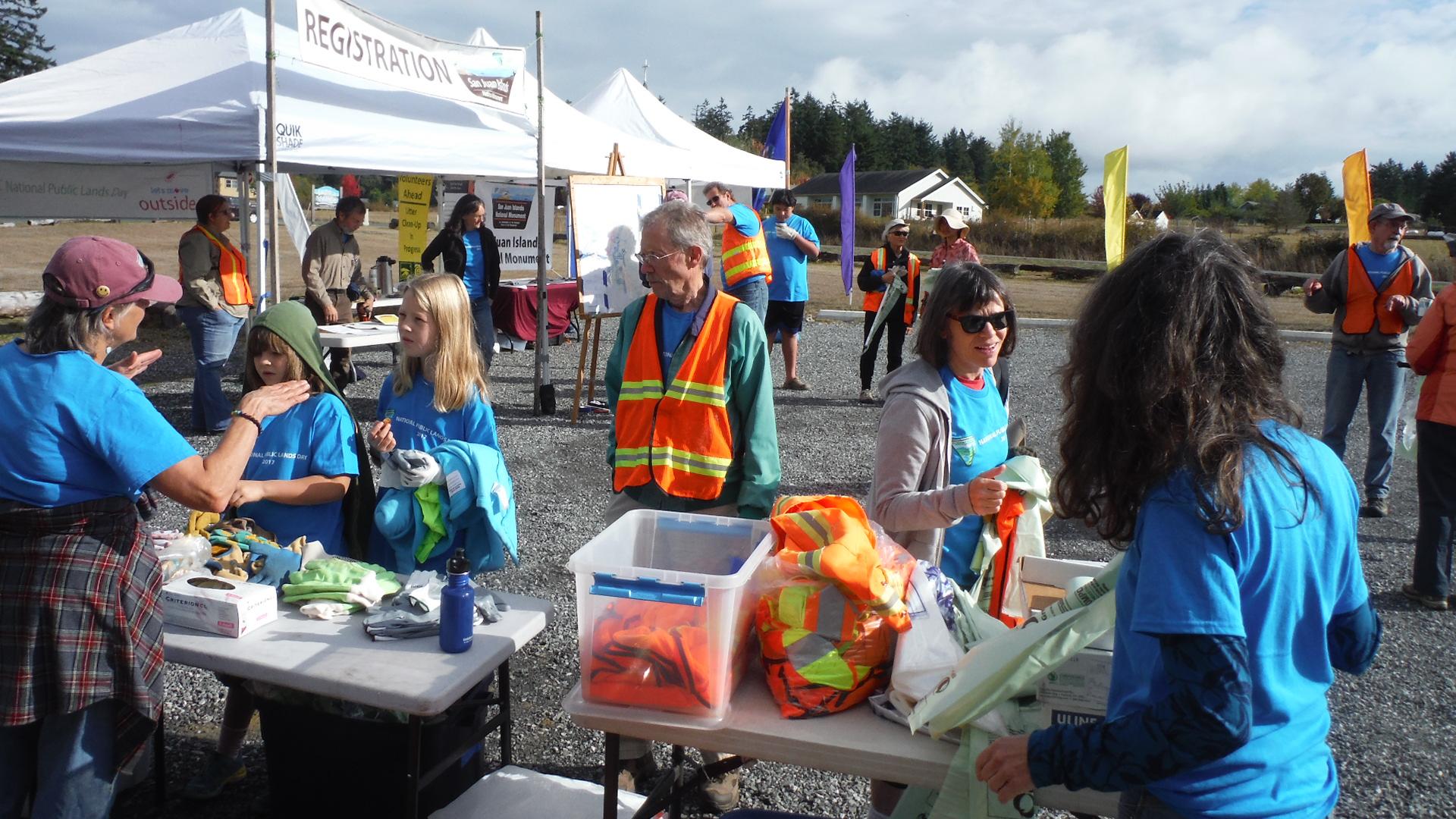
Lopez Island
Lopez Island combines rolling farmland, a small village on Fisherman Bay and a varied coast of beaches, wooded points and exposed bluffs. Its quieter roads attract cyclists, but this is still a rural island with distances between services. A satisfying visit can revolve around a village meal, the history museum and one coastal walk rather than trying to circle every shore in a day.
Get to know the place
Clinton, Whidbey Island
Clinton is the southern ferry gateway to Whidbey Island, with a small waterfront arrival area, shops uphill on State Route 525 and a much wider rural hinterland. Its appeal lies in slowing down after the crossing: a beach pause, locally made food, a farm stop or a woodland walk can turn the landing into part of the holiday.
Get to know the placePhoto credits4
- Depicts: Port TownsendPt. Townsend, WA shoreline 01. Author: Joe Mabel. Credit: Photo by Joe Mabel. License: CC BY-SA 3.0 (https://creativecommons.org/licenses/by-sa/3.0/). Source: https://commons.wikimedia.org/wiki/File:Pt._Townsend,_WA_shoreline_01.jpgCropped to fit the display.
- Depicts: AnacortesAnacortes from Cap Sante. Author: JXthemeteorologist. Credit: Own work. License: CC0 (https://creativecommons.org/publicdomain/zero/1.0/). Source: https://commons.wikimedia.org/wiki/File:Anacortes_from_Cap_Sante.jpg
- Depicts: Lopez IslandBureau of Land Management Oregon and Washington from Portland, AmericaWikimedia CommonsPublic domainNational Public Lands Day 2017 at Lopez Island (36767732454). Author: Bureau of Land Management Oregon and Washington from Portland, America. Credit: National Public Lands Day 2017 at Lopez Island. License: Public domain (https://creativecommons.org/publicdomain/mark/1.0/). Source: https://commons.wikimedia.org/wiki/File:National_Public_Lands_Day_2017_at_Lopez_Island_(36767732454).jpg
- Depicts: Clinton, Whidbey IslandThis Photo was taken by Timothy A. Gonsalves . Feel free to use my photos, but please mention me as the author. I would much appreciate if you send me an email tagooty@yahoo.com or write on my talk page , for my information. Please contact me before commercial use. Please do not upload an edited image here without consulting me. I would like to make corrections only at my own source to ensure that the changes improve the image and are preserved. Otherwise you may upload an edited image with a new name. Please use one of the templates derivative or extract .Wikimedia CommonsCC BY-SA 4.0Clinton Shore Front Whidbey Mar23 R16 07087. Author: This Photo was taken by Timothy A. Gonsalves . Feel free to use my photos, but please mention me as the author. I would much appreciate if you send me an email tagooty@yahoo.com or write on my talk page , for my information. Please contact me before commercial use. Please do not upload an edited image here without consulting me. I would like to make corrections only at my own source to ensure that the changes improve the image and are preserved. Otherwise you may upload an edited image with a new name. Please use one of the templates derivative or extract .. Credit: Own work. License: CC BY-SA 4.0 (https://creativecommons.org/licenses/by-sa/4.0). Source: https://commons.wikimedia.org/wiki/File:Clinton_Shore_Front_Whidbey_Mar23_R16_07087.jpgCropped to fit the display.
