
New Bedford.
New Bedford is a working Massachusetts port with a compact historic downtown, a major whaling museum and strong Portuguese and Cape Verdean cultural connections. Its maritime story includes global trade and migration, but also abolitionism, families and the dangerous labour of seafarers. Spend time on the streets above the harbour rather than treating the city only as an island-ferry departure point.
Photo credits1
- Depicts: New BedfordDepartment of Defense. Department of the Army. U.S. Army Corps of Engineers. North Atlantic Division. U.S. Army Engineer District, New England. 6/14/1979Wikimedia CommonsPublic domainBuilding T-3 Arms Room, U.S. Army Reserve Center, Fort Rodman, New Bedford, Massachusetts. Author: Department of Defense. Department of the Army. U.S. Army Corps of Engineers. North Atlantic Division. U.S. Army Engineer District, New England. 6/14/1979. Credit: This file was contributed to Wikimedia Commons by National Archives and Records Administration as part of a cooperation project. The donation was facilitated by the Digital Public Library of America , via its partner Digital Public Library of America . Record in source catalog DPLA identifier: 6bbf67e5618cc242a52f9bae1fa668a5 National Archives Identifier: 134673890. License: Public domain (https://creativecommons.org/publicdomain/mark/1.0/). Source: https://commons.wikimedia.org/wiki/File:Building_T-3_Arms_Room,_U.S._Army_Reserve_Center,_Fort_Rodman,_New_Bedford,_Massachusetts_-_DPLA_-_6bbf67e5618cc242a52f9bae1fa668a5.jpg
Make your way to New Bedford
Choose a tool and your dates to check the options for your trip.
More ways to explore
- Country
- United States
- Currency
- USD
- Time zone
- America/New York
New Bedford is a working Massachusetts port with a compact historic downtown, a major whaling museum and strong Portuguese and Cape Verdean cultural connections. Its maritime story includes global trade and migration, but also abolitionism, families and the dangerous labour of seafarers. Spend time on the streets above the harbour rather than treating the city only as an island-ferry departure point.
A useful first day combines Johnny Cake Hill, the surrounding historical park and waterfront food. Fort Taber is a separate outing towards the southern peninsula, while Martha's Vineyard, Nantucket and Cuttyhunk require their own crossings. The ferries do not share one year-round timetable or identical State Pier boarding arrangements, so check the specific operator before planning a connection.
When to go
A museum-and-city visit remains worthwhile beyond the beach season, but individual historical buildings and visitor centres change their days. For travel in late October 2026, Seastreak's current island page advertises its next Vineyard Haven sailings for 25–29 November, not a normal daily winter service. Cuttyhunk's 13 October 2026–25 April 2027 table instead lists Monday and Friday crossings, with additional holiday trips handled separately. An island day trip therefore needs a dated outbound and return plan.
Getting there
Seastreak uses 49 State Pier, with the current holiday route naming Vineyard Haven as the Martha's Vineyard landing. Cuttyhunk Ferry Company directs passengers to the northeast corner at 66B State Pier, using a container office and its own parking instructions. Do not merge the two check-ins. The Whaling Museum also describes arrival from Boston by MBTA rail followed by a walk from New Bedford station. The station and ferry pier are separate locations; allow a real land transfer between them.
Getting around
Walk the historic downtown in manageable sections, taking account of paving, slopes and road crossings. SRTA publishes the city's bus routes, including a Fort Rodman service and a North End shuttle; use the current route and day for farther outings. The museum describes an approximately twenty-minute walk from the railway station and warns of road-work detours around the I-195/Route 18 interchange through summer 2027. Use current signs and leave a margin before any reserved boat.
Local food
The city tourism office describes a food culture shaped by Portugal, Cape Verde and other communities alongside the seafood trade. It identifies Portuguese-inspired sandwiches and dishes such as shrimp Mozambique in the downtown area, while the North End provides further choices. Fathoms on Popes Island describes seafood sourced through its affiliated fishing fleet, including scallops and fish. Compare the exact menu and service period; a seafood restaurant, fish market and ferry café are different stops.
What to see
The Whaling Museum includes the half-scale Lagoda ship model and exhibits interpreting maritime life; allow time beyond a quick photograph. The National Historical Park extends through city streets and partner buildings rather than one enclosed site. Nathan and Polly Johnson's house at 21 Seventh Street recalls their abolitionist work and shelter for Frederick and Anna Douglass. Seamen's Bethel adds maritime memorials and a Melville connection, but interior visiting has a seasonal calendar rather than universal access.
Towns and neighbourhoods
Johnny Cake Hill and the William Street area form a convenient heritage core. The waterfront below remains a workplace, with passenger facilities and fishing operations beside one another. The North End offers another part of the city's food and neighbourhood life, while Popes Island is a distinct harbour setting. Fort Taber and Fort Rodman lie on the southern peninsula facing Buzzards Bay; they are not part of the short museum-to-ferry walk downtown.
Coast and outdoors
For outdoor time, Fort Taber Park combines coastal walking and cycling paths, picnic space, historic defence structures and a fishing pier. The city lists beach and recreation facilities, but a seasonal amenity list does not confirm lifeguards or concessions in winter. Check current parking-pass requirements. Around downtown, choose public waterfront routes and viewpoints; commercial fishing docks and State Pier loading areas should not be treated as unrestricted promenades or swimming access.
Where to stay
Downtown accommodation suits the Whaling Museum, historic streets and restaurants. The city's visitor guide places New Bedford Harbor Hotel in the centre and Fairfield Inn & Suites along the waterfront near ferry-related attractions. Compare the actual entrance, luggage route and parking terms rather than relying on the word harbour. A northern or outer-city address may be convenient by car but require transport for evening dining or an early State Pier check-in.
Useful before you go
Treat the waterfront as an active port and obey restricted-access signs. Seastreak's current dockside and off-site parking offers specify particular November and December dates; they do not establish an always-running shuttle. Cuttyhunk's prominent ticket instructions require passenger and freight reservations, and its relocated office has limited parking. Pack and label baggage as the operator requests. National Park Service buildings and independent partner museums have different opening and admission arrangements, even within the same historical district.
Good to know before you go
Is New Bedford just a ferry stop?
No. The Whaling Museum, historical district, abolitionist history, food and coastal park make a substantial city visit.
Do Seastreak and Cuttyhunk share one check-in?
No. Seastreak lists 49 State Pier. Cuttyhunk directs travellers to its container office at the northeast corner, 66B State Pier.
Does Seastreak run every day in winter?
Do not assume that. Its current page advertises Vineyard Haven holiday sailings on 25–29 November 2026, with separate dated arrangements.
Does Cuttyhunk have a winter boat?
The operator's 13 October 2026–25 April 2027 calendar lists Monday and Friday crossings. Check additional holidays and weather changes.
Can I walk from the train to the museum?
The museum describes an approximately twenty-minute route from New Bedford station. Add time for luggage or mobility needs and do not confuse the station with the ferry pier.
Where is a good outdoor alternative to the museum?
Fort Taber Park on the southern peninsula has coastal paths and historic defence features. It requires a separate journey from the compact downtown.
Sources & references
These references support the guide. Confirm opening hours, access and travel services before you go.
- 01National Park Service: urban park, immigration and maritime history
- 02Museum: Lagoda, visitor access and rail walking directions
- 03National Park Service: abolitionist household and Douglass connection
- 04National Park Service: chapel, maritime memorials and seasonal visits
- 05City recreation department: Fort Taber Park coastal paths and facilities
- 06City tourism office: Portuguese, Cape Verdean and waterfront food context
- 07Restaurant owner: Popes Island seafood and affiliated fishing fleet
- 08Operator: current November25-29 holiday sailings to Vineyard Haven
- 09Operator:49StatePier and date-specific parking arrangements
- 10Operator: October2026-April2027 Monday/Friday winter calendar
- 11Operator: relocated northeast-corner container office and limited parking
- 12Operator: prominent required reservations and labelled baggage
- 13Transit authority: route set effective August30 2026
- 14City tourism office: downtown parking and walking maps
- 15City tourism office: downtown and waterfront lodging distinctions
- 16National Park Service: seasonal visitor centre days and separate partner hours
Where could the journey go next?
More guides in United States. Compare the places and check actual connections before combining stops.

Woods Hole
Woods Hole is a village within Falmouth on mainland Cape Cod, not a town on Martha's Vineyard. Ferries, marine research and a compact waterfront give it a distinctive character. Water Street links cafés and scientific institutions, while the harbour and the end of the Shining Sea Bikeway provide a reason to linger before or after a crossing.
Get to know the place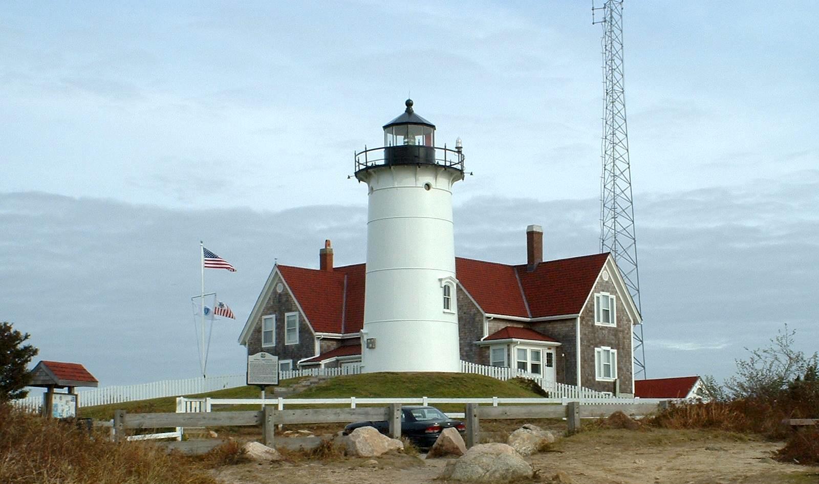
Falmouth
Falmouth is a mainland Cape Cod town with eight villages, a walkable Main Street, beach districts and a strong maritime and scientific identity. Its centre and Village Green suit a history-and-food day; Woods Hole, North Falmouth and the other villages add separate coast and countryside outings. A Falmouth address can cover much more ground than the compact shopping centre suggests.
Get to know the place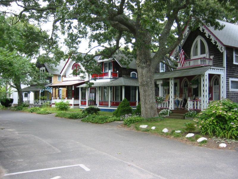
Oak Bluffs
Oak Bluffs is a distinct town on the northeast side of Martha's Vineyard, with a compact harbour, a lively commercial centre and colourful cottages around a historic religious campground. Its strongest experiences are architectural and cultural as much as beach-oriented: slow down for the cottage streets, the carousel and the town's African American heritage.
Get to know the place
Martha's Vineyard (Vineyard Haven)
Martha's Vineyard is an island of distinct towns, and Vineyard Haven is the harbour village within Tisbury that provides its year-round mainland ferry gateway. It deserves more than a transfer: a working waterfront, independent shops, cultural venues and the island museum sit within a manageable local visit. Tisbury and Vineyard Haven are often used interchangeably, but the village name is not a synonym for the whole island.
Get to know the placePhoto credits4
- Depicts: Woods HoleMarine Biological Laboratory, Woods Hole by Pam Wilmot. Author: Diana Kenney created file; Pam Wilmot took the photo. Credit: Marine Biological Laboratory. License: CC0 (https://creativecommons.org/publicdomain/zero/1.0/). Source: https://commons.wikimedia.org/wiki/File:Marine_Biological_Laboratory,_Woods_Hole_by_Pam_Wilmot.jpg
- Depicts: FalmouthNobska Lighthouse 1. Author: T.S. Custadio aka ToddC4176 at en.wikipedia. Credit: self-made. License: CC BY-SA 3.0 (https://creativecommons.org/licenses/by-sa/3.0/). Source: https://commons.wikimedia.org/wiki/File:Nobska_Lighthouse_1.jpgCropped to fit the display.
- Depicts: Oak BluffsOakBluffs1. Author: Elkman at en.wikipedia. Credit: Transferred from en.wikipedia to Commons by User:Phansen .. License: CC BY-SA 3.0 (https://creativecommons.org/licenses/by-sa/3.0/). Source: https://commons.wikimedia.org/wiki/File:OakBluffs1.jpgCropped to fit the display.
- Depicts: Martha's Vineyard (Vineyard Haven)Marthasvineyard-Aquinnah-cliffs-summer. Author: Alex Wilcox Cheek. Credit: Own work. License: CC BY-SA 4.0 (https://creativecommons.org/licenses/by-sa/4.0). Source: https://commons.wikimedia.org/wiki/File:Marthasvineyard-Aquinnah-cliffs-summer.jpegCropped to fit the display.
