
Cumberland Island National Seashore.
Cumberland Island National Seashore is a boat-access coastal landscape of maritime forest, salt marsh, dunes and long Atlantic beaches off southern Georgia. A first visit usually works best around the southern landings, with time for both natural habitats and the Dungeness historic district. Arrive prepared to walk and carry the day's supplies.
Photo credits1
- Depicts: Cumberland Island National SeashoreBlackened grass. Author: NPS Photo. Credit: NPGallery. License: Public domain (https://creativecommons.org/publicdomain/mark/1.0/). Source: https://commons.wikimedia.org/wiki/File:Blackened_grass_(6bbd5109-ce9b-453c-a500-9f873ca9e9d9).jpg
Make your way to Cumberland Island National Seashore
Choose a tool and your dates to check the options for your trip.
More ways to explore
- Country
- United States
- Currency
- USD
- Time zone
- America/New York
Cumberland Island National Seashore is a boat-access coastal landscape of maritime forest, salt marsh, dunes and long Atlantic beaches off southern Georgia. A first visit usually works best around the southern landings, with time for both natural habitats and the Dungeness historic district. Arrive prepared to walk and carry the day's supplies.
This is not an island town with cafés waiting at every stop. The public ferry from St. Marys, park entry, camping and any guided tour are separate arrangements. Private accommodation also exists on the island, but its guest transport and services should not be confused with the ordinary national-seashore day visit.
When to go
Heat, biting insects and afternoon storms influence route length and equipment. The operator's winter pattern omits Tuesday and Wednesday ferries; confirm your date and return before reserving nights. The current NPS 2026–27 hunt schedule includes 3–5 November 2026 and later winter periods. During active hunts, specified northern zones including the Wilderness Area, Plum Orchard and its dock close to non-hunters. Consult that dated notice and staff for the precise effect on your planned route or campsite.
Getting there
Reserve the concession-operated passenger ferry from downtown St. Marys and check in at the mainland visitor centre an hour before departure. Buy the outward and return journey together as the operator requires. The crossing is approximately 45 minutes; park admission is additional and cashless. The ferry does not carry cars, kayaks or ordinary pets. Tell staff whether your plan starts at Dungeness or Sea Camp, and follow the actual day's boarding instructions.
Getting around
Expect sandy walking surfaces and unpaved roads. The park does not offer bike rentals; bring a suitable bicycle only with reserved ferry space and follow the designated road and beach restrictions. Bikes are not allowed on general hiking trails. Mobility chairs are available through specified arrangements, with advance reservation and a companion needed for some options. Discuss the whole route and landing with staff; accessible ferry transport alone does not make every island trail easy to use.
Local food
Bring lunch, drinking water and refillable bottles for a public day visit. NPS identifies treated water on the south end, including Sea Camp and Dungeness, but visitors should not expect shops or restaurants on the walking circuit. Carry out every food scrap and wrapper because there are no island rubbish bins. Greyfield Inn's meals belong to its separately booked guest stay, not a general food stop included with the St. Marys ferry ticket.
What to see
The Dungeness ruins mark the remains of the Carnegie family's late nineteenth-century estate. Walk the permitted grounds and interpretive route; do not enter closed ruins. The marsh boardwalk shows the transition between forest, tidal habitat and dunes. Ranger programmes depend on staffing. Plum Orchard is much farther north, around seven miles from Sea Camp, so its mansion tour is not an easy addition to a short southern walking day; choose suitable transport and check access first.
Towns and neighbourhoods
Dungeness Dock is useful for the historic district, while Sea Camp serves the ranger-station area, campground and a beach route. The northern wilderness, Plum Orchard and the Settlement require substantially more planning. Private inholdings and docks are not public shortcuts. Use the park map to distinguish landings, roads, walking trails and closed areas, then agree which dock you will use for the return before leaving the boat.
Coast and outdoors
Sea Camp offers a more shaded approach to the ocean than the exposed dune crossing near Dungeness. NPS specifically discourages that Dungeness crossing in summer heat. Stay on marked dune routes and protect vegetation. There are no lifeguards; understand rip-current conditions before swimming and keep children close. A long empty beach should not tempt you beyond a realistic return distance, especially with soft sand, changing weather and a fixed boat departure.
Where to stay
For a day trip, stay in mainland St. Marys near the departure or a road-access hotel. Island camping requires a separate permit and a plan for carrying gear, water and rubbish. Sea Camp is the more developed option; wilderness sites have different water and equipment requirements and hunt restrictions. Greyfield Inn is a separate private stay whose rates include its own ferry transport from Fernandina Beach, meals and activities. Confirm its minimum stay and guest conditions directly.
Useful before you go
Keep at least 50 feet from horses, give them the right of way and never feed or touch them. They are feral animals, not tame riding horses. Protect archaeological remains and obey barriers around historic structures. Carry insect protection, sun protection and rain gear, save a map offline, and leave enough time for the correct return dock. Do not rely on reaching Plum Orchard and returning on foot during a short day visit.
Good to know before you go
Can I buy lunch after arriving on the public ferry?
Plan to bring it. The public visitor circuit does not provide ordinary shops or restaurants.
Are Dungeness and Sea Camp the same dock?
No. They serve different starting points; confirm both arrival and return with the crew.
Can I rent a bicycle from the park?
NPS says it no longer offers bike rentals. Reserve ferry space for your own suitable bicycle instead.
Is Plum Orchard always available in autumn?
No. Managed hunts close specified northern areas, including Plum Orchard; the current calendar includes 3–5 November 2026.
Does a ferry ticket include camping?
No. Camping requires a separate reservation and permit, with date and area restrictions.
Can I approach the horses for a photograph?
Keep at least 50 feet away and more if their behaviour changes. Do not feed or touch them.
Is Greyfield's ferry the public St. Marys service?
No. The inn publishes its own guest transport arrangements from Fernandina Beach.
Sources & references
These references support the guide. Confirm opening hours, access and travel services before you go.
- 01NPS: boat access, supplies and visitor facilities
- 02Concession: seasonal timetable, one-hour check-in, return booking and excluded vehicles/pets
- 03NPS: distinct Dungeness and Sea Camp ferry landings
- 04NPS: Dungeness historic landscape and mansion ruins
- 05NPS: marsh habitat and hot exposed dune crossing alternative
- 06NPS: staff-dependent tours and distant Plum Orchard
- 07NPS: 2026–27 hunt dates and specific area closures
- 08NPS: water, heat, insects, no lifeguards and pack-out requirements
- 09NPS: no bike rentals, reserved own-bike transport and road restrictions
- 10NPS: sandy trails and mobility-chair advance arrangements
- 11NPS: separate camping reservation, water and wilderness equipment rules
- 12NPS: feral-horse history, impacts and 50-foot distance
- 13Private inn: separate guest transport, meals and accommodation conditions
- 14Town tourism: mainland St. Marys accommodation
- 15NPS: entrance is separate and cashless
- 16NPS: closed historic structures and visitor vehicle restrictions
Where could the journey go next?
More guides in United States. Compare the places and check actual connections before combining stops.
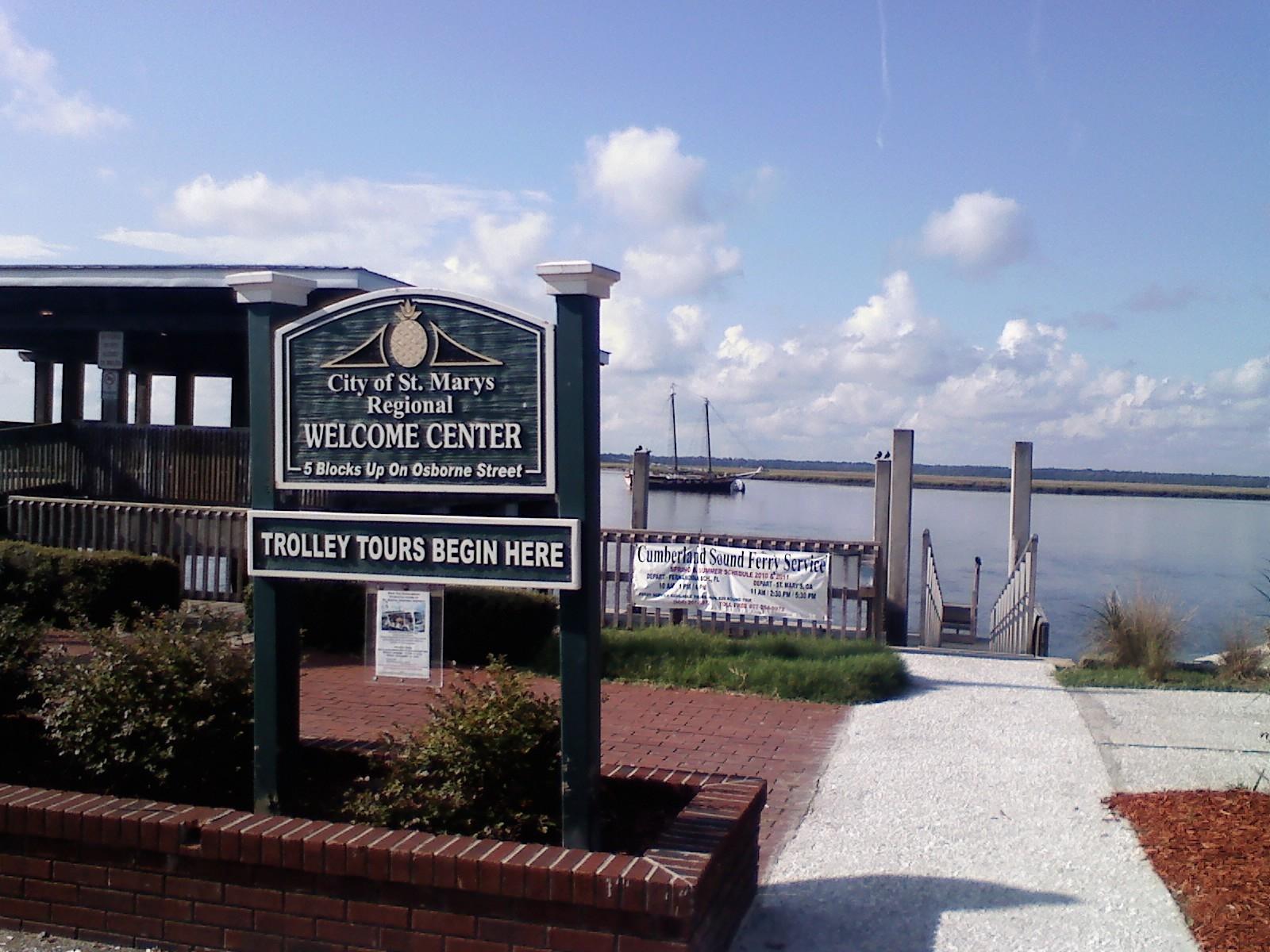 St. Marys town overview — waterfront gazebo
St. Marys, Georgia
St. Marys, Georgia, is the mainland gateway for the public Cumberland Island ferry and a worthwhile waterfront stop of its own. A small downtown around Osborne Street combines maritime museums, places to eat and a riverfront history walk. Staying here makes an early ferry check-in easier without requiring every day to be an island excursion.
Get to know the place
Fort George Island
Fort George Island combines maritime forest, tidal scenery and difficult chapters of Florida history near the mouth of the St. Johns River. Ribault Club and Kingsley Plantation provide different ways into that history, from a twentieth-century resort landscape to the lives of enslaved people and plantation owners.
Get to know the place Mayport riverfront overview — St. Johns River
Mayport Village
Mayport Village is a working fishing community near the mouth of the St. Johns River, where shrimp boats, seafood businesses and a vehicle ferry shape the waterfront. Come for a dockside meal and a close look at a maritime neighbourhood rather than expecting a long resort promenade.
Get to know the place Area near Savannah
Savannah
Savannah is a river city of public squares, historic houses and a busy commercial waterfront. Start with a walk through the Historic District, make time for a museum and continue toward Forsyth Park or River Street. A short ferry crossing adds another view of the city without turning the day into a long excursion.
Get to know the placePhoto credits4
- Area image: St. Marys, Georgia waterfront gazeboSt Marys Waterfront 3. Author: Legohead. Credit: Own work. License: CC BY-SA 3.0 (https://creativecommons.org/licenses/by-sa/3.0). Source: https://commons.wikimedia.org/wiki/File:St_Marys_Waterfront_3.JPGCropped to fit the display.
- Depicts: Fort George IslandFort George Island Historical Marker. Author: Deisenbe. Credit: Own work. License: CC BY-SA 4.0 (https://creativecommons.org/licenses/by-sa/4.0). Source: https://commons.wikimedia.org/wiki/File:Fort_George_Island_Historical_Marker.jpgCropped to fit the display.
- Area image: St. Johns River at Mayport, viewed from the Mayport FerryMayport FL St Johns from ferry03. Author: Ebyabe. Credit: Own work. License: CC BY-SA 3.0 (https://creativecommons.org/licenses/by-sa/3.0). Source: https://commons.wikimedia.org/wiki/File:Mayport_FL_St_Johns_from_ferry03.jpgCropped to fit the display.
- Area image: Street Of Savannah — Area near SavannahStreet Of Savannah - panoramio (1). Author: ---=XEON=---. Credit: https://web.archive.org/web/20161028205126/http://www.panoramio.com/photo/97933155. License: CC BY 3.0 (https://creativecommons.org/licenses/by/3.0). Source: https://commons.wikimedia.org/wiki/File:Street_Of_Savannah_-_panoramio_(1).jpgCropped to fit the display.
