
Ludington.
Ludington combines a working Lake Michigan harbour with a walkable downtown, a broad town beach and a much larger dune landscape to the north. The cross-lake car ferry is part of its identity, but the town also makes a useful overnight stop for maritime history and relaxed waterfront walks.
Photo credits1
- Area image: SS Badger Ludington, Mi — Area near LudingtonSS Badger Ludington, Mi - panoramio. Author: papadakp. Credit: https://web.archive.org/web/20161027071608/http://www.panoramio.com/photo/72092249. License: CC BY-SA 3.0 (https://creativecommons.org/licenses/by-sa/3.0). Source: https://commons.wikimedia.org/wiki/File:SS_Badger_Ludington,_Mi_-_panoramio.jpgCropped to fit the display.
Make your way to Ludington
Choose a tool and your dates to check the options for your trip.
More ways to explore
- Country
- United States
- Currency
- USD
- Time zone
- America/Detroit
Ludington combines a working Lake Michigan harbour with a walkable downtown, a broad town beach and a much larger dune landscape to the north. The cross-lake car ferry is part of its identity, but the town also makes a useful overnight stop for maritime history and relaxed waterfront walks.
Build your visit around two distinct settings. Downtown and Stearns Park fit together comfortably, while Ludington State Park and Hamlin Lake need a separate outing. The ferry terminal sits beside the harbour rather than at the state park, so choose accommodation and transport with your actual boarding point in mind.
When to go
Summer supports beach days and the broadest visitor programme; autumn suits walking with warmer layers. The museum’s published visitor season ends in October. As checked on 29 October 2026, the state park’s Skyline Trail, intersecting trails and amphitheatre area were closed for reconstruction expected through mid-2027. Plan an alternative walk and recheck the DNR notice before travelling.
Getting there
S.S. Badger connects Ludington with Manitowoc, Wisconsin, using the Ludington dock at 701 Maritime Drive. Its published 2026 season ended on 11 October, and the current schedule page now describes the 2027 season. This is a seasonal crossing, not a winter shortcut. The advertised crossing takes about four hours; check the operator’s dated sailing and boarding instructions for your trip.
Getting around
Central waterfront and downtown loops are practical on foot, with accessible sidewalk routes described by the visitor bureau. Ludington Mass Transit Authority operates an on-demand bus service in Ludington and its published surrounding service area. Reserve a ride rather than expecting a fixed sightseeing shuttle. For the state park, check the actual pickup and return coverage before leaving your vehicle behind.
Local food
Ice cream is a recognisable part of a Ludington visit. The local visitor bureau lists House of Flavors on Ludington Avenue for its homemade ice cream, soups and roast turkey. South James Street offers brewpub dining near the harbour, including locally made beer at Jamesport. These are examples of local food traditions, not live table availability or a promise of today’s opening hours.
What to see
The Port of Ludington Maritime Museum occupies the former 1934 Coast Guard station on South Lakeshore Drive. Its interactive galleries connect shipwrecks, rescues and railroad car ferries with the town outside. For a different family stop, Sandcastles Children’s Museum offers hands-on exhibits downtown. Check each museum’s current calendar before building a rainy-day plan around it.
Towns and neighbourhoods
Ludington Avenue provides a useful axis between downtown dining and the lakefront. South James Street leads toward the harbour, while the waterfront walking loops connect Pere Marquette Lake, parks and the beach. Hamlin Lake is an inland-water setting north of town, not another name for Lake Michigan. A lakeside cottage there gives a different experience from a central hotel.
Coast and outdoors
Stearns Park Beach is the convenient town choice, with sand, picnic space and family recreation nearby. Farther north, the state park lies between Lake Michigan and Hamlin Lake, with dunes and the Big Sable River linking the landscapes. The walk toward Big Sable Point Lighthouse follows a sand-and-gravel path with little shade; carry water and suitable footwear.
Where to stay
Choose downtown for shops, meals and the harbour, or the Stearns Beach area for easier access to the lakefront. Historic accommodation includes the Stearns Hotel on East Ludington Avenue. Hamlin Lake cottages provide a quieter inland-lake base, but require a separate journey to the ferry. Check seasonal opening and the property’s street address rather than relying on a broad Ludington label.
Useful before you go
Ludington uses Eastern Time; Manitowoc uses Central Time, so the clock difference changes the apparent arrival time without shortening the crossing. At the beach, check flags and local warnings: Lake Michigan has strong currents, especially near piers and river outlets. Do not walk onto a breakwater in breaking waves. State-park beaches have no lifeguards; supervise children closely.
Good to know before you go
Is the ferry a winter service?
No. The published 2026 season ended on 11 October; consult the operator’s next-season schedule.
Which terminal should I use?
S.S. Badger lists 701 Maritime Drive in Ludington, separate from the state park.
Are all state-park trails currently open?
No. The Skyline Trail and associated areas were closed on 29 October 2026 for work expected through mid-2027.
Can I explore without a car?
Downtown and the waterfront suit walking; reserve on-demand transport and verify coverage for farther outings.
Why does the ferry arrival clock look unusual?
Ludington is on Eastern Time and Manitowoc on Central Time. The advertised crossing itself is about four hours.
Sources & references
These references support the guide. Confirm opening hours, access and travel services before you go.
- 01Michigan DNR: park landscape and current Skyline closure
- 02Historical society: maritime museum and visitor season
- 03Tourism bureau: town beach and children’s museum
- 04Tourism bureau: walking loops and demand transport
- 05Tourism bureau: local dairy and comfort food
- 06Tourism bureau: harbour brewpub
- 07Ferry operator: dated 2027 schedule and time zones
- 08Ferry operator: exact terminals
- 09Ferry operator: 2026 operating season
- 10Tourism bureau: downtown lodging location
- 11Tourism bureau: Hamlin Lake lodging location
- 12Michigan DNR: Great Lakes currents and beach safety
Where could the journey go next?
More guides in United States. Compare the places and check actual connections before combining stops.
 Area near Manitowoc
Manitowoc
Manitowoc sits on Lake Michigan’s western shore, where a working river mouth meets a compact downtown and a long lakeside walking route. Shipbuilding history gives the city its strongest theme, but art, Wisconsin food traditions and accessible waterfront outings make it more than a ferry stop.
Get to know the place Area near Cheboygan
Cheboygan
Cheboygan stands where its river reaches Lake Huron, combining a working port with a small downtown and access to northern Michigan’s inland lakes. It is the mainland departure point for Bois Blanc Island, but also a worthwhile base for river walks, local culture and short nature outings.
Get to know the place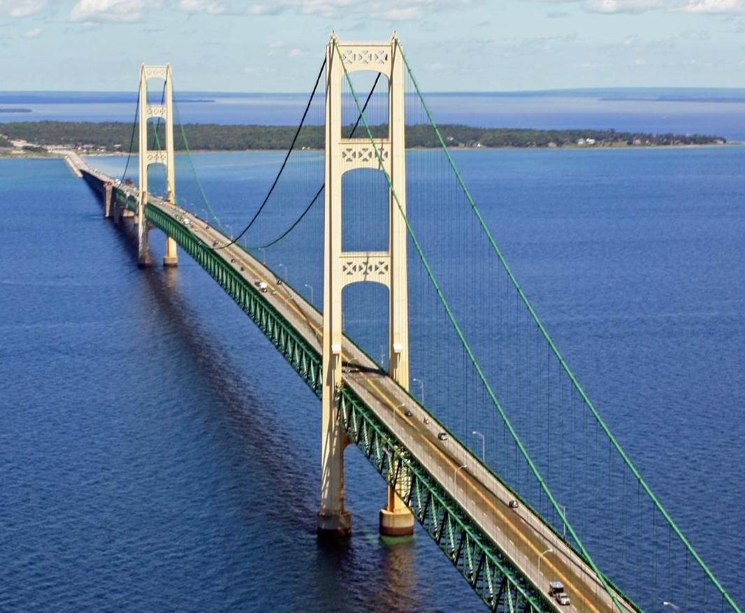 Straits of Mackinac overview — Mackinac Bridge
Bois Blanc Island
Bois Blanc Island lies in Michigan’s Straits of Mackinac, with wooded roads, Lake Huron shores and a small resident community around Pointe aux Pins. Locally its name is pronounced roughly “Bob-low.” The appeal is a quiet nature stay, with the mainland ferry journey setting a slower pace before you arrive.
Get to know the place
Middle Bass Island
Middle Bass Island offers a quieter Lake Erie stay than nearby Put-in-Bay, with vineyard history, nature preserves and a marina around its southern shore. The former Lonz Winery gives the state park its distinctive landmark, while wooded island lanes lead to small protected habitats and open-water views.
Get to know the placePhoto credits4
- Area image: The Manitowoc County Courthouse at 1110 South 8th Street in Manitowoc, Wisconsin. — Area near ManitowocManitowoc County Courthouse Wisconsin (31754727350). Author: Tony Webster from Minneapolis, Minnesota. Credit: Manitowoc County Courthouse. License: CC BY-SA 2.0 (https://creativecommons.org/licenses/by-sa/2.0). Source: https://commons.wikimedia.org/wiki/File:Manitowoc_County_Courthouse_Wisconsin_(31754727350).jpgCropped to fit the display.
- Area image: In Cheboygan, MI — Area near CheboyganNorth Main Street at night (53882785849). Author: Chris Rycroft from Madison, Wisconsin, United States. Credit: North Main Street at night. License: CC BY 2.0 (https://creativecommons.org/licenses/by/2.0). Source: https://commons.wikimedia.org/wiki/File:North_Main_Street_at_night_(53882785849).jpgCropped to fit the display.
- Area image: Mackinac Bridge over the Straits of MackinacMackinac Bridge from the air4. Author: Justin Billau. Credit: Flickr : Mackinac Bridge. License: CC BY 2.0 (https://creativecommons.org/licenses/by/2.0). Source: https://commons.wikimedia.org/wiki/File:Mackinac_Bridge_from_the_air4.jpgCropped to fit the display.
- Depicts: Middle Bass IslandLakeErieIslands. Author: Lake Erie Coastal Ohio, Inc.. Credit: http://www.fhwa.dot.gov/byways/photos/60169. License: Public domain (https://creativecommons.org/publicdomain/mark/1.0/). Source: https://commons.wikimedia.org/wiki/File:LakeErieIslands.JPG
