
Jersey City (Warren Street waterfront).
The Warren Street waterfront is a small Jersey City landing beside the former Morris Canal basin, with residential streets and harbour history close at hand. It is a useful starting point for a quiet walk, a meal in Paulus Hook or a crossing to Liberty State Park.
Photo credits1
- Area image: Looking northeast, full zoom, at Liberty State Park station on a cloudy midday. I-78 in background. — Area near Jersey City (Warren Street waterfront)Lib St Park HBLR jeh. Author: Jim.henderson. Credit: Own work. License: CC0 (https://creativecommons.org/publicdomain/zero/1.0/). Source: https://commons.wikimedia.org/wiki/File:Lib_St_Park_HBLR_jeh.jpg
Make your way to Jersey City (Warren Street waterfront)
Choose a tool and your dates to check the options for your trip.
More ways to explore
- Country
- United States
- Currency
- USD
- Time zone
- America/New York
The Warren Street waterfront is a small Jersey City landing beside the former Morris Canal basin, with residential streets and harbour history close at hand. It is a useful starting point for a quiet walk, a meal in Paulus Hook or a crossing to Liberty State Park.
Treat Warren Street as its own stop. The Liberty Landing marina dock lies across the basin, while the NY Waterway Paulus Hook terminal is elsewhere on the Hudson frontage. A short distance on a map can still mean a different operator, ticket and boarding point.
When to go
A mild day makes the basin walk and a meal an easy combination; in colder weather, keep the exposed waterside section short. The current Liberty Landing Ferry page displays weekday departures, despite broader promotional language about outdoor weekends. Confirm your specific date rather than extending that timetable to Saturday or Sunday. Use current restaurant and market notices too, since a year-round neighbourhood does not make every service available every day.
Getting there
Liberty Landing Ferry's route links the Warren Street stop with Liberty Landing Marina and Manhattan's Brookfield Place. Check direction as well as stop name before boarding. Its directions place this landing at the end of Warren Street, not at Sussex Street's Paulus Hook terminal. A visit to Liberty or Ellis Island requires a separate authorized island-ferry service from the park; this local basin crossing does not itself land on those islands.
Getting around
Walk the neighbourhood using Morris, Warren and Washington Streets as references. Exchange Place offers light-rail and PATH connections farther north; the light-rail platforms are on Hudson Street between York and Montgomery. Leave a realistic walking margin with luggage. If the local ferry does not fit your return, plan the land connection in advance instead of assuming another nearby operator's ticket or departure will substitute.
Local food
Satis Bistro at 212 Washington Street provides European-style dining within Paulus Hook. County tourism describes homemade pasta, cheeses and charcuterie; check the owner's current menu and service calendar before choosing a meal. Its lunch, dinner and brunch patterns differ, so a restaurant address is not a guarantee of midday food every day. For market shopping, the city's Paulus Hook market is a separate Saturday stop at 158 Washington Street.
What to see
Follow the Canal Society's walking map around the Little Basin, the eastern end of the former Morris Canal. It identifies the historic lock site and an Underground Railroad sculpture, connecting the waterway with the area's transport and freedom-seeking histories. Continue towards the Colgate Clock on the Hudson frontage to see another reminder of the industrial waterfront. The small parks at Grand and Washington Streets add a residential neighbourhood stop inland.
Towns and neighbourhoods
The ferry leaves from the foot of Warren Street. Morris Street provides one approach from the Exchange Place side, while Washington Street leads through Paulus Hook's older blocks. The marina water separates this shore from Liberty Landing. Keep the basin's shape in mind when planning a walk: the visible destination directly opposite may need a boat or a longer land route, rather than a simple straight crossing.
Coast and outdoors
Choose the Morris Canal peninsula and public waterfront paths for boat watching and harbour views. These are urban open spaces, not a bathing beach. Take the walking map and follow public access around the basin without entering private pontoons. If extending to Liberty State Park, select a few park stops rather than promising to cover all the lawns, nature areas and museums in the time between two ferries.
Where to stay
For an overnight visit, compare the residential Paulus Hook area with hotels around Exchange Place. Hyatt House Jersey City is at One Exchange Place, a downtown base rather than a property on the Warren Street dock. Its owner says it does not offer a shuttle. Verify the room and its accessibility features, then plan the actual route to the water with bags, especially for an early departure or late return.
Useful before you go
Keep the full landing name on your itinerary and show it when arranging a pickup. The ferry operator welcomes bicycles and strollers, but ask about boarding assistance and space for your particular sailing. Around the basin, respect residents, marina gates and working vessels. For historic context, the public library explains how boats from this waterfront helped people escaping enslavement; give the commemorative sites time rather than treating them only as skyline photo stops.
Good to know before you go
Where is the Warren Street ferry stop?
At the foot of Warren Street in Jersey City, as described by Liberty Landing Ferry.
Is it the same as Paulus Hook?
No. NY Waterway's Paulus Hook terminal is at the end of Sussex Street.
Does this boat take me onto Liberty Island?
No. The local published route links Warren Street, Liberty Landing and Brookfield Place. Island visits use a separate authorized service.
Can I assume weekend departures?
The current operator page shows a weekday timetable. Confirm weekend travel directly before relying on it.
Is the basin a swimming destination?
No. Plan an urban waterfront walk and stay clear of marina pontoons and working boats.
Will a nearby hotel shuttle take me to this dock?
Do not assume that. Hyatt House explicitly lists no shuttle; arrange your own final connection.
Sources & references
These references support the guide. Confirm opening hours, access and travel services before you go.
- 01Operator: Warren Street foot-of-street stop and distinct Liberty Landing/Brookfield calls
- 02Canal Society: basin, lock site, monument and neighbourhood walking map
- 03City library: canal basin and journeys towards freedom
- 04City library: nearby Colgate Clock and waterfront industry
- 05Neighbourhood association: Grand/Washington park and historic district
- 06Restaurant owner: European-style dining at Washington Street
- 07County tourism: European dishes, cheeses and homemade pasta; current hours checked with owner
- 08City: separate farmers markets and locations
- 09Rail operator: Exchange Place station location
- 10Hotel owner: Exchange Place location and no shuttle
- 11NJDEP: park and separate ferry services
- 12NY Waterway: separate Sussex Street dock
Where could the journey go next?
More guides in United States. Compare the places and check actual connections before combining stops.

Jersey City
Jersey City is a city of its own across the Hudson, with harbour landscapes, transport history and neighbourhood food traditions worth a visit beyond a Manhattan commute. Liberty State Park offers its broadest open-water views, while downtown brings restaurants, markets and streets that feel different from the great lawns.
Get to know the place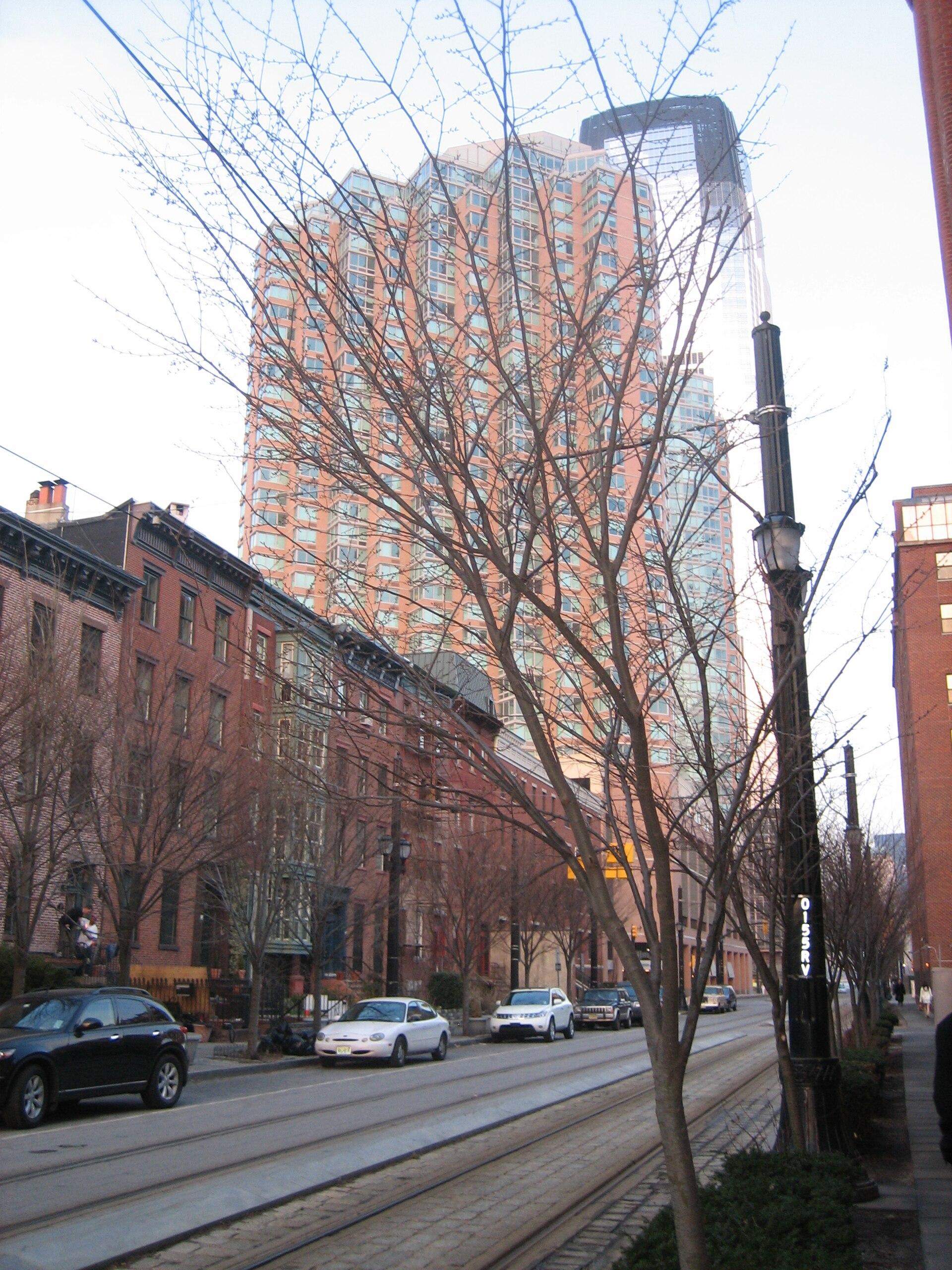
Paulus Hook
Paulus Hook offers a compact Jersey City day of nineteenth-century residential streets, small parks and an open Hudson waterfront. The Manhattan skyline is the backdrop, but the neighbourhood's own canal, railway and industrial history gives the walk its substance.
Get to know the place
Governors Island
Governors Island places lawns, former military buildings and harbour views a short ferry crossing from Lower Manhattan. The Lenape knew it as Paggank, or Nut Island; later Army and Coast Guard occupation shaped the historic buildings that now sit beside public landscapes and cultural spaces.
Get to know the place New York City area overview
New York City (Lower Manhattan and Brooklyn)
The Battery and Bay Ridge show two different faces of New York Harbor. At Manhattan's southern tip, garden paths surround Castle Clinton and boats leave for the Statue of Liberty. Across the harbour in Brooklyn, Bay Ridge offers a residential waterfront, community gardens and neighbourhood restaurants beyond the busiest sightseeing circuit.
Get to know the placePhoto credits4
- Depicts: Jersey CityJournal Square Jersey City November 2021 003. Author: King of Hearts. Credit: Own work. License: CC BY-SA 4.0 (https://creativecommons.org/licenses/by-sa/4.0). Source: https://commons.wikimedia.org/wiki/File:Journal_Square_Jersey_City_November_2021_003.jpgCropped to fit the display.
- Depicts: Paulus HookPaulusHook. Author: A1% at English Wikipedia. Credit: Own work. License: Public domain (https://creativecommons.org/publicdomain/mark/1.0/). Source: https://commons.wikimedia.org/wiki/File:PaulusHook.JPG
- Depicts: Governors IslandGovernors Island from One World Observatory 2017. Author: Antony-22. Credit: Own work. License: CC BY-SA 4.0 (https://creativecommons.org/licenses/by-sa/4.0). Source: https://commons.wikimedia.org/wiki/File:Governors_Island_from_One_World_Observatory_2017.jpgCropped to fit the display.
- Area image: New York City
