
New Zealand.
Aotearoa New Zealand combines island coastlines, volcanic country, mountains and small cities with strong local identities. Give each region time: a walking holiday, a food-and-wine journey and a trip between ferry islands are different ways to experience the country, rather than tasks to fit into one hurried circuit.
Photo credits1
A little closer to New Zealand
Geography, regions and practical details from the country guide. Go straight to a chapter, or browse every destination below.
Go straight to the destinationsAotearoa New Zealand combines island coastlines, volcanic country, mountains and small cities with strong local identities. Give each region time: a walking holiday, a food-and-wine journey and a trip between ferry islands are different ways to experience the country, rather than tasks to fit into one hurried circuit.
The North and South Islands can be combined by air or across Cook Strait, but the crossing deserves its own place in your itinerary. Short distances on a map can involve slow, winding roads. Choose fewer overnight bases and leave room for weather changes, a longer walk or a conversation with your host.
Two main islands and many smaller ones
The North Island, Te Ika-a-Māui, and South Island, Te Waipounamu, form the country’s main landmass. Rakiura / Stewart Island lies farther south. Mountain ranges and a central North Island volcanic zone help explain the changing landscapes. Wellington is the capital; Auckland is a separate northern city, not the departure point for the Cook Strait crossing.
Choosing an itinerary
Northland offers coastal travel, while Auckland connects with the Hauraki Gulf islands. Rotorua and the central North Island introduce geothermal landscapes and hosted Māori experiences. Wellington pairs a city stay with a southbound ferry connection.
Across the strait, Marlborough and Nelson Tasman offer sounds, vineyards and coast. Canterbury sits east of the Southern Alps; the West Coast has a different, wetter setting. Queenstown, Wānaka and Central Otago suit lake-and-mountain itineraries. Fiordland and Rakiura require their own time and transport planning rather than being treated as quick additions.
English and te reo Māori
English is widely used for travel services. Te reo Māori and New Zealand Sign Language have official status. Māori place names are part of everyday geography, and you will often see paired names on maps and signs. Kia ora is a common greeting. Listen to local pronunciation and keep the full destination name when arranging a pickup.
New Zealand dollars
The currency is the New Zealand dollar, NZD. Major cards are widely accepted, particularly Visa and Mastercard. Keep some cash for small purchases and a backup payment option. Compare the full cost of an island crossing, including passengers, vehicle dimensions and any added services, rather than assuming a passenger fare covers your whole party and car.
Being a considerate guest
Māori tikanga, or customary ways of doing things, varies between iwi, hapū and communities. A marae visit follows the hosts’ invitation and welcome; ask what is expected. Remove shoes before entering a meeting house when instructed, avoid sitting on food tables and seek permission before taking photographs. Hosted experiences are an opportunity to listen to local stories in their own setting.
Regional produce and shared meals
A hāngī traditionally cooks food with heated stones and steam in an earth oven; a hosted meal offers cultural context as well as flavour. Explore Auckland’s varied restaurants and Wellington’s cafés, then look for regional produce: Marlborough sauvignon blanc, Central Otago pinot noir, Kaikōura crayfish and seasonal Bluff oysters. Availability varies, so let the local menu guide your choices.
Prepare for changing conditions
Summer runs from December to February and winter from June to August. Conditions vary between the subtropical north, exposed coasts and alpine areas. Rain is possible during summer, and the West Coast is particularly wet. Pack layers and waterproof clothing, and choose a walk using its current conditions and your abilities rather than the season alone.
Roads and the Cook Strait ferry
Drive on the left and allow more time than a simple distance estimate suggests. Check current licence rules and the rental agreement before departure. The Wellington–Picton ferry carries foot passengers and booked vehicles, but rental companies differ: some permit the car aboard, while others require an exchange between islands. Confirm the exact terminal, check-in instructions and vehicle arrangement for your booking.
Arrival formalities and outdoor preparation
Most visitors need the appropriate visa or NZeTA before travel; check the rule for your passport and situation. The New Zealand Traveller Declaration is a separate, free requirement. Declare food, plant and animal products as instructed, including items forgotten in hand luggage.
Before hiking, read Department of Conservation alerts, choose a route matching your skills and tell someone your plan. Carry warm clothing, extra food and an appropriate way to summon help. River levels and alpine conditions can change rapidly, so be prepared to shorten or change a route.
Good to know before you go
Where does the ferry between the main islands run?
Across Cook Strait between Wellington on the North Island and Picton on the South Island. Check the terminal for your chosen operator.
Can I take any rental car on the ferry?
No. Policies vary. Confirm permission before booking, or arrange the rental company’s vehicle exchange on each island.
Is the Traveller Declaration the same as an NZeTA?
No. Entry permission or travel authority and the Traveller Declaration are separate. Use the official government sites for each.
Is summer weather reliable for every hike?
No. Mountains and exposed coasts can change quickly. Check the specific track, forecast and DOC alerts before setting out.
Can I visit both main islands in a short trip?
It is possible, but transfers use valuable time. For a short stay, one region or one island usually allows a less hurried itinerary.
Sources & references
These references support the guide. Confirm opening hours, access and travel services before you go.
- 01Ministry for the Environment — physical geography
- 02Tourism New Zealand — regional highlights
- 03New Zealand Government — regions
- 04Tourism New Zealand — touring map
- 05Ministry of Education — languages
- 06Tourism New Zealand — visitor facts
- 07Education New Zealand — Māori tikanga
- 08Unitec marae — visitor protocols
- 09Tourism New Zealand — food regions
- 10Te Ara — Māori cooking
- 11Tourism New Zealand — summer and regional weather
- 12NZ Transport Agency — visiting drivers
- 13Interislander — crossing and vehicle arrangements
- 14Immigration New Zealand — before travel
- 15New Zealand Traveller Declaration — official guidance
- 16New Zealand Customs — arrival
- 17MPI — biosecurity declarations
- 18Department of Conservation — outdoor preparation
Find your place in New Zealand
Open the guides, get a feel for the differences between places, and find the ones that fit your plans.
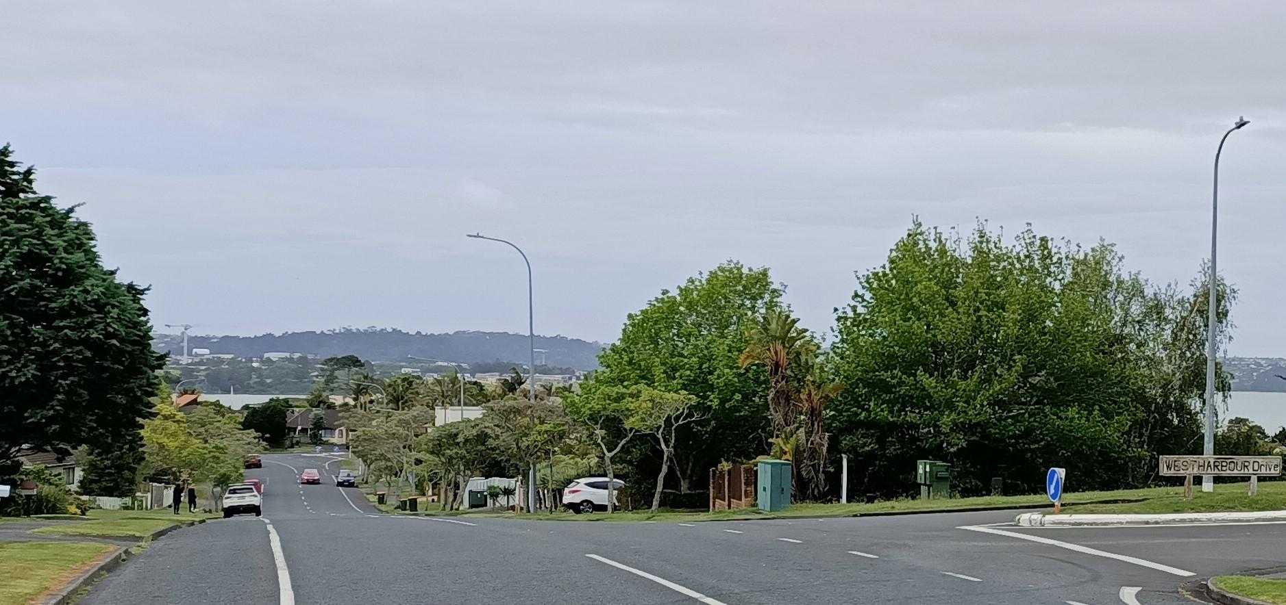
Auckland — West Harbour
West Harbour offers an upper-Waitematā outing built around a working recreational marina and coastal paths. The Auckland ferry arrives at Hobsonville Marina, formerly called Westpark Marina, where the boat-filled water and surrounding residential streets give the visit a quieter scale than the central-city waterfront.
Read the field guideAuckland
Auckland, or Tāmaki Makaurau, is the main urban gateway to the upper North Island. Its downtown waterfront, volcanic maunga, Māori and Pacific identity, and Hauraki Gulf islands make it more than a transit stop.
Read the field guide
Bluff
Bluff is a working Southland port where fishing boats, maritime history and a steep green hill meet Foveaux Strait. Many travellers come to catch the Stewart Island ferry, but the town rewards time ashore: a museum visit, a coastal walk and a meal make a useful counterpoint to the crossing.
Read the field guide Christchurch city overview — Mona Vale gardens
Christchurch / Lyttelton
Use Christchurch as the practical base for exploring Canterbury, then make time for Lyttelton, the historic port town on Banks Peninsula. The harbour settlement is close to central Christchurch by road and combines harbour scenery with cafés, restaurants, walks and small-cove beaches.
Read the field guide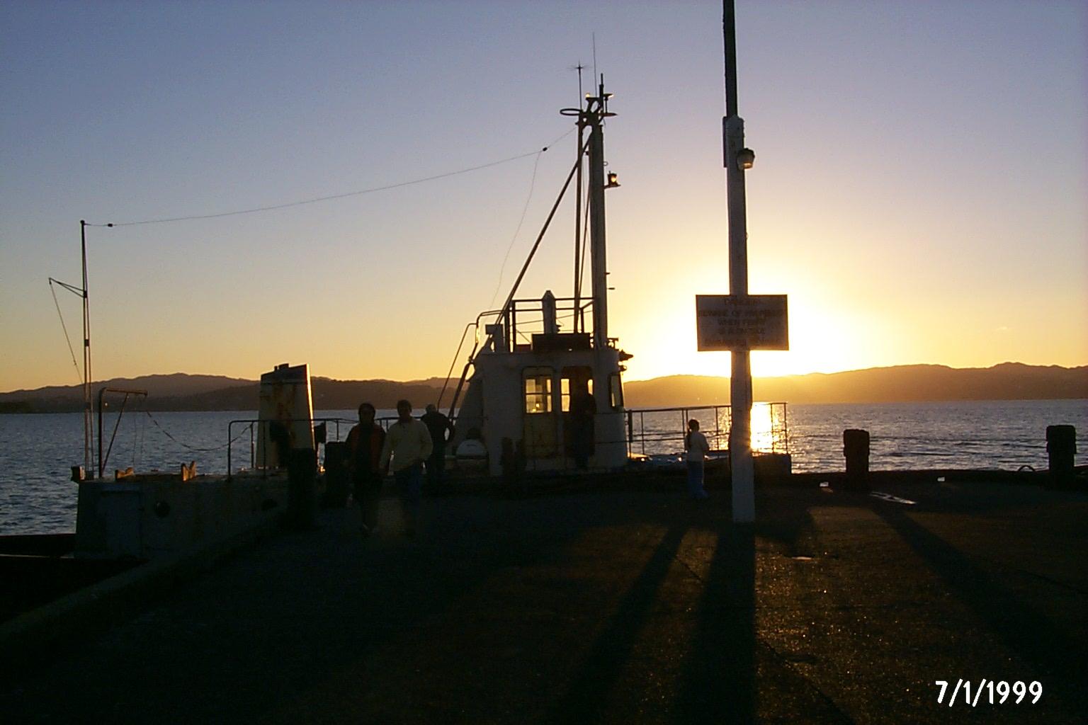 Area near Days Bay / Eastbourne
Days Bay / Eastbourne
Days Bay turns a Wellington harbour crossing into a beach-and-bush day. The wharf lands beside a sandy shore, with Williams Park behind and forest rising above the waterfront. Nearby Eastbourne adds a village centre, small shops and a longer coastal outing on the eastern side of the harbour.
Read the field guide
Dunedin
Dunedin (Ōtepoti) combines a strong built-heritage identity with coastal scenery and the biodiversity of the Otago Peninsula. Port Chalmers is the principal cruise gateway, while the city centre offers museums, galleries and civic landmarks.
Read the field guide
Golden Bay
Golden Bay Wharf sits on Stewart Island/Rakiura, looking into Paterson Inlet/Whaka a Te Wera. It is a small departure point for the forest sanctuary of Ulva Island/Te Wharawhara, with bush walks nearby and Oban’s village services across the hill. This guide concerns that wharf and its immediate surroundings.
Read the field guide
Mapua
Māpua is a small coastal village beside Waimea Inlet, between Nelson and Motueka. Former fruit-shipping cool stores now house places to eat, shop and look at local art, making the wharf a natural focus for a leisurely visit. It is as rewarding for a waterfront lunch as for a longer stay.
Read the field guide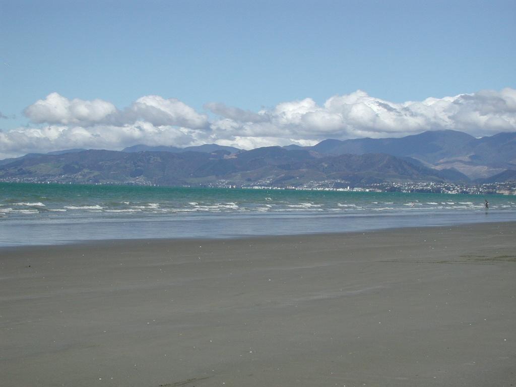 Area near Moturoa / Rabbit Island
Moturoa / Rabbit Island
Moturoa/Rabbit Island is a beach-and-forest day destination in Waimea Estuary, close to Richmond and linked to Māpua by a small passenger ferry. Its long sandy shore, picnic spaces and cycle tracks offer a quieter counterpoint to the cafés across the channel. This is a recreational reserve, not a resort village.
Read the field guide Area near Narrows (Hokianga Harbour)
Narrows (Hokianga Harbour)
The Narrows is the northern landing of the Hokianga vehicle ferry, opposite Rawene and four kilometres south of Kohukohu. It is a useful local connection on a Northland road journey, bringing travellers across a harbour with a long history of settlement and trade.
Read the field guide
Otehei Bay, Urupukapuka Island
Otehei Bay is the ferry landing on Urupukapuka Island, where a sandy shoreline, café and walking tracks make an island day straightforward to organise. It is a separate destination from Paihia or Russell: both mainland towns are departure points across the water.
Read the field guide
Paihia
Paihia is compact and practical for an island-rich region. The waterfront is the starting point for Russell, Urupukapuka, Cape Brett and wildlife cruises.
Read the field guide
Picton (Waitohi)
Picton, also known as Waitohi, opens onto the sheltered waterways and wooded hills of the Marlborough Sounds. Ferries make it a busy gateway between New Zealand’s main islands, but the foreshore, maritime museum and walking tracks give good reasons to stay beyond a connection.
Read the field guide
Port Chalmers (Dunedin)
Port Chalmers is a small harbour town with its own maritime museum, hillside art and independent shops, beside the working port on Otago Harbour. It is also the berth for most cruise ships visiting Dunedin, but the city centre is a separate onward journey.
Read the field guide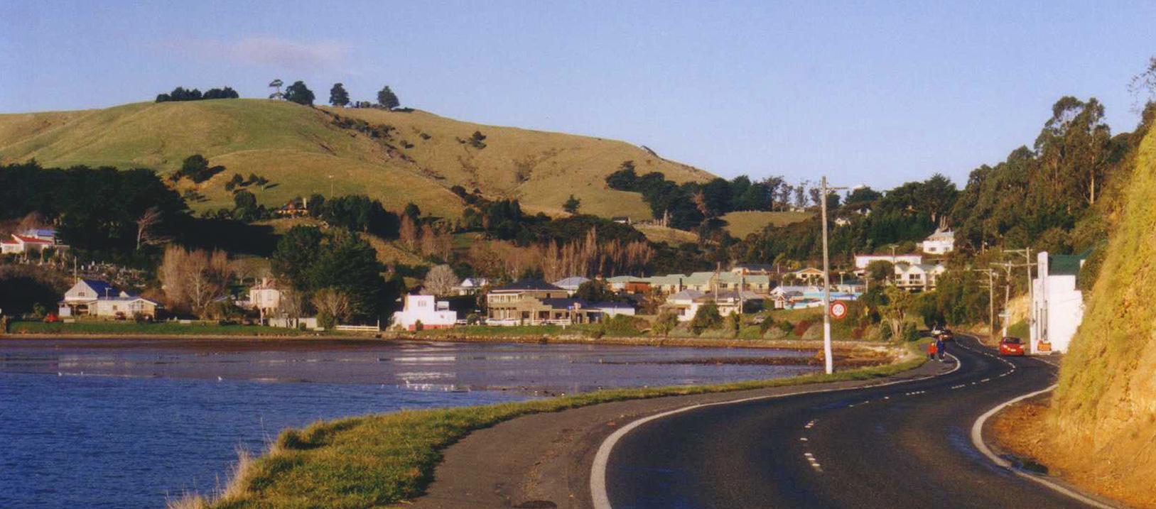
Portobello
Portobello sits beside Otago Harbour on the peninsula opposite Port Chalmers. Its small village, local museum and passenger ferry make it a worthwhile stop in its own right, with the city of Dunedin and the wildlife headlands belonging to the wider itinerary.
Read the field guide
Queens Wharf (Wellington)
Queens Wharf sits on Wellington’s central waterfront, where a harbour-ferry departure can become a full day of museums, seafood and walks beside the water. The East by West service connects this city landing with Days Bay on the eastern side of Wellington Harbour.
Read the field guide
Queenstown
The town is framed by the Remarkables, Coronet Peak and the Southern Alps, but Queenstown is more than an adrenaline stop. The waterfront, gardens, historic streets and cafés make a gentle day possible, while lake cruises, walks, cycling, skiing and wine-country outings reward a longer stay.
Read the field guide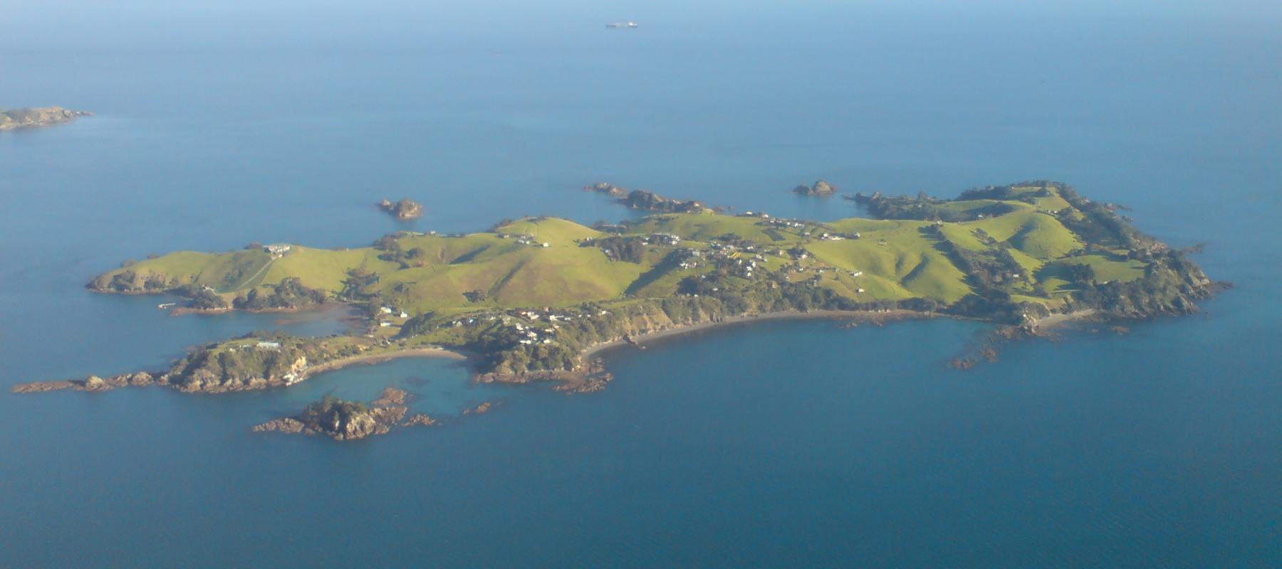
Rakino Island
Rakino’s appeal is low-key island life: coves, historic homes and walking rather than a dense visitor infrastructure. Its small community lives northeast of Motutapu, with no grid electricity or ordinary shopping street. Visitors need the same practical approach to supplies as residents.
Read the field guide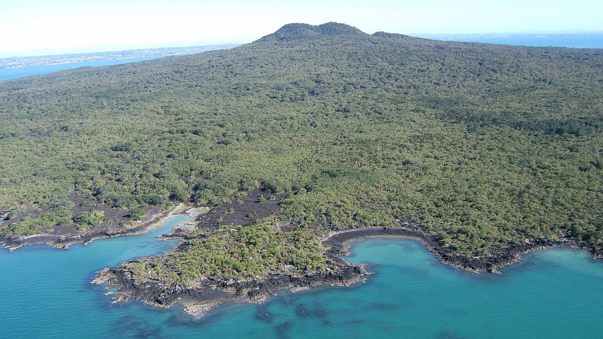
Rangitoto Island
Rangitoto brings together black lava fields, pōhutukawa forest and a summit overlooking Auckland and the Hauraki Gulf. The island experience is a self-contained walking day, with no shops or drinking-water supply to fall back on.
Read the field guide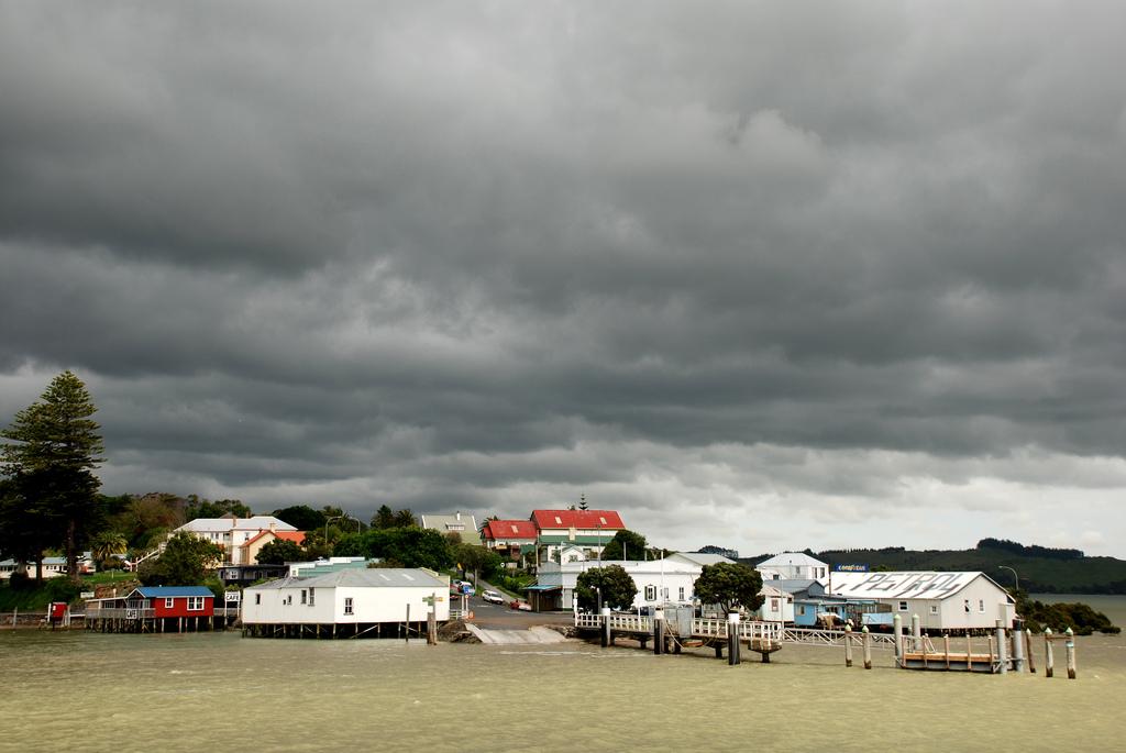
Rawene
Rawene is a small Northland village on the southern shore of Hokianga Harbour. Its waterfront, old buildings, cafés and craft culture suit travellers who prefer a slow local stay to a resort strip.
Read the field guide
Russell (Kororāreka)
Russell is compact, walkable and rich in early maritime and colonial history, but its identity is also Māori and coastal: coves, headlands and island waters frame the town.
Read the field guide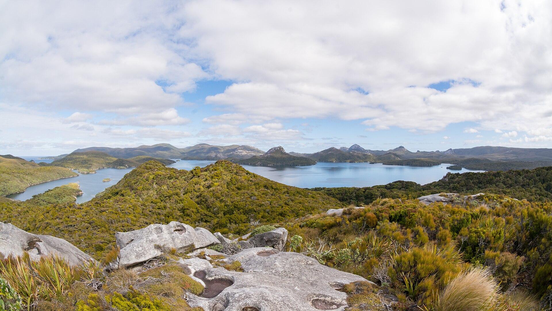
Stewart Island/Rakiura
Stewart Island/Rakiura combines a small inhabited waterfront with an extensive landscape of forest, inlets and walking country. Oban gives you the practical starting point: settle into an island stay, visit the museum and choose between a short coastal walk, a boat excursion or a properly prepared overnight hike.
Read the field guide
Waiheke Island
Waiheke combines permanent island communities, sandy bays and a strong wine-and-food culture. Oneroa is the main visitor village; farther east, vineyards, rural roads and coastal reserves create a very different day from simply staying near the ferry.
Read the field guide
Wellington
Wellington brings a capital city’s museums and political landmarks into a compact harbour setting. Its appeal is easy to experience on foot: follow the waterfront, turn inland for coffee on Cuba Street, then climb or ride into the hills for a view back over the city and its busy water.
Read the field guidePhoto credits24
- Depicts: Auckland — West HarbourWest Harbour - 51655901100 - Cropped. Author: aklmuseumstaffwikipedia. Credit: https://www.flickr.com/photos/194100792@N06/51655901100/. License: CC BY 2.0 (https://creativecommons.org/licenses/by/2.0). Source: https://commons.wikimedia.org/wiki/File:West_Harbour_-_51655901100_-_Cropped.jpgCropped to fit the display.
- Depicts: BluffBluff from Stewart Island ferry. Author: AlasdairW. Credit: Own work. License: CC BY-SA 3.0 (https://creativecommons.org/licenses/by-sa/3.0). Source: https://commons.wikimedia.org/wiki/File:Bluff_from_Stewart_Island_ferry.jpgCropped to fit the display.
- Area image: Mona Vale gardens, ChristchurchGazebo VI, Mona Vale. Author: Ann (Helen) Devereux. Credit: Flickr : Christchurch/Lyttelton Earthquake Feb 22. License: CC BY-SA 2.0 (https://creativecommons.org/licenses/by-sa/2.0). Source: https://commons.wikimedia.org/wiki/File:Gazebo_VI,_Mona_Vale.jpgCropped to fit the display.
- Area image: Sunset, Days Bay Wharf — Area near Days Bay / Eastbourne.Sunset, Days Bay Wharf - panoramio. Author: DB Thats-Me. Credit: https://web.archive.org/web/20161011154457/http://www.panoramio.com/photo/4633431. License: CC BY-SA 3.0 (https://creativecommons.org/licenses/by-sa/3.0). Source: https://commons.wikimedia.org/wiki/File:Sunset,_Days_Bay_Wharf_-_panoramio.jpgCropped to fit the display.
- Depicts: DunedinDunedin-Nueva Zelanda01. Author: Diego Delso. Credit: Own work. License: CC BY-SA 3.0 (https://creativecommons.org/licenses/by-sa/3.0). Source: https://commons.wikimedia.org/wiki/File:Dunedin-Nueva_Zelanda01.JPGCropped to fit the display.
- Depicts: Golden BayPlate from Dalrymple Account of Discoveries in the South Pacifick Nla.obj-18696055-111. Author: Alexander Dalrymple, 1737-1808. Credit: National Library of Australia. License: Public domain (https://creativecommons.org/publicdomain/mark/1.0/). Source: https://commons.wikimedia.org/wiki/File:Plate_from_Dalrymple_Account_of_Discoveries_in_the_South_Pacifick_Nla.obj-18696055-111.jpg
- Depicts: MapuaMapua school 27. Author: Wildman NZ. Credit: Own work. License: CC BY-SA 4.0 (https://creativecommons.org/licenses/by-sa/4.0). Source: https://commons.wikimedia.org/wiki/File:Mapua_school_27.jpgCropped to fit the display.
- Area image: Beach on Rabbit Island near Nelson , with Nelson in the distance — Area near Moturoa / Rabbit IslandBeach on Rabbit Island near Nelson. Author: Pseudopanax at English Wikipedia. Credit: Own work. License: Public domain (https://creativecommons.org/publicdomain/mark/1.0/). Source: https://commons.wikimedia.org/wiki/File:Beach_on_Rabbit_Island_near_Nelson.jpg
- Area image: Sail the Kohu Ra Tuarua from picturesque Rawene across the scenic Hokianga Harbour. Travel on by road through Kohukohu and Broadwood to Kaitaia, Ninety Mile Beach and fabulous Cape Reinga. Or travel south from Kohukohu, board the ferry at the Narrows and travel to Rawene, and then drive on to the beaches of Opononi and Omapere and the giant Kauris of the Waipoua Forest. — Area near Narrows (Hokianga Harbour)The Hokianga Vehicle Ferry (21234509213). Author: Bernard Spragg. NZ from Christchurch, New Zealand. Credit: The Hokianga Vehicle Ferry. License: CC0 (https://creativecommons.org/publicdomain/zero/1.0/). Source: https://commons.wikimedia.org/wiki/File:The_Hokianga_Vehicle_Ferry_(21234509213).jpg
- Depicts: Otehei Bay, Urupukapuka Island00 0866 Island of the Bay of Islands. Author: W. Bulach. Credit: Own work. License: CC BY-SA 4.0 (https://creativecommons.org/licenses/by-sa/4.0). Source: https://commons.wikimedia.org/wiki/File:00_0866_Island_of_the_Bay_of_Islands.jpgCropped to fit the display.
- Depicts: PaihiaPaihia, Williams Road. Author: Ulrich Lange, Bochum, Germany. Credit: Own work. License: CC BY 3.0 (https://creativecommons.org/licenses/by/3.0). Source: https://commons.wikimedia.org/wiki/File:Paihia,_Williams_Road.jpgCropped to fit the display.
- Depicts: Picton (Waitohi)2022-06-05 Picton, New Zealand. Author: Maxim75. Credit: Own work. License: CC BY 4.0 (https://creativecommons.org/licenses/by/4.0). Source: https://commons.wikimedia.org/wiki/File:2022-06-05_Picton,_New_Zealand.jpgCropped to fit the display.
- Depicts: Port Chalmers (Dunedin)Port Chalmers from Centenary lookout. Author: Pseudopanax at English Wikipedia. Credit: Own work. License: Public domain (https://creativecommons.org/publicdomain/mark/1.0/). Source: https://commons.wikimedia.org/wiki/File:Port_Chalmers_from_Centenary_lookout.jpg
- Depicts: PortobelloPortobelloNZ. Author: The original uploader was Grutness at English Wikipedia .. Credit: Transferred from en.wikipedia to Commons.. License: CC BY-SA 3.0 (https://creativecommons.org/licenses/by-sa/3.0/). Source: https://commons.wikimedia.org/wiki/File:PortobelloNZ.jpgCropped to fit the display.
- Depicts: Queens Wharf (Wellington)QueensWharfFIFA2023 01. Author: L Maule. Credit: Own work. License: CC BY-SA 4.0 (https://creativecommons.org/licenses/by-sa/4.0). Source: https://commons.wikimedia.org/wiki/File:QueensWharfFIFA2023_01.jpgCropped to fit the display.
- Depicts: QueenstownQueenstown 1 (8168013172). Author: Bernard Spragg. NZ from Christchurch, New Zealand. Credit: Queenstown 1. License: CC0 (https://creativecommons.org/publicdomain/zero/1.0/). Source: https://commons.wikimedia.org/wiki/File:Queenstown_1_(8168013172).jpg
- Depicts: Rakino IslandRakino Island From Above Southeast. Author: Ingolfson. Credit: Self-photographed. License: Public domain (https://creativecommons.org/publicdomain/mark/1.0/). Source: https://commons.wikimedia.org/wiki/File:Rakino_Island_From_Above_Southeast.jpg
- Depicts: Rangitoto IslandRangitoto09f. Author: Bruce Hayward. Credit: Own work. License: CC BY-SA 4.0 (https://creativecommons.org/licenses/by-sa/4.0). Source: https://commons.wikimedia.org/wiki/File:Rangitoto09f.jpgCropped to fit the display.
- Depicts: RaweneRawene from the water. Author: Flickr user PhillipC / Phillip Capper. Credit: https://www.flickr.com/photos/flissphil/1596542679/. License: CC BY 2.0 (https://creativecommons.org/licenses/by/2.0). Source: https://commons.wikimedia.org/wiki/File:Rawene_from_the_water.jpgCropped to fit the display.
- Depicts: Russell (Kororāreka)1870 house in Russell. Author: Sylvain Machefert / Symac. Credit: Own work. License: CC BY-SA 3.0 (https://creativecommons.org/licenses/by-sa/3.0). Source: https://commons.wikimedia.org/wiki/File:1870_house_in_Russell.jpgCropped to fit the display.
- Depicts: Stewart Island/RakiuraPikihatiti. Author: Jake Osborne. Credit: https://www.flickr.com/photos/theylooklikeus/33279695271/. License: CC BY-SA 2.0 (https://creativecommons.org/licenses/by-sa/2.0). Source: https://commons.wikimedia.org/wiki/File:Pikihatiti.jpgCropped to fit the display.
- Depicts: Waiheke IslandWaiheke Island Vineyard. Author: russellstreet. Credit: https://www.flickr.com/photos/russellstreet/6410271405/. License: CC BY-SA 2.0 (https://creativecommons.org/licenses/by-sa/2.0). Source: https://commons.wikimedia.org/wiki/File:Waiheke_Island_Vineyard.jpgCropped to fit the display.
- Depicts: WellingtonSeddon Statue in Parliament Grounds. Author: russellstreet. Credit: https://www.flickr.com/photos/russellstreet/4640549163/. License: CC BY-SA 2.0 (https://creativecommons.org/licenses/by-sa/2.0). Source: https://commons.wikimedia.org/wiki/File:Seddon_Statue_in_Parliament_Grounds.jpgCropped to fit the display.
