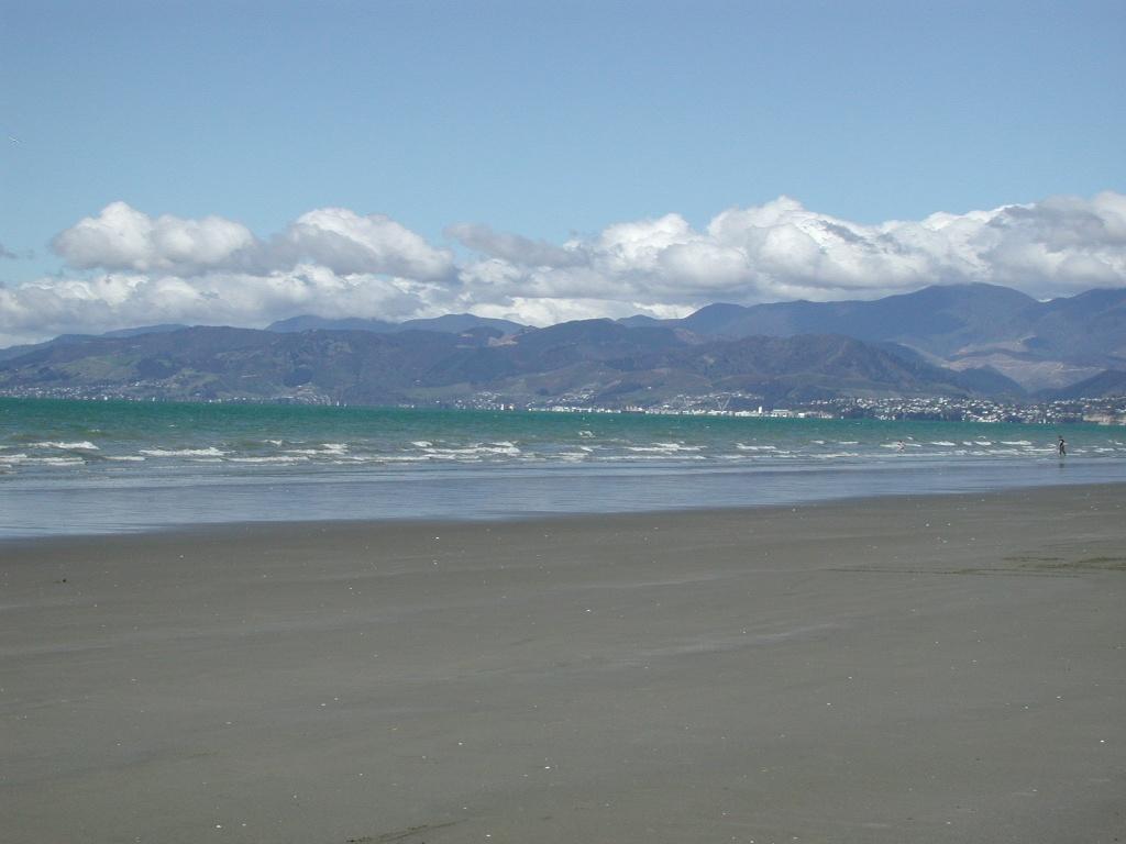
Moturoa / Rabbit Island.
Moturoa/Rabbit Island is a beach-and-forest day destination in Waimea Estuary, close to Richmond and linked to Māpua by a small passenger ferry. Its long sandy shore, picnic spaces and cycle tracks offer a quieter counterpoint to the cafés across the channel. This is a recreational reserve, not a resort village.
Photo credits1
- Area image: Beach on Rabbit Island near Nelson , with Nelson in the distance — Area near Moturoa / Rabbit IslandBeach on Rabbit Island near Nelson. Author: Pseudopanax at English Wikipedia. Credit: Own work. License: Public domain (https://creativecommons.org/publicdomain/mark/1.0/). Source: https://commons.wikimedia.org/wiki/File:Beach_on_Rabbit_Island_near_Nelson.jpg
Make your way to Moturoa / Rabbit Island
Choose a tool and your dates to check the options for your trip.
More ways to explore
- Country
- New Zealand
- Currency
- NZD
- Time zone
- Pacific/Auckland
Moturoa/Rabbit Island is a beach-and-forest day destination in Waimea Estuary, close to Richmond and linked to Māpua by a small passenger ferry. Its long sandy shore, picnic spaces and cycle tracks offer a quieter counterpoint to the cafés across the channel. This is a recreational reserve, not a resort village.
A visit can be a simple beach picnic or part of a longer ride on Tasman’s Great Taste Trail. Choose the arrival method first: a road bridge reaches the island from the mainland, whereas the ferry lands at its western end. Parking, beach access and the ferry landing are different places, so allow time to move between them.
When to go
The beach can be visited throughout the year during permitted daylight access, with shorter days limiting winter outings. The ferry runs a fuller summer timetable and a restricted winter pattern, so a sunny weekday does not itself mean a crossing is scheduled. Wind can disrupt the boat link; have a return arrangement that does not depend on an unconfirmed late departure.
Getting there
By road, approach from the Richmond side across the mainland connection to the recreation reserve. Walkers and cyclists can also arrive on the Māpua ferry. The operator states that the nearest island-side parking is 4.5 kilometres from the ferry landing along the cycle trail. A car drop-off therefore does not put you beside the boat ramp.
Getting around
Cycling is useful for linking the beach, western landing and mainland trail. Walkers should choose a shorter outing or allow extra time for the same distance. Carry the official trail map and basic repair equipment for a bike day. The wider Great Taste Trail mixes coastal sections and more demanding terrain, so do not extend a family ride solely because another section looks nearby.
Local food
Treat the island outing as a picnic and bring food and drinking water. Across the ferry channel, Māpua offers a wider choice: The Smokehouse sells smoked seafood, pies, chowder and fish and chips, while Hamish’s supplies ice cream and local fruit flavours. Make a meal in the village part of the itinerary rather than expecting those wharf businesses beside the island beach.
What to see
The main attraction is the landscape itself: a broad sandy coast with pine forest behind it and estuary views on the approach. The surrounding inlet supports varied birdlife, including herons and spoonbills. Bring binoculars and watch from existing routes. A short ride through the recreation area and a pause by the water can be more rewarding than trying to cover every forest track.
Towns and neighbourhoods
The front beach recreation area contains the main picnic spaces, with named areas and signed beach access points helping visitors orient themselves. The ferry landing sits farther west. Rough Island is a neighbouring island on the mainland approach, not another name for Moturoa. Keep these landmarks separate when agreeing a meeting point or a return pickup.
Coast and outdoors
The long tidal beach allows room for walking and relaxed time beside the water. Picnic tables, barbecues, toilets and changing facilities support a day out, but choose an access point that suits your group before unpacking. For cycling, the coastal trail connects the reserve to the wider Waimea landscape; select a manageable section and keep sufficient time for the return.
Where to stay
Arrange overnight accommodation on the mainland. Rabbit Island Huts is at 305 Redwood Road near the island, with shared guest facilities and road access; it is not a hut inside the reserve. Māpua village suits visitors wanting restaurants and a morning ferry, while the Appleby area suits a rural base. Plan separately how to collect any bicycle left with a hire company.
Useful before you go
The council permits daylight visits and posts gate-closing times at the entrance. Dogs are prohibited, and forestry operations can close routes. Follow signs and keep clear of logging vehicles. At the review date, the horse trail to the front beach was closed because of unstable trees; this did not mean the whole island was closed.
Good to know before you go
Can I drive directly to the ferry landing?
No. The ferry operator identifies the closest island-side parking as 4.5 kilometres away along the cycle trail. Allow walking or cycling time.
Is the island only reachable by boat?
No. There is a mainland road connection as well as the passenger-and-cycle ferry from Māpua.
Can I stay overnight inside the recreation reserve?
The reserve closes overnight. Choose mainland accommodation and leave before the signed closing time.
Can I bring my dog?
Dogs are prohibited on Moturoa/Rabbit Island.
Are the café choices in Māpua on the same side as the island beach?
No. Māpua Wharf is across the ferry channel. Carry a picnic or plan a separate crossing for a meal.
Sources & references
These references support the guide. Confirm opening hours, access and travel services before you go.
- 01Nelson Tasman — island recreation, bridge and overnight closure
- 02Māpua Ferry — facilities and 4.5 km parking-to-landing distance
- 03Tasman District Council — 12 October 2026 access notice, forestry, dogs and horse-trail closure
- 04Māpua Ferry — seasonal service
- 05Māpua Ferry — people and bicycles
- 06New Zealand Cycle Trail — Waimea birdlife, causeway and ferry route
- 07Nelson Tasman Cycle Trails Trust — route planning and cycling equipment
- 08Nelson Tasman / The Smokehouse — village food across the channel
- 09Nelson Tasman — Hamish’s ice cream at Māpua Wharf
- 10Rabbit Island Huts — mainland Redwood Road location
- 11Appleby House — guest facilities and proximity to island
- 12Māpua 41 South — village accommodation
Where could the journey go next?
More guides in New Zealand. Compare the places and check actual connections before combining stops.

Mapua
Māpua is a small coastal village beside Waimea Inlet, between Nelson and Motueka. Former fruit-shipping cool stores now house places to eat, shop and look at local art, making the wharf a natural focus for a leisurely visit. It is as rewarding for a waterfront lunch as for a longer stay.
Get to know the place
Picton (Waitohi)
Picton, also known as Waitohi, opens onto the sheltered waterways and wooded hills of the Marlborough Sounds. Ferries make it a busy gateway between New Zealand’s main islands, but the foreshore, maritime museum and walking tracks give good reasons to stay beyond a connection.
Get to know the place
Wellington
Wellington brings a capital city’s museums and political landmarks into a compact harbour setting. Its appeal is easy to experience on foot: follow the waterfront, turn inland for coffee on Cuba Street, then climb or ride into the hills for a view back over the city and its busy water.
Get to know the place
Queens Wharf (Wellington)
Queens Wharf sits on Wellington’s central waterfront, where a harbour-ferry departure can become a full day of museums, seafood and walks beside the water. The East by West service connects this city landing with Days Bay on the eastern side of Wellington Harbour.
Get to know the placePhoto credits4
- Depicts: MapuaMapua school 27. Author: Wildman NZ. Credit: Own work. License: CC BY-SA 4.0 (https://creativecommons.org/licenses/by-sa/4.0). Source: https://commons.wikimedia.org/wiki/File:Mapua_school_27.jpgCropped to fit the display.
- Depicts: Picton (Waitohi)2022-06-05 Picton, New Zealand. Author: Maxim75. Credit: Own work. License: CC BY 4.0 (https://creativecommons.org/licenses/by/4.0). Source: https://commons.wikimedia.org/wiki/File:2022-06-05_Picton,_New_Zealand.jpgCropped to fit the display.
- Depicts: WellingtonSeddon Statue in Parliament Grounds. Author: russellstreet. Credit: https://www.flickr.com/photos/russellstreet/4640549163/. License: CC BY-SA 2.0 (https://creativecommons.org/licenses/by-sa/2.0). Source: https://commons.wikimedia.org/wiki/File:Seddon_Statue_in_Parliament_Grounds.jpgCropped to fit the display.
- Depicts: Queens Wharf (Wellington)QueensWharfFIFA2023 01. Author: L Maule. Credit: Own work. License: CC BY-SA 4.0 (https://creativecommons.org/licenses/by-sa/4.0). Source: https://commons.wikimedia.org/wiki/File:QueensWharfFIFA2023_01.jpgCropped to fit the display.
