
Auckland.
Auckland, or Tāmaki Makaurau, is the main urban gateway to the upper North Island. Its downtown waterfront, volcanic maunga, Māori and Pacific identity, and Hauraki Gulf islands make it more than a transit stop.
Photo credits1
Make your way to Auckland
Choose a tool and your dates to check the options for your trip.
More ways to explore
- Country
- New Zealand
- Currency
- NZD
- Time zone
- Pacific/Auckland
Auckland, or Tāmaki Makaurau, is the main urban gateway to the upper North Island. Its downtown waterfront, volcanic maunga, Māori and Pacific identity, and Hauraki Gulf islands make it more than a transit stop.
Use the centre for museums, waterfront walks and food, then reserve a separate day for a Hauraki Gulf island or the west coast. A harbour crossing to Devonport gives a different view of the city without committing to a full island excursion; Waiheke and Rangitoto deserve more time.
When to go
Summer falls in December–February and gives longer days for harbour and island outings. Spring and autumn can suit a mixed programme of city galleries, neighbourhood walks and outdoor trips without making every day depend on beach weather. Keep a wet-weather option such as the museum or art gallery, and bring a layer for an exposed ferry deck even on a city stay.
Getting there
Auckland Airport is outside the centre. AirportLink connects the airport with Puhinui Station for an onward train journey; it is a bus-and-rail connection, not a train from the terminal itself. SkyDrive runs to Hobson Street beside SkyCity. From that stop you still need to reach your hotel or ferry pier. Check rail replacement arrangements before choosing an airport connection.
Getting around
Walk between downtown attractions, use rail and buses for longer urban trips, and choose the correct operator for each ferry. The downtown rail station is now Waitematā, while Britomart remains the neighbourhood name. Te Waihorotiu is useful for the art gallery. Fullers and Island Direct Waiheke tickets are not interchangeable; island services such as Rangitoto also have different ticket arrangements from ordinary urban ferries.
Local food
For New Zealand produce, Ahi in Commercial Bay builds its menus around seasonal ingredients, including its own garden. Kingi in Britomart focuses on local land and seafood ingredients. Nori Sushi in Harbour Eats is a simpler option for sushi, nigiri or sashimi. Allow time to sit down and eat rather than compressing a restaurant booking into the gap before an island ferry.
What to see
Auckland Museum in the Domain introduces the country through its collections and Māori cultural experiences. Pair it with the park’s Wintergardens, or choose Auckland Art Gallery Toi o Tāmaki for New Zealand, Māori and Pacific art. Walk up Maungawhau / Mount Eden for views from a volcanic maunga; private vehicles cannot drive the summit road, so allow for the uphill walk.
Towns and neighbourhoods
Britomart and Commercial Bay connect the downtown ferry waterfront with shopping and dining lanes. The Viaduct and Wynyard areas extend the waterside walk westward. Across the harbour, Devonport has Victoria Road shops, heritage houses and the Torpedo Bay Navy Museum. Its ferry wharf and the separate Bayswater terminal serve different North Shore neighbourhoods; match the destination to your accommodation or intended walk.
Coast and outdoors
Mission Bay offers a sandy urban waterfront, Selwyn Reserve and the Tāmaki Drive coastal route toward Kohimarama and St Heliers. Piha on the west coast is a different outing, with iron sand, Lion Rock and powerful surf. Follow the local lifesavers’ advice and swim between the flags when patrols are operating; a scenic beach photograph is not evidence of safe conditions.
Where to stay
Britomart and the downtown waterfront suit early ferry departures and city dining; The Hotel Britomart is on Galway Street. Devonport suits travellers who want a smaller neighbourhood across the harbour, with options including the Esplanade Hotel, but account for the return crossing after evening plans. Mission Bay is another base for beach walks, farther from the main downtown ferry departures.
Useful before you go
Respect the cultural significance of the maunga and use formed paths rather than cutting across slopes or earthworks. General entry to Auckland Art Gallery is free, but special exhibitions and events may charge. Do not treat an island excursion as an open-ended city walk: book the appropriate ticket, locate the actual pier and keep the last return sailing in your plan.
Good to know before you go
Is there a direct train from Auckland Airport?
No. AirportLink provides the bus connection to Puhinui, where you transfer to rail; check for replacement services.
Are Britomart and Waitematā different downtown stations?
Waitematā is the current name of the station formerly called Britomart. Britomart still names the surrounding precinct.
Can I drive to the summit of Mount Eden?
The summit road is closed to private vehicles. Plan a walk up Maungawhau and follow the designated routes.
Which beach is easier to combine with a city day?
Mission Bay lies on the eastern urban waterfront with the TāmakiLink bus and a coastal walking route. Piha is a separate west-coast outing.
Can I use any Waiheke ferry with one ticket?
No. Fullers and Island Direct have separate ticketing. Check the booked operator, departure pier and return before travelling.
Sources & references
These references support the guide. Confirm opening hours, access and travel services before you go.
- 01Auckland Art Gallery — collections, admission and transport
- 02Auckland Museum — collections and Māori cultural experience
- 03Auckland Museum — Domain and Wintergardens
- 04Tūpuna Maunga Authority — Maungawhau and vehicle restrictions
- 05Auckland tourism — Devonport sights and stays
- 06Auckland tourism — Mission Bay and coastal route
- 07Piha Surf Life Saving Club — beach and flagged swimming
- 08Ahi — seasonal New Zealand produce
- 09kingi — local ingredients
- 10Commercial Bay — Nori Sushi
- 11The Hotel Britomart — accommodation location
- 12Auckland Transport — Waitematā station name
- 13Auckland Transport — airport bus and rail connection
- 14SkyDrive — SkyCity city stop
- 15Auckland Transport — operator-specific ferry ticketing
- 16Tourism New Zealand — seasons
Where could the journey go next?
More guides in New Zealand. Compare the places and check actual connections before combining stops.
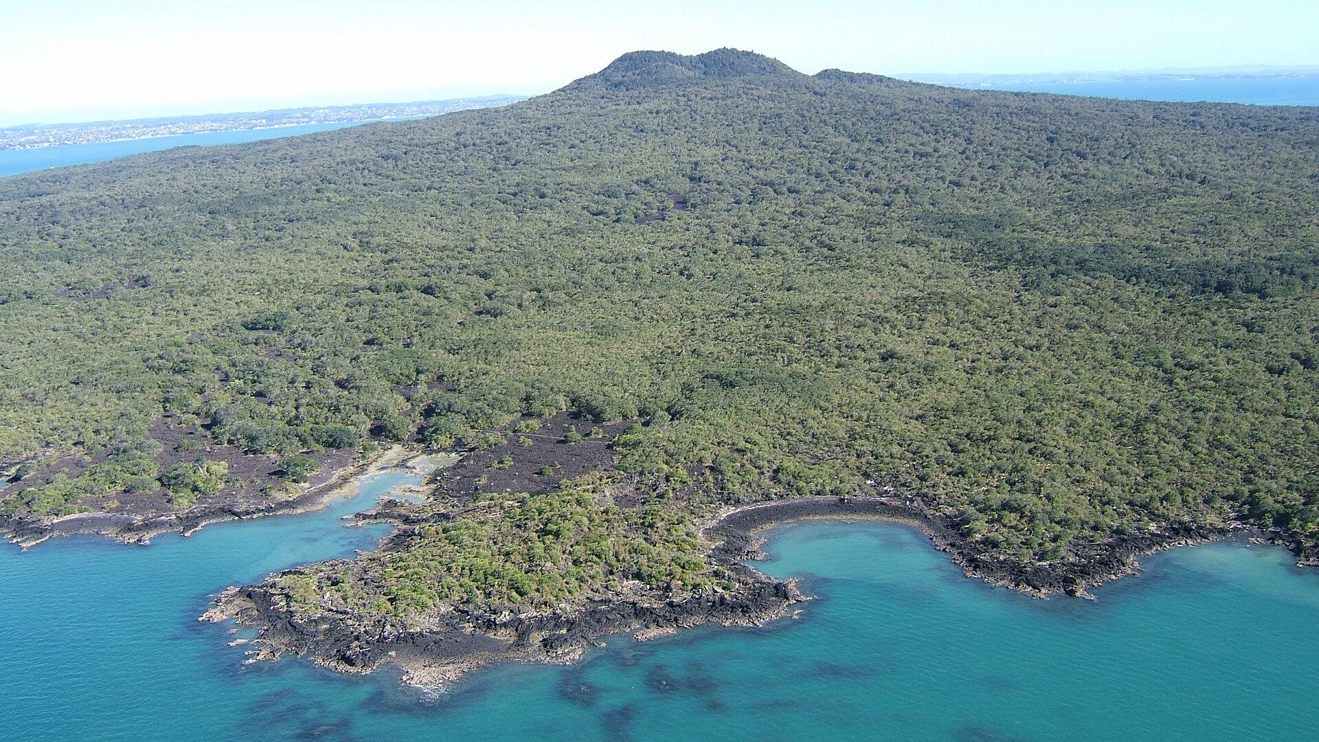
Rangitoto Island
Rangitoto brings together black lava fields, pōhutukawa forest and a summit overlooking Auckland and the Hauraki Gulf. The island experience is a self-contained walking day, with no shops or drinking-water supply to fall back on.
Get to know the place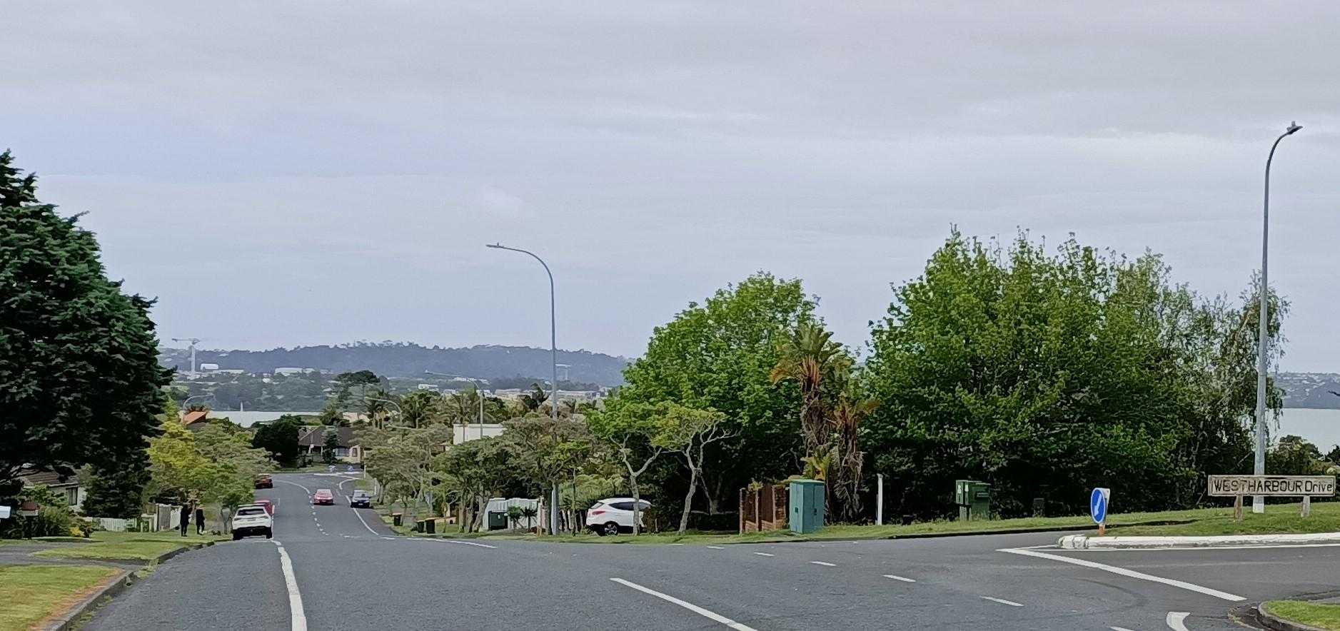
Auckland — West Harbour
West Harbour offers an upper-Waitematā outing built around a working recreational marina and coastal paths. The Auckland ferry arrives at Hobsonville Marina, formerly called Westpark Marina, where the boat-filled water and surrounding residential streets give the visit a quieter scale than the central-city waterfront.
Get to know the place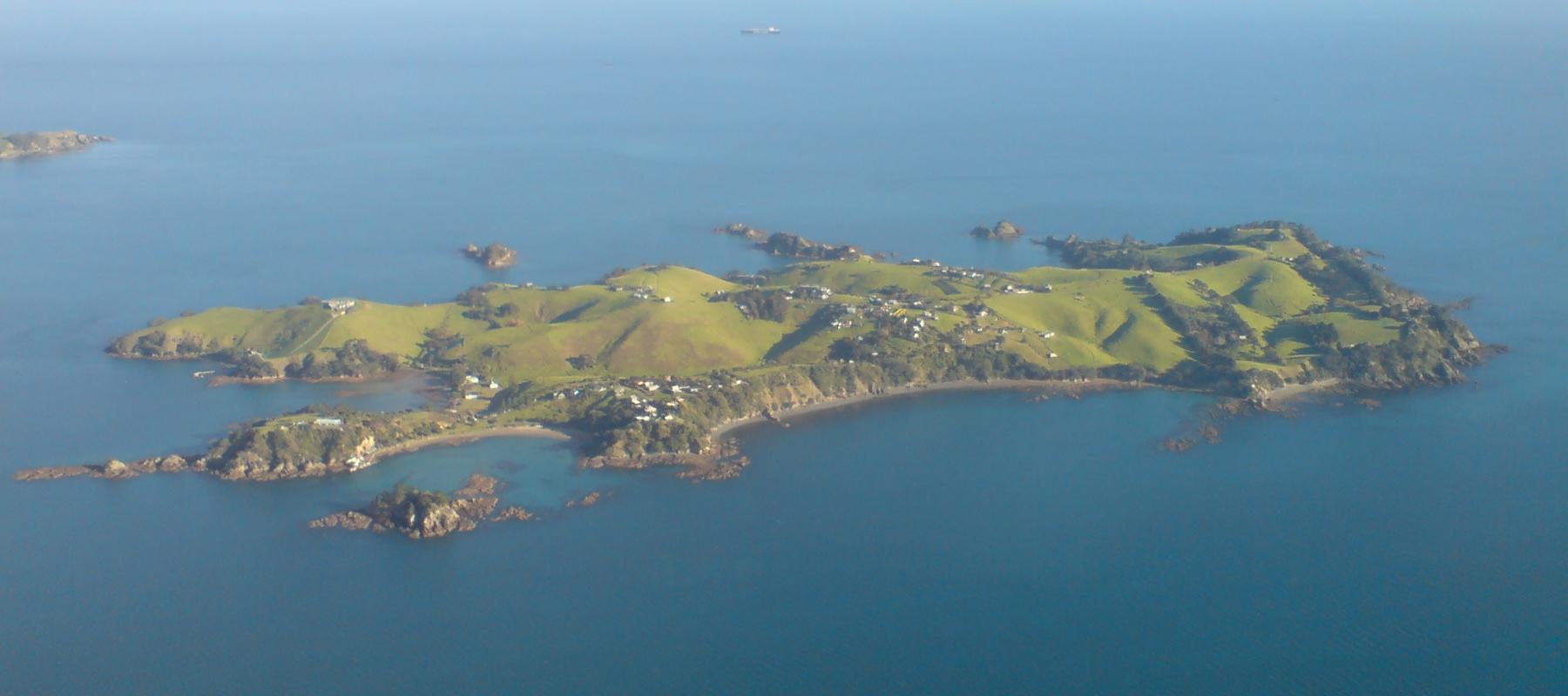
Rakino Island
Rakino’s appeal is low-key island life: coves, historic homes and walking rather than a dense visitor infrastructure. Its small community lives northeast of Motutapu, with no grid electricity or ordinary shopping street. Visitors need the same practical approach to supplies as residents.
Get to know the place
Waiheke Island
Waiheke combines permanent island communities, sandy bays and a strong wine-and-food culture. Oneroa is the main visitor village; farther east, vineyards, rural roads and coastal reserves create a very different day from simply staying near the ferry.
Get to know the placePhoto credits4
- Depicts: Rangitoto IslandRangitoto09f. Author: Bruce Hayward. Credit: Own work. License: CC BY-SA 4.0 (https://creativecommons.org/licenses/by-sa/4.0). Source: https://commons.wikimedia.org/wiki/File:Rangitoto09f.jpgCropped to fit the display.
- Depicts: Auckland — West HarbourWest Harbour - 51655901100 - Cropped. Author: aklmuseumstaffwikipedia. Credit: https://www.flickr.com/photos/194100792@N06/51655901100/. License: CC BY 2.0 (https://creativecommons.org/licenses/by/2.0). Source: https://commons.wikimedia.org/wiki/File:West_Harbour_-_51655901100_-_Cropped.jpgCropped to fit the display.
- Depicts: Rakino IslandRakino Island From Above Southeast. Author: Ingolfson. Credit: Self-photographed. License: Public domain (https://creativecommons.org/publicdomain/mark/1.0/). Source: https://commons.wikimedia.org/wiki/File:Rakino_Island_From_Above_Southeast.jpg
- Depicts: Waiheke IslandWaiheke Island Vineyard. Author: russellstreet. Credit: https://www.flickr.com/photos/russellstreet/6410271405/. License: CC BY-SA 2.0 (https://creativecommons.org/licenses/by-sa/2.0). Source: https://commons.wikimedia.org/wiki/File:Waiheke_Island_Vineyard.jpgCropped to fit the display.
