
Russell (Kororāreka).
Russell is compact, walkable and rich in early maritime and colonial history, but its identity is also Māori and coastal: coves, headlands and island waters frame the town.
Photo credits1
- Depicts: Russell (Kororāreka)1870 house in Russell. Author: Sylvain Machefert / Symac. Credit: Own work. License: CC BY-SA 3.0 (https://creativecommons.org/licenses/by-sa/3.0). Source: https://commons.wikimedia.org/wiki/File:1870_house_in_Russell.jpgCropped to fit the display.
Make your way to Russell (Kororāreka)
Choose a tool and your dates to check the options for your trip.
More ways to explore
- Country
- New Zealand
- Currency
- NZD
- Time zone
- Pacific/Auckland
Russell is compact, walkable and rich in early maritime and colonial history, but its identity is also Māori and coastal: coves, headlands and island waters frame the town.
It works as a slower alternative to Paihia. Passenger ferries land at Russell wharf, while cars use the Opua–Okiato vehicle ferry; Cape Brett and Waitangi are regional excursions rather than town walks.
When to go
December–February is the summer period for beach afternoons and longer outdoor days. Spring and autumn can combine heritage visits with walks, while winter suits a more flexible plan that leaves room for rain. Pompallier publishes different summer and winter hours and tour schedules. Reserve a specific tour when the historic working spaces are central to your visit.
Getting there
The Paihia passenger ferry reaches Russell’s central wharf. Drivers instead cross from Ōpua to Okiato and continue by road, or use the road route via Whakapara and Russell Road. Flights into Bay of Islands Airport near Kerikeri require an onward transfer; prebook it and make clear whether you need the Paihia passenger wharf or a direct road journey to your Russell accommodation.
Getting around
The centre is compact enough for a walking visit, but trips into the wider peninsula need more planning. For Flagstaff Hill, choose the low-tide shoreline approach or the signed high-tide alternative from Wellington Street. That street is narrow, so watch for vehicles. Island ferries from Russell serve Otehei Bay separately from the Paihia crossing; match the boat to your intended destination.
Local food
The Duke of Marlborough on the waterfront serves seasonal New Zealand produce in its hotel restaurant. The Gables, also on The Strand, offers local oysters, handmade pasta and market fish, with Northland wines among its list. These are useful starting points for a meal, not guarantees that a particular catch or dish will be available when you arrive.
What to see
Pompallier Mission and Printery interprets nineteenth-century printing, tanning and bookbinding in its waterfront setting. Christ Church, built in 1835, preserves traces of the 1845 fighting and a significant churchyard. Russell Museum brings Māori history and early encounters into the town story. Above town, Te Maiki/Flagstaff Hill combines wide views with the history of Hōne Heke’s challenges to British authority.
Towns and neighbourhoods
The Strand is the harbour-facing centre, with the passenger wharf, restaurants and heritage stops close together. Oneroa/Long Beach lies over the hill on the other side of the peninsula. Tapeka is a separate residential coastal pocket beyond Flagstaff Hill. Farther south, Orongo Bay and Okiato are useful road-based locations; Okiato’s vehicle landing is not Russell’s town wharf.
Coast and outdoors
Use the town waterfront for a gentle stroll and boat watching, or head over the hill to Oneroa/Long Beach for a longer beach visit. At Tapeka, a sandy western beach and rocky eastern shore offer different settings. The point walk climbs a narrow grassy ridge through former defensive earthworks; parts are steep and slippery after rain, and DOC advises against walking it after dark.
Where to stay
A room near The Strand puts the passenger wharf, evening dining and central heritage sites within easy reach; the Duke is one waterfront option. Orongo Bay Holiday Park offers cabins, cottages and camping in native bush outside the centre, suitable for visitors with onward transport. Beach-focused stays around Tapeka give a different setting, with a road journey back to the town’s main services.
Useful before you go
At Pompallier, the garden-and-museum visit does not include the printery, bindery or tannery: choose a guided visit for those spaces. The printery’s lower level has ramp access, but its upper level is not wheelchair accessible. Keep dogs off the Flagstaff Hill track to protect wildlife, and clean footwear at available stations before entering forest tracks.
Good to know before you go
Does the car ferry arrive at Russell Wharf?
No. It lands at Okiato, followed by a road journey to Russell. The Paihia passenger ferry serves the central wharf.
Can I enter the Pompallier printery with the garden ticket?
No. The historic printing, binding and tanning spaces require the guided tour; the separate ticket covers the garden and museum.
Can I use the beach route to Flagstaff Hill at any tide?
No. Use the signed high-tide alternative when the shoreline route is unsuitable.
Is Tapeka Point an entirely level beach walk?
No. Its narrow grassy track climbs the headland and can be steep or slippery. Supervise children and stay on the maintained path.
Is Orongo Bay Holiday Park in the walkable town centre?
No. It is outside the centre on Russell–Whakapara Road. Plan the road connection to meals, sights and the passenger wharf.
Sources & references
These references support the guide. Confirm opening hours, access and travel services before you go.
- 01Northland Ferries — Russell peninsula and Long Beach
- 02Northland Ferries — separate passenger and vehicle crossings
- 03Heritage New Zealand — Pompallier tour scope, seasons and accessibility
- 04Heritage New Zealand — Christ Church history
- 05Russell Museum — Māori history and early encounters
- 06DOC — Te Maiki history
- 07DOC — tidal alternatives, narrow road and no dogs
- 08DOC — Tapeka Point route and hazards
- 09Tapeka del Mar — local coast geography; promotional safety guarantees excluded
- 10Duke of Marlborough — seasonal restaurant
- 11The Gables — published food and wine menu
- 12Duke of Marlborough — waterfront accommodation
- 13Orongo Bay Holiday Park — accommodation types
- 14Orongo Bay Holiday Park — physical location and sealed road route; old ferry prices/times excluded
- 15Tourism New Zealand — seasonal framework
- 16Bay of Islands Airport — prebooked onward taxi
- 17Explore — separate Russell to Otehei ferry
Where could the journey go next?
More guides in New Zealand. Compare the places and check actual connections before combining stops.

Paihia
Paihia is compact and practical for an island-rich region. The waterfront is the starting point for Russell, Urupukapuka, Cape Brett and wildlife cruises.
Get to know the place
Otehei Bay, Urupukapuka Island
Otehei Bay is the ferry landing on Urupukapuka Island, where a sandy shoreline, café and walking tracks make an island day straightforward to organise. It is a separate destination from Paihia or Russell: both mainland towns are departure points across the water.
Get to know the place Area near Narrows (Hokianga Harbour)
Narrows (Hokianga Harbour)
The Narrows is the northern landing of the Hokianga vehicle ferry, opposite Rawene and four kilometres south of Kohukohu. It is a useful local connection on a Northland road journey, bringing travellers across a harbour with a long history of settlement and trade.
Get to know the place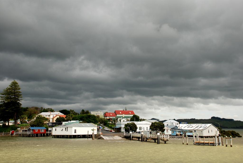
Rawene
Rawene is a small Northland village on the southern shore of Hokianga Harbour. Its waterfront, old buildings, cafés and craft culture suit travellers who prefer a slow local stay to a resort strip.
Get to know the placePhoto credits4
- Depicts: PaihiaPaihia, Williams Road. Author: Ulrich Lange, Bochum, Germany. Credit: Own work. License: CC BY 3.0 (https://creativecommons.org/licenses/by/3.0). Source: https://commons.wikimedia.org/wiki/File:Paihia,_Williams_Road.jpgCropped to fit the display.
- Depicts: Otehei Bay, Urupukapuka Island00 0866 Island of the Bay of Islands. Author: W. Bulach. Credit: Own work. License: CC BY-SA 4.0 (https://creativecommons.org/licenses/by-sa/4.0). Source: https://commons.wikimedia.org/wiki/File:00_0866_Island_of_the_Bay_of_Islands.jpgCropped to fit the display.
- Area image: Sail the Kohu Ra Tuarua from picturesque Rawene across the scenic Hokianga Harbour. Travel on by road through Kohukohu and Broadwood to Kaitaia, Ninety Mile Beach and fabulous Cape Reinga. Or travel south from Kohukohu, board the ferry at the Narrows and travel to Rawene, and then drive on to the beaches of Opononi and Omapere and the giant Kauris of the Waipoua Forest. — Area near Narrows (Hokianga Harbour)The Hokianga Vehicle Ferry (21234509213). Author: Bernard Spragg. NZ from Christchurch, New Zealand. Credit: The Hokianga Vehicle Ferry. License: CC0 (https://creativecommons.org/publicdomain/zero/1.0/). Source: https://commons.wikimedia.org/wiki/File:The_Hokianga_Vehicle_Ferry_(21234509213).jpg
- Depicts: RaweneRawene from the water. Author: Flickr user PhillipC / Phillip Capper. Credit: https://www.flickr.com/photos/flissphil/1596542679/. License: CC BY 2.0 (https://creativecommons.org/licenses/by/2.0). Source: https://commons.wikimedia.org/wiki/File:Rawene_from_the_water.jpgCropped to fit the display.
