
Queenstown.
The town is framed by the Remarkables, Coronet Peak and the Southern Alps, but Queenstown is more than an adrenaline stop. The waterfront, gardens, historic streets and cafés make a gentle day possible, while lake cruises, walks, cycling, skiing and wine-country outings reward a longer stay.
Photo credits1
- Depicts: QueenstownQueenstown 1 (8168013172). Author: Bernard Spragg. NZ from Christchurch, New Zealand. Credit: Queenstown 1. License: CC0 (https://creativecommons.org/publicdomain/zero/1.0/). Source: https://commons.wikimedia.org/wiki/File:Queenstown_1_(8168013172).jpg
Make your way to Queenstown
Choose a tool and your dates to check the options for your trip.
More ways to explore
- Country
- New Zealand
- Currency
- NZD
- Time zone
- Pacific/Auckland
The town is framed by the Remarkables, Coronet Peak and the Southern Alps, but Queenstown is more than an adrenaline stop. The waterfront, gardens, historic streets and cafés make a gentle day possible, while lake cruises, walks, cycling, skiing and wine-country outings reward a longer stay.
Plan around the shape of Lake Whakatipu. Central Queenstown suits evenings and short walks; Frankton and Kelvin Heights offer different access to the airport and lakeside paths. Arrowtown, Glenorchy and Gibbston are separate outings, each with a reason to go: gold-rush history, mountain landscapes and wine country respectively.
When to go
Summer, December–February, brings long days for lake walks, cycling and outdoor excursions. March–May brings autumn colours, particularly around deciduous trees in Arrowtown. Winter, June–August, centres many trips on the mountain ski areas; spring, September–November, mixes changing mountain conditions with walking and cycling at lower elevations. Pack for the activity and elevation rather than assuming a warm town afternoon describes the mountains.
Getting there
Queenstown Airport is in Frankton. Public buses leave outside the terminal and connect with central Queenstown; the Frankton interchange provides onward connections such as Arrowtown. Allow for the transfer when choosing accommodation. The ferry is an inland lake service between Queenstown Bay and Frankton Marina, calling at Hilton and Bayview; it is not an ocean-ferry arrival into New Zealand.
Getting around
Walk between the central waterfront, gardens and dining streets. Use the airport’s published bus information to plan journeys through Frankton, and consult Queenstown Ferries for the lake crossing. Bayview and Frankton Marina are request stops: wait visibly on the wharf and signal the approaching ferry. At night the operator asks passengers to use a light. Build in time for boarding rather than arriving as the vessel leaves.
Local food
Gibbston’s cellar doors are a useful introduction to Central Otago pinot noir; a guided wine outing or shuttle lets you taste without driving afterward. For food in town, Sherwood highlights produce from its garden, while Amisfield draws on regional ingredients. Historic waterside venues include Eichardt’s, the Bathhouse and the Boat Shed. Choose the setting and meal you want, then check the venue’s actual opening and booking arrangements.
What to see
Start at Queenstown Bay and continue into Queenstown Gardens. The botanical gardens have an easy two-kilometre circuit around the peninsula, with mature trees, lake views and places to pause. Skyline’s gondola climbs 480 metres to Bob’s Peak, where the luge and Stratosfare restaurant add activities beyond the panorama. Stargazing is a seasonal March–October experience.
For a longer lake outing, the historic TSS Earnslaw connects Queenstown with Walter Peak, where RealNZ offers farm visits and dining. This is a scenic excursion rather than the local commuter ferry. In Arrowtown, visit the miners’ cottages, Chinese settlement and Lakes District Museum to understand the gold-rush town beyond its attractive main street.
Towns and neighbourhoods
Queenstown Bay is the central waterfront, while Frankton Marina and the airport occupy a different part of the lake’s northern arm. Kelvin Heights lies across that arm, with the Hilton and Bayview ferry stops. Choose meeting points carefully: a reference to Frankton is not sufficient to identify an airport entrance, a bus interchange or a marina.
Glenorchy is a road trip along the lake toward its northern end, with mountain, river and forest excursions. Gibbston lies in wine country by the Kawarau River. Treat these as separate plans with transport arranged, rather than neighbourhoods to add casually to an afternoon walk around central Queenstown.
Coast and outdoors
Queenstown Bay puts a lakeside beach beside the centre. Frankton Beach has a playground, toilets and picnic facilities; Kelvin Heights offers a different shoreline with boat activity. The water remains cold even in summer. Choose a safe entry and exit, avoid swimming alone and keep clear of moving vessels.
At Bobs Cove, native bush leads toward the shoreline, a historic lime kiln and a short, steeper Picnic Point loop. DOC’s current notice says the Old Bridle Track is permanently closed. Follow the marked route; do not use a saved map to enter the closed track.
Where to stay
Central Queenstown suits a stay focused on restaurants and evenings on foot. Frankton and Kelvin Heights can work for airport access and lakeside recreation, with the exact bus or ferry connection worth checking. Fernhill and Sunshine Bay offer a different outlook, but an elevated address can mean a climb. Arrowtown is a separate historic-town base; choose it deliberately if that quieter setting is central to your trip.
Useful before you go
Queenstown Ferries does not carry bicycles and does not offer standard wheelchair access; ask about your access needs before relying on it. Luggage space is limited and passengers must handle their own bags. The ferry accepts Bee Card or bank card, not cash. These are ferry rules: do not assume every bus, cruise or attraction has the same payment and luggage arrangements.
Good to know before you go
Does the lake ferry go to the airport terminal?
No. It serves Queenstown Bay, Hilton, Bayview and Frankton Marina. Continue by suitable ground transport to the airport.
Can I take a bicycle on Queenstown Ferries?
No. The operator’s FAQ says bicycles are not accepted. Plan a separate route for a cycling day.
Is the TSS Earnslaw the local commuter ferry?
No. It is a historic scenic-cruise experience associated with Walter Peak visits, separate from the local lake service.
Which nearby places work as distinct day trips?
Arrowtown for gold-rush history, Gibbston for wine country and Glenorchy for the northern lake’s mountain setting. Arrange transport for the chosen outing.
Is the whole Bobs Cove walk closed?
No. DOC identifies the Old Bridle Track as permanently closed; follow its marked Bobs Cove route and current notices.
Sources & references
These references support the guide. Confirm opening hours, access and travel services before you go.
- 01Destination Queenstown — gardens route
- 02Skyline Queenstown — gondola and seasonal experiences
- 03RealNZ — historic lake excursion and Walter Peak
- 04Destination Queenstown — Arrowtown history and sights
- 05Destination Queenstown — Glenorchy geography and excursions
- 06Destination Queenstown — Gibbston wine country
- 07Destination Queenstown — lake beaches and cold-water advice
- 08DOC — Bobs Cove marked route and Old Bridle Track closure
- 09Destination Queenstown — regional food and historic dining venues
- 10Destination Queenstown — seasonal conditions
- 11Queenstown Airport — public bus connections
- 12Queenstown Ferries — lake route and payment
- 13Queenstown Ferries — request stops, bikes, luggage and access
- 14Destination Queenstown — accommodation areas
Where could the journey go next?
More guides in New Zealand. Compare the places and check actual connections before combining stops.

Dunedin
Dunedin (Ōtepoti) combines a strong built-heritage identity with coastal scenery and the biodiversity of the Otago Peninsula. Port Chalmers is the principal cruise gateway, while the city centre offers museums, galleries and civic landmarks.
Get to know the place
Bluff
Bluff is a working Southland port where fishing boats, maritime history and a steep green hill meet Foveaux Strait. Many travellers come to catch the Stewart Island ferry, but the town rewards time ashore: a museum visit, a coastal walk and a meal make a useful counterpoint to the crossing.
Get to know the place
Port Chalmers (Dunedin)
Port Chalmers is a small harbour town with its own maritime museum, hillside art and independent shops, beside the working port on Otago Harbour. It is also the berth for most cruise ships visiting Dunedin, but the city centre is a separate onward journey.
Get to know the place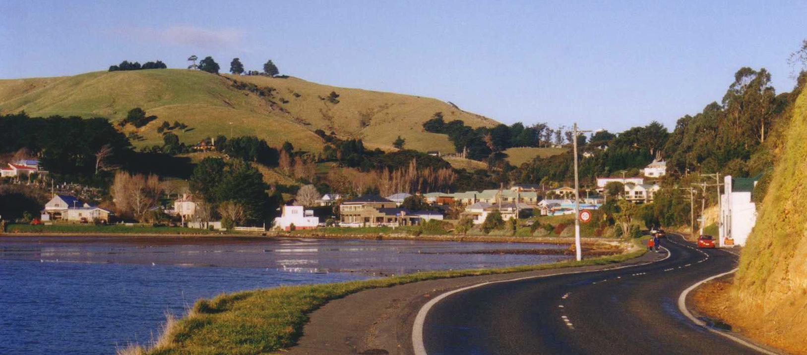
Portobello
Portobello sits beside Otago Harbour on the peninsula opposite Port Chalmers. Its small village, local museum and passenger ferry make it a worthwhile stop in its own right, with the city of Dunedin and the wildlife headlands belonging to the wider itinerary.
Get to know the placePhoto credits4
- Depicts: DunedinDunedin-Nueva Zelanda01. Author: Diego Delso. Credit: Own work. License: CC BY-SA 3.0 (https://creativecommons.org/licenses/by-sa/3.0). Source: https://commons.wikimedia.org/wiki/File:Dunedin-Nueva_Zelanda01.JPGCropped to fit the display.
- Depicts: BluffBluff from Stewart Island ferry. Author: AlasdairW. Credit: Own work. License: CC BY-SA 3.0 (https://creativecommons.org/licenses/by-sa/3.0). Source: https://commons.wikimedia.org/wiki/File:Bluff_from_Stewart_Island_ferry.jpgCropped to fit the display.
- Depicts: Port Chalmers (Dunedin)Port Chalmers from Centenary lookout. Author: Pseudopanax at English Wikipedia. Credit: Own work. License: Public domain (https://creativecommons.org/publicdomain/mark/1.0/). Source: https://commons.wikimedia.org/wiki/File:Port_Chalmers_from_Centenary_lookout.jpg
- Depicts: PortobelloPortobelloNZ. Author: The original uploader was Grutness at English Wikipedia .. Credit: Transferred from en.wikipedia to Commons.. License: CC BY-SA 3.0 (https://creativecommons.org/licenses/by-sa/3.0/). Source: https://commons.wikimedia.org/wiki/File:PortobelloNZ.jpgCropped to fit the display.
