
Paihia.
Paihia is compact and practical for an island-rich region. The waterfront is the starting point for Russell, Urupukapuka, Cape Brett and wildlife cruises.
Photo credits1
- Depicts: PaihiaPaihia, Williams Road. Author: Ulrich Lange, Bochum, Germany. Credit: Own work. License: CC BY 3.0 (https://creativecommons.org/licenses/by/3.0). Source: https://commons.wikimedia.org/wiki/File:Paihia,_Williams_Road.jpgCropped to fit the display.
Make your way to Paihia
Choose a tool and your dates to check the options for your trip.
More ways to explore
- Country
- New Zealand
- Currency
- NZD
- Time zone
- Pacific/Auckland
Paihia is compact and practical for an island-rich region. The waterfront is the starting point for Russell, Urupukapuka, Cape Brett and wildlife cruises.
It also works as a mainland base: Waitangi and Kerikeri add cultural depth while the town itself supplies cafés, accommodation and tour desks.
When to go
Summer falls in December–February, with longer daylight for island outings and coastal walks. Autumn and spring can suit a mix of heritage and outdoor days, while winter calls for a more flexible water-based itinerary. Ferry and experience schedules vary: the hāngī evening is seasonal and has exceptions around Waitangi commemorations. Confirm the dated programme rather than copying an old timetable into your plans.
Getting there
Bay of Islands Airport near Kerikeri needs an onward road transfer to Paihia. The airport recommends prebooking taxis because last-minute availability can be limited; shuttle operators also serve Paihia. InterCity uses the Maritime Building beside the wharf for its Auckland connection. Visitors coming from Russell can arrive directly at the waterfront on the passenger ferry.
Getting around
The central waterfront is easy to explore on foot. Use the passenger ferry for a town-to-town Russell visit, and separate island boats for Urupukapuka or a cruise. Drivers going to Russell use the Ōpua–Okiato vehicle ferry, followed by road travel. Waitangi is a mainland visit north of Paihia; do not confuse it with an island ferry destination.
Local food
Charlotte’s Kitchen at the wharf serves sharing plates, pizza and market fish; Zane Grey’s offers casual food at The Dock and a separate evening restaurant, The Aquarium. For a Māori food experience, Waitangi’s hāngī and concert operates on selected seasonal dates. Book that evening specifically: a daytime Treaty Grounds visit does not automatically include dinner.
What to see
Give Waitangi Treaty Grounds enough time for its museums, heritage buildings and guided interpretation. Te Kōngahu explores the Treaty story, while Te Rau Aroha addresses the Price of Citizenship; the admission includes a guided tour and cultural experience. Back in Paihia, the wharf is the starting point for a Russell visit or a longer cruise toward the outer islands and Hole in the Rock.
Towns and neighbourhoods
Marsden Road follows the central waterfront, with the Maritime Building and wharf anchoring transport and visitor services. The Williams Road area adds town shops and accommodation. Northward, Te Ti Bay and Waitangi form a different base along the shoreline. Ōpua, farther south, is the marina and vehicle-ferry area; Russell stands across the water and has its own town centre.
Coast and outdoors
Paihia’s town shoreline suits a short beach stop between activities, while Te Ti Bay offers another waterfront setting on the Waitangi side. For a longer outing, the coastal walk toward Ōpua passes beaches and mangroves. Some shoreline sections depend on the tide, with road or stair alternatives where indicated. Island coves on Urupukapuka require a separate boat excursion and return plan.
Where to stay
Central streets around Williams Road or MacMurray Road keep meals and the wharf accessible; check the specific walk from your chosen room. The Te Ti Bay–Waitangi side offers a shoreline setting and a holiday park beside the river. Ōpua suits a marina or vehicle-ferry itinerary, while staying in Russell means arranging a different arrival and evening return if you visit Paihia.
Useful before you go
Follow the Bay of Islands marine mammal sanctuary rules on water outings: swimming within 300 metres of a marine mammal is prohibited, and encountering one while swimming requires a safe exit. For shore walks, check tides and signed alternatives. The Paihia isite at 69 Marsden Road helps with local planning; arrange airport pickup and the correct wharf before relying on a tight connection.
Good to know before you go
Can I take my car on the ferry at Paihia Wharf?
The direct Paihia–Russell route is for passengers. Vehicles use Ōpua–Okiato, with road journeys at both ends.
Is Waitangi admission only valid for one day?
The published admission is valid for two consecutive days and includes the listed museums, guided tour and cultural experience.
Does the Waitangi day ticket include the hāngī dinner?
No. The evening hāngī and concert is a separate seasonal experience; a combined ticket is also offered.
Can I assume a taxi will wait at Kerikeri Airport?
Prebook your transfer. The airport warns that last-minute taxi availability is limited, especially for later arrivals.
Is every coastal walking section usable at high tide?
No. The Paihia–Ōpua route has tide-dependent shoreline sections and indicated alternatives. Check the route before committing to the full walk.
Sources & references
These references support the guide. Confirm opening hours, access and travel services before you go.
- 01Tourism New Zealand — Paihia base and mainland excursions
- 02Waitangi Treaty Grounds — admission inclusions and two-day validity
- 03Waitangi — guided interpretation and seasonal schedule
- 04Waitangi — separate 2026–27 hāngī experience and date exceptions; old FAQ dates excluded
- 05Charlotte’s Kitchen — wharf food and location
- 06Zane Grey’s — Dock and Aquarium dining
- 07Northland Ferries — passenger versus vehicle routes
- 08Explore — separate island and sightseeing boats
- 09Herenga ā Nuku — coastal path and tide alternatives; old transport table excluded
- 10Tourism New Zealand — seasons
- 11Bay of Islands Airport — prebooked taxi advice
- 12ABC Shuttles — airport-to-Paihia transfer
- 13InterCity — Maritime Building stop
- 14Northland Inc / Bay of Islands Lodge — central MacMurray Road accommodation
- 15Northland Inc / Waitangi Holiday Park — Te Ti Bay and riverside location
- 16Tui Motel — Williams Road location
- 17Far North District Council — Paihia isite location
- 18DOC — current sanctuary restrictions, including swimming separation
Where could the journey go next?
More guides in New Zealand. Compare the places and check actual connections before combining stops.

Russell (Kororāreka)
Russell is compact, walkable and rich in early maritime and colonial history, but its identity is also Māori and coastal: coves, headlands and island waters frame the town.
Get to know the place
Otehei Bay, Urupukapuka Island
Otehei Bay is the ferry landing on Urupukapuka Island, where a sandy shoreline, café and walking tracks make an island day straightforward to organise. It is a separate destination from Paihia or Russell: both mainland towns are departure points across the water.
Get to know the place Area near Narrows (Hokianga Harbour)
Narrows (Hokianga Harbour)
The Narrows is the northern landing of the Hokianga vehicle ferry, opposite Rawene and four kilometres south of Kohukohu. It is a useful local connection on a Northland road journey, bringing travellers across a harbour with a long history of settlement and trade.
Get to know the place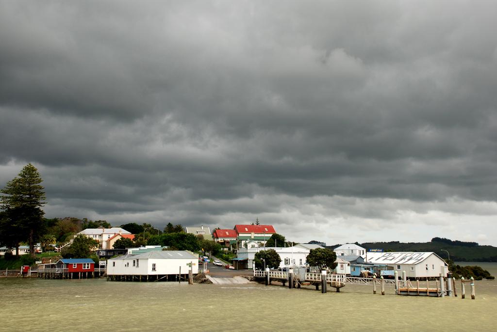
Rawene
Rawene is a small Northland village on the southern shore of Hokianga Harbour. Its waterfront, old buildings, cafés and craft culture suit travellers who prefer a slow local stay to a resort strip.
Get to know the placePhoto credits4
- Depicts: Russell (Kororāreka)1870 house in Russell. Author: Sylvain Machefert / Symac. Credit: Own work. License: CC BY-SA 3.0 (https://creativecommons.org/licenses/by-sa/3.0). Source: https://commons.wikimedia.org/wiki/File:1870_house_in_Russell.jpgCropped to fit the display.
- Depicts: Otehei Bay, Urupukapuka Island00 0866 Island of the Bay of Islands. Author: W. Bulach. Credit: Own work. License: CC BY-SA 4.0 (https://creativecommons.org/licenses/by-sa/4.0). Source: https://commons.wikimedia.org/wiki/File:00_0866_Island_of_the_Bay_of_Islands.jpgCropped to fit the display.
- Area image: Sail the Kohu Ra Tuarua from picturesque Rawene across the scenic Hokianga Harbour. Travel on by road through Kohukohu and Broadwood to Kaitaia, Ninety Mile Beach and fabulous Cape Reinga. Or travel south from Kohukohu, board the ferry at the Narrows and travel to Rawene, and then drive on to the beaches of Opononi and Omapere and the giant Kauris of the Waipoua Forest. — Area near Narrows (Hokianga Harbour)The Hokianga Vehicle Ferry (21234509213). Author: Bernard Spragg. NZ from Christchurch, New Zealand. Credit: The Hokianga Vehicle Ferry. License: CC0 (https://creativecommons.org/publicdomain/zero/1.0/). Source: https://commons.wikimedia.org/wiki/File:The_Hokianga_Vehicle_Ferry_(21234509213).jpg
- Depicts: RaweneRawene from the water. Author: Flickr user PhillipC / Phillip Capper. Credit: https://www.flickr.com/photos/flissphil/1596542679/. License: CC BY 2.0 (https://creativecommons.org/licenses/by/2.0). Source: https://commons.wikimedia.org/wiki/File:Rawene_from_the_water.jpgCropped to fit the display.
