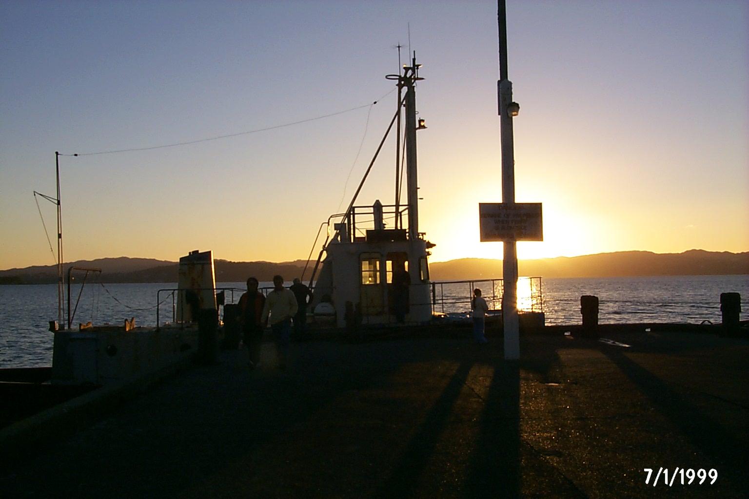
Days Bay / Eastbourne.
Days Bay turns a Wellington harbour crossing into a beach-and-bush day. The wharf lands beside a sandy shore, with Williams Park behind and forest rising above the waterfront. Nearby Eastbourne adds a village centre, small shops and a longer coastal outing on the eastern side of the harbour.
Photo credits1
- Area image: Sunset, Days Bay Wharf — Area near Days Bay / Eastbourne.Sunset, Days Bay Wharf - panoramio. Author: DB Thats-Me. Credit: https://web.archive.org/web/20161011154457/http://www.panoramio.com/photo/4633431. License: CC BY-SA 3.0 (https://creativecommons.org/licenses/by-sa/3.0). Source: https://commons.wikimedia.org/wiki/File:Sunset,_Days_Bay_Wharf_-_panoramio.jpgCropped to fit the display.
Make your way to Days Bay / Eastbourne
Choose a tool and your dates to check the options for your trip.
More ways to explore
- Country
- New Zealand
- Currency
- NZD
- Time zone
- Pacific/Auckland
Days Bay turns a Wellington harbour crossing into a beach-and-bush day. The wharf lands beside a sandy shore, with Williams Park behind and forest rising above the waterfront. Nearby Eastbourne adds a village centre, small shops and a longer coastal outing on the eastern side of the harbour.
The appeal is the combination rather than one must-see monument: coffee by the water, a picnic, then a forest trail or a walk toward the village. Choose the length of the outing before boarding. A relaxed beach visit and the exposed route toward Pencarrow need different equipment, time and weather conditions.
When to go
Summer, December–February, suits a beach-and-picnic plan and attracts more visitors to the shore. Cooler months can still suit a harbour trip followed by a café stop, but take a windproof layer. Forest tracks and the Pencarrow coast can feel very different on the same day. Check conditions before committing to a long walk far from the return wharf.
Getting there
East By West ferries connect Wellington’s Queens Wharf with Days Bay, with a crossing commonly around half an hour. Use the harbour-ferry timetable for your date and confirm the last return before leaving. An overland journey is also possible: Metlink route 83 serves the Eastbourne–Lower Hutt–Petone–Wellington corridor. This is distinct from the Cook Strait ferries to the South Island.
Getting around
Combine the wharf, beach and park on foot, then decide whether to continue into Eastbourne. The Tupua Horo Nuku shared path along the eastern bays officially opened in April 2026, improving the walking and cycling connection on Marine Drive. If bringing a bicycle by ferry, check the operator’s reservation rules; dedicated bike spaces must be booked for specified daytime and weekend sailings.
Local food
The local community directory lists Days Bay Pavilion in Williams Park and Chocolate Dayz on Marine Drive, useful places to check for coffee or a casual meal. Eastbourne provides another cluster around Rimu Street, including Tartines and the village bakery. For picnic supplies, the village Four Square is on Oroua Street. Confirm opening if your visit depends on an early or late meal.
What to see
Williams Park is the immediate place to pause after arrival, with a duck pond, open lawn and pavilion. Its renewed barbecue area incorporates tāniko paving developed around local cultural stories. Pātiki refers to nourishment, while other designs express connections between generations and landscape. For a broader coastal view, follow a signed forest route above the bay rather than entering private hillside properties.
Towns and neighbourhoods
Days Bay centres on the wharf, Marine Drive and Williams Park. Eastbourne village lies farther south, with cafés and shops around Rimu and Oroua Streets. Burdan’s Gate, beyond the village, is the starting point for the Pencarrow coast route. It is not the ferry landing: include the approach from Days Bay when calculating a walk or cycle outing.
Coast and outdoors
Stay near Days Bay beach for a simple shore day, or choose the Days Bay Loop from Williams Park for a steeper forest outing. Greater Wellington grades that loop as medium. Butterfly Creek involves a larger circuit and a ridge crossing. Beyond Burdan’s Gate, the lower lighthouse is about 6.7 kilometres one way; this exposed route calls for a deliberate return plan.
Where to stay
For a local overnight stay, compare the actual address with Days Bay Wharf and Eastbourne’s village services. A property above the waterfront may involve a steep walk even when the map distance looks short. If Wellington’s museums and nightlife are your main plans, staying in the city and making a day visit here reduces dependence on the last ferry home.
Useful before you go
East By West currently states that its ferries are inaccessible by wheelchair because of steps and steep gangways; discuss alternatives before travelling, including route 83. On the harbour ferry, Metlink lists contactless or EFTPOS payment rather than cash or Snapper. Carry water on longer trails, follow current park notices and keep coastal wildlife protection areas clear.
Good to know before you go
Is Days Bay the centre of Eastbourne?
They are nearby but distinct. The ferry arrives at Days Bay; the village shopping and café area lies farther south.
Can I make this a short outing?
Yes. The beach, Williams Park and pavilion are close to the wharf. Leave the longer forest and lighthouse routes for another visit if time is limited.
Can I take a wheelchair on the ferry?
The operator currently says its services are inaccessible by wheelchair. Contact it about options and consider the route 83 bus.
Is Pencarrow Lighthouse just beside the wharf?
No. First reach Burdan’s Gate beyond Eastbourne, then allow for the coastal distance and return journey.
Is the eastern bays shared path still under construction?
Hutt City Council records its official opening in April 2026. Follow any newer local maintenance notices during your visit.
Sources & references
These references support the guide. Confirm opening hours, access and travel services before you go.
- 01WellingtonNZ — Days Bay and Eastbourne geography
- 02Hutt City Council — Williams Park facilities and cultural paving
- 03Hutt City Council — completed park improvements
- 04Greater Wellington — exact track distances, grades and access restrictions
- 05WellingtonNZ — regional park access and preparation
- 06Hutt City Council — April 2026 path opening distinct from cancelled celebration
- 07Eastbourne Community Board — local café and food directory
- 08WellingtonNZ — Queens Wharf to Days Bay harbour crossing
- 09Metlink — current ferry payment information
- 10East By West — wheelchair limitations, bus alternative and bike reservations
- 11Metlink — route 83 corridor
- 12Tourism New Zealand — seasons
Where could the journey go next?
More guides in New Zealand. Compare the places and check actual connections before combining stops.

Queens Wharf (Wellington)
Queens Wharf sits on Wellington’s central waterfront, where a harbour-ferry departure can become a full day of museums, seafood and walks beside the water. The East by West service connects this city landing with Days Bay on the eastern side of Wellington Harbour.
Get to know the place
Wellington
Wellington brings a capital city’s museums and political landmarks into a compact harbour setting. Its appeal is easy to experience on foot: follow the waterfront, turn inland for coffee on Cuba Street, then climb or ride into the hills for a view back over the city and its busy water.
Get to know the place
Picton (Waitohi)
Picton, also known as Waitohi, opens onto the sheltered waterways and wooded hills of the Marlborough Sounds. Ferries make it a busy gateway between New Zealand’s main islands, but the foreshore, maritime museum and walking tracks give good reasons to stay beyond a connection.
Get to know the place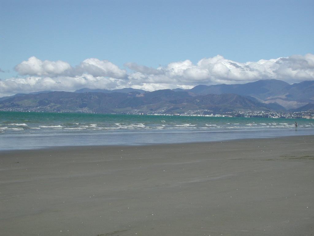 Area near Moturoa / Rabbit Island
Moturoa / Rabbit Island
Moturoa/Rabbit Island is a beach-and-forest day destination in Waimea Estuary, close to Richmond and linked to Māpua by a small passenger ferry. Its long sandy shore, picnic spaces and cycle tracks offer a quieter counterpoint to the cafés across the channel. This is a recreational reserve, not a resort village.
Get to know the placePhoto credits4
- Depicts: Queens Wharf (Wellington)QueensWharfFIFA2023 01. Author: L Maule. Credit: Own work. License: CC BY-SA 4.0 (https://creativecommons.org/licenses/by-sa/4.0). Source: https://commons.wikimedia.org/wiki/File:QueensWharfFIFA2023_01.jpgCropped to fit the display.
- Depicts: WellingtonSeddon Statue in Parliament Grounds. Author: russellstreet. Credit: https://www.flickr.com/photos/russellstreet/4640549163/. License: CC BY-SA 2.0 (https://creativecommons.org/licenses/by-sa/2.0). Source: https://commons.wikimedia.org/wiki/File:Seddon_Statue_in_Parliament_Grounds.jpgCropped to fit the display.
- Depicts: Picton (Waitohi)2022-06-05 Picton, New Zealand. Author: Maxim75. Credit: Own work. License: CC BY 4.0 (https://creativecommons.org/licenses/by/4.0). Source: https://commons.wikimedia.org/wiki/File:2022-06-05_Picton,_New_Zealand.jpgCropped to fit the display.
- Area image: Beach on Rabbit Island near Nelson , with Nelson in the distance — Area near Moturoa / Rabbit IslandBeach on Rabbit Island near Nelson. Author: Pseudopanax at English Wikipedia. Credit: Own work. License: Public domain (https://creativecommons.org/publicdomain/mark/1.0/). Source: https://commons.wikimedia.org/wiki/File:Beach_on_Rabbit_Island_near_Nelson.jpg
