
Narrows (Hokianga Harbour).
The Narrows is the northern landing of the Hokianga vehicle ferry, opposite Rawene and four kilometres south of Kohukohu. It is a useful local connection on a Northland road journey, bringing travellers across a harbour with a long history of settlement and trade.
Photo credits1
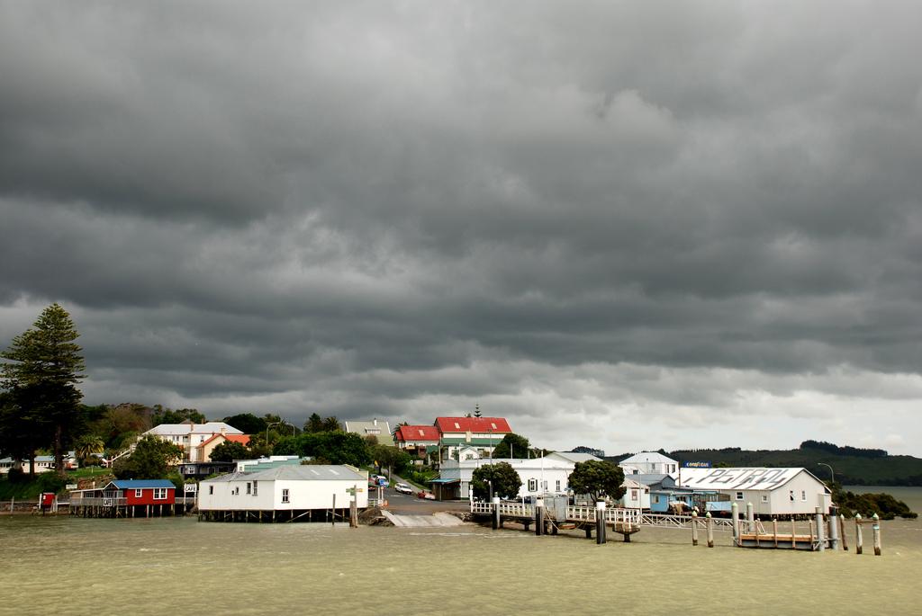
- Area image: Sail the Kohu Ra Tuarua from picturesque Rawene across the scenic Hokianga Harbour. Travel on by road through Kohukohu and Broadwood to Kaitaia, Ninety Mile Beach and fabulous Cape Reinga. Or travel south from Kohukohu, board the ferry at the Narrows and travel to Rawene, and then drive on to the beaches of Opononi and Omapere and the giant Kauris of the Waipoua Forest. — Area near Narrows (Hokianga Harbour)The Hokianga Vehicle Ferry (21234509213). Author: Bernard Spragg. NZ from Christchurch, New Zealand. Credit: The Hokianga Vehicle Ferry. License: CC0 (https://creativecommons.org/publicdomain/zero/1.0/). Source: https://commons.wikimedia.org/wiki/File:The_Hokianga_Vehicle_Ferry_(21234509213).jpg
Make your way to Narrows (Hokianga Harbour)
Choose a tool and your dates to check the options for your trip.
More ways to explore
- Country
- New Zealand
- Currency
- NZD
- Time zone
- Pacific/Auckland
The Narrows is the northern landing of the Hokianga vehicle ferry, opposite Rawene and four kilometres south of Kohukohu. It is a useful local connection on a Northland road journey, bringing travellers across a harbour with a long history of settlement and trade.
Treat the landing as a gateway rather than a town centre. Continue to Kohukohu for historic streets, art and food, or arrange a rural stay on the north shore. Rawene lies across the water, while the harbour mouth and western beaches require further travel; a ferry crossing alone does not reach those attractions.
When to go
Summer’s longer daylight makes it easier to combine the crossing with village walks and a western coastal drive. In winter, plan fewer distant stops and reach your accommodation before dark if possible. The ferry is a year-round service, unlike many seasonal sightseeing boats. Weather still matters for the broader road trip, and a quiet travel day does not remove the need to check the final sailing.
Getting there
Northland Ferries runs the Rawene–Narrows connection for vehicles and foot passengers. The northern ramp is on Kohukohu Road; the southern departure is at the end of Parnell Street in Rawene. The operator describes a crossing of about fifteen minutes. Road travellers approaching from the north can continue through Kohukohu to the ramp, while southern approaches commonly use Rawene.
Getting around
A car or arranged road transfer is practical for combining the landing, Kohukohu and rural accommodation. A walk-on crossing does not include onward transport to the village. Cyclists use this part of the Hokianga on longer routes, with some local accommodation offering secure storage and charging; ask about the exact facilities needed for your bicycle rather than assuming every property provides them.
Local food
For supplies and a meal, continue into Kohukohu. The community directory identifies a general store selling groceries and produce and the Hokianga Harbour Hotel and Café for café service, drinks and light meals. Travellers arriving late should bring provisions: accommodation hosts specifically warn that village shops and cafés may already be closed. Do not assume food is sold at the ferry ramp.
What to see
Kohukohu is the natural nearby stop. Its heritage walk introduces buildings associated with the former timber town, while Village Arts presents changing exhibitions by established and emerging Hokianga artists. The gallery includes painting, photography, sculpture, jewellery and Māori art. These are village experiences beyond the ramp, so build time for the short onward road journey rather than only a queue-side pause.
Towns and neighbourhoods
Keep three names distinct when navigating: Narrows is the north-bank ferry landing, Kohukohu is the village farther north, and Rawene is the settlement at the southern end of the crossing. West Coast Road leads toward rural north-shore communities. A property described broadly as Hokianga may be on either side of the harbour, which can materially change the last stage of your arrival.
Coast and outdoors
The landing is a working transport site beside tidal water, not a beach facility. Mitimiti is a separate west-coast excursion from the north shore, with a broad ocean setting and a very different character from the sheltered upper harbour. Allow for rural roads and approach swimming cautiously. Respect local homes, marae and cemetery areas instead of treating every scenic place as unrestricted visitor space.
Where to stay
Kohukohu offers cottages, guest accommodation and small local properties. Downes House occupies a heritage building with guest rooms in one wing, while The Tree House provides cabins and shared lodge facilities in a garden-and-forest setting. The latter is on West Coast Road, about two kilometres west of the landing. Choose the north shore if you want to avoid another ferry crossing before settling in.
Useful before you go
Confirm your direction and return plan with the operator, particularly if a late arrival depends on the ferry. Low tides can affect extra-large or heavy vehicles, so discuss unusual vehicle requirements ahead of travel. Buy provisions before an evening rural arrival. At cultural and residential stops, follow local access guidance and ask before entering spaces that are not clearly public.
Good to know before you go
Is Narrows another name for central Kohukohu?
No. It is the ferry landing approximately four kilometres south of the village.
Can foot passengers use the vehicle ferry?
Yes. Northland Ferries carries foot passengers, but the northern landing requires a separate onward journey for village services.
Where are the nearest useful visitor stops?
Kohukohu has the heritage precinct and Village Arts gallery. Rawene has its own historic attractions across the ferry.
Can I rely on getting dinner at the ramp?
Plan a meal in a settlement or bring food. Local hosts advise that cafés and shops may be closed by a late arrival.
Is The Tree House directly at the terminal?
No. Its published location is about two kilometres west of the Narrows landing on West Coast Road; arrange how you will reach it.
Sources & references
These references support the guide. Confirm opening hours, access and travel services before you go.
- 01Northland Ferries — exact Narrows ramp and separation from Kohukohu
- 02Northland Ferries — year-round vehicle and passenger service
- 03Northland Inc — distinct harbour settlements
- 04Northland Inc — Kohukohu heritage and Mitimiti cultural setting; no old timetables used
- 05Village Arts — community exhibitions and exact village location
- 06Kohukohu community — general store and hotel café
- 07Kohukohu community — local accommodation types
- 08The Tree House — facilities and cycling amenities
- 09The Tree House — north-bank location and evening food planning; old ferry fares excluded
- 10Kohukohu community — Mitimiti beach walking and swimming caution
- 11Kohukohu community / Downes House — guest wing and heritage setting
- 12Tourism New Zealand — seasonal calendar
Where could the journey go next?
More guides in New Zealand. Compare the places and check actual connections before combining stops.
Rawene
Rawene is a small Northland village on the southern shore of Hokianga Harbour. Its waterfront, old buildings, cafés and craft culture suit travellers who prefer a slow local stay to a resort strip.
Get to know the place
Paihia
Paihia is compact and practical for an island-rich region. The waterfront is the starting point for Russell, Urupukapuka, Cape Brett and wildlife cruises.
Get to know the place
Russell (Kororāreka)
Russell is compact, walkable and rich in early maritime and colonial history, but its identity is also Māori and coastal: coves, headlands and island waters frame the town.
Get to know the place
Otehei Bay, Urupukapuka Island
Otehei Bay is the ferry landing on Urupukapuka Island, where a sandy shoreline, café and walking tracks make an island day straightforward to organise. It is a separate destination from Paihia or Russell: both mainland towns are departure points across the water.
Get to know the placePhoto credits4
- Depicts: RaweneRawene from the water. Author: Flickr user PhillipC / Phillip Capper. Credit: https://www.flickr.com/photos/flissphil/1596542679/. License: CC BY 2.0 (https://creativecommons.org/licenses/by/2.0). Source: https://commons.wikimedia.org/wiki/File:Rawene_from_the_water.jpgCropped to fit the display.
- Depicts: PaihiaPaihia, Williams Road. Author: Ulrich Lange, Bochum, Germany. Credit: Own work. License: CC BY 3.0 (https://creativecommons.org/licenses/by/3.0). Source: https://commons.wikimedia.org/wiki/File:Paihia,_Williams_Road.jpgCropped to fit the display.
- Depicts: Russell (Kororāreka)1870 house in Russell. Author: Sylvain Machefert / Symac. Credit: Own work. License: CC BY-SA 3.0 (https://creativecommons.org/licenses/by-sa/3.0). Source: https://commons.wikimedia.org/wiki/File:1870_house_in_Russell.jpgCropped to fit the display.
- Depicts: Otehei Bay, Urupukapuka Island00 0866 Island of the Bay of Islands. Author: W. Bulach. Credit: Own work. License: CC BY-SA 4.0 (https://creativecommons.org/licenses/by-sa/4.0). Source: https://commons.wikimedia.org/wiki/File:00_0866_Island_of_the_Bay_of_Islands.jpgCropped to fit the display.
