
Newhaven.
Newhaven is a working Sussex port where the River Ouse reaches the Channel, with fishing boats, a cross-Channel ferry and a clifftop fort shaping the landscape. Give the town its own stop rather than treating it simply as Brighton’s departure point: the West Quay, Castle Hill and nearby wetlands show different sides of its maritime setting.
Photo credits1
- Depicts: NewhavenNewhaven, East Sussex, England-2Oct2011. Author: Ian Stannard from Southsea, England. Credit: Newhaven Harbour Uploaded by snowmanradio. License: CC BY-SA 2.0 (https://creativecommons.org/licenses/by-sa/2.0). Source: https://commons.wikimedia.org/wiki/File:Newhaven,_East_Sussex,_England-2Oct2011.jpgCropped to fit the display.
Make your way to Newhaven
Choose a tool and your dates to check the options for your trip.
More ways to explore
- Country
- United Kingdom
- Currency
- GBP
- Time zone
- Europe/London
Newhaven is a working Sussex port where the River Ouse reaches the Channel, with fishing boats, a cross-Channel ferry and a clifftop fort shaping the landscape. Give the town its own stop rather than treating it simply as Brighton’s departure point: the West Quay, Castle Hill and nearby wetlands show different sides of its maritime setting.
The two sides of the harbour serve different purposes. West Quay is a place to walk past fishing boats and look across to the ferry facilities; passengers for Dieppe should follow the terminal directions on the other side. A stay can combine the fort with a nature walk, then extend to Seaford’s promenade or Brighton as a separate outing.
When to go
The fort’s published 2026 visitor season runs from 14 February to 1 November; events outside that period should not be confused with ordinary daily admission. Spring and summer bring flowers and birds to the reserves, while the Ouse wetlands also attract winter waterfowl. Exposed clifftops and the seafront need a different plan in strong wind. In colder months, combine a shorter outdoor route with a town meal or an indoor outing in nearby Brighton.
Getting there
The Dieppe ferry uses Newhaven’s passenger terminal on Rail Approach, postcode BN9 0DF. Newhaven Town railway station is the relevant nearby station; do not select Newhaven Harbour purely because its name sounds more suitable. Southern rail services connect the town with the surrounding Sussex network, with changes depending on the origin. Follow the booking’s check-in instructions and separate passenger-terminal directions from the address of the commercial port administration.
Getting around
The town centre, West Quay and fort can form a walking visit, but the climb to Castle Hill and the crossing between harbour sides add effort with luggage. Coaster buses link Newhaven with Brighton, Seaford and the Eastbourne corridor. The council’s summer 2026 update merged routes 12 and 12A into route 12, so use current information instead of older maps. The reserve’s surfaced cycle route continues towards Seaford; its other unsurfaced path should not be cycled when soft.
Local food
The fishing fleet gives Newhaven a concrete food connection: West Quay’s local fishmonger sells locally caught fish. Ask what has landed and how it can be prepared rather than expecting a fixed selection throughout the year. Cafés and pubs provide a useful meal stop before a crossing, while a picnic can suit a longer nature-reserve outing. Choose somewhere on the side of the harbour that fits your next activity, leaving the transfer to check-in in your schedule.
What to see
Newhaven Fort presents coastal-defence history in its restored military buildings, with exhibitions, tunnels, ramparts and a family playground. Allow time to explore rather than squeezing it between check-in and departure. The town’s Poppy Trail recalls its role supplying the Western Front during the First World War. For a less formal introduction, follow the public West Quay route beside the working fishing boats, keeping clear of operational areas and watching the movement of the harbour.
Towns and neighbourhoods
The centre and West Quay sit on the town side of the river, while Railway Approach serves the station and passenger-terminal area. Castle Hill rises beside the fort and gives a higher view over the Ouse and Channel. The Ouse Estuary Nature Reserve lies between Newhaven and Seaford; it is a distinct wetland outing rather than the fort’s clifftop reserve. Seaford and Brighton offer different additional bases, respectively a quieter promenade setting and a larger city visit.
Coast and outdoors
West Beach remains closed to public access in the port authority and council statements reviewed on 29 October 2026. Do not treat an open gate or people crossing a barrier as permission to enter. Nearby Seaford has a long shingle beach and promenade, with Tide Mills ruins towards its western end. The beach shelves steeply and lifeguards are not always on duty; follow flags and local advice, and stay away from chalk-cliff edges and bases.
Where to stay
A Newhaven address suits a ferry stop or a visit focused on the fort and working harbour. Check the walking route to Rail Approach: a room overlooking the water may be on the opposite bank. Seaford suits promenade walks and access to the estuary reserve, with an extra transfer for the ferry. Brighton offers a broader city programme but adds travel time. For an early departure, compare the first available connection with the required check-in margin.
Useful before you go
Castle Hill has an accessible surfaced path from its car park, but that does not make every clifftop route step-free. At the fort, exhibition rooms have accessible provision while some tunnels and ramparts do not; discuss the route that suits your needs before visiting. Newhaven Town station has step-free platform access via streets or ramps and no lifts. Respect working-port boundaries, reserve livestock notices and any temporary seafront restrictions rather than relying on an unrestricted waterfront walk.
Good to know before you go
Which station should I use for the Dieppe ferry?
Newhaven Town is the nearby station for the passenger terminal on Rail Approach. Newhaven Harbour is a separate station and should not be chosen just because of its name.
Can I visit West Beach?
The port authority and council still state that public access is closed. Respect the barriers and use permitted coastal routes or Seaford’s seafront instead.
Is the fort open throughout winter?
Its published ordinary 2026 season ends on 1 November. Check any later event separately rather than assuming daily access continues.
Are Castle Hill and Ouse Estuary the same reserve?
No. Castle Hill is beside the fort on the cliffs; Ouse Estuary lies between Newhaven and Seaford and includes wetlands, paths and a birdwatching screen.
Can I explore without a car?
Yes, using the railway, current Coaster buses and local walking routes. Plan the last connection to the terminal and allow for the hill up to the fort.
Sources & references
These references support the guide. Confirm opening hours, access and travel services before you go.
- 01Visit Lewes — Newhaven and Poppy Trail
- 02Visit Lewes — West Quay working harbour and local fish
- 03Visit Lewes — Castle Hill reserve access
- 04East Sussex Council — Ouse Estuary paths and wildlife
- 05Newhaven Fort — restored exhibitions and family facilities
- 06Newhaven Fort — 2026 visitor season
- 07East Sussex i-go — fort accessibility, dated building-history wording not used
- 08Newhaven Port — July 2026 West Beach access statement
- 09Newhaven Council — West Beach remains closed
- 10Seaford Council — promenade, shingle beach and Tide Mills
- 11Seaford Lifeguards — steep beach and cliff hazards
- 12Experience Sussex — ferry terminal address and Newhaven Town station
- 13National Rail — Newhaven Town station access
- 14East Sussex Council — summer 2026 bus route changes
Where could the journey go next?
More guides in United Kingdom. Compare the places and check actual connections before combining stops.
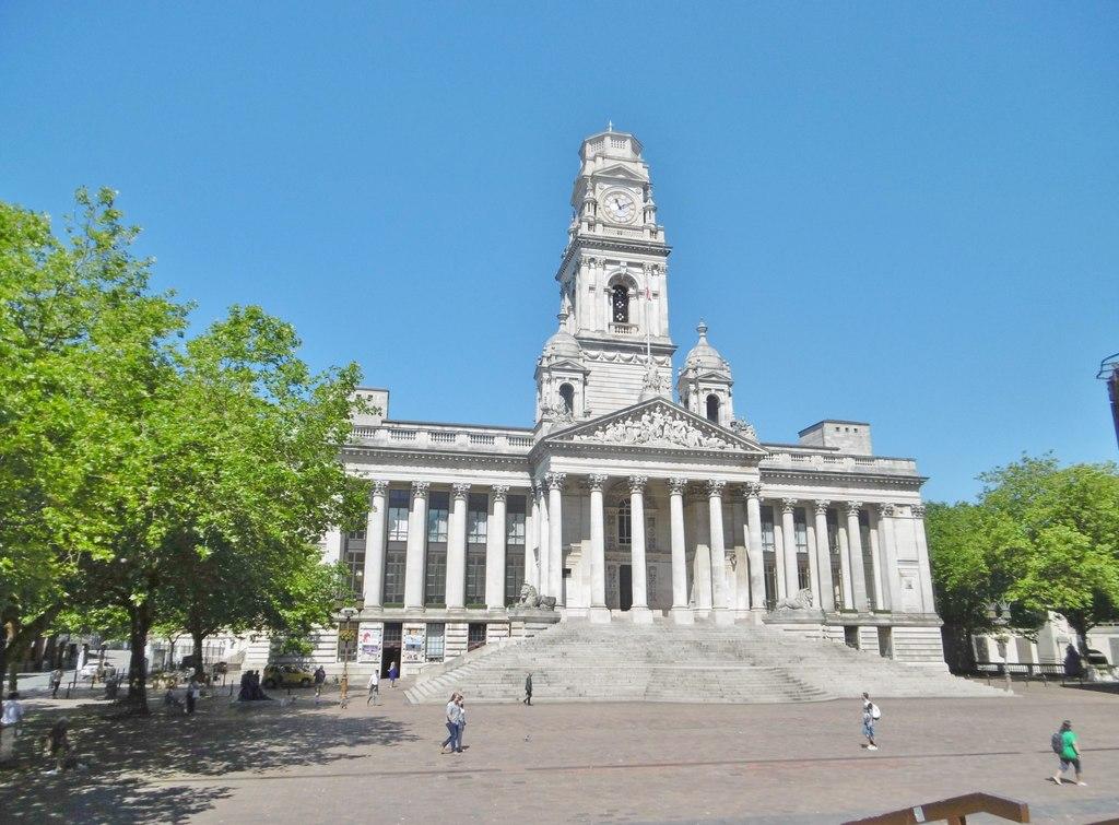
Portsmouth
Portsmouth is a naval city with a tightly connected harbour landscape: historic warships, old defensive walls, modern waterfront development and the open seafront of Southsea. The interest lies in moving between these different layers, rather than treating the city only as a departure point for France or the Isle of Wight.
Get to know the place
Ryde
Ryde rises from the north-east shore of the Isle of Wight, with a long pier, sandy foreshore and shopping streets climbing inland. It is both an arrival town and a place to spend time: the seafront leads east towards Appley and Puckpool, while Union Street offers an alternative to a purely beach-based day.
Get to know the place Area near Fishbourne
Fishbourne
Fishbourne is the Isle of Wight ferry arrival beside Wootton Creek, with woodland, a small shore and Quarr Abbey close enough to shape a quiet first day. It is a village and working port, not a substitute name for the whole island. The route from Portsmouth brings both vehicles and pedestrians here, while the separate FastCat lands at Ryde Pier Head.
Get to know the place
East Cowes
East Cowes sits on the eastern bank of the River Medina, where ferries from Southampton meet a town shaped by maritime industry and its royal neighbour, Osborne. It is a useful place to slow down after the crossing: the heritage centre, esplanade and former royal estate offer distinct reasons to stay rather than immediately drive across the island.
Get to know the placePhoto credits4
- Depicts: PortsmouthPortsmouth Guildhall - geograph.org.uk - 5431834. Author: Mike Faherty. Credit: Geograph Britain and Ireland. License: CC BY-SA 2.0 (https://creativecommons.org/licenses/by-sa/2.0). Source: https://commons.wikimedia.org/wiki/File:Portsmouth_Guildhall_-_geograph.org.uk_-_5431834.jpgCropped to fit the display.
- Depicts: RydeRydefromthesolent. Author: David Jones from Isle of Wight, United Kingdom. Credit: Ryde from the Solent Uploaded by DavidJones. License: CC BY 2.0 (https://creativecommons.org/licenses/by/2.0). Source: https://commons.wikimedia.org/wiki/File:Rydefromthesolent.jpgCropped to fit the display.
- Area image: Fishbourne Ferry Terminal waiting area — Area near FishbourneFishbourne Ferry Terminal waiting area - geograph.org.uk - 7610676. Author: Steve Daniels. Credit: Geograph Britain and Ireland. License: CC BY-SA 2.0 (https://creativecommons.org/licenses/by-sa/2.0). Source: https://commons.wikimedia.org/wiki/File:Fishbourne_Ferry_Terminal_waiting_area_-_geograph.org.uk_-_7610676.jpgCropped to fit the display.
- Depicts: East CowesEAST COWES HARBOUR INDUSTRY... (8169284465). Author: Ronald Saunders from Warrington, UK. Credit: EAST COWES HARBOUR INDUSTRY.... License: CC BY-SA 2.0 (https://creativecommons.org/licenses/by-sa/2.0). Source: https://commons.wikimedia.org/wiki/File:EAST_COWES_HARBOUR_INDUSTRY..._(8169284465).jpgCropped to fit the display.
