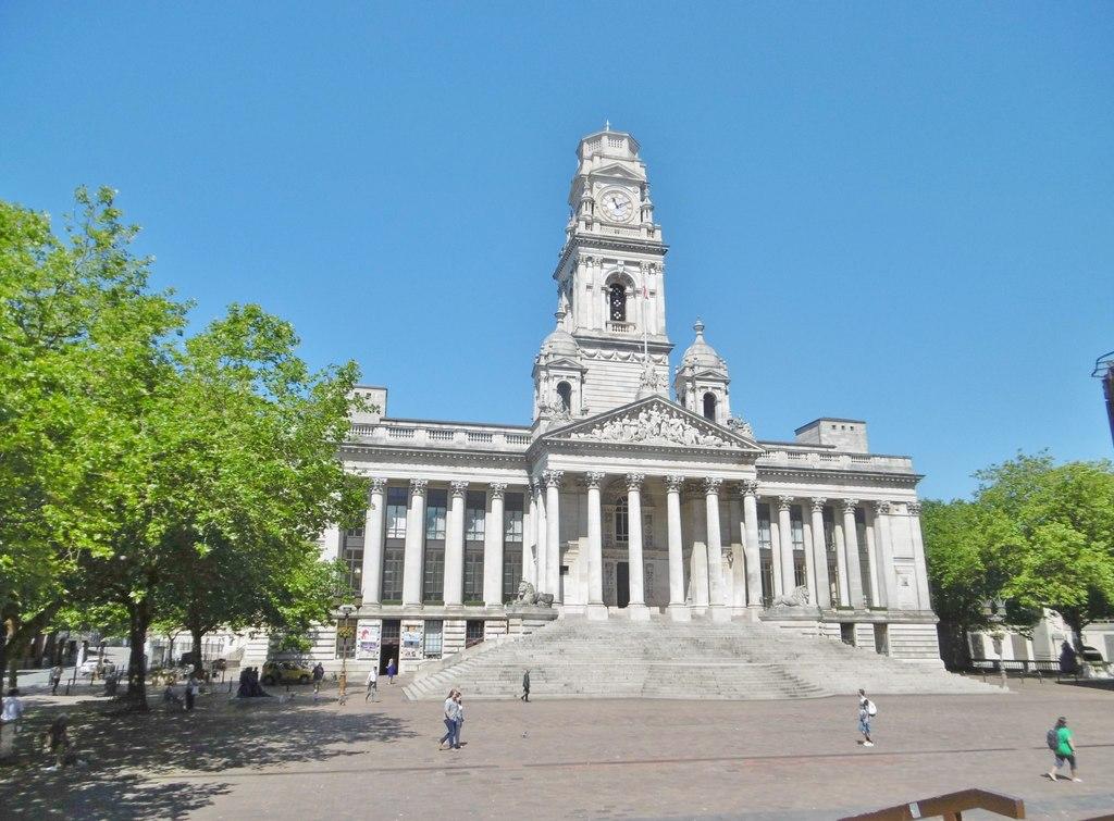
Portsmouth.
Portsmouth is a naval city with a tightly connected harbour landscape: historic warships, old defensive walls, modern waterfront development and the open seafront of Southsea. The interest lies in moving between these different layers, rather than treating the city only as a departure point for France or the Isle of Wight.
Photo credits1
- Depicts: PortsmouthPortsmouth Guildhall - geograph.org.uk - 5431834. Author: Mike Faherty. Credit: Geograph Britain and Ireland. License: CC BY-SA 2.0 (https://creativecommons.org/licenses/by-sa/2.0). Source: https://commons.wikimedia.org/wiki/File:Portsmouth_Guildhall_-_geograph.org.uk_-_5431834.jpgCropped to fit the display.
Make your way to Portsmouth
Choose a tool and your dates to check the options for your trip.
More ways to explore
- Country
- United Kingdom
- Currency
- GBP
- Time zone
- Europe/London
Portsmouth is a naval city with a tightly connected harbour landscape: historic warships, old defensive walls, modern waterfront development and the open seafront of Southsea. The interest lies in moving between these different layers, rather than treating the city only as a departure point for France or the Isle of Wight.
Give the Historic Dockyard substantial time, then plan a separate walk through Old Portsmouth and along Southsea Common. Several ferry terminals serve the city, but they are spread across different locations. Portsmouth International Port, the Gunwharf car-ferry terminal, Portsmouth Harbour’s FastCat and Southsea’s hoverport must be matched to the actual service you have booked.
When to go
Museums make Portsmouth useful beyond summer, while longer days favour the full waterfront walk and time on Southsea Common. The castle’s visitor calendar changes materially in winter: its courtyard and café continue, but the keep and ramparts close from November to March. Major seafront events can temporarily change access and transport, so compare event dates with your visit. For tower views, a clear day matters more than a nominal season; low cloud and rain can limit what you see across the Solent.
Getting there
Continental sailings use Portsmouth International Port, reached by a separate transfer from the city’s railway stations. Wightlink’s FastCat to Ryde Pier Head leaves from inside Portsmouth Harbour railway station, while its vehicle ferry to Fishbourne uses Gunwharf Road. Hovertravel leaves from Clarence Esplanade in Southsea and arrives beside Ryde’s esplanade. These are distinct services and terminals. Follow the operator’s current booking directions, particularly when a dated maintenance diversion is announced, rather than applying an old diversion to every future journey.
Getting around
A walking route can link the Historic Dockyard area, Gunwharf, Old Portsmouth and Southsea, with buses useful when extending farther east or carrying luggage. The Hard is a transport interchange beside the harbour station. Hovertravel’s H1 Hoverbus connects its Southsea terminal with rail and coach connections and the centre. The city also has Park and Ride options for drivers. Separate the time spent enjoying the seafront from the final transfer to a ferry, and check the exact stop and terminal instead of relying on the word “port”.
Local food
A fish-and-chips stop fits the seafront, while Old Portsmouth’s pubs and tea rooms suit a slower harbour meal. Southsea’s independent food scene is another reason to venture inland: the visitor board lists a pie café paired with a record shop on Castle Road, cafés near Canoe Lake and seasonal menus by the beach. The Hotwalls arts quarter has a café inside the old barracks. Gunwharf offers a broader concentration of waterfront dining; choose the district that fits the rest of the day instead of crossing the city solely for a meal.
What to see
The Historic Dockyard combines HMS Victory, HMS Warrior and the Mary Rose experience with wider naval collections. Victory remains open during its major conservation project: the operator’s October 2026 guide explains that some deck areas have restricted views while the work itself forms part of the visit. In Old Portsmouth, follow the fortifications and Hotwalls arts quarter before looking back across the harbour. Spinnaker Tower provides an elevated city-and-Solent view. Southsea adds Henry VIII’s castle and The D-Day Story, including the surviving landing craft LCT 7074.
Towns and neighbourhoods
The Hard and Portsmouth Harbour station are useful landmarks for the Historic Dockyard and nearby Gunwharf Quays. Old Portsmouth, around the Camber and defensive towers, has a smaller-scale maritime feel. Southsea stretches along the Common and promenade, with independent cafés and shops inland around Castle Road, Palmerston Road and Albert Road. Eastney continues the seafront farther east. The international port lies away from this visitor-waterfront circuit, so a hotel near the Historic Dockyard does not automatically put you beside a continental departure.
Coast and outdoors
Southsea’s seafront combines beaches, promenade, open grass and views across the Solent; the Common and Canoe Lake Park are useful for a walk or picnic without entering the water. The council page reviewed on 29 October 2026 advises against swimming in Southsea East, between the Pyramids and South Parade Pier, because of its poor bathing-water classification. Read local warning signs and current advice, including at Eastney, rather than treating all of the seafront alike. Lifeguard provision is seasonal and only covers some beaches.
Where to stay
Gunwharf and The Hard suit access to harbour attractions and the Ryde FastCat. Old Portsmouth offers a quieter historic setting close to the harbour entrance. Southsea works well for the Common, seafront, castle and independent dining, with a longer transfer to the international port. A city-centre base can favour rail and bus travel. Before an early international sailing, compare the accommodation’s actual transfer with check-in requirements; for a sightseeing stay, prioritise the district you want to explore on foot.
Useful before you go
Historic ships and fortifications have very different access conditions from a modern terminal. Southsea Castle’s courtyard is largely cobbled and its keep and ramparts require stairs. Confirm a suitable route at the Dockyard rather than assuming every deck or conservation walkway is accessible. Brittany Ferries describes an accessible international terminal and adapted transport for disabled foot passengers. Spinnaker Tower’s current homepage confirms walk-up admission and an open Kitchen & Bar, while the Sky Bar, Clouds Café, afternoon tea and private-event spaces remain closed. Older attraction listings still describe these services, so use the current operator notice.
Good to know before you go
Which Portsmouth terminal serves Ryde?
Wightlink FastCat departs from Portsmouth Harbour railway station for Ryde Pier Head. Hovertravel is a different service from Southsea’s Clarence Esplanade to Ryde’s esplanade.
Is the Fishbourne car ferry at the international port?
Its normal Portsmouth terminal is on Gunwharf Road. Operators can publish dated diversions, so follow the directions attached to your specific sailing.
Can I visit HMS Victory during repairs?
Yes. The Dockyard’s October 2026 information confirms visits continue, with conservation forming part of the experience and some restricted sections or views.
Is Southsea Castle fully open in winter?
No. The courtyard and café continue during the winter season, but the keep and ramparts close from November to March. Events can also affect individual areas.
Is every Southsea beach suitable for swimming?
No. The council currently advises against swimming between the Pyramids and South Parade Pier at Southsea East. Follow local signs and current conditions elsewhere too.
Sources & references
These references support the guide. Confirm opening hours, access and travel services before you go.
- 01Visit Portsmouth — official visitor guide, stable geography and sights only
- 02Visit Portsmouth — travel options
- 03Historic Dockyard — HMS Victory visitor access during conservation, 23 October 2026
- 04Southsea Castle — summer/winter access and stairs
- 05Spinnaker Tower — current reopening, walk-up tickets and closed spaces
- 06Portsmouth Council — seafront districts and parks
- 07Portsmouth Council — Southsea East bathing-water warning
- 08Portsmouth Council — swimming and seasonal patrol advice
- 09Visit Portsmouth — independent cafés and food districts
- 10Brittany Ferries — international terminal and access
- 11Wightlink — Portsmouth Harbour FastCat terminal
- 12Wightlink — Gunwharf vehicle-ferry terminal
- 13Hovertravel — Southsea terminal and Hoverbus
Where could the journey go next?
More guides in United Kingdom. Compare the places and check actual connections before combining stops.

Ryde
Ryde rises from the north-east shore of the Isle of Wight, with a long pier, sandy foreshore and shopping streets climbing inland. It is both an arrival town and a place to spend time: the seafront leads east towards Appley and Puckpool, while Union Street offers an alternative to a purely beach-based day.
Get to know the place Area near Fishbourne
Fishbourne
Fishbourne is the Isle of Wight ferry arrival beside Wootton Creek, with woodland, a small shore and Quarr Abbey close enough to shape a quiet first day. It is a village and working port, not a substitute name for the whole island. The route from Portsmouth brings both vehicles and pedestrians here, while the separate FastCat lands at Ryde Pier Head.
Get to know the place
East Cowes
East Cowes sits on the eastern bank of the River Medina, where ferries from Southampton meet a town shaped by maritime industry and its royal neighbour, Osborne. It is a useful place to slow down after the crossing: the heritage centre, esplanade and former royal estate offer distinct reasons to stay rather than immediately drive across the island.
Get to know the place
West Cowes
West Cowes, usually called simply Cowes, occupies the western side of the River Medina where it reaches the Solent. Yachts, boatbuilding and waterfront streets give it a clear identity, with the High Street and Parade forming a compact route from the passenger ferry into town. It is a northern Isle of Wight base, not a name for the whole island.
Get to know the placePhoto credits4
- Depicts: RydeRydefromthesolent. Author: David Jones from Isle of Wight, United Kingdom. Credit: Ryde from the Solent Uploaded by DavidJones. License: CC BY 2.0 (https://creativecommons.org/licenses/by/2.0). Source: https://commons.wikimedia.org/wiki/File:Rydefromthesolent.jpgCropped to fit the display.
- Area image: Fishbourne Ferry Terminal waiting area — Area near FishbourneFishbourne Ferry Terminal waiting area - geograph.org.uk - 7610676. Author: Steve Daniels. Credit: Geograph Britain and Ireland. License: CC BY-SA 2.0 (https://creativecommons.org/licenses/by-sa/2.0). Source: https://commons.wikimedia.org/wiki/File:Fishbourne_Ferry_Terminal_waiting_area_-_geograph.org.uk_-_7610676.jpgCropped to fit the display.
- Depicts: East CowesEAST COWES HARBOUR INDUSTRY... (8169284465). Author: Ronald Saunders from Warrington, UK. Credit: EAST COWES HARBOUR INDUSTRY.... License: CC BY-SA 2.0 (https://creativecommons.org/licenses/by-sa/2.0). Source: https://commons.wikimedia.org/wiki/File:EAST_COWES_HARBOUR_INDUSTRY..._(8169284465).jpgCropped to fit the display.
- Depicts: West CowesBuildings in Cowes as seen from esplanade. Author: Garry Knight. Credit: originally posted to Flickr as Cowes. License: CC BY-SA 2.0 (https://creativecommons.org/licenses/by-sa/2.0). Source: https://commons.wikimedia.org/wiki/File:Buildings_in_Cowes_as_seen_from_esplanade.jpgCropped to fit the display.
