Skip to content
Rugged volcanic landscape on a hillside in La Gomera, showcasing natural geological formations and arid wilderness.
Spain / Canary Islands · Your field guide

La Gomera.

The island is best understood vertically: coast, ravine, village and high forest are often close in distance but different in climate and atmosphere. The south is sunnier and warmer, the north cooler and more humid, while Garajonay gathers mist around ancient laurisilva.

9 chapters11 referencesChecked
Photo: Liisbet LuupPexels
Photo credits1
A few decisions before you go
When should I go?When to visitWhere should I base myself?Where to stayHow will I get there?Getting there
From a place to a plan

Make your way to La Gomera

Choose a tool and your dates to check the options for your trip.

More ways to explore
Destination field guide9 chaptersContent checked 11 references
Country
Spain
Currency
EUR
Time zone
Atlantic/Canary
Airport
GMZ

The island is best understood vertically: coast, ravine, village and high forest are often close in distance but different in climate and atmosphere. The south is sunnier and warmer, the north cooler and more humid, while Garajonay gathers mist around ancient laurisilva.

Use San Sebastián, Valle Gran Rey, Hermigua, Agulo, Vallehermoso and Playa de Santiago as real anchors for a whole-island itinerary. Roads and trails are part of the experience, so allow time for curves, viewpoints and unplanned village stops.

01
A closer look

When to visit

All year

La Gomera can be explored throughout the year. We suggest cooler periods for longer hikes, while keeping plans flexible for rain, cloud and coastal conditions.

02
A closer look

Getting there

Ferries connect Los Cristianos in Tenerife with San Sebastián de La Gomera. La Gomera also has an airport near Playa de Santiago for inter-island flights. Check the exact Tenerife airport and road connection if combining flight and ferry; Tenerife North, Tenerife South and Los Cristianos are separate locations. Leave a generous connection margin.

03
A closer look

Getting around

The island’s steep roads make a car useful for linking San Sebastián, Agulo, Hermigua, Garajonay, Valle Gran Rey and Playa de Santiago. Walking is essential for the forest and ravine experience; allow extra time for bends, viewpoints and trail access.

04
A closer look

Local food

Almogrote

The island’s most famous spread combines cured goat cheese, hot pepper, olive oil and garlic. It is traditionally served on bread or toast and has an intense, spicy flavour.

Palm honey

Palm honey is made from guarapo, the sap of the Canary date palm. It appears in desserts, dressings, cocktails and savoury combinations, reflecting the island’s palm culture.

Fresh fish and shellfish

The seafront at Playa de Santiago is highlighted for fish and shellfish, while Valle Gran Rey and San Sebastián combine fishing traditions with restaurants near the port or historic quarter.

Gofio and cured cheese

Gofio and cured cheese belong to the island’s traditional pantry and pair naturally with almogrote and palm honey in mountain and village meals.

05
A closer look

Sights & experiences

Garajonay National Park

Garajonay National Park protects a misty laurel-forest landscape and is a UNESCO World Heritage Site. Laguna Grande, the Juego de Bolas visitor centre and Alto de Garajonay give different introductions; choose a route matched to weather and walking ability.

San Sebastián de La Gomera

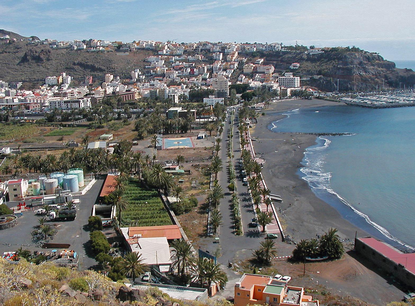
The capital is the island’s cultural and maritime centre, with the port associated with Columbus, the Torre del Conde, Casa de la Aguada and the Church of the Assumption nearby.

Abrante Viewpoint and Agulo

Agulo is celebrated for its historic quarter, while Abrante’s glass platform looks over the village and toward Tenerife. Together they make one of the north’s clearest combinations of settlement, cliff and view.

Valle Gran Rey

The valley is one of the island’s main coastal bases, with Playa del Inglés, Playa de Vueltas, the port of Vueltas and access to cetacean excursions. Its cliffs and terraces make the approach part of the visit.

Los Órganos and Vallehermoso

Los Órganos is a coastal formation of vertical volcanic columns, viewed on boat excursions when sea conditions permit. Vallehermoso provides a village base for the northwest and routes towards the high forest.

06
A closer look

Neighbourhoods & villages

07
A closer look

Beaches & coast

Playa del Inglés

Playa del Inglés near Valle Gran Rey offers black sand, cliffs and sunset views. It is an exposed beach: observe warning signs and currents, and choose a coastal walk instead of swimming when conditions are unsuitable.

La Cueva and Santiago

La Cueva is an option near the capital, while Santiago belongs to the southern coastal town. Check facilities and flags locally; awards and services can change between seasons.

Avalos and Tapahuga

Avalos lies near San Sebastián in a cliff-and-palm setting. Tapahuga is on the southern coast near Playa de Santiago; plan it with that area rather than as a short walk from the capital.

08
A closer look

Where to stay

09
A closer look

Practical information

Cultural respect

Silbo Gomero, crafts, folklore and Columbus heritage are living parts of the island. Visit museums and villages respectfully rather than treating traditions as scenery.

Live details

Arrange a return transfer before starting a linear walk. For a boat excursion, ask about the actual departure harbour and sea conditions; the nearest town on a map is not always a quick road journey.

Good to know before you go

Is La Gomera mainly for hikers?

Hiking is central, with more than 650 km of signposted trails, but the island also offers beaches, villages, viewpoints, food, cultural sites and marine excursions.

Where is the main ferry arrival?

The main inter-island ferry arrival is San Sebastián de La Gomera. Arrange the onward road journey separately if staying in Valle Gran Rey or another valley.

What is almogrote?

It is a spicy paste of cured goat cheese, pepper, olive oil and garlic, usually spread on toast and strongly associated with La Gomera.

Which side is sunnier?

The south generally has a sunnier, warmer feel, while the north and high forest are cooler and more humid. Carry a layer when moving between them.

Behind the guide

Sources & references

These references support the guide. Confirm opening hours, access and travel services before you go.

Keep the curiosity going

Where could the journey go next?

More guides in Spain. Compare the places and check actual connections before combining stops.

Spain
Photo credits4
  • Depicts: Playa SantiagoLa Gomera, GR 132 (16). Author: Michal Klajban. Credit: Own work. License: CC BY-SA 4.0 (https://creativecommons.org/licenses/by-sa/4.0). Source: https://commons.wikimedia.org/wiki/File:La_Gomera,_GR_132_(16).jpgCropped to fit the display.
  • Depicts: San Sebastián de la GomeraSan Sebastián de La Gomera, Islas Canarias. Author: Oliver Raupach. Credit: Own work. License: CC BY-SA 2.5 (https://creativecommons.org/licenses/by-sa/2.5). Source: https://commons.wikimedia.org/wiki/File:San_Sebasti%C3%A1n_de_La_Gomera,_Islas_Canarias.jpgCropped to fit the display.
  • Depicts: Valle Gran Rey
  • Depicts: Los CristianosVista de Los Cristianos, Tenerife, España, 2012-12-14, DD 01. Author: Diego Delso. Credit: Own work. License: CC BY-SA 3.0 (https://creativecommons.org/licenses/by-sa/3.0). Source: https://commons.wikimedia.org/wiki/File:Vista_de_Los_Cristianos,_Tenerife,_Espa%C3%B1a,_2012-12-14,_DD_01.jpgCropped to fit the display.
Another direction in mind?

Your next field guide is here.

Where to?

Explore the world92 countries & territories

Photo credits91