
Santa Marina Salina.
Santa Marina Salina is the east-coast town and passenger port beneath the slopes of Fossa delle Felci. Its waterfront, church and pedestrian main street make an approachable first base on Salina, with cafés and small shops close to the arrival area. This guide covers the town and nearby Lingua within the same municipality, rather than treating every village on the island as a suburb of the port.
Photo credits1
- Depicts: Santa Marina SalinaSalina landscape. Author: Dedda71. Credit: Own work. License: CC BY 3.0 (https://creativecommons.org/licenses/by/3.0). Source: https://commons.wikimedia.org/wiki/File:Salina_landscape.jpgCropped to fit the display.
Make your way to Santa Marina Salina
Choose a tool and your dates to check the options for your trip.
More ways to explore
- Country
- Italy
- Currency
- EUR
- Time zone
- Europe/Rome
Santa Marina Salina is the east-coast town and passenger port beneath the slopes of Fossa delle Felci. Its waterfront, church and pedestrian main street make an approachable first base on Salina, with cafés and small shops close to the arrival area. This guide covers the town and nearby Lingua within the same municipality, rather than treating every village on the island as a suburb of the port.
Stay long enough to leave the boarding quay behind. A town walk can lead into an afternoon of museums and the salt-lagoon landscape at Lingua; another day can focus on the archaeological evidence north of town or a planned island excursion. The practical advantage is a choice of activities that does not depend entirely on a beach day. Check the exact boat destination, because Rinella is Salina’s other port and has a different onward journey.
When to go
In summer, combine an early town walk with a longer pause out of the midday heat. Outside the busiest period, museums and local food can support a slower stay, provided the relevant services are open. The municipal museum page specifies advance arrangements from November for the Lingua civic and archaeological museums and Santa Marina’s wine museum. Its detailed notice is more useful than a generic claim that every heritage site is freely accessible. Check both the ferry season and the bus timetable for your dates.
Getting there
Liberty Lines identifies Santa Marina Salina as a distinct destination and lists its agency at the hydrofoil embarkation area. Check the actual sailing programme and your ticket, including any intermediate island stops. Do not select Rinella merely because both results contain Salina. If your accommodation is in Lingua or farther inland, arrange the onward journey and communicate the precise arrival port to the host. Keep a margin before any mainland airport connection, since sea conditions can affect the first leg.
Getting around
Walk the central pedestrian area and use CITIS for longer journeys. Its network links Santa Marina with Lingua, Malfa, Pollara and Rinella through the island’s routes. Read the timetable direction and branch carefully; the reviewed notice starts a new schedule on 8 September 2026. Waiting for a late boat is discretionary under the operator’s rules, not a guaranteed connection. With heavy luggage, check size conditions or arrange a transfer, particularly for a room uphill from the harbour.
Local food
Lingua is a place to seek pane cunzato, bread dressed with a variety of toppings, while Santa Marina’s pedestrian centre offers places to pause for a meal or aperitivo. Ask what is included rather than assuming a fixed recipe. The Hauner winery’s Lingua history connects local grapes with Malvasia and the revival of island vineyards; its range also includes other wines and capers. Contact the producer for visit arrangements. A tasting deserves a planned return journey, especially if staying above the town.
What to see
Begin at Piazza Santa Marina and the church before walking the main street. The archaeological park describes Contrada Barone at the northern end of the waterfront: Roman baths were later reused for processing and salting fish. Farther along the coast towards Malfa, Portella preserves a Bronze Age settlement associated with collecting rainwater in large storage jars. Plan the site access separately from the town walk. In Lingua, the museum circuit brings together archaeological finds, household and agricultural objects, and maritime history.
Towns and neighbourhoods
The central square and pedestrian corso face the harbour area and provide an easy orientation point. A passenger quay, a tourist marina and a café-lined promenade have different functions, so confirm your embarkation instructions. Lingua is a separate coastal hamlet to the south, with its lighthouse and lagoon setting. Accommodation higher on the slope may be less convenient with luggage than it first appears. Malfa and Rinella are other destinations on Salina, reached through the island transport network.
Coast and outdoors
Use the waterfront and the route towards Lingua for a coastal outing, checking the actual surfaces and traffic crossings if walking. Choose a permitted swimming access away from passenger and marina operations, and assess the day’s swell. The lagoon at Lingua is a historic salt-production setting, not a swimming pool or a white-sand beach. Its Roman installations are largely submerged. For a more demanding outdoor day on Fossa delle Felci, obtain current route advice and treat the ascent as a mountain walk.
Where to stay
The town centre is convenient for a short stay with a boat arrival, evening walks and access to shops. Lingua suits a smaller waterfront base centred on the lighthouse landscape, food and museums, with a transfer back to the port. Higher properties can provide a broader sea outlook but require attention to steps and return transport. Ask whether the entrance is reachable by vehicle and whether assistance is offered with luggage. Confirm winter meals before choosing a remote address.
Useful before you go
Separate museum access from outdoor archaeological sites: they have different arrangements and not every overview page reflects the municipal winter notice. Request accessibility information for the actual building or path rather than extending the square’s accessibility label to the whole municipality. Keep your ticket and lodging directions available offline. Stay outside protected archaeological structures, and use the public museum to understand finds that cannot be seen in place. Before leaving, recheck the departure quay and the transport from Lingua or a hillside room.
Good to know before you go
Is Santa Marina Salina the whole island?
No. It is one town and municipality on Salina. Rinella, Malfa and other settlements have separate locations and transport needs.
What can I see without organising a boat excursion?
The town square and church, waterfront, local archaeological settings and the museum-and-lagoon visit at nearby Lingua offer a varied programme.
Are the Lingua museums open without booking all winter?
The municipality specifies advance arrangements from November for several museums. Confirm the current visit directly before going.
Is Lingua’s lagoon a beach?
No. It is a salt-lagoon and archaeological setting with largely submerged Roman production remains.
Will the bus automatically wait for my ferry?
No. CITIS permits a limited discretionary wait, so check the timetable and arrange an alternative for a risky connection.
Sources & references
These references support the guide. Confirm opening hours, access and travel services before you go.
- 01Municipality — central square, pedestrian corso and Lingua connection
- 02Municipality — museum content and winter access superseding generic free-access summaries
- 03Archaeological park — Contrada Barone and Portella context
- 04Archaeological park — submerged Roman saltworks
- 05Hauner — Lingua winery, grapes and capers
- 06Hauner — direct enquiries
- 07CITIS — village network
- 08CITIS — effective8September2026programme
- 09CITIS — discretionary connection wait and luggage
- 10Liberty Lines — exact Santa Marina port; Santa Maria typo and unsupported cave chronology not repeated
- 11Liberty Lines — dated schedules
- 12Liberty Lines — Santa Marina embarkation agency
- 13Italian tourism — mountain reserve
Where could the journey go next?
More guides in Italy. Compare the places and check actual connections before combining stops.
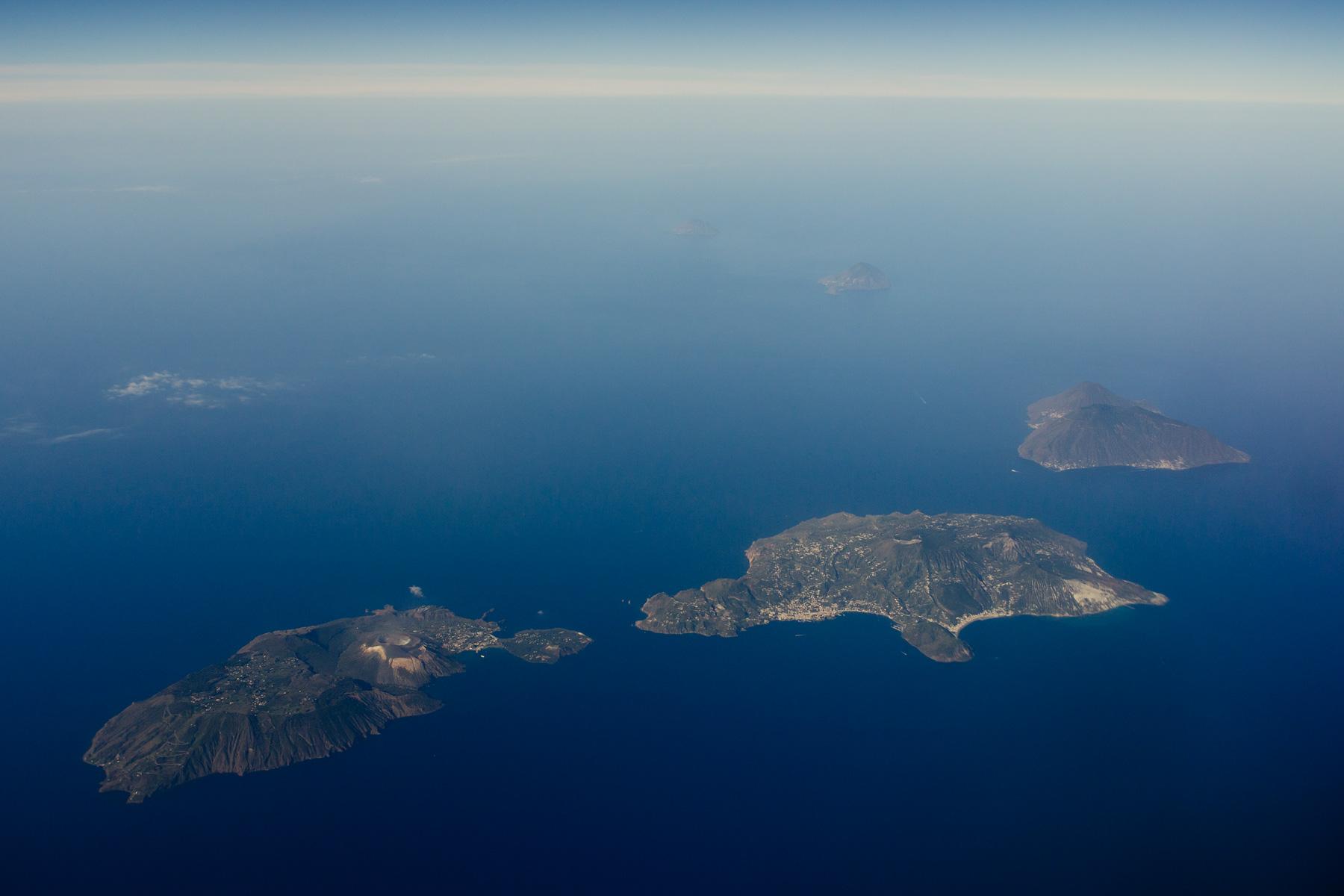 Aeolian Islands area overview
Salina
Salina is an Aeolian island of vineyards, caper cultivation and two conspicuous mountain masses. Fossa delle Felci and Monte dei Porri give it a recognisable silhouette from the sea; villages and agricultural land occupy the lower slopes. The appeal is the combination of cultivated countryside, coastal settlements and walks, rather than an active-crater spectacle like neighbouring Stromboli.
Get to know the placeAeolian Islands
The Aeolian archipelago comprises seven main volcanic islands off northern Sicily: Lipari, Vulcano, Salina, Stromboli, Panarea, Filicudi and Alicudi. Their UNESCO recognition concerns the exceptional record of volcanic landforms and processes. For a traveller, the same geology creates very different holidays, from a museum-rich town to steep footpaths, coastal villages and active volcanic landscapes.
Get to know the place
Rinella
Rinella is Salina’s southern harbour village, in the municipality of Leni. A steep valley descends to a compact waterfront, where passenger boats, fishing traditions and a small black-sand beach sit close together. Its scale makes the arrival memorable: this is a village attached to a working port, rather than a large resort spread along an uninterrupted beach.
Get to know the place
Lipari
Lipari combines the largest island in the Aeolian archipelago with its principal historic town. A fortified headland rises above the waterfront, while the surrounding villages reveal a different landscape of cultivated slopes, volcanic rock and open sea. It works well for a first visit to the islands because you can devote a day to archaeology and still explore a quieter coast without changing accommodation.
Get to know the placePhoto credits3
- Area image: Aeolian Islands — Aeolian Islands area overviewLiparic Islands. Author: Wolfram Schubert from Germany. Credit: Liparic Islands. License: CC BY 2.0 (https://creativecommons.org/licenses/by/2.0). Source: https://commons.wikimedia.org/wiki/File:Liparic_Islands.jpgCropped to fit the display.
- Depicts: RinellaX2.26 Rinella und Leni (Salina). Author: Falk2. Credit: Own work. License: CC BY-SA 4.0 (https://creativecommons.org/licenses/by-sa/4.0). Source: https://commons.wikimedia.org/wiki/File:X2.26_Rinella_und_Leni_(Salina).jpgCropped to fit the display.
- Depicts: LipariAerial image of Lipari (view from the southwest). Author: Carsten Steger. Credit: Own work. License: CC BY-SA 4.0 (https://creativecommons.org/licenses/by-sa/4.0). Source: https://commons.wikimedia.org/wiki/File:Aerial_image_of_Lipari_(view_from_the_southwest).jpgCropped to fit the display.
