
Porto Venere.
Porto Venere sits on a rocky promontory at the entrance to the Gulf of Poets. Its compact waterfront and steep lanes reward exploring on foot: tall houses face the harbour, the Doria fortress rises behind them, and San Pietro stands at the exposed end of the headland. The scenery changes quickly as you move from the sheltered waterfront towards the open sea.
Photo credits1
- Depicts: Porto VenerePortovenere - Comune di Porto Venere - 2023-09-08 21-17-00 001. Author: Caba2011. Credit: Own work. License: CC BY-SA 4.0 (https://creativecommons.org/licenses/by-sa/4.0). Source: https://commons.wikimedia.org/wiki/File:Portovenere_-_Comune_di_Porto_Venere_-_2023-09-08_21-17-00_001.jpgCropped to fit the display.
Make your way to Porto Venere
Choose a tool and your dates to check the options for your trip.
More ways to explore
- Country
- Italy
- Currency
- EUR
- Time zone
- Europe/Rome
Porto Venere sits on a rocky promontory at the entrance to the Gulf of Poets. Its compact waterfront and steep lanes reward exploring on foot: tall houses face the harbour, the Doria fortress rises behind them, and San Pietro stands at the exposed end of the headland. The scenery changes quickly as you move from the sheltered waterfront towards the open sea.
The village and the islands of Palmaria, Tino and Tinetto form part of the UNESCO cultural landscape shared with the Cinque Terre. Porto Venere is nevertheless a separate destination, with no railway station. Give the old town time of its own, then choose an island walk or a Gulf excursion that fits the season and your return transport.
When to go
Spring and autumn suit a village visit combined with a properly equipped walk in the regional park. Summer brings beach activity and the Madonna Bianca celebration traditionally held on 17 August; check the year’s actual programme. Doria Castle’s ordinary winter calendar is more limited than its April–October programme. Coastal boats also use seasonal schedules, with a distinct winter trip advertised for late 2026. That does not mean every summer stop runs throughout winter. In poor sea conditions, focus on the mainland and confirm the bus connection back to La Spezia.
Getting there
La Spezia Centrale is the rail gateway. Continue by ATC towards Porto Venere, using the operator’s current stops and timetable rather than assuming the bus is directly beside the railway platform. Pisa and Genoa are relevant airport approaches through onward ground transport. Boats can connect the village with La Spezia, Lerici, Palmaria and the Cinque Terre when their particular services operate. Use the named operator’s landing and distinguish a transfer from a sightseeing cruise. A route’s inclusion on a tourism map is not confirmation of a departure on your travel date.
Getting around
Walk the old village, allowing for steps and inclines between the waterfront, churches and castle. The ATC P connection is useful for the road corridor back towards La Spezia; check stops for Le Grazie or Fezzano before boarding. On Palmaria, match your chosen path to the arrival and return landing and keep sufficient time for the final boat. A three-island cruise usually describes scenery seen from the water; it should not be understood as permission to land on each island. Confirm mobility assistance for the actual vessel and landing.
Local food
Local menus draw on both fishing and cultivation. Muscoli are mussels, often served with pasta or stuffed; a traditional filling can include bread, milk, eggs and cheese, so ask about ingredients. Mesciua is a mixed pulse-and-grain soup, while seasonal vegetables also appear in minestrone and savoury pies. The area’s food tradition includes rice cake and the Easter pasqualina. Buccellato provides a simple sweet finish. Look for an actual local menu rather than expecting every restaurant on the same waterfront to offer identical dishes or sourcing.
What to see
San Pietro combines older Romanesque fabric with a later Gothic church, making the building more interesting than its famous seaward silhouette alone. San Lorenzo contains the devotional image of the Madonna Bianca and other historic artworks. Climb towards Doria Castle for its fortifications and layered views, checking its seasonal opening beforehand. For a different historical period, the Roman Villa of Varignano at Le Grazie preserves residential rooms, oil-production remains, baths and a cistern. That archaeological site is outside the main village and needs a separate journey.
Towns and neighbourhoods
The central carugio and waterfront Palazzata of tall houses give Porto Venere its distinctive dense shape. The side towards Via dell’Olivo extends the coastal setting beyond the oldest lanes. Le Grazie and Fezzano are separate inhabited bays along the approach from La Spezia, each with its own maritime character. Palmaria lies across the channel and is an island excursion, not a pedestrian continuation of the village. Choose one side trip rather than trying to cover every bay and island between an arriving and departing boat.
Coast and outdoors
Via dell’Olivo has beach areas and bathing establishments, while Palmaria offers a different coastline reached by boat. Select the island landing before planning a walk: Terrizzo and Pozzale are not interchangeable starting points. The park describes the full Palmaria circuit as a medium-difficulty hike of roughly three and a half hours, with abrupt changes in height and steep sections. It is not a flat stroll around the shore. The rocky Arpaia–Byron inlet is a dramatic viewpoint; do not turn a scenic photograph into an assumption of safe swimming or unrestricted access.
Where to stay
The historic centre suits evenings among the lanes and an early walk to San Pietro, but confirm stairs and luggage arrangements. The Via dell’Olivo side may be more convenient for a beach-focused stay, depending on the exact address. Le Grazie and Fezzano offer a different bay setting and involve an additional journey to the main monuments. Staying in La Spezia instead gives stronger rail access but changes the evening-return plan. Compare the final walk from parking or bus stop, not simply a property’s municipality label.
Useful before you go
Parking rules and charges vary by zone and season, including the Cavo area; read the current signs and arrange unloading with your accommodation. The Varignano museum states that its archaeological area is not physically accessible to visitors with walking limitations, although it offers digital interpretation near the entrance. Ask specifically about the visit you can make. Tino is a restricted naval island, open only for authorised visits or announced occasions. For park walks, check current route conditions, carry water and suitable footwear, and leave protected plants and remains undisturbed.
Good to know before you go
Is Porto Venere one of the five Cinque Terre villages?
No. It is a separate village within the same wider UNESCO cultural landscape. It also has different transport arrangements.
Can I arrive directly by train?
No railway station serves Porto Venere. Continue from La Spezia by bus, road transfer or an operating passenger-boat service.
Is the Palmaria circuit an easy promenade?
No. The park grades the full circuit as medium difficulty, with steep sections and changes in height. Choose a shorter suitable route if needed.
Does an islands cruise allow me to land on Tino?
Not automatically. Tino is under naval restrictions and requires an authorised visit or an officially announced opening.
Where is the Roman villa?
The Villa of Varignano is at Le Grazie, outside Porto Venere’s main old village. Check its own visiting calendar and physical-access limitations.
Sources & references
These references support the guide. Confirm opening hours, access and travel services before you go.
- 01UNESCO — distinct village and cultural landscape
- 02Regional park — San Pietro and San Lorenzo
- 03Regional park — Doria Castle
- 04Regional park — Porto Venere, Le Grazie and Fezzano
- 05Italian Culture Ministry — Varignano collection and access
- 06Regional park — bathing areas and activities
- 07Regional park — Palmaria circuit and difficulty
- 08Regional park — island identities and Tino restrictions
- 09Regional park — marked paths and preparation
- 10Local tourism consortium — culinary traditions
- 11Local tourism consortium — railway gateway
- 12Regional park — arrivals and Palmaria transport
- 13ATC — tourist road connections
- 14Navigation operator — seasonal2026 programme
- 15Local tourism consortium — parking zones
- 16Municipality — Doria seasonal admission
- 17Regional natural park — visitor conduct rules
Where could the journey go next?
More guides in Italy. Compare the places and check actual connections before combining stops.
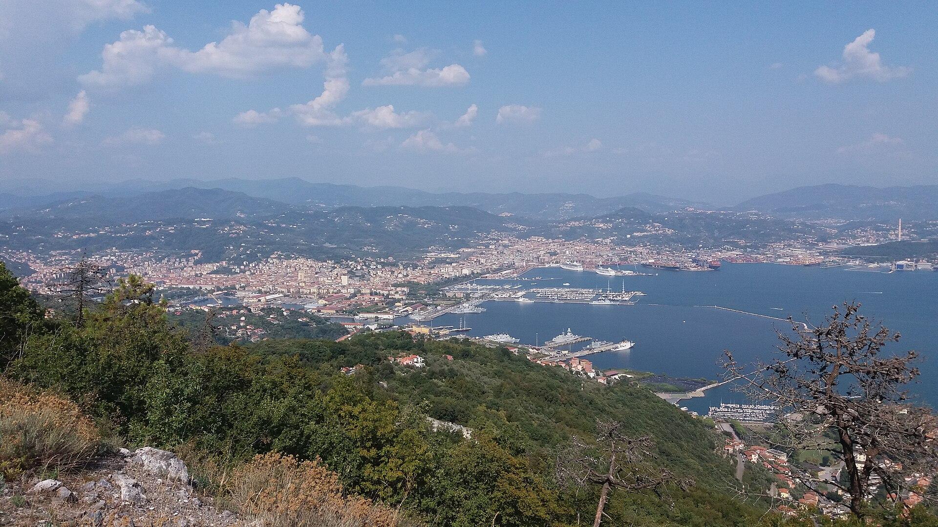
La Spezia
La Spezia sits at the head of the Gulf of Poets, with a working maritime identity and a centre that deserves more than a night between trains. Its pedestrian streets lead to art collections, a hilltop castle and an elegant waterfront, while the naval museum explains a different side of the sea from the neighbouring holiday villages. It is a city base with services and transport connections.
Get to know the place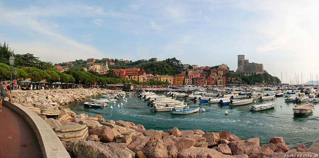
Lerici
Lerici combines a historic harbour town with the nearby villages of San Terenzo and Tellaro on the Gulf of Poets. The castle rises above narrow lanes and a waterfront made for lingering, while the bay offers a gentler setting than the cliffs on the Cinque Terre coast. A walk between the two castles gives the area a clear shape before you explore farther.
Get to know the place
Riomaggiore
Riomaggiore rises in a steep fold of the Ligurian coast, with tall coloured houses above a small working marina. It is the first Cinque Terre village when approaching from La Spezia. The view from the water is memorable, but the village also rewards time above the harbour, where churches, lanes and the castle reveal a settlement shaped by both fishing and hillside agriculture.
Get to know the place
Manarola
Manarola is built around a narrow valley and a rocky sea edge, its tall coloured houses rising above fishing boats and small lanes. The harbour view makes an immediate impression, but the vineyards behind it are just as important to understanding the village. Wine growing, stone terraces and old agricultural buildings give the place a character that extends well beyond a photograph.
Get to know the placePhoto credits4
- Depicts: La SpeziaSpezia. Author: Zucchero82. Credit: Own work. License: CC BY-SA 4.0 (https://creativecommons.org/licenses/by-sa/4.0). Source: https://commons.wikimedia.org/wiki/File:Spezia.jpgCropped to fit the display.
- Depicts: LericiLerici-02. Author: www.thhe.dk. Credit: Own work. License: CC BY-SA 3.0 (https://creativecommons.org/licenses/by-sa/3.0). Source: https://commons.wikimedia.org/wiki/File:Lerici-02.jpgCropped to fit the display.
- Depicts: RiomaggioreThis Photo was taken by Timothy A. Gonsalves . Feel free to use my photos, but please mention me as the author. I would much appreciate if you send me an email tagooty@yahoo.com or write on my talk page , for my information. Please contact me before commercial use. Please do not upload an edited image here without consulting me. I would like to make corrections only at my own source to ensure that the changes improve the image and are preserved. Otherwise you may upload an edited image with a new name. Please use one of the templates derivative or extract .Wikimedia CommonsCC BY-SA 4.0Riomaggiore From Ferry Cinque Terre Italy Sep23 A7C 07414. Author: This Photo was taken by Timothy A. Gonsalves . Feel free to use my photos, but please mention me as the author. I would much appreciate if you send me an email tagooty@yahoo.com or write on my talk page , for my information. Please contact me before commercial use. Please do not upload an edited image here without consulting me. I would like to make corrections only at my own source to ensure that the changes improve the image and are preserved. Otherwise you may upload an edited image with a new name. Please use one of the templates derivative or extract .. Credit: Own work. License: CC BY-SA 4.0 (https://creativecommons.org/licenses/by-sa/4.0). Source: https://commons.wikimedia.org/wiki/File:Riomaggiore_From_Ferry_Cinque_Terre_Italy_Sep23_A7C_07414.jpgCropped to fit the display.
- Depicts: ManarolaThis Photo was taken by Timothy A. Gonsalves . Feel free to use my photos, but please mention me as the author. I would much appreciate if you send me an email tagooty@yahoo.com or write on my talk page , for my information. Please contact me before commercial use. Please do not upload an edited image here without consulting me. I would like to make corrections only at my own source to ensure that the changes improve the image and are preserved. Otherwise you may upload an edited image with a new name. Please use one of the templates derivative or extract .Wikimedia CommonsCC BY-SA 4.0Manarola NW Cinque Terre Sep23 A7C 07233. Author: This Photo was taken by Timothy A. Gonsalves . Feel free to use my photos, but please mention me as the author. I would much appreciate if you send me an email tagooty@yahoo.com or write on my talk page , for my information. Please contact me before commercial use. Please do not upload an edited image here without consulting me. I would like to make corrections only at my own source to ensure that the changes improve the image and are preserved. Otherwise you may upload an edited image with a new name. Please use one of the templates derivative or extract .. Credit: Own work. License: CC BY-SA 4.0 (https://creativecommons.org/licenses/by-sa/4.0). Source: https://commons.wikimedia.org/wiki/File:Manarola_NW_Cinque_Terre_Sep23_A7C_07233.jpgCropped to fit the display.
