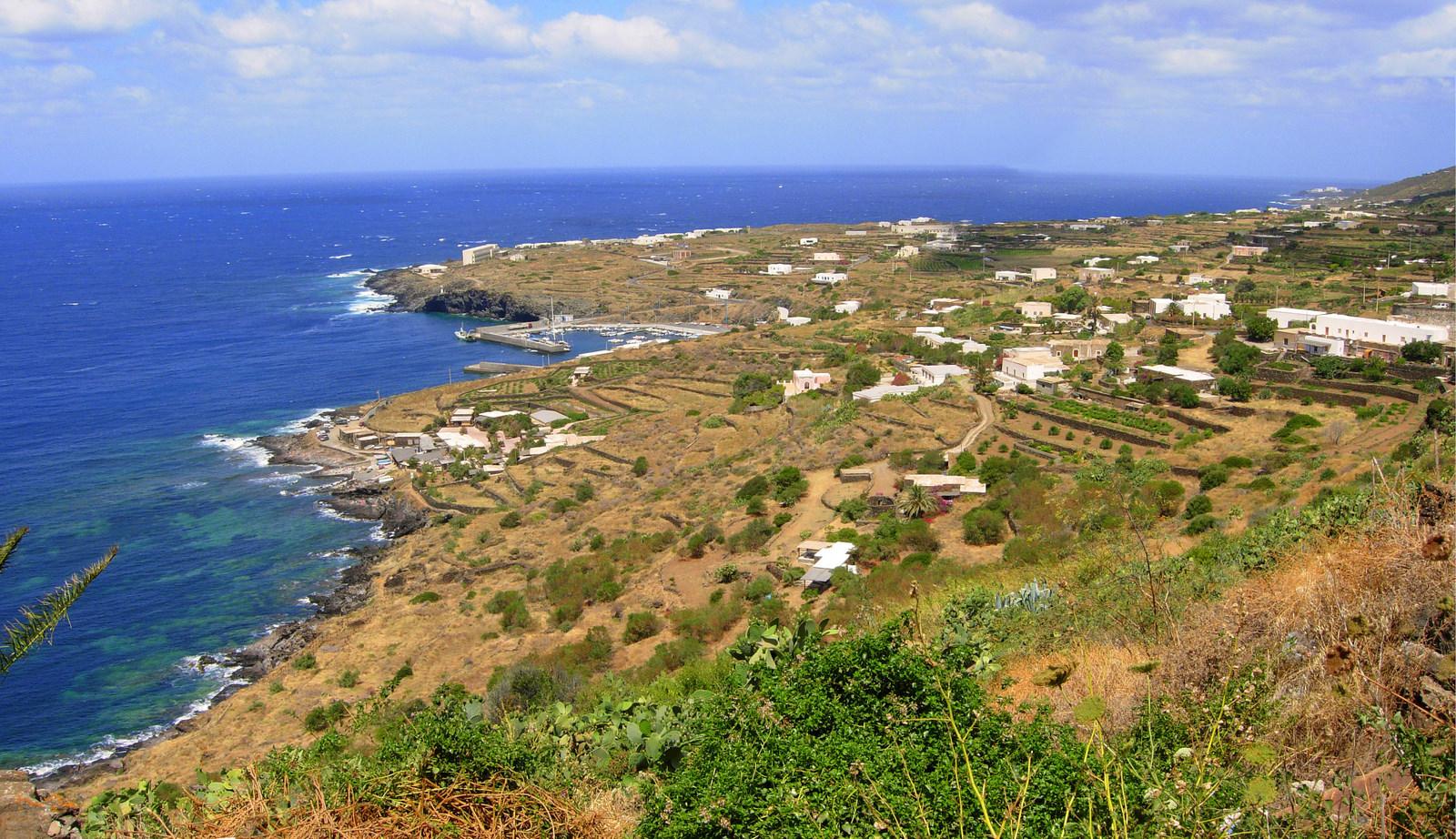
Pantelleria.
Pantelleria combines a compact harbour town with a lava-built coast and an inland landscape of dry-stone walls, vineyards and traditional dammusi. Between Sicily and Tunisia, the island rewards an interest in farming and volcanic geology as much as swimming. Its most recognisable buildings have thick stone walls and vaulted roofs, closely connected to the rural landscape.
Photo credits1
- Depicts: PantelleriaPantelleria sulla Costa. Author: Goldmund100. Credit: Own work. License: CC BY-SA 3.0 (https://creativecommons.org/licenses/by-sa/3.0). Source: https://commons.wikimedia.org/wiki/File:Pantelleria_sulla_Costa.jpgCropped to fit the display.
Make your way to Pantelleria
Choose a tool and your dates to check the options for your trip.
More ways to explore
- Country
- Italy
- Currency
- EUR
- Time zone
- Europe/Rome
Pantelleria combines a compact harbour town with a lava-built coast and an inland landscape of dry-stone walls, vineyards and traditional dammusi. Between Sicily and Tunisia, the island rewards an interest in farming and volcanic geology as much as swimming. Its most recognisable buildings have thick stone walls and vaulted roofs, closely connected to the rural landscape.
Plan a stay around several contrasting areas: archaeology near the main town, the lake and agricultural interior, then selected coastal accesses such as those around Scauri or the eastern coves. A beautiful view does not always mean easy entry to the sea. Allow time to choose outings according to wind, road access and park advice, rather than trying to complete every named attraction in one circuit.
When to go
Spring and autumn can suit walks and agricultural landscapes, while summer calls for early starts on exposed paths and careful water planning. Wind matters for boats and coastal access in every season. The hydrofoil programme is seasonal: the published 2026 Pantelleria schedule covers 1 June to 31 October, so it cannot establish winter or next-year departures. Rural accommodation and activities may have their own opening periods. Choose dates around the experiences that matter to you and verify the relevant seasonal programme before booking onward travel.
Getting there
Pantelleria has an airport and a sea link from Trapani. Caronte & Tourist’s ferry information describes a crossing of several hours; confirm the actual vessel, terminal and duration for your date. Liberty Lines publishes a seasonal fast-passenger programme separately. Its current security notice requires arrival at the port at least one hour before departure and identity details matching the ticket. If bringing a vehicle, check applicable landing restrictions as well as carriage availability. Leave a buffer between island travel and a separate flight connection.
Getting around
A hire car or arranged transfer can help link scattered districts, rural accommodation and coast roads. Municipal buses are another option, but read the applicable dated timetable: the municipality’s June 2026 publication is a summer programme, not proof of year-round frequency. Walking routes need their own preparation. The park requires closed footwear with grippy soles, marked-path use and checking actual passability. It discourages trail access under yellow weather warnings and closes the network under orange or red alerts. Do not use a scooter or car as permission to enter walking trails.
Local food
Agriculture is central to Pantescan cooking. Look for the island’s protected capers, tomatoes and local wine rather than assuming every traditional meal is based on fish. Ravioli amari are savoury filled pasta: the park’s recipe uses ricotta or tumma cheese and mint, with tomato sauce or other dressings. The word amari does not make them a dessert. Zibibbo grapes are associated with the island’s wine culture, including passito. Arrange producer visits directly, and ask about dairy, nuts and other ingredients in individual preparations.
What to see
The castle beside the old harbour introduces the main town. At San Marco and Santa Teresa, the archaeological acropolis preserves Punic and Roman layers, including terraces and cisterns; check access arrangements for the areas you intend to visit. Mursia and its associated sesi tombs reveal a much earlier Bronze Age community. Inland, the low bush vines and dry-stone architecture are cultural sights in their own right. UNESCO recognition concerns the traditional vine-growing practice, not a blanket World Heritage designation for every part of the island.
Towns and neighbourhoods
Pantelleria town is the main services and harbour base. Scauri is a separate settlement and port area on the southwestern coast, not another name for the northern harbour. The agricultural districts scattered inland offer a different atmosphere from either port. On the eastern side, Khamma and Tracino provide context for exploring the coves around that coast. Choose one area at a time and check the road approach: an accommodation address labelled simply Pantelleria may refer to anywhere on the island.
Coast and outdoors
Expect lava platforms, coves and rocky approaches rather than an island ringed by sandy beaches. Cala Levante, Cala Tramontana and the Arco dell’Elefante are recognisable eastern coastal landmarks; sea entry remains a separate judgement about waves and footing. The lake, also called Bagno dell’Acqua or Specchio di Venere, is a protected hydrothermal ecosystem. Thermal outlets can be very hot. Treat it as a natural site with conservation rules, not a supervised spa, and follow current instructions around restoration work and sensitive shoreline areas.
Where to stay
Choose the main town for convenient access to harbour services and everyday supplies. Scauri can suit a stay focused on the southwestern side, while eastern districts make sense when nearby coves and rural scenery are the priority. A dammuso offers a distinctive setting, but confirm driving access, stairs, heating or cooling, and the distance to food shops. A remote house is a different practical choice from a town room. Ask how transfers work if a flight or ferry arrives later than expected.
Useful before you go
Before hiking near Monte Gibele, check the park’s current notices. Its 11 December 2025 warning identified affected sections of paths 971 and 977 because of unexploded ordnance; do not infer reopening merely because a route remains on the general trail list. This does not describe a closure of the entire island. Respect barriers and seek an alternative confirmed-open walk. At the lake, follow the conservation guidance, avoid disturbing mud and shoreline habitats, and do not rely on promotional claims about medical benefits or universally safe bathing.
Good to know before you go
Is Pantelleria mainly a sandy-beach island?
No. Much of the coast is rocky, with coves and lava platforms. Assess access and sea conditions at each location.
What is the UNESCO recognition for?
It recognises the traditional practice of cultivating low bush vines. It is not a designation of the whole island as a World Heritage property.
Can I assume the hydrofoil runs all winter?
No. The published 2026 Pantelleria programme is seasonal. Check a timetable covering your exact date and consider the ferry or airport separately.
Are the thermal waters a supervised spa?
No. The lake and coastal thermal features are natural environments, with potentially hot outlets and conservation requirements.
Are all park paths available?
No. Check current notices and weather restrictions. A dated warning affects sections near Monte Gibele; a route appearing on a map does not prove it has reopened.
Sources & references
These references support the guide. Confirm opening hours, access and travel services before you go.
- 01Sicily tourism — coast and cultural overview; therapeutic and rough-sea bathing claims excluded
- 02Regional archaeological park — Mursia and acropolis; inconsistent exact dating excluded
- 03National park — dammuso architecture
- 04National park — precise intangible UNESCO recognition
- 05National park — agricultural food traditions
- 06National park — savoury ravioli ingredients
- 07National park — lake geology and hydrothermal ecosystem
- 08National park — July 2026 lake conservation work
- 09National park — footwear, weather alerts and trail rules
- 10National park — 11 December 2025 Monte Gibele closure notice; reopening not assumed
- 11Destination organisation — island mobility and distinct ports; old flight programmes excluded
- 12Ferry operator — Trapani and vehicle limitations
- 13Hydrofoil operator — dated 2026 seasonal programme
- 14Hydrofoil operator — identity and one-hour port arrival notice
- 15Municipality — dated summer bus publication, not winter timetable
Where could the journey go next?
More guides in Italy. Compare the places and check actual connections before combining stops.
 Sicily area overview
Marsala
Marsala brings together a walkable historic centre, a working wine tradition and the shallow Stagnone lagoon on Sicily’s western coast. Its name is familiar from fortified wine, but the city also tells the story of ancient Lilybaeum, maritime trade and Garibaldi’s landing. A route through the streets and museum makes sense even when the sea is unsuitable for an excursion.
Get to know the place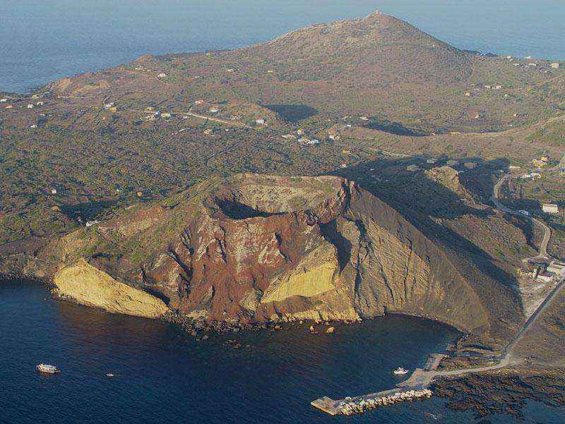
Linosa
Linosa is the volcanic member of the Pelagie islands, with dark hills, lava-shaped shores and one small settlement. It feels different from limestone Lampedusa: the contrast is visible in the coastline, the slopes above the houses and the cultivated ground between old volcanic features. Walking, suitable sea access and time in the village make a more satisfying visit than a hurried checklist.
Get to know the place
Favignana
Favignana combines the working history of the Egadi Islands with coves cut into pale limestone. Around the harbour, the former Florio tuna works explain how fishing and processing shaped island life. Beyond the village, the coastline changes between sandy pockets, rock shelves and old quarry faces, so choosing the right swimming spot matters as much as choosing a view.
Get to know the place
Marettimo
Marettimo is the westernmost of the three main Egadi islands, a mountainous place with one compact village and a coast shaped by cliffs, caves and protected water. The settlement gives you a practical harbour base, while paths quickly lead into a very different landscape. It suits visitors who enjoy walking and boat excursions more than a sequence of beach clubs or a driving circuit.
Get to know the placePhoto credits4
- Area image: Sicily — Sicily area overview
- Depicts: LinosaLinosa 2. Author: fab.. Credit: linosa_2 Uploaded by Markos90. License: CC BY 2.0 (https://creativecommons.org/licenses/by/2.0). Source: https://commons.wikimedia.org/wiki/File:Linosa_2.jpgCropped to fit the display.
- Depicts: FavignanaFavignana e la tonnara. Author: Luce61. Credit: Own work. License: CC BY-SA 4.0 (https://creativecommons.org/licenses/by-sa/4.0). Source: https://commons.wikimedia.org/wiki/File:Favignana_e_la_tonnara.jpgCropped to fit the display.
- Depicts: MarettimoMarettimo-panorama. Author: jim from Lausanne, Switzerland. Credit: Marettimo. License: CC BY-SA 2.0 (https://creativecommons.org/licenses/by-sa/2.0). Source: https://commons.wikimedia.org/wiki/File:Marettimo-panorama.jpgCropped to fit the display.
