
Capraia Isola.
Capraia is a volcanic island of the Tuscan Archipelago, with a harbour below a small hilltop village and a much larger landscape of scrub, ridges and rocky coast. Its appeal lies in combining a quiet waterfront evening with time on foot or on the water. This is a place to choose a few outings carefully rather than fill a schedule with road trips.
Photo credits1
- Depicts: Capraia IsolaCapraia Isola panorama 01. Author: Luca Aless. Credit: Own work. License: CC BY-SA 4.0 (https://creativecommons.org/licenses/by-sa/4.0). Source: https://commons.wikimedia.org/wiki/File:Capraia_Isola_panorama_01.JPGCropped to fit the display.
Make your way to Capraia Isola
Choose a tool and your dates to check the options for your trip.
More ways to explore
- Country
- Italy
- Currency
- EUR
- Time zone
- Europe/Rome
Capraia is a volcanic island of the Tuscan Archipelago, with a harbour below a small hilltop village and a much larger landscape of scrub, ridges and rocky coast. Its appeal lies in combining a quiet waterfront evening with time on foot or on the water. This is a place to choose a few outings carefully rather than fill a schedule with road trips.
The national park protects much of the island and parts of the surrounding sea. A boat outing can reveal the colour of Cala Rossa's cliffs, while inland trails tell a different story through old agricultural terraces and the former penal colony. The village, coast and hiking country each need a different pace and level of preparation.
When to go
Spring and autumn are good times to prioritise walking, with the route chosen for weather and daylight. Summer suits sea outings, but exposed inland climbs need an early start and enough water. Outside the main visitor season, build plans around confirmed accommodation and food openings. Treat favourable swimming conditions as a daily judgement rather than a promise attached to a calendar month.
Getting there
Toremar operates the Livorno–Capraia ferry route. Use the precise departure information on your booking to reach the correct Livorno embarkation area; the city's port has several different functions. Check both directions before committing to a short stay. Leave a comfortable buffer for mainland rail or air travel, since an island crossing should not be treated as a guaranteed tight connection.
Getting around
Walking is central to a visit, including the climb between the harbour and village. Ask your accommodation about luggage transfer if that climb is unsuitable. Small-boat outings give another view of the coast when operating and when sea conditions allow. For inland exploration use the park's trail map, not a straight-line distance: the Stagnone and Zenobito circuits are classified as demanding walks.
Local food
Totano, a type of squid, is a strong part of the island's food identity and appears in stuffed and other seafood preparations. Local products also include goat cheese, honey and preserves. Ask which items are made on the island and what is available that day. The autumn squid festival can be a reason for a visit, but confirm the current programme before arranging travel around it.
What to see
Fort San Giorgio and the coastal towers recall the island's defensive history. Walk through the upper village to San Nicola church and its main square. For another layer of history, explore an authorised route through the former agricultural penal colony. Santo Stefano is an inland church on the walking network, so do not expect all the island's churches to sit on one short village circuit.
Towns and neighbourhoods
Porto is the arrival point and waterfront settlement; Paese is the village uphill. Their proximity on a map can hide the climb between them. Beyond these inhabited centres, routes enter open country rather than a chain of serviced neighbourhoods. Choose a day's walking endpoint deliberately, particularly if you need to return to the port with time before boarding.
Coast and outdoors
Most of the coast is rocky. Cala della Mortola is known for sand, but its presence and extent change with currents and wind. For Cala Rossa, compare a coastal boat visit with the demanding Zenobito walk, which reaches views above the cove rather than an easy beach entrance. Agree any boat pickup and check conditions before being dropped at a remote swimming spot.
Where to stay
Stay by the port for easier ferry arrival and waterfront meals. Choose Paese for the village streets and access towards inland paths, accepting the hill on the way home. Check whether a property is actually in one of these centres or on a more isolated stretch. For a hiking stay, a clear plan for meals and drinking-water supplies is more useful than a room chosen only for its view.
Useful before you go
Marine protection zones have different access rules; the strictest zones prohibit entry even to unpowered boats. Consult the park map before a rental or independent excursion. On land, respect marked routes and do not enter abandoned buildings merely because a path passes nearby. Download the route and tell someone your walking plan, especially for an exposed circuit away from the settlements.
Good to know before you go
Is there a reliable sandy-beach option?
Mortola is known for sand, but wind and currents can change how much is present. Much of Capraia has rocky coastal access.
Does the ferry arrive at the upper village?
It arrives at the harbour, below Paese. Account for the uphill journey and ask about luggage transfer if needed.
Is the Zenobito walk a short beach stroll?
No. The national park classifies the circuit as demanding. It leads to the southern landscape and views above Cala Rossa.
Can I take a kayak anywhere around the island?
No. Strict marine protection zones restrict entry even for unpowered craft. Check the current park zoning before setting out.
Sources & references
These references support the guide. Confirm opening hours, access and travel services before you go.
- 01Tuscan Archipelago National Park: Capraia
- 02Visit Tuscany: Capraia village, history and food
- 03Visit Tuscany: Capraia coast and settlements
- 04National Park: Zenobito hiking route
- 05National Park: Stagnone hiking route
- 06National Park: visiting rules and marine zones
- 07Toremar: Livorno–Capraia route
- 08Toremar: embarkation ports
Where could the journey go next?
More guides in Italy. Compare the places and check actual connections before combining stops.

Elba
Elba combines fortified harbour towns, mining history, wooded hills and many different beaches. Portoferraio is the main arrival town, but it is only one part of the island. A good stay chooses a few nearby areas each day instead of driving the whole coast repeatedly.
Get to know the place
Portoferraio
Portoferraio is Elba's main port, but its fortified old town deserves more than a quick passage after the ferry. Medici walls climb above the harbour, while Napoleon's Palazzina dei Mulini stands high in the historic centre. The combination makes this a useful base for visitors who want culture and coastal time in the same stay.
Get to know the place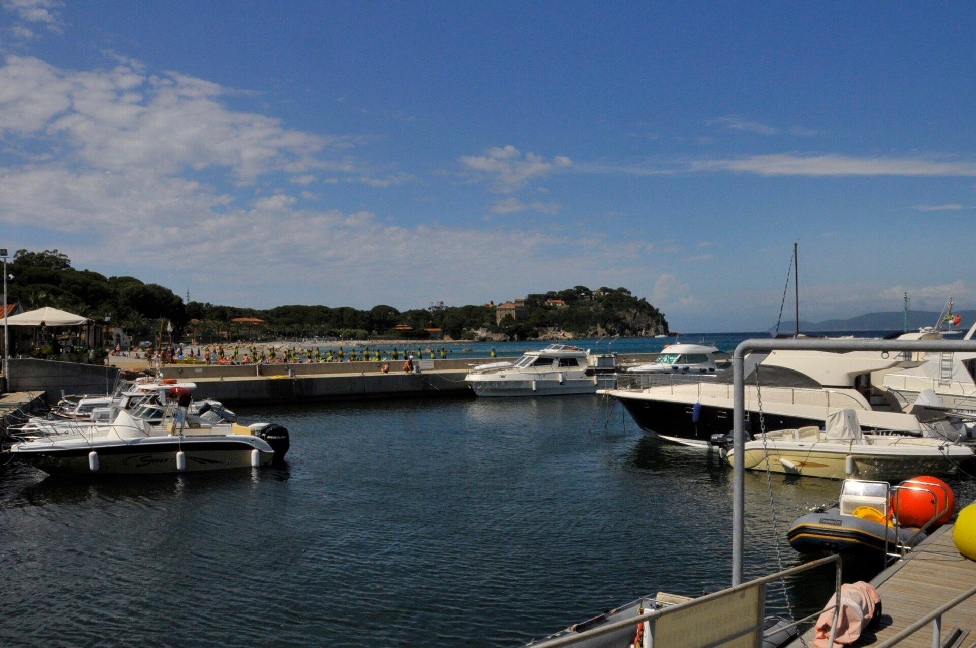 Area near Cavo, Elba
Cavo, Elba
Cavo is a coastal settlement in the municipality of Rio on north-eastern Elba. The landing, beach and waterfront form a compact arrival point, with wooded hills behind them. It is a useful base for the eastern end of the island, but its identity is different from both the mining port of Rio Marina and inland Rio nell’Elba.
Get to know the place
Rio Marina
Rio Marina faces the sea on Elba’s mineral-rich eastern side. Its harbour developed around storing and shipping iron ore, and the reddish mining landscape still gives the town a character distinct from the island’s beach resorts. The waterfront tower, museum and former workings make the industrial story visible within a short stay.
Get to know the placePhoto credits4
- Depicts: Elba
- Depicts: Portoferraio
- Area image: Cavo, Rio Marina, Elba — Area near Cavo, ElbaCavo-CTH. Author: CTHOE. Credit: Own work. License: CC BY-SA 3.0 (https://creativecommons.org/licenses/by-sa/3.0). Source: https://commons.wikimedia.org/wiki/File:Cavo-CTH.JPGCropped to fit the display.
- Depicts: Rio Marina57038 Rio Marina, Province of Livorno, Italy - panoramio. Author: Gianni Mazzantini. Credit: https://web.archive.org/web/20161105112913/http://www.panoramio.com/photo/123250518. License: CC BY 3.0 (https://creativecommons.org/licenses/by/3.0). Source: https://commons.wikimedia.org/wiki/File:57038_Rio_Marina,_Province_of_Livorno,_Italy_-_panoramio.jpgCropped to fit the display.
