
Camaret-sur-Mer.
Camaret-sur-Mer sits at the western end of the Crozon peninsula, where colourful harbourfront houses face boats and a long protective sillon. The golden Vauban tower, seafarers' chapel and old boat hulls give a short waterfront walk real depth before you head farther into the peninsula's heath and cliff landscape.
Photo credits1
- Depicts: Camaret-sur-Mer
Make your way to Camaret-sur-Mer
Choose a tool and your dates to check the options for your trip.
More ways to explore
- Country
- France
- Currency
- EUR
- Time zone
- Europe/Paris
Camaret-sur-Mer sits at the western end of the Crozon peninsula, where colourful harbourfront houses face boats and a long protective sillon. The golden Vauban tower, seafarers' chapel and old boat hulls give a short waterfront walk real depth before you head farther into the peninsula's heath and cliff landscape.
Stay in Camaret for its own maritime character rather than treating it only as an island-transfer point. The town, Crozon and Morgat are separate places. Island services from Camaret are seasonal, so plan a land-based visit independently of any boat itinerary and check the precise operating period before making a connection.
When to go
Summer brings more visitor activity and the seasonal island option; spring and autumn can suit the harbour and a measured coastal walk. The operator describes its Camaret terminal as closed October–March. Treat the published April 2026 restart as that year's programme, not an automatic promise of identical 2027 dates or winter sailings.
Getting there
Penn Ar Bed identifies its Camaret terminal at Quai Louis Auguste Téphany. A mainland train journey still needs a road leg; the operator describes connections from Quimper and Brest. Use the current coach programme and allow the final walk to the actual embarkation. A translated terminal page mentioning railway does not establish a local passenger station.
Getting around
Explore the harbour on foot, then use current road transport for another Crozon-peninsula settlement or trailhead. Check the return before a long walk. The sillon can be closed in strong-wind alerts, affecting access to the tower as well. Use local instructions rather than treating the waterfront's proximity as an assurance of open access.
Local food
A savoury crêpe or galette makes a straightforward harbour lunch, with the filling chosen from the day's menu. Western Breton usage can call both wheat and buckwheat versions crêpes. For a sweet finish, butter and sugar or salted-butter caramel are regional choices. Ask about the actual batter and filling when ingredients matter.
What to see
Walk towards Notre-Dame de Rocamadour and the Vauban tower on the sillon. The tower forms part of the serial UNESCO Fortifications of Vauban property; the designation does not cover every building in town. Look at the old boat hulls from permitted access. Interior visits depend on the current tower and chapel programme.
Towns and neighbourhoods
The quays provide the compact harbour setting, while the sillon and Téphany embarkation area have different functions. Crozon's centre and Morgat offer separate regional bases. Choose one part of the peninsula for a day's outing instead of assuming a harbour walk also covers its distant headlands, beaches and inland roads.
Coast and outdoors
The peninsula combines sheltered-looking coves, open Atlantic shores, cliffs and heath. Pick a specifically accessible beach and read the day's signs and conditions. For a coastal walk, stay on marked paths and back from fragile cliff edges. Quiet water in a photograph does not establish safe swimming or access along the next headland.
Where to stay
A harbour address suits quayside meals and town heritage; an outlying peninsula property offers a different landscape with added transport. Compare the village, final road and parking with your plans. If an island trip matters, choose accommodation only after confirming the correct port and season, since Camaret is not an all-year substitute for every mainland departure.
Useful before you go
For a first day, combine quays, chapel and the tower area with lunch, then choose a short marked walk. Check actual heritage opening and current wind restrictions before heading onto the sillon. Save road return details and your room address. Old tower calendars and a previous summer's crossings should not determine a future travel day.
Good to know before you go
Is the Vauban tower a UNESCO site?
It is a component of the serial Fortifications of Vauban property, rather than a designation for all Camaret.
Can I assume a Camaret island sailing in winter?
The operator describes the terminal as closed October–March. Check the actual programme.
Is the harbour always accessible during strong wind?
The Vauban network warns that the sillon and tower access can close in wind alerts.
Are Camaret, Crozon and Morgat the same base?
They are separate settlements with their own road journeys and coastal settings.
Sources & references
These references support the guide. Confirm opening hours, access and travel services before you go.
Where could the journey go next?
More guides in France. Compare the places and check actual connections before combining stops.

Brest
Brest is an Atlantic maritime city divided by the Penfeld, with a castle, active ports, rebuilt central streets and new uses for its naval-industrial heritage. Combine the Château's museum with a crossing towards the Ateliers des Capucins, then leave another part of the day for the waterfront or marine science at Océanopolis.
Get to know the place
Le Conquet
Le Conquet combines an active fishing harbour, historic small-town streets and a varied Iroise coast. Stay for the estuary, dunes and shore walks as well as the boats to Molène and Ouessant. The town offers a worthwhile mainland day rather than only a place to leave the car before an island visit.
Get to know the place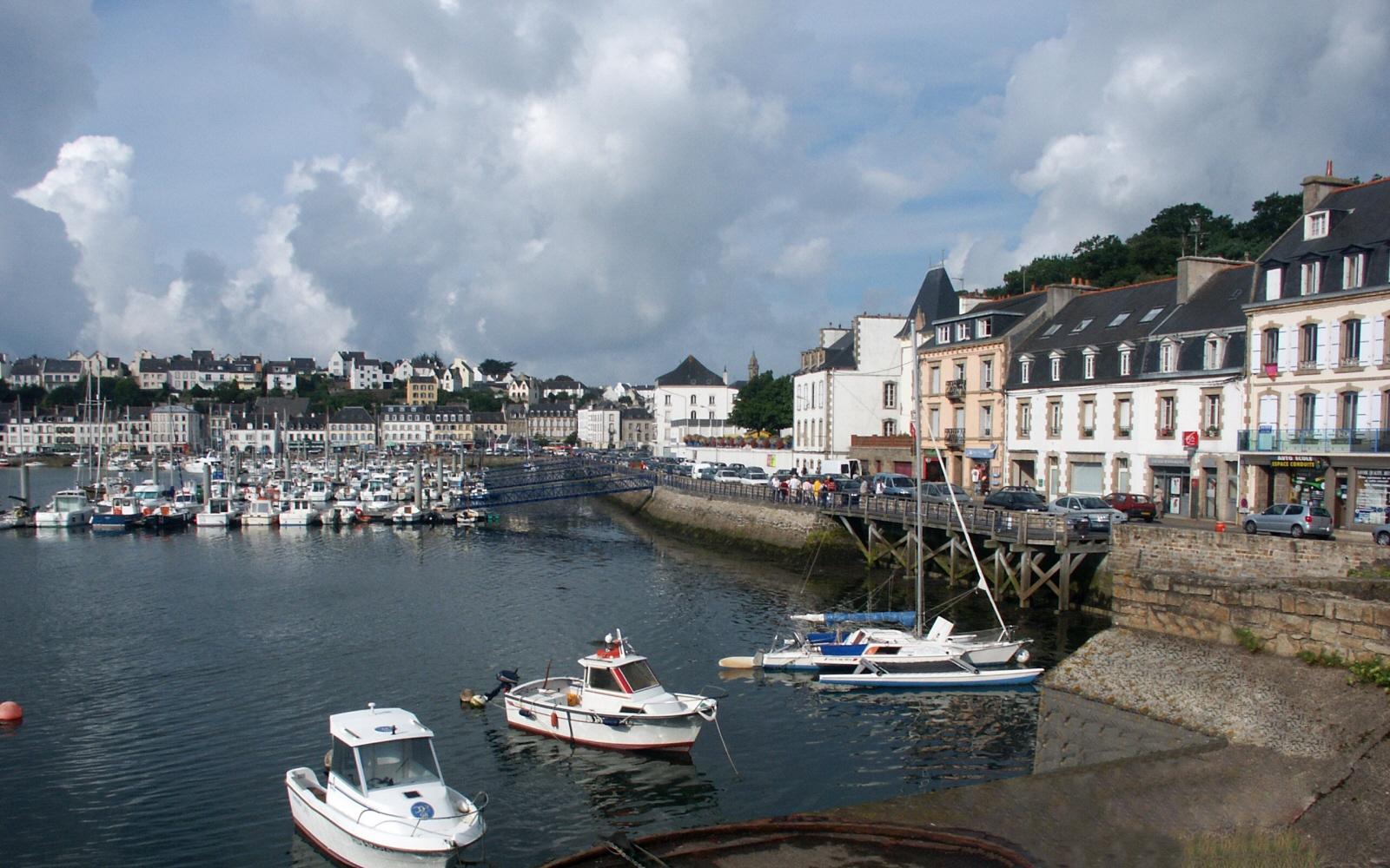
Audierne
Audierne is a small maritime town at the Goyen estuary, with white-fronted streets, fishing and leisure boats and a shore walk towards Trescadec. It works well for a gentle harbour day before exploring Cap Sizun or making a separately booked crossing to the Île de Sein.
Get to know the place
Molène
Molène is a small inhabited island in an archipelago of reefs, islets and shifting Iroise light. Come for the harbour village, sea-rescue memory and a walk at the pace of the tide. An overnight stay changes the visit from a quick stop into time with a working island community.
Get to know the placePhoto credits4
- Depicts: BrestBrest - Le Château - PA00089847 - 011. Author: Thesupermat. Credit: Own work. License: CC BY-SA 3.0 (https://creativecommons.org/licenses/by-sa/3.0). Source: https://commons.wikimedia.org/wiki/File:Brest_-_Le_Ch%C3%A2teau_-_PA00089847_-_011.JPGCropped to fit the display.
- Depicts: Le ConquetLe Conquet (Kermorvan Lighthouse). Author: Alexandre Dulaunoy from Les Bulles, Chiny, Belgium. Credit: Le Conquet (Kermorvan Lighthouse). License: CC BY-SA 2.0 (https://creativecommons.org/licenses/by-sa/2.0). Source: https://commons.wikimedia.org/wiki/File:Le_Conquet_(Kermorvan_Lighthouse).jpgCropped to fit the display.
- Depicts: AudierneAudierne Port. Author: Fafner. Credit: Own work. License: CC BY-SA 3.0 (https://creativecommons.org/licenses/by-sa/3.0). Source: https://commons.wikimedia.org/wiki/File:Audierne_Port.jpgCropped to fit the display.
- Depicts: MolèneAerial image of Île de Molène (view from the southeast). Author: Carsten Steger. Credit: Own work. License: CC BY-SA 4.0 (https://creativecommons.org/licenses/by-sa/4.0). Source: https://commons.wikimedia.org/wiki/File:Aerial_image_of_%C3%8Ele_de_Mol%C3%A8ne_(view_from_the_southeast).jpgCropped to fit the display.
