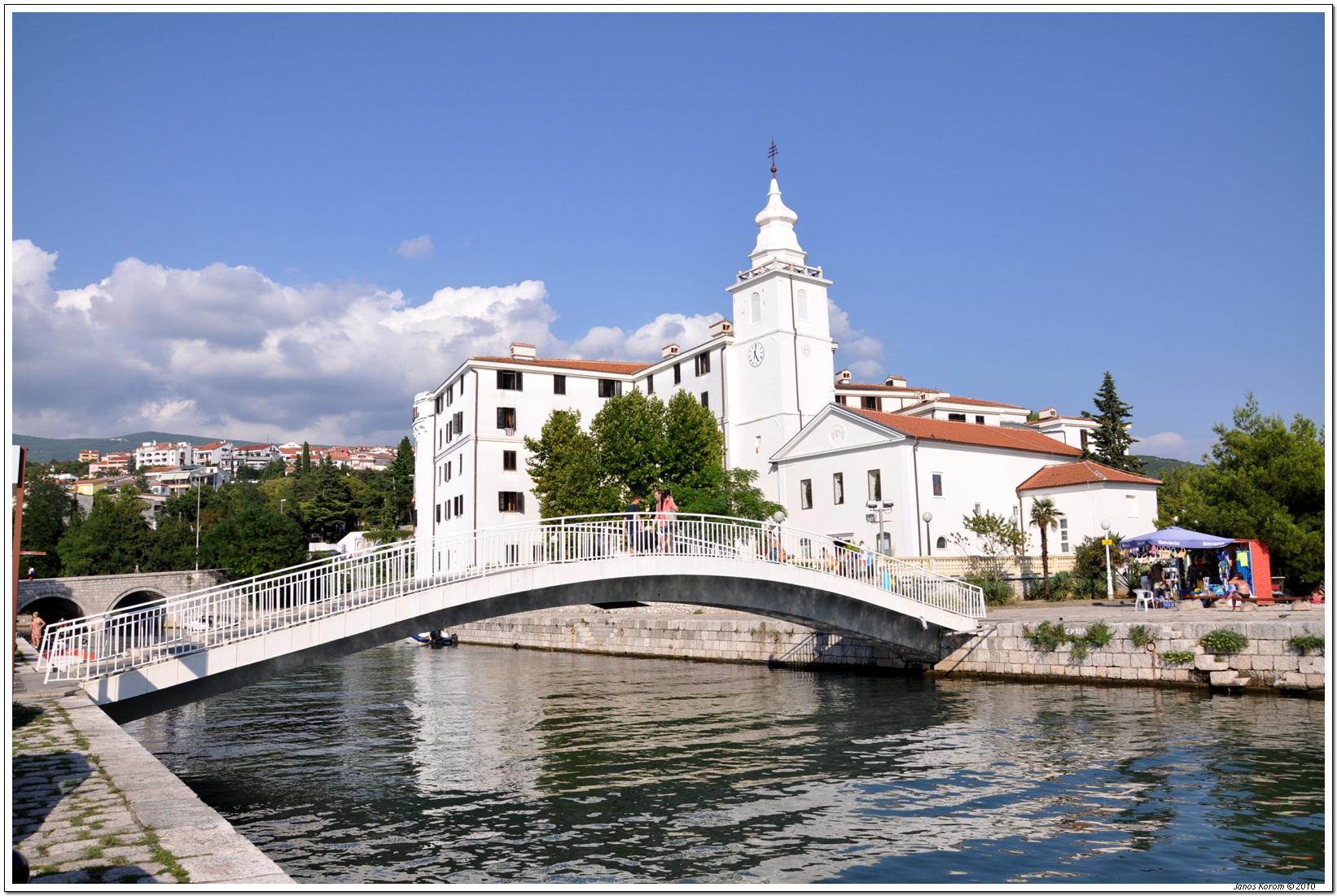
Crikvenica.
Crikvenica is a mainland Kvarner seaside town where a central harbour, bathing beaches and promenades sit below wooded and historic inland routes. It works for a beach holiday with small cultural outings, without requiring a boat for everyday access.
Photo credits1
- Depicts: CrikvenicaCrikvenica 072. Author: János Korom Dr.. Credit: Flickr : Crikvenica 072. License: CC BY-SA 2.0 (https://creativecommons.org/licenses/by-sa/2.0). Source: https://commons.wikimedia.org/wiki/File:Crikvenica_072.jpgCropped to fit the display.
Make your way to Crikvenica
Choose a tool and your dates to check the options for your trip.
More ways to explore
- Country
- Croatia
- Currency
- EUR
- Time zone
- Europe/Zagreb
Crikvenica is a mainland Kvarner seaside town where a central harbour, bathing beaches and promenades sit below wooded and historic inland routes. It works for a beach holiday with small cultural outings, without requiring a boat for everyday access.
The wider Crikvenica Riviera also includes Dramalj, Jadranovo and Selce. They are separate coastal places with their own beaches and addresses. Choose the actual town and neighbourhood that suit your plans instead of assuming every Riviera booking is beside Crikvenica’s harbour.
When to go
Summer brings the main bathing and evening-event rhythm. Outside that period, the centre, museum and selected walking routes can make a shorter visit, with separate opening checks. The published 2026 passenger line 323 covers only a summer interval, so a harbour shown on that itinerary should not be used to promise an October sailing.
Getting there
The tourist board directs visitors to regional buses, Rijeka railway station and Rijeka Airport for onward connections. A mainland road arrival avoids the need for an island crossing. If approaching by sea, check the dated passenger line 323 programme and exact call; it is distinct from regional vehicle ferries to islands.
Getting around
Use the waterfront on foot and consult current local bus, taxi or tourist-train arrangements for a longer Riviera outing. The Love Path is an approximately eight-kilometre walking route, not merely a short seafront promenade. Its fort, former spring and inland viewpoints involve a different outing, so take suitable shoes, water and enough daylight.
Local food
Look for Crkveniške rupice, the fish balls highlighted on the local Oily Fish Route, rather than limiting the meal to generic grilled fish. The tourism board also identifies žlahtina wine from Vinodol and the Frankopan cake tradition. Ask which establishment currently prepares a speciality: an older venue reference is not evidence that its café or kitchen still operates.
What to see
The Town Museum on Petra Preradovića Street introduces archaeological finds, everyday objects, photographs and documents from the Riviera. The Church of the Assumption and St Anthony of Padua offer other stops in town. For an outdoor heritage outing, the Love Path leads towards Badanj fort and viewpoints inland; museum opening and a walking itinerary require separate planning.
Towns and neighbourhoods
The centre is useful for the harbour, museum and meals. The Strossmayer promenade provides a bathing-oriented frontage, while Podvorska is associated with a small harbour and the dog beach. Trips to Dramalj, Jadranovo or Selce broaden the holiday, but confirm the return connection rather than treating these places as adjacent streets.
Coast and outdoors
The main town bathing beach, Gradsko kupalište, is listed as sandy and has a developed range of amenities. Podvorska’s designated dog beach is a different choice with posted rules for owners. Check the exact stretch and current access equipment if mobility matters; beach listings describe facilities, not a guarantee that every seasonal service is staffed on your date.
Where to stay
Choose the centre if meals, museum visits and the harbour matter most. A promenade-side stay prioritises bathing, while a property above the coast may require uphill walking after the beach. The city’s accommodation context includes large hotels such as Miramare and Narrivi alongside other options; compare the precise address and room access rather than assuming identical facilities across the Riviera.
Useful before you go
Pod Veli Kamik on the Love Path is a historic water-supply site; the tourism board says the spring dried up after an earthquake, so do not plan it as a drinking-water refill. With a dog, use designated bathing areas and the posted rules. A walk to a fort ruin does not imply that climbing its masonry is safe or permitted.
Good to know before you go
Are Selce and Dramalj part of the same town centre?
They are separate Riviera places. Check the property address and local transport.
Which beach is the main sandy option?
Gradsko kupalište on the Strossmayer promenade is the town’s listed sandy bathing beach.
Where is the dog beach?
The designated Podvorska beach is by the small harbour; follow its local rules.
Is the Love Path a brief promenade?
No. The described route is about eight kilometres with inland heritage stops and viewpoints.
Can I refill water at the historic spring?
Do not rely on it: the official route account says Pod Veli Kamik dried up.
Sources & references
These references support the guide. Confirm opening hours, access and travel services before you go.
- 01Crikvenica Tourist Board — four distinct Riviera towns
- 02Crikvenica Tourist Board — museum collections and location
- 03Crikvenica Tourist Board — churches and regional heritage
- 04Crikvenica Tourist Board — Love Path, Badanj and former spring
- 05Crikvenica Tourist Board — main sandy bathing beach
- 06Crikvenica Tourist Board — Podvorska dog beach
- 07Crikvenica Tourist Board — oily fish route and local dishes
- 08Crikvenica Tourist Board — Frankopan cake tradition
- 09Crikvenica Tourist Board — transport options
- 10Jadrolinija — dated summer 2026 passenger line 323
- 11City of Crikvenica — 2026 destination management plan and accommodation context
Where could the journey go next?
More guides in Croatia. Compare the places and check actual connections before combining stops.
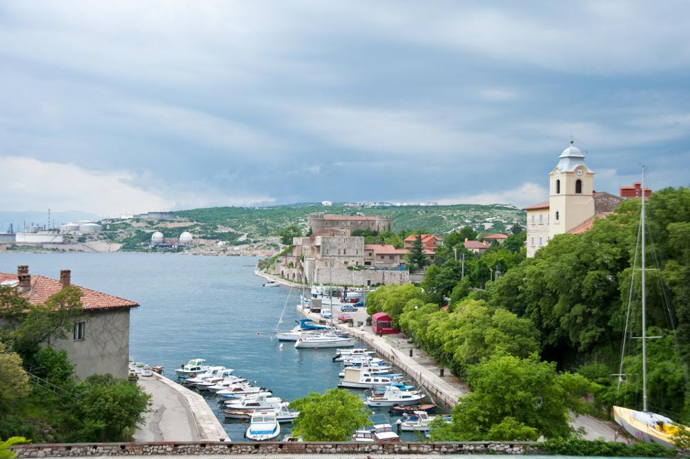
Kraljevica
Kraljevica is a mainland Kvarner town at the entrance to Bakar Bay, close to the approach to Krk. Its harbour and shipbuilding history sit alongside two distinct castle complexes, making a stop here more than a pause on the road to the island.
Get to know the place
Baška
Baška sits at the southern end of Krk, where a long pebble beach curves below rocky hills. The compact old centre and promenade make it an easy place to combine swimming, evening meals and walks into a very different inland landscape.
Get to know the place
Senj
Senj is a compact historic port beneath the mountains, with Nehaj Fortress dominating the skyline above its old streets. The town’s Uskok history and the meeting of coast and Velebit give it a distinct character within northern Adriatic travel.
Get to know the place
Lopar
Lopar occupies the sandy northern part of Rab island, with a different holiday rhythm from the walled town of Rab farther south. Rajska Plaža, also called Paradise Beach, is the familiar starting point, but the peninsula has varied bays and an unusual geological landscape.
Get to know the placePhoto credits4
- Depicts: KraljevicaKraljevica 140510 1. Author: Roberta F.. Credit: Own work. License: CC BY-SA 3.0 (https://creativecommons.org/licenses/by-sa/3.0). Source: https://commons.wikimedia.org/wiki/File:Kraljevica_140510_1.jpgCropped to fit the display.
- Depicts: Baška
- Depicts: SenjSenj přístav a Nehaj 1. Author: VitVit. Credit: Own work. License: CC BY-SA 4.0 (https://creativecommons.org/licenses/by-sa/4.0). Source: https://commons.wikimedia.org/wiki/File:Senj_p%C5%99%C3%ADstav_a_Nehaj_1.jpgCropped to fit the display.
- Depicts: LoparRođenje BDM Lopar. Author: Mudroslov. Credit: Own work. License: CC BY-SA 4.0 (https://creativecommons.org/licenses/by-sa/4.0). Source: https://commons.wikimedia.org/wiki/File:Ro%C4%91enje_BDM_Lopar.jpgCropped to fit the display.
