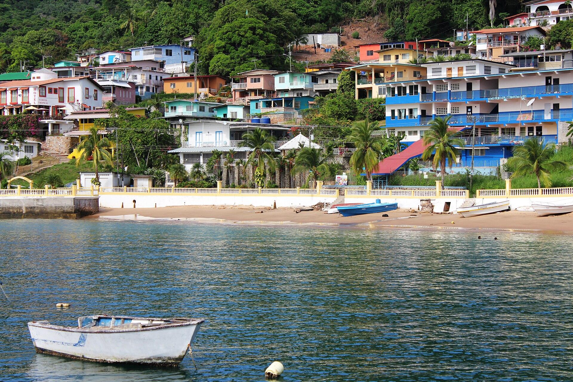
Taboga Island.
Taboga is an inhabited island in the Gulf of Panama, close enough to the capital for a day trip but with its own village life. San Pedro climbs a hillside above the waterfront; narrow lanes, gardens and painted walls make a walk through the settlement part of the visit, alongside time on the sand.
Photo credits1
- Depicts: Taboga IslandTabogaBeach. Author: Ayaita. Credit: Own work. License: CC BY 3.0 (https://creativecommons.org/licenses/by/3.0). Source: https://commons.wikimedia.org/wiki/File:TabogaBeach.JPGCropped to fit the display.
Make your way to Taboga Island
Choose a tool and your dates to check the options for your trip.
More ways to explore
- Country
- Panama
- Time zone
- America/Panama
Taboga is an inhabited island in the Gulf of Panama, close enough to the capital for a day trip but with its own village life. San Pedro climbs a hillside above the waterfront; narrow lanes, gardens and painted walls make a walk through the settlement part of the visit, alongside time on the sand.
A short visit works best with one beach and a village stroll. Stay overnight if you want to add a hill walk without rushing back to the ferry. Taboga is on the Pacific side of Panama, so tides, exposed slopes and the exact return departure matter more to a good day than packing in every possible activity.
When to go
Panama’s Pacific planning pattern is a generally drier December–April period and a wetter remainder of the year. That is climate context, not a daily forecast. During wetter spells, keep hiking flexible and allow time for slippery ground or disrupted boat plans. A hat, drinking water and sun protection are useful even on an overcast crossing.
Getting there
Taboga Express identifies its city check-in at Fuerte Amador Mall on Isla Flamenco, along the Amador Causeway. Use the meeting point printed by your chosen operator: an Amador address alone is not precise enough. Confirm the outward and return sailing, check-in instructions and identification requirement before leaving your hotel. Allow for city traffic on the way to the pier.
Getting around
Plan to explore the village on foot, with shoes suitable for slopes and steps. For an overnight stay, ask the accommodation how to move luggage from the landing point. Keep the hill trail, beach and return pier in a realistic sequence; a ferry booking is a fixed commitment, and a walk finishing late can mean missing it.
Local food
Fish and seafood feature in local dining: the published San Pedro hotel menu includes snapper, corvina, garlic shrimp and ceviche. Taboga Express also lists whole fried fish with sides such as rice or patacones in its day package. Those are examples of actual offerings, not a promise that every kitchen serves the same menu. Ask about preparation, availability and dietary needs.
What to see
Visit San Pedro church and the surrounding lanes for the island’s historic village setting. The tourism authority identifies Cerro del Vigía, Cerro de la Cruz and Las Tres Cruces as walking destinations. Choose a route that fits your fitness and daylight, and ask locally about its condition before climbing. Do not treat a hill viewpoint as an extension of an easy beach walk.
Towns and neighbourhoods
San Pedro is the practical centre for village walks and waterfront activity. Playa Honda and La Restinga have more visitor services, while the upper village and hillsides offer a different outlook. A hillside room can mean a climb with luggage; check the actual approach and collection arrangements rather than choosing only from a sea-view photograph.
Coast and outdoors
Playa Honda suits a beach stop near village services. At La Restinga, a sand connection toward El Morro appears at low tide; it is not a permanent causeway. Check the tide before crossing and leave ample time to return. Playa Piedra Llana is another beach named by the tourism authority. Observe local swimming conditions and keep away from boat movements.
Where to stay
A village or beach-area stay keeps meals and the waterfront convenient. Hillside accommodation offers another setting but requires checking access, especially for limited mobility. Compare the room location, steps, breakfast and any luggage transfer directly with the property. A day pass covering chairs or lunch is different from an overnight room reservation.
Useful before you go
Carry identification and a saved copy of the ferry confirmation. Taboga Express advises bringing cash because it does not list an island ATM; withdraw what you need before boarding and confirm payment methods for your stay. Keep rubbish off the beach, check rules for food, coolers and glass with the operator, and leave spare time for the return check-in.
Good to know before you go
Can I visit Taboga in a day?
Yes, the island is served by day-trip ferries. Reserve a workable outward and return sailing and keep the beach-and-village plan realistic.
Where does Taboga Express check in?
Its published location is Fuerte Amador Mall on Isla Flamenco, Amador Causeway. Follow the latest directions on your ticket.
Can I always walk across to El Morro?
No. The La Restinga sand connection depends on low tide. Check local conditions and the return window before crossing.
Should I choose a beach or hillside room?
Choose the waterfront for simpler access to meals and the landing area; check steps and luggage arrangements carefully for hillside accommodation.
Sources & references
These references support the guide. Confirm opening hours, access and travel services before you go.
- 01Panama tourism authority: village and named hill walks
- 02Panama tourism authority: beach services and accommodation setting
- 03Panama tourism authority: village and hill itinerary
- 04Panama tourism authority: tide-dependent La Restinga connection
- 05Taboga Express: current check-in location, identification and cash advice
- 06Taboga Express: actual day-package menu and inclusions
- 07Hotel San Pedro de Taboga: published restaurant menu
- 08Panama tourism authority: Pacific-side seasonal planning
Where could the journey go next?
More guides in Panama. Compare the places and check actual connections before combining stops.

Panama City
Panama City brings together a modern Pacific skyline, the ruins of an earlier city and the historic streets of Casco Antiguo. It is both a destination and a transport gateway, with canal visits, urban food culture and forest walks close enough to combine over several days. Allow time for each part rather than treating the capital only as an airport stop.
Get to know the place
Contadora Island
Contadora is a small island in the Pearl Islands archipelago, on Panama’s Pacific side. It combines beaches and holiday accommodation with a useful base for boat excursions. Its scale makes a quiet beach stay possible without the urban distances of Panama City, but getting there and moving luggage still need advance planning.
Get to know the place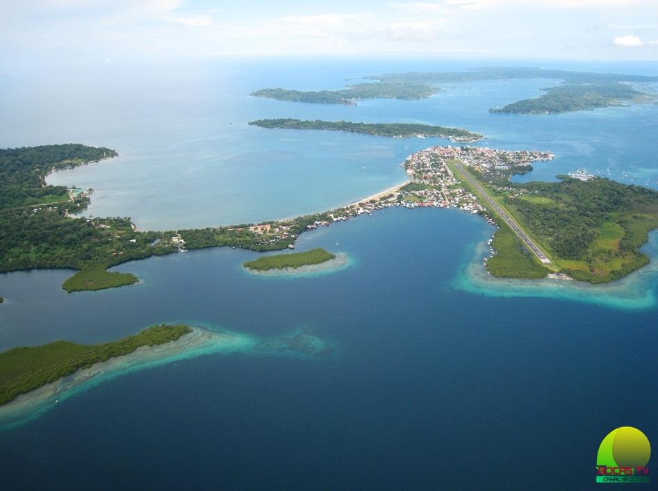 Area overview: Bocas del Toro Province
Chiriquí Grande
Chiriquí Grande is a mainland port town in Bocas del Toro province, despite the name it shares with neighbouring Chiriquí. Its value for travellers is the meeting of road and sea: arrive across the mainland, then continue by passenger boat toward Isla Colón or a prearranged stop along the coastal route.
Get to know the place Local overview of Isla Colón / Bocas Town
Isla Colón / Bocas Town
Isla Colón is the main service island of the Bocas del Toro archipelago, with Bocas Town as its lively waterfront hub. It is a practical base for restaurants, supplies and boats to neighbouring islands, but there is more to it than a transfer dock: the island also has forested areas, coastal roads and very different beach settings.
Get to know the placePhoto credits4
- Depicts: Panama CityPanama Papers. Author: Dronepicr. Credit: Imported from 500px ( archived version ) by the Archive Team . ( detail page ). License: CC BY 3.0 (https://creativecommons.org/licenses/by/3.0). Source: https://commons.wikimedia.org/wiki/File:Panama_Papers_(148830809).jpegCropped to fit the display.
- Depicts: Contadora IslandMain Boulevardmin Contadora. Author: Aworld196. Credit: Own work. License: CC BY-SA 4.0 (https://creativecommons.org/licenses/by-sa/4.0). Source: https://commons.wikimedia.org/wiki/File:Main_Boulevardmin_Contadora.jpgCropped to fit the display.
- Area image: Bocas del Toro Province — Area overview: Bocas del Toro ProvinceBocas2. Author: Panapro. Credit: Bocas TV. License: CC BY-SA 4.0 (https://creativecommons.org/licenses/by-sa/4.0). Source: https://commons.wikimedia.org/wiki/File:Bocas2.jpgCropped to fit the display.
- Area image: This is a picture of the panamanian cultural heritage monument with the ID — local overview of Isla Colón / Bocas Town.Gobernacion, Bocas del Toro, Isla Colón. Author: Charlotte Elton. Credit: Own work. License: CC BY-SA 3.0 (https://creativecommons.org/licenses/by-sa/3.0). Source: https://commons.wikimedia.org/wiki/File:Gobernacion,_Bocas_del_Toro,_Isla_Col%C3%B3n.jpgCropped to fit the display.
