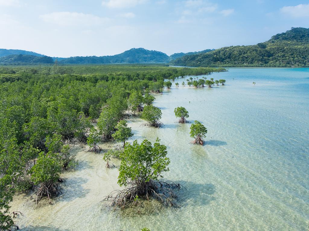
Ohara (Iriomote Island).
Ohara is Iriomote’s southeastern passenger gateway, beside the lower Nakama River and within reach of the island’s eastern communities. It is a useful starting point for mangrove boat trips, a visit towards Yubu and a slower look at the forest-and-village landscape. This is a different arrival from Uehara in the north.
Photo credits1
- Area image: Iriomote Island — Iriomote Island overviewMangrove swamp, Iriomote Island, Okinawa, Japan. Author: Anagounagi. Credit: Own work. License: CC BY-SA 4.0 (https://creativecommons.org/licenses/by-sa/4.0). Source: https://commons.wikimedia.org/wiki/File:Mangrove_swamp,_Iriomote_Island,_Okinawa,_Japan.jpgCropped to fit the display.
Make your way to Ohara (Iriomote Island)
Choose a tool and your dates to check the options for your trip.
More ways to explore
- Country
- Japan
- Currency
- JPY
- Time zone
- Asia/Tokyo
Ohara is Iriomote’s southeastern passenger gateway, beside the lower Nakama River and within reach of the island’s eastern communities. It is a useful starting point for mangrove boat trips, a visit towards Yubu and a slower look at the forest-and-village landscape. This is a different arrival from Uehara in the north.
For a short visit, keep the itinerary on this side of the island rather than spending much of the day transferring between ports. A river cruise and a carefully planned eastern outing can introduce Iriomote without attempting a strenuous jungle route. An overnight stay gives more room for weather changes and local life.
When to go
Warm, humid weather supports mangrove visits, with rain protection useful throughout the year. Tides can affect the scope of river and Yubu outings, and strong wind or typhoons can close services. Ohara can be used in some Uehara cancellation situations, but it is not an all-weather guarantee. Confirm the whole day’s operation before crossing.
Getting there
Book the Ishigaki–Ohara passenger route for this side of Iriomote. From Ishigaki Airport, first make the road transfer to the passenger terminal. If switching from a cancelled Uehara booking, ask the company about replacement tickets and road transport; these are not automatically included simply because both ports belong to the same island.
Getting around
Use the local bus, arranged pickup or a suitable rental vehicle for sights beyond the port. The Yubu operator directs visitors to its own departure stand reached overland from Ohara. Check bus frequency and the return before combining several stops. Drive slowly around villages and wildlife crossings, especially as daylight fades.
Local food
Look for seasonal pineapple or mango from Iriomote’s farms and ask small kitchens about the day’s island ingredients. Mangrove crab is another local speciality where available, but supplies and menus vary. If staying near Ohara, arrange dinner with the host or a confirmed restaurant; the port is not an all-hours dining centre.
What to see
The Nakama River is the natural focus from Ohara, with mangrove cruises departing from the port area. The Otomi forest area offers a different perspective on the subtropical vegetation. Farther along the eastern coast, Yubu is a separate small botanical-garden island reached from its own Iriomote-side departure point, not from the Ohara ferry pier itself.
Towns and neighbourhoods
Ohara, neighbouring Otomi and Toyohara form the southeastern settlement area. The coastal road continues north past the approach to Yubu and onward towards the northern visitor districts. Check the actual location of any tour meeting point: an attraction described as Iriomote may be on the opposite side from your arrival.
Coast and outdoors
The southeastern coast includes Haemidanohama, while the Nakama estuary gives a tidal mangrove landscape rather than a conventional swimming beach. Enjoy shore walks according to access and conditions. Do not enter unfamiliar estuary water or assume a beach has supervision. Use a qualified guide for paddling, with a plan matched to tide and weather.
Where to stay
Small accommodation around Ohara and the southeastern communities suits early river plans and a quieter local base. Choose Uehara-area accommodation only if the longer transfer fits your activities. Ask about port pickup, meals and equipment storage when travelling with kayaking or hiking gear, rather than assuming a large resort service model.
Useful before you go
River access and forest paths have different rules: a cruise ticket does not permit unrestricted entry into the interior. Check designated-field approval requirements with the ecotourism council before a trek. Save transport details offline, keep water and rainwear handy and respect sacred sites. Leave the landscape as you found it and do not seek out wildlife by leaving authorised routes.
Good to know before you go
Is Ohara the right arrival for Nakama River?
Yes. The river cruise operates from the Ohara port area, subject to its current schedule and conditions.
Does the Ishigaki ferry land on Yubu?
No. Arrive at Ohara, travel overland to the Yubu departure stand and use the garden’s access arrangements.
Can Ohara always replace Uehara during bad weather?
No. Its boat and onward road transfer must both be confirmed for that day.
Should I stay here for northern waterfall tours?
Only if the transfer fits. A northern base may be more convenient for activities around Uehara and the northwest.
Sources & references
These references support the guide. Confirm opening hours, access and travel services before you go.
- 01Okinawa tourism: island geography and accommodations
- 02Taketomi ecotourism: Nakama River and Otomi forest
- 03Iriomote Kotsu: Nakama River cruise and access
- 04Yubu botanical garden: actual access and conditions
- 05Amami–Okinawa World Heritage tourism: Iriomote food
- 06Taketomi Town: island map and visitor manners
- 07Taketomi ecotourism: designated-field access
- 08Taketomi tourism: transport and local communities
- 09Anei: current Uehara transfer changes
Where could the journey go next?
More guides in Japan. Compare the places and check actual connections before combining stops.
 Local overview of Kohama
Kohama
Kohama lies between Ishigaki and Iriomote, with sugarcane fields, cattle pastures and a central village of red-tiled houses. Its appeal is the contrast between a working agricultural island and the comfort of resort stays. The sea is never far away, but the interior gives the visit much of its character.
Get to know the place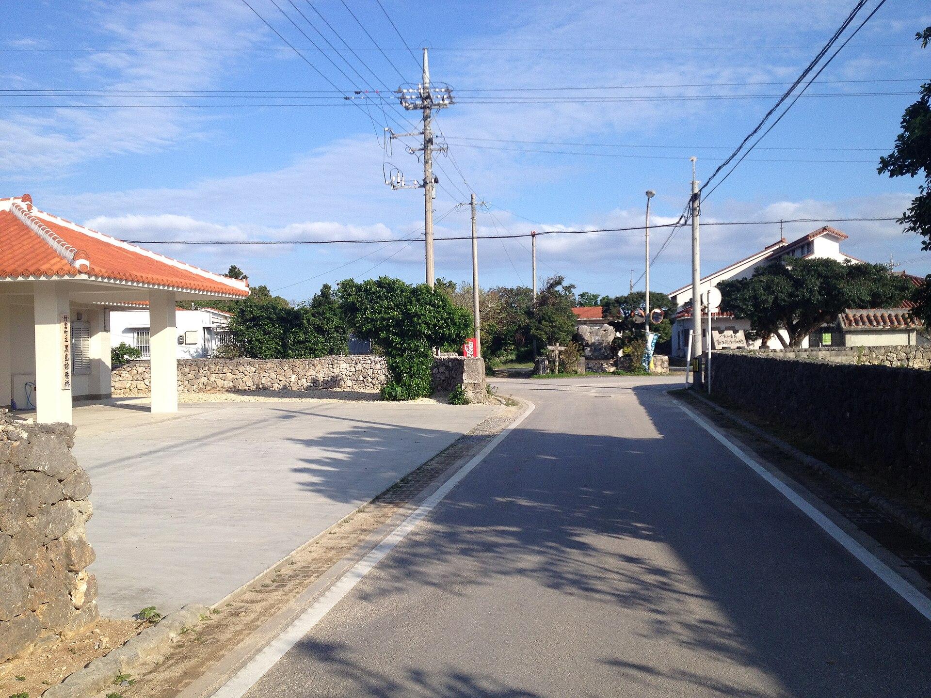 Area near Kuroshima (Yaeyama)
Kuroshima (Yaeyama)
Kuroshima in the Yaeyama Islands is a low, pastoral island southwest of Ishigaki. Cattle fields, small settlements and a broad sky shape its character more than resort development. A bicycle outing here feels very different from the hills of Kohama or the forested interior of Iriomote.
Get to know the placeIriomote Island (Uehara)
Uehara is the northern gateway to Iriomote, a forested Yaeyama island where mangrove rivers, protected wildlife and coastal settlements shape the trip. It is a useful arrival for the northwestern visitor area and guided river outings. It is not interchangeable with Ohara, the island’s other main passenger port in the southeast.
Get to know the place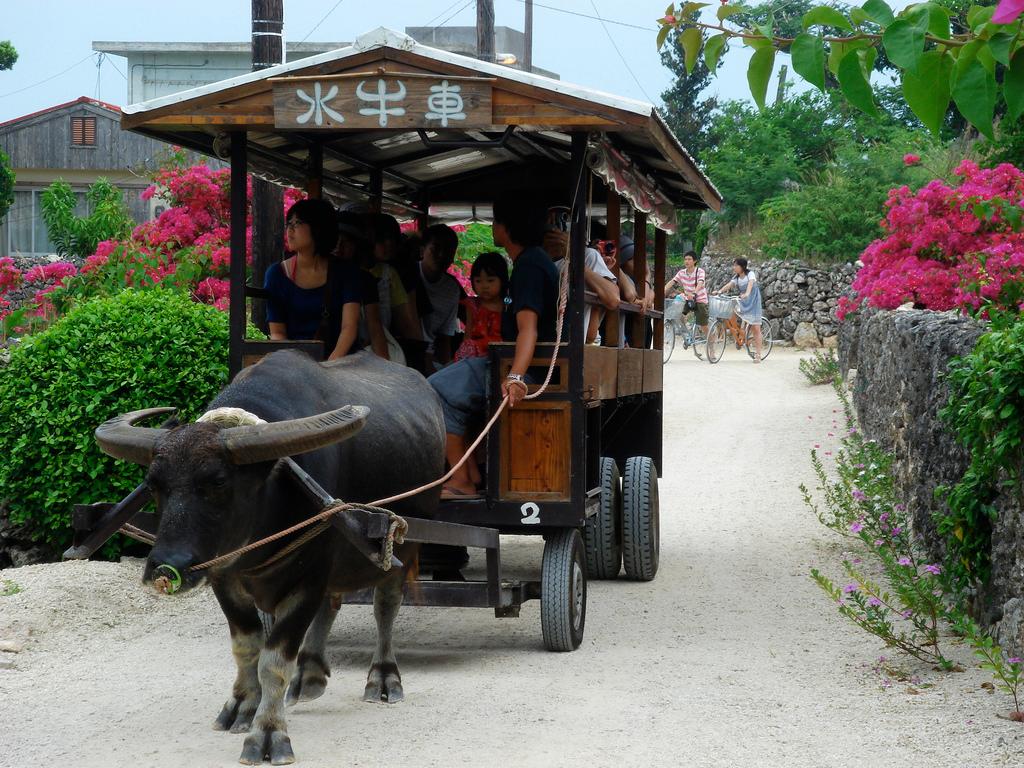
Taketomi
Taketomi is a small coral island close to Ishigaki, best known for its preserved village of red-tiled houses, stone walls and pale sandy lanes. It is a place for walking slowly, noticing roof-top shisa guardians and learning how an inhabited landscape is cared for.
Get to know the placePhoto credits4
- Area image: at Mount Ufu-daki in Kohamajima, Taketomi Town, Okinawa Prefecture , Japan . — local overview of Kohama.Ufu-daki Kohamajima Okinawa Japan01s3s4440. Author: 663highland. Credit: Own work. License: CC BY 2.5 (https://creativecommons.org/licenses/by/2.5). Source: https://commons.wikimedia.org/wiki/File:Ufu-daki_Kohamajima_Okinawa_Japan01s3s4440.jpgCropped to fit the display.
- Area image: Center of Kuroshima — Area near Kuroshima (Yaeyama)Kuroshima 1. Author: VKaeru. Credit: Own work. License: CC BY-SA 3.0 (https://creativecommons.org/licenses/by-sa/3.0). Source: https://commons.wikimedia.org/wiki/File:Kuroshima_1.jpgCropped to fit the display.
- Depicts: Iriomote Island (Uehara)Mangrove swamp, Iriomote Island, Okinawa, Japan. Author: Anagounagi. Credit: Own work. License: CC BY-SA 4.0 (https://creativecommons.org/licenses/by-sa/4.0). Source: https://commons.wikimedia.org/wiki/File:Mangrove_swamp,_Iriomote_Island,_Okinawa,_Japan.jpgCropped to fit the display.
- Depicts: TaketomiFlickr user: Ken@Okinawa Okinawa, Japan https://www.flickr.com/people/trektrack/Wikimedia CommonsCC BY-SA 2.0JP-47 Taketomi Water-buffalo-taxi. Author: Flickr user: Ken@Okinawa Okinawa, Japan https://www.flickr.com/people/trektrack/. Credit: Flickr: https://www.flickr.com/photos/trektrack/2835574036/. License: CC BY-SA 2.0 (https://creativecommons.org/licenses/by-sa/2.0). Source: https://commons.wikimedia.org/wiki/File:JP-47_Taketomi_Water-buffalo-taxi.jpgCropped to fit the display.
