
Japan.
Japan stretches from northern landscapes around Hokkaido to the subtropical islands of Okinawa. Mountain country, dense cities and small coastal communities require different travel rhythms: a rail journey through Honshu is a very different proposition from a boat connection to a remote island.
Photo credits1
A little closer to Japan
Geography, regions and practical details from the country guide. Go straight to a chapter, or browse every destination below.
Go straight to the destinationsJapan stretches from northern landscapes around Hokkaido to the subtropical islands of Okinawa. Mountain country, dense cities and small coastal communities require different travel rhythms: a rail journey through Honshu is a very different proposition from a boat connection to a remote island.
For this directory, Tokyo and Atami are mainland gateways, the Izu Islands form a separate Pacific island journey, and Ishigaki connects the Yaeyama group far to the southwest. Build the route around those geographic clusters rather than treating every Japanese port as a nearby alternative.
Coasts, mountains and island chains
The Pacific and Sea of Japan coasts frame a mountainous archipelago. Large urban corridors occupy relatively limited lowland areas, while forests, volcanic terrain and offshore islands create extensive outdoor possibilities. Tokyo’s island territory lies south of the city; the Yaeyama Islands are in Okinawa and are not an extension of a Tokyo commuter ferry trip.
Choose a regional journey
Northern Hokkaido and Tohoku suit a different seasonal plan from Tokyo’s Kanto region. Central Honshu includes mountain and coastal districts, while Kansai brings Kyoto, Osaka and Nara into a connected cultural journey. Western Honshu, Shikoku and Kyushu each warrant time of their own. Okinawa’s island groups need separate flights or sea connections rather than an assumption of continuous rail travel.
Communication
Japanese is the main language of everyday travel. Major city transport has useful multilingual information, but small island guesthouses and local services may require advance written coordination. Keep addresses and terminal names in Japanese as well as romanised text. A simple greeting, a patient question and a saved booking reference help more than assuming fluent English everywhere.
Japanese yen
The currency is the Japanese yen, JPY. Keep some cash for small businesses and island services even where cards are useful in cities. ATM availability, hours and foreign-card support vary, so arrange money before travelling to a small island. Check your bank’s charges and the displayed withdrawal terms rather than relying on a fixed exchange-rate estimate.
Shrines, homes and bathing
Take shoes off where requested, especially around tatami, and follow the host’s arrangement for slippers. Keep transport conversations quiet and allow passengers to leave before boarding. At a bath, wash before entering shared water and follow the facility’s clothing and tattoo policy. Shrines, village sacred places and private homes need respectful access rather than being treated as unrestricted photo settings.
Regional meals
Tokyo has Edomae sushi, monjayaki and Fukagawa clam rice among its local specialities. Yaeyama cooking introduces a different food landscape, including island soba and Ishigaki produce. Ryokan and island guesthouses may offer set meal plans; check what is included and discuss dietary needs before arrival. Broths and sauces can contain fish or other ingredients that are not obvious from a translated dish name.
Separate connections carefully
Use rail for many mainland corridors and confirm the precise operator and ticket coverage in cities. Offshore travel requires checking both the boat and the road transfer between airport, town and terminal. On small islands, an arrival may be followed by walking, a rental bicycle or host pickup. Leave a buffer before a separately booked international flight, particularly after weather-sensitive ferry travel.
Seasons and preparation
Choose forecasts for the actual destination: northern snow, humid city summers and subtropical conditions can coexist across this long country. Check local volcanic restrictions before mountain excursions and know the evacuation directions at your accommodation. Seasonal flowers and events need current dates. Keep important addresses and booking details offline and review individual transport notices close to departure.
Good to know before you go
Is there one best season for Japan?
No; choose the region and activity first, then check its weather and seasonal conditions.
Are the Izu Islands and Yaeyama nearby?
No. Izu lies south of mainland Tokyo; Yaeyama is in far-southwestern Okinawa.
Should I carry cash?
Yes, especially before travelling to small islands, where card and ATM options can be limited.
Are all hot springs used in the same way?
No. Washing, clothing, tattoos and mixed-bath arrangements differ; ask the facility directly.
Sources & references
These references support the guide. Confirm opening hours, access and travel services before you go.
- 01JNTO: geography and regional weather
- 02JNTO: destination regions
- 03JNTO: yen and cash access
- 04JNTO: manners and bathing
- 05JNTO: Tokyo culture and food
- 06Tokyo tourism: communication and customs
- 07Okinawa tourism: Ishigaki and Yaeyama
- 08Tokyo Metropolitan Government: Izu Oshima
- 09Tokyo tourism: transport operators
Find your place in Japan
Open the guides, get a feel for the differences between places, and find the ones that fit your plans.

Atami
Atami is a hot-spring town where steep hills meet the sea on the eastern side of the Izu Peninsula. Its position on the Tokaido rail corridor makes it an accessible change of pace from Tokyo: a bath, an art collection and a waterfront walk can form a satisfying visit.
Read the field guide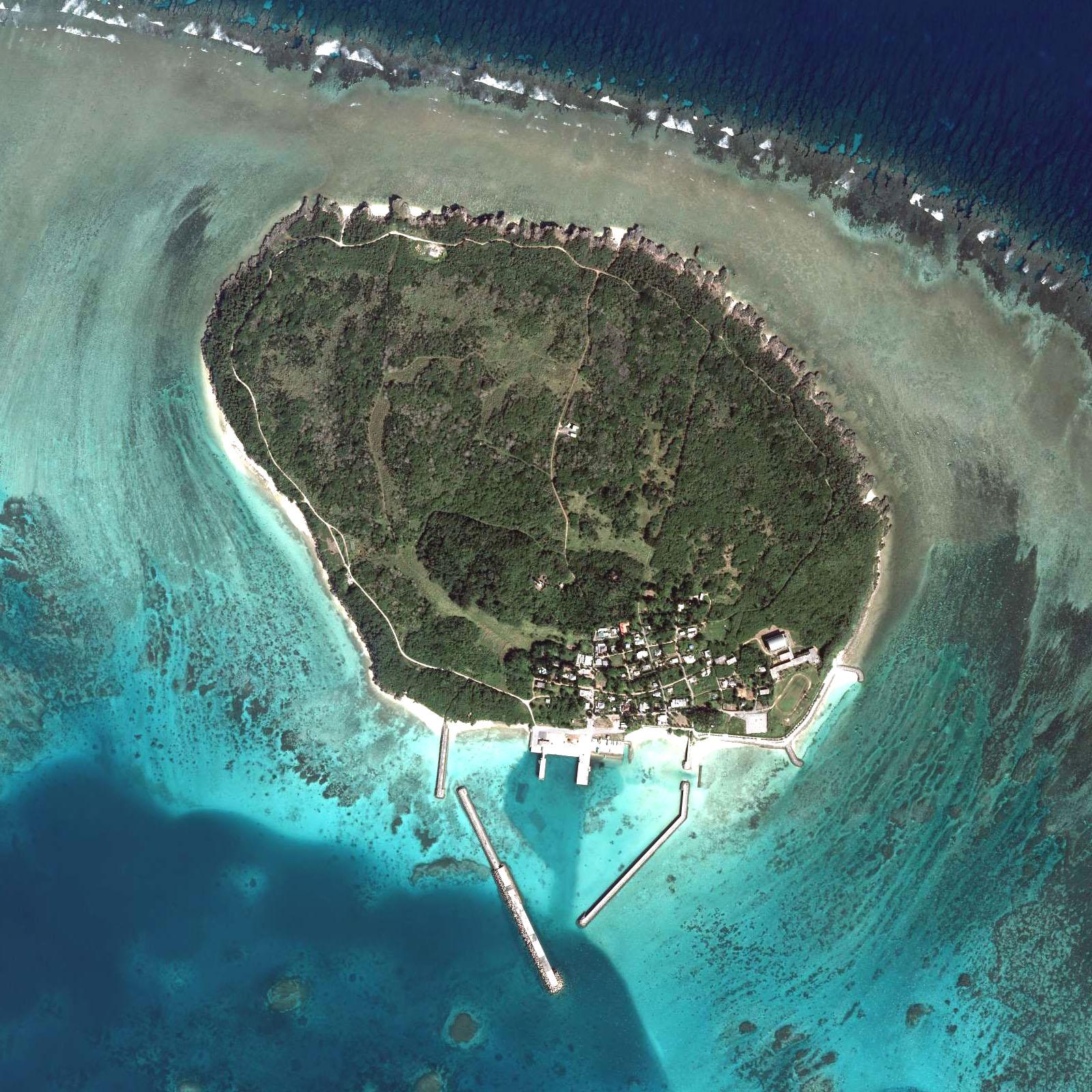
Hatoma
Hatoma is a tiny inhabited island off northern Iriomote, with a port-side village, a wooded interior and quiet coastal paths. It suits travellers who want to slow down and look closely at an island landscape rather than fill a day with large attractions or shopping.
Read the field guide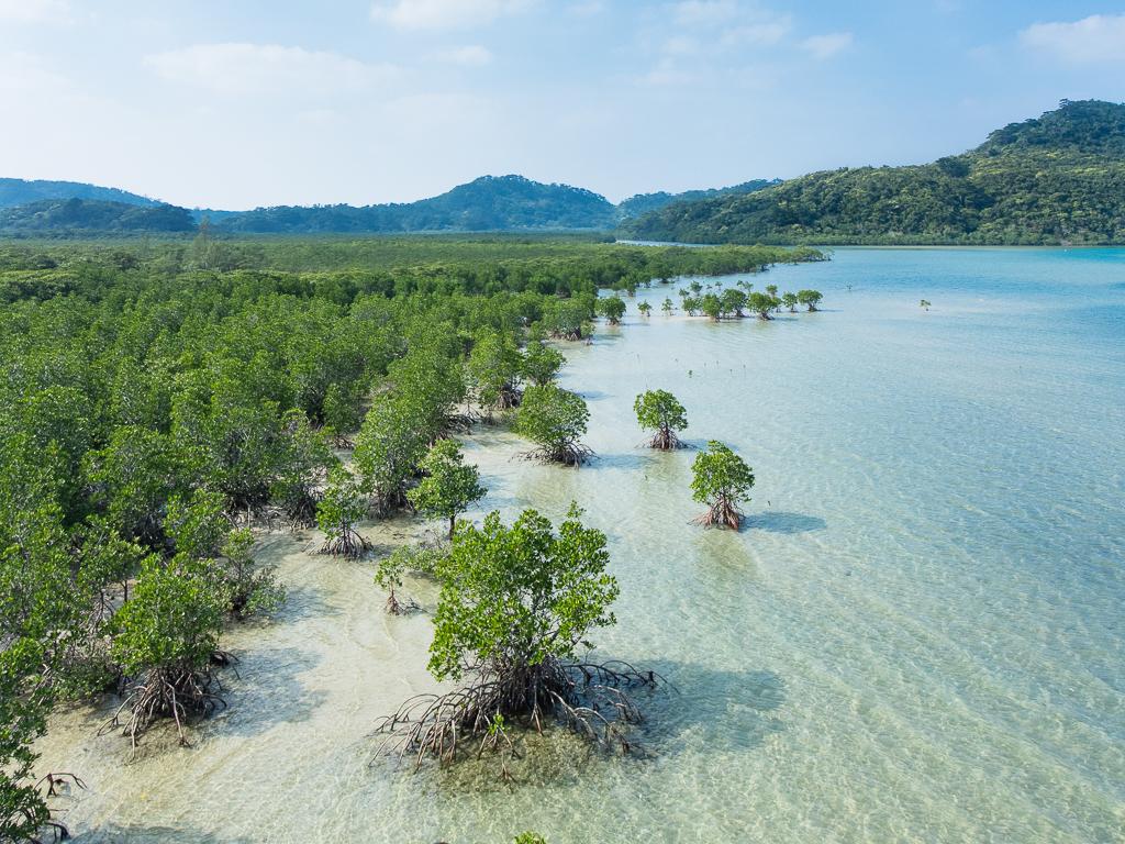
Iriomote Island (Uehara)
Uehara is the northern gateway to Iriomote, a forested Yaeyama island where mangrove rivers, protected wildlife and coastal settlements shape the trip. It is a useful arrival for the northwestern visitor area and guided river outings. It is not interchangeable with Ohara, the island’s other main passenger port in the southeast.
Read the field guide
Ishigaki
Ishigaki is the Yaeyama Islands’ main arrival hub, but it deserves more than a night between flights and boats. A developed southern city gives way to reefs, agricultural scenery, wooded hills and long coastal drives. The island can support both practical ferry connections and a slower stay of its own.
Read the field guide Local overview of Kohama
Kohama
Kohama lies between Ishigaki and Iriomote, with sugarcane fields, cattle pastures and a central village of red-tiled houses. Its appeal is the contrast between a working agricultural island and the comfort of resort stays. The sea is never far away, but the interior gives the visit much of its character.
Read the field guide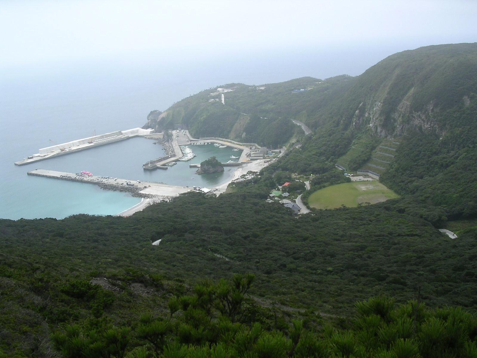
Kozushima
Kozushima is an Izu island where pale mountain terrain, a blue coast and carefully protected night skies meet. Mount Tenjo rises above the village and sea, while a slower coastal day can revolve around a beach, a bath and local fish. It is part of Tokyo’s island territory, far from the urban capital.
Read the field guide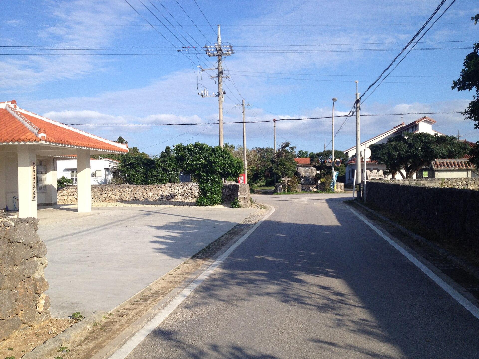 Area near Kuroshima (Yaeyama)
Kuroshima (Yaeyama)
Kuroshima in the Yaeyama Islands is a low, pastoral island southwest of Ishigaki. Cattle fields, small settlements and a broad sky shape its character more than resort development. A bicycle outing here feels very different from the hills of Kohama or the forested interior of Iriomote.
Read the field guide Area near Niijima
Niijima
Niijima combines pale volcanic stone, long beaches and an island craft tradition south of mainland Tokyo. Habushiura draws surfers, while glass workshops, sculpted Moyai figures and village streets give a visit more variety than a beach holiday alone. It belongs to the Izu chain, separate from Okinawa’s islands.
Read the field guideIriomote Island overviewOhara (Iriomote Island)
Ohara is Iriomote’s southeastern passenger gateway, beside the lower Nakama River and within reach of the island’s eastern communities. It is a useful starting point for mangrove boat trips, a visit towards Yubu and a slower look at the forest-and-village landscape. This is a different arrival from Uehara in the north.
Read the field guideOsaka
Osaka brings together canal-side evenings in Dotonbori, the grounds of Osaka Castle and a food culture built around dishes such as takoyaki and okonomiyaki. It is a city for combining a few major sights with time in its shopping streets and smaller eating districts.
Read the field guide
Oshima (Izu Oshima)
Izu Oshima is the volcanic island east of the Izu Peninsula, administered as part of Tokyo. The black slopes of Mount Mihara, layers of old eruption deposits and camellia groves create a landscape quite unlike the capital’s streets. This is Izu Oshima, not one of Japan’s other islands called Oshima.
Read the field guide
Shikinejima
Shikinejima is a small Izu island between Niijima and Kozushima, with indented coves, coastal paths and natural hot springs. Its appeal is intimate: a viewpoint, a village lunch and a rocky bathing place can fill a satisfying day without a large resort or a long sightseeing checklist.
Read the field guide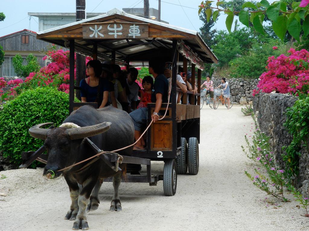
Taketomi
Taketomi is a small coral island close to Ishigaki, best known for its preserved village of red-tiled houses, stone walls and pale sandy lanes. It is a place for walking slowly, noticing roof-top shisa guardians and learning how an inhabited landscape is cared for.
Read the field guide
Tokyo
Tokyo is easiest to enjoy as a collection of neighbourhoods. Asakusa’s temple streets, the brick frontage of Tokyo Station and Shibuya’s busy crossings create very different days, connected by an extensive railway network. Trying to walk between all of them can turn a varied visit into hours of transit.
Read the field guide
Toshima Island
Toshima is a tiny, volcanic Izu island in Tokyo Prefecture where a single village, a camellia forest and a steep central mountain shape the experience. It suits walkers, stargazers and travellers who value local island life over a dense attraction schedule.
Read the field guidePhoto credits14
- Depicts: AtamiAtami 20170211-1. Author: Suicasmo. Credit: Own work. License: CC BY-SA 4.0 (https://creativecommons.org/licenses/by-sa/4.0). Source: https://commons.wikimedia.org/wiki/File:Atami_20170211-1.jpgCropped to fit the display.
- Depicts: HatomaYaeyama hatoma COK20096X-C1-4. Author: Geospatial Information Authority of Japan. Credit: Aerial photo numbered Reference number: COK20096X, cource number: C1, photo number: 4 on map & aerial photo browsing service. License: CC BY 4.0 (https://creativecommons.org/licenses/by/4.0). Source: https://commons.wikimedia.org/wiki/File:Yaeyama_hatoma_COK20096X-C1-4.jpgCropped to fit the display.
- Depicts: Iriomote Island (Uehara)Mangrove swamp, Iriomote Island, Okinawa, Japan. Author: Anagounagi. Credit: Own work. License: CC BY-SA 4.0 (https://creativecommons.org/licenses/by-sa/4.0). Source: https://commons.wikimedia.org/wiki/File:Mangrove_swamp,_Iriomote_Island,_Okinawa,_Japan.jpgCropped to fit the display.
- Depicts: IshigakiIshigaki-Cave08s5s4592. Author: 663highland. Credit: Own work. License: CC BY 2.5 (https://creativecommons.org/licenses/by/2.5). Source: https://commons.wikimedia.org/wiki/File:Ishigaki-Cave08s5s4592.jpgCropped to fit the display.
- Area image: at Mount Ufu-daki in Kohamajima, Taketomi Town, Okinawa Prefecture , Japan . — local overview of Kohama.Ufu-daki Kohamajima Okinawa Japan01s3s4440. Author: 663highland. Credit: Own work. License: CC BY 2.5 (https://creativecommons.org/licenses/by/2.5). Source: https://commons.wikimedia.org/wiki/File:Ufu-daki_Kohamajima_Okinawa_Japan01s3s4440.jpgCropped to fit the display.
- Depicts: KozushimaKozushima Tako Bay 2005. Author: Mkill. Credit: Own work. License: CC BY 2.5 (https://creativecommons.org/licenses/by/2.5). Source: https://commons.wikimedia.org/wiki/File:Kozushima_Tako_Bay_2005.jpgCropped to fit the display.
- Area image: Center of Kuroshima — Area near Kuroshima (Yaeyama)Kuroshima 1. Author: VKaeru. Credit: Own work. License: CC BY-SA 3.0 (https://creativecommons.org/licenses/by-sa/3.0). Source: https://commons.wikimedia.org/wiki/File:Kuroshima_1.jpgCropped to fit the display.
- Area image: 新島村および神津島村を管轄する警視庁新島警察署。 所在地:東京都新島村本村三丁目13番4号 — Area near NiijimaNiijima Police Station. Author: ヤンくん. Credit: Own work. License: CC BY-SA 4.0 (https://creativecommons.org/licenses/by-sa/4.0). Source: https://commons.wikimedia.org/wiki/File:Niijima_Police_Station.jpgCropped to fit the display.
- Depicts: Osaka
- Depicts: Oshima (Izu Oshima)Godzilla Rock on Mount Mihara, Japan. Author: Yoshi Canopus. Credit: Own work. License: CC BY-SA 4.0 (https://creativecommons.org/licenses/by-sa/4.0). Source: https://commons.wikimedia.org/wiki/File:Godzilla_Rock_on_Mount_Mihara,_Japan.jpgCropped to fit the display.
- Depicts: ShikinejimaShikine-jima 2023 Jan 29 01-11PM. Author: Nesnad. Credit: Own work. License: CC BY-SA 4.0 (https://creativecommons.org/licenses/by-sa/4.0). Source: https://commons.wikimedia.org/wiki/File:Shikine-jima_2023_Jan_29_01-11PM.jpegCropped to fit the display.
- Depicts: TaketomiFlickr user: Ken@Okinawa Okinawa, Japan https://www.flickr.com/people/trektrack/Wikimedia CommonsCC BY-SA 2.0JP-47 Taketomi Water-buffalo-taxi. Author: Flickr user: Ken@Okinawa Okinawa, Japan https://www.flickr.com/people/trektrack/. Credit: Flickr: https://www.flickr.com/photos/trektrack/2835574036/. License: CC BY-SA 2.0 (https://creativecommons.org/licenses/by-sa/2.0). Source: https://commons.wikimedia.org/wiki/File:JP-47_Taketomi_Water-buffalo-taxi.jpgCropped to fit the display.
- Depicts: TokyoSkyscrapers of Shinjuku 2009 January. Author: Morio. Credit: Own work. License: CC BY-SA 3.0 (https://creativecommons.org/licenses/by-sa/3.0/). Source: https://commons.wikimedia.org/wiki/File:Skyscrapers_of_Shinjuku_2009_January.jpgCropped to fit the display.
- Depicts: Toshima IslandToshima street. Author: ゆうき315. Credit: Own work. License: CC BY-SA 3.0 (https://creativecommons.org/licenses/by-sa/3.0). Source: https://commons.wikimedia.org/wiki/File:Toshima_street.jpgCropped to fit the display.
