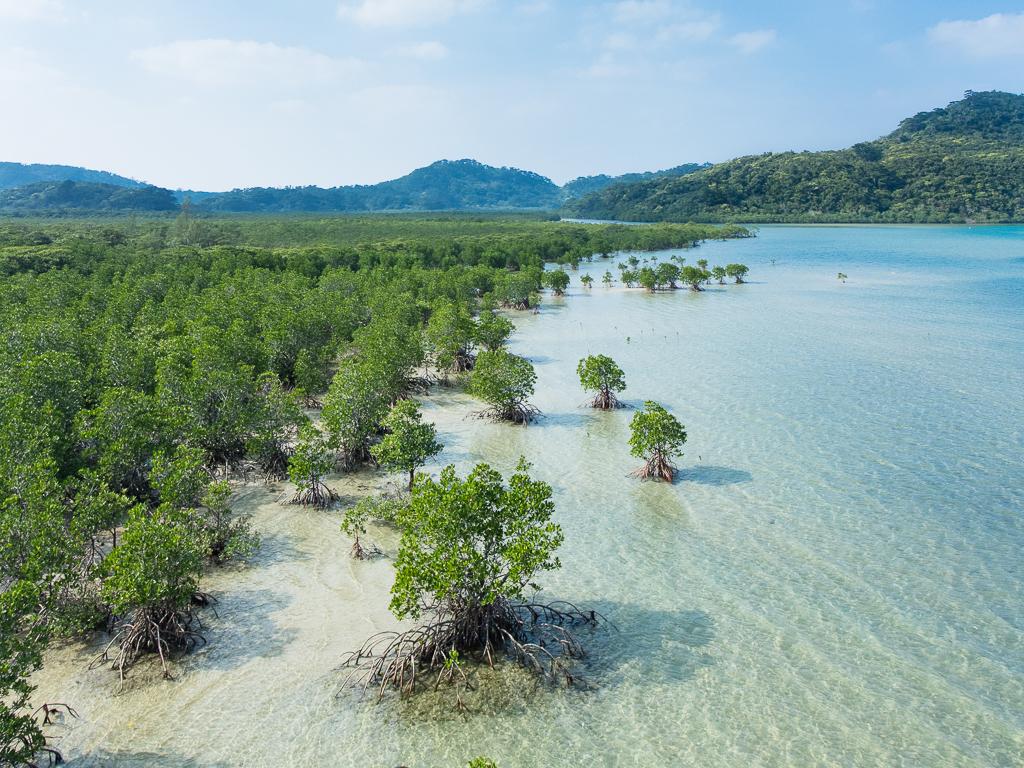
Iriomote Island (Uehara).
Uehara is the northern gateway to Iriomote, a forested Yaeyama island where mangrove rivers, protected wildlife and coastal settlements shape the trip. It is a useful arrival for the northwestern visitor area and guided river outings. It is not interchangeable with Ohara, the island’s other main passenger port in the southeast.
Photo credits1
- Depicts: Iriomote Island (Uehara)Mangrove swamp, Iriomote Island, Okinawa, Japan. Author: Anagounagi. Credit: Own work. License: CC BY-SA 4.0 (https://creativecommons.org/licenses/by-sa/4.0). Source: https://commons.wikimedia.org/wiki/File:Mangrove_swamp,_Iriomote_Island,_Okinawa,_Japan.jpgCropped to fit the display.
Make your way to Iriomote Island (Uehara)
Choose a tool and your dates to check the options for your trip.
More ways to explore
- Country
- Japan
- Currency
- JPY
- Time zone
- Asia/Tokyo
Uehara is the northern gateway to Iriomote, a forested Yaeyama island where mangrove rivers, protected wildlife and coastal settlements shape the trip. It is a useful arrival for the northwestern visitor area and guided river outings. It is not interchangeable with Ohara, the island’s other main passenger port in the southeast.
Choose one or two nature experiences and leave time for the coast. The island’s interior is a protected environment with access rules, not an open network of casual walking shortcuts. A local guide and a base near the activities you want can make the visit both richer and easier to organise.
When to go
Spring can bring Yaeyama firefly outings, while warm months support river and marine activities. Rain, wind and typhoons can alter both access and ferry plans. Uehara is exposed to sea conditions, so allow for a changed arrival port. Clear night skies are an opportunity rather than a certainty; book night activities with appropriate local guidance.
Getting there
Take a current ferry from Ishigaki to Uehara when the route operates. On cancellation days, travelling through Ohara requires a separately confirmed boat and road arrangement. Anei ended its connecting bus for normal Uehara operating days on 31 May 2026; cancellation-day arrangements are separate and revised. Confirm the exact company, ticket and transfer rather than assuming a free shuttle is always included.
Getting around
Arrange accommodation pickup, a tour transfer, local bus or a suitable rental vehicle around your actual base. Northern attractions are not all walkable from the pier. Drive slowly for wildlife and residents, particularly after dark, and check return bus times before a river excursion. A transfer from Ohara can substantially change the day’s plan.
Local food
Iriomote’s cultivated pineapples and mangoes are seasonal highlights, including the aromatic peach-pineapple variety. Island kitchens may also offer mangrove crab when responsibly sourced and available; it is a limited local resource, not an unlimited buffet item. Reserve dinner or ask your host for a workable plan, particularly if staying beyond the main settlement.
What to see
The Urauchi River offers a boat-based introduction to forest and mangroves, with selected trail experiences arranged according to current access. Pinaisara Falls is another major draw, reached through a regulated nature area. Book the appropriate registered guide and entry approval rather than arriving with an old map that treats every waterfall as unrestricted.
Towns and neighbourhoods
Uehara, Nakano and the northwestern coastal accommodation areas form a different base from Ohara. Hoshizuna Beach, Urauchi and the road towards Shirahama belong to the northern and western side. A single coastal road links the principal settlements; the mountainous interior does not provide a quick cross-island road alternative.
Coast and outdoors
Hoshizuna is associated with star-shaped sand, while Tsukigahama provides another coastal landscape near the northwestern stays. Leave natural materials in place. Swimming and snorkelling require current local advice because reefs and currents matter even when a beach looks sheltered. Use an experienced operator for offshore excursions rather than treating a ferry arrival as a beach-safety assessment.
Where to stay
The Uehara and Hoshizuna side offers guesthouses and resort accommodation suited to northern activities. Compare the pickup point for your chosen guide, evening food and port-transfer arrangements. A property labelled Iriomote may be far from Uehara; choose by the address and itinerary rather than assuming one island-wide central location.
Useful before you go
Five designated nature fields require advance town approval, with guide or other qualifying conditions specified for each. For Pinaisara and Sangara, use the required registered accompanying guide. Protect the Iriomote cat by careful driving, keep to authorised routes and take rubbish away. Tell your host about changed ferry plans before heading across the island.
Good to know before you go
Are Uehara and Ohara the same port?
No. They serve different sides of Iriomote and are linked by a substantial coastal-road journey.
Can I visit Pinaisara independently without approval?
No. The designated area requires advance approval and a registered accompanying guide.
Is a free connecting bus always included?
No. Anei’s normal-operating-day Uehara bus ended in May 2026; cancellation arrangements must be checked separately.
Can I expect to see an Iriomote cat?
No. It is rare wildlife. A responsible visit protects habitat and drives carefully rather than seeking a guaranteed encounter.
Sources & references
These references support the guide. Confirm opening hours, access and travel services before you go.
- 01Okinawa tourism: Iriomote geography and visitor areas
- 02Taketomi ecotourism council: required entry approval for five fields
- 03Taketomi Town: 2025 visitor manner book
- 04Amami–Okinawa World Heritage tourism: Iriomote foods
- 05Forestry Agency: Iriomote recreation forest
- 06Anei: Uehara service and June 2026 bus changes
- 07Taketomi tourism: island transport
Where could the journey go next?
More guides in Japan. Compare the places and check actual connections before combining stops.
Hatoma
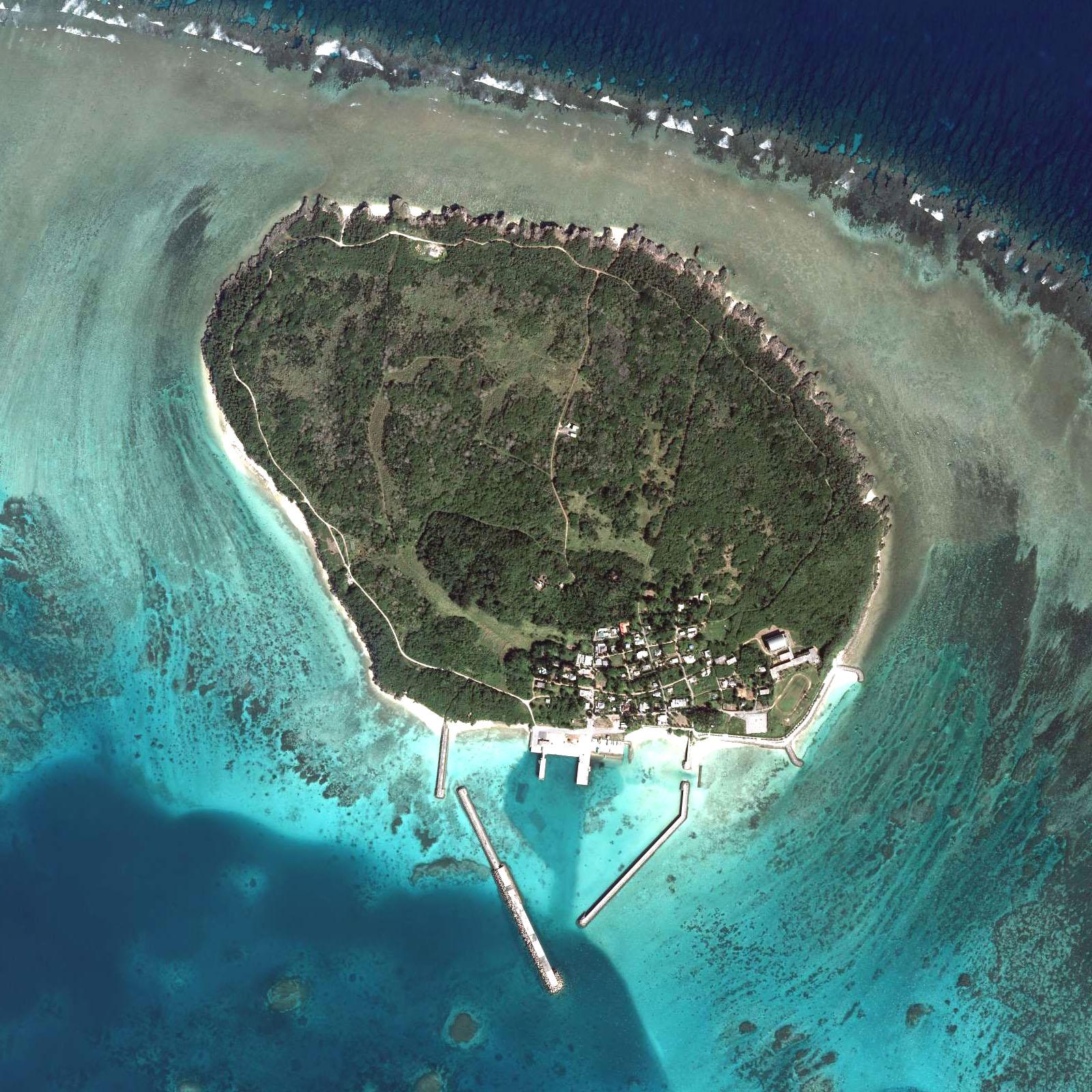
Hatoma is a tiny inhabited island off northern Iriomote, with a port-side village, a wooded interior and quiet coastal paths. It suits travellers who want to slow down and look closely at an island landscape rather than fill a day with large attractions or shopping.
Get to know the placeIriomote Island overviewOhara (Iriomote Island)
Ohara is Iriomote’s southeastern passenger gateway, beside the lower Nakama River and within reach of the island’s eastern communities. It is a useful starting point for mangrove boat trips, a visit towards Yubu and a slower look at the forest-and-village landscape. This is a different arrival from Uehara in the north.
Get to know the place Local overview of Kohama
Kohama
Kohama lies between Ishigaki and Iriomote, with sugarcane fields, cattle pastures and a central village of red-tiled houses. Its appeal is the contrast between a working agricultural island and the comfort of resort stays. The sea is never far away, but the interior gives the visit much of its character.
Get to know the place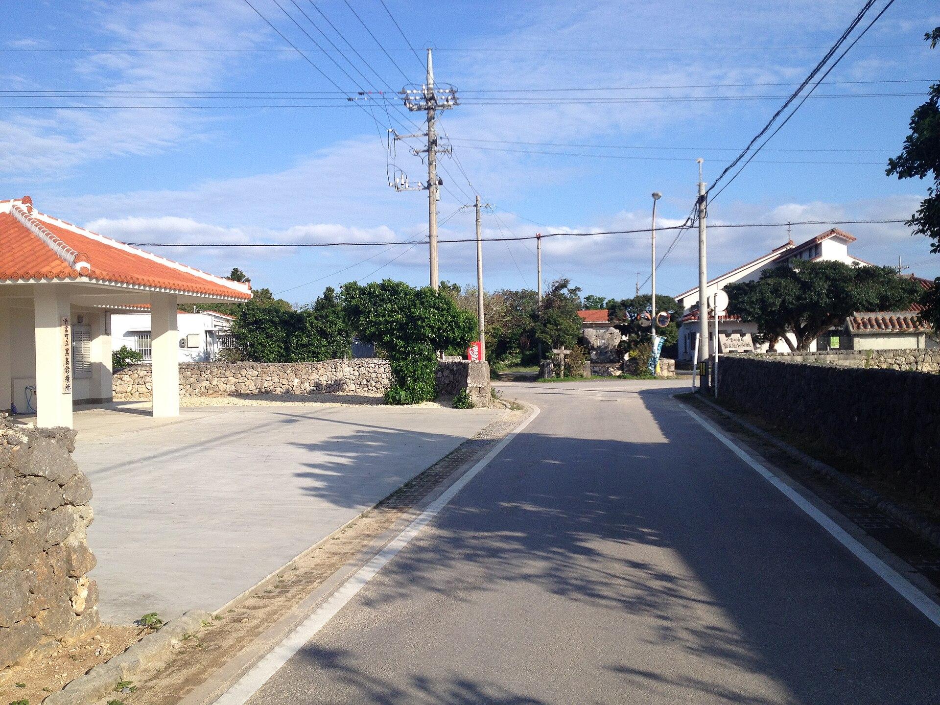 Area near Kuroshima (Yaeyama)
Kuroshima (Yaeyama)
Kuroshima in the Yaeyama Islands is a low, pastoral island southwest of Ishigaki. Cattle fields, small settlements and a broad sky shape its character more than resort development. A bicycle outing here feels very different from the hills of Kohama or the forested interior of Iriomote.
Get to know the placePhoto credits4
- Depicts: HatomaYaeyama hatoma COK20096X-C1-4. Author: Geospatial Information Authority of Japan. Credit: Aerial photo numbered Reference number: COK20096X, cource number: C1, photo number: 4 on map & aerial photo browsing service. License: CC BY 4.0 (https://creativecommons.org/licenses/by/4.0). Source: https://commons.wikimedia.org/wiki/File:Yaeyama_hatoma_COK20096X-C1-4.jpgCropped to fit the display.
- Area image: Iriomote Island — Iriomote Island overviewMangrove swamp, Iriomote Island, Okinawa, Japan. Author: Anagounagi. Credit: Own work. License: CC BY-SA 4.0 (https://creativecommons.org/licenses/by-sa/4.0). Source: https://commons.wikimedia.org/wiki/File:Mangrove_swamp,_Iriomote_Island,_Okinawa,_Japan.jpgCropped to fit the display.
- Area image: at Mount Ufu-daki in Kohamajima, Taketomi Town, Okinawa Prefecture , Japan . — local overview of Kohama.Ufu-daki Kohamajima Okinawa Japan01s3s4440. Author: 663highland. Credit: Own work. License: CC BY 2.5 (https://creativecommons.org/licenses/by/2.5). Source: https://commons.wikimedia.org/wiki/File:Ufu-daki_Kohamajima_Okinawa_Japan01s3s4440.jpgCropped to fit the display.
- Area image: Center of Kuroshima — Area near Kuroshima (Yaeyama)Kuroshima 1. Author: VKaeru. Credit: Own work. License: CC BY-SA 3.0 (https://creativecommons.org/licenses/by-sa/3.0). Source: https://commons.wikimedia.org/wiki/File:Kuroshima_1.jpgCropped to fit the display.
