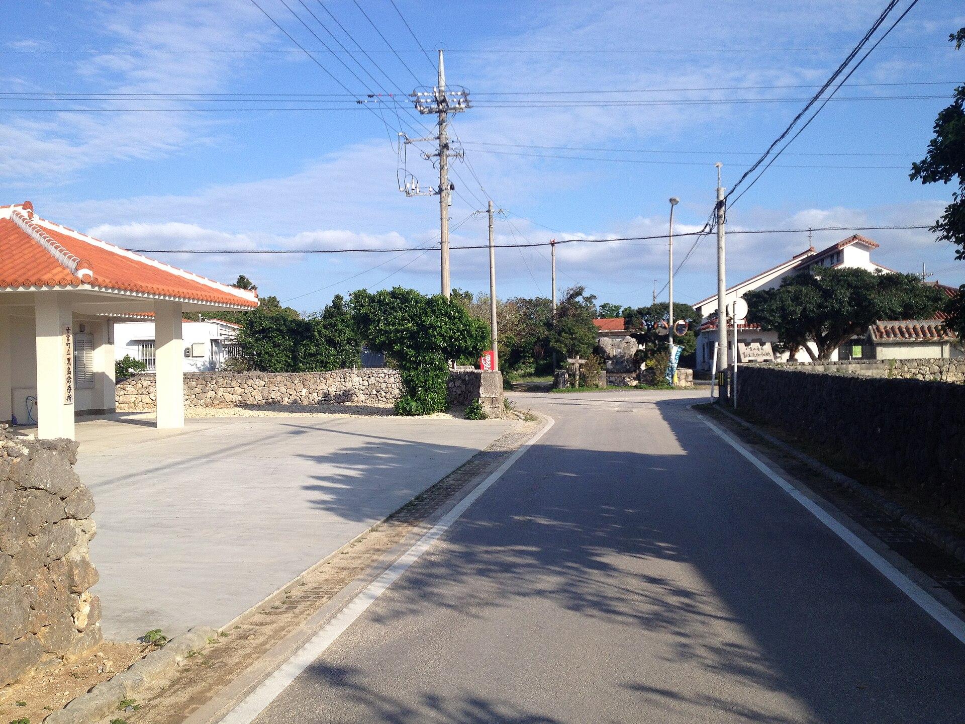
Kuroshima (Yaeyama).
Kuroshima in the Yaeyama Islands is a low, pastoral island southwest of Ishigaki. Cattle fields, small settlements and a broad sky shape its character more than resort development. A bicycle outing here feels very different from the hills of Kohama or the forested interior of Iriomote.
Photo credits1
- Area image: Center of Kuroshima — Area near Kuroshima (Yaeyama)Kuroshima 1. Author: VKaeru. Credit: Own work. License: CC BY-SA 3.0 (https://creativecommons.org/licenses/by-sa/3.0). Source: https://commons.wikimedia.org/wiki/File:Kuroshima_1.jpgCropped to fit the display.
Make your way to Kuroshima (Yaeyama)
Choose a tool and your dates to check the options for your trip.
More ways to explore
- Country
- Japan
- Currency
- JPY
- Time zone
- Asia/Tokyo
Kuroshima in the Yaeyama Islands is a low, pastoral island southwest of Ishigaki. Cattle fields, small settlements and a broad sky shape its character more than resort development. A bicycle outing here feels very different from the hills of Kohama or the forested interior of Iriomote.
Come for the agricultural landscape, a sea-turtle research visit and time beside the coast. This guide concerns the Kuroshima reached from Ishigaki, not another Japanese island with the same name. The distinction matters when choosing a ferry, accommodation or directions.
When to go
Clear nights can be rewarding for stargazing away from artificial light, although cloud and moonlight affect the experience. Sunny daytime rides need shade breaks and water. The island is known for its cattle festival, but check the announced edition before planning around it. Typhoons and rough seas can interrupt the ferry in any vulnerable travel period.
Getting there
The practical gateway is Ishigaki’s passenger terminal, with an operator-specific Kuroshima service. If arriving by air, transfer from Ishigaki Airport to the terminal before the boat. Confirm the return sailing before leaving for a day visit. A short crossing remains dependent on the sea and should not be treated as a guaranteed flight connection.
Getting around
The relatively flat terrain makes rental cycling a useful way to explore. Ask about bicycle availability and the return location on arrival or through your host. Walking works for a selected area but can be tiring across exposed pasture roads. Give livestock and farm vehicles space, and keep gates and agricultural entrances unobstructed.
Local food
Arrange lunch with your day plan or ask a guesthouse about meals. The small island does not have the dining range of Ishigaki. Yaeyama soba and regional fish dishes are useful possibilities where offered, but the cattle landscape does not guarantee a local steak restaurant. Ask what the kitchen actually prepares and carry enough drinking water for the ride.
What to see
The Kuroshima Research Center introduces the island’s marine environment and turtle conservation. Iko Pier is another recognisable coastal landmark, while village lanes and pasture roads reveal everyday island life. Visit according to current opening and access information; turtle research does not promise that visitors will witness nesting on a beach.
Towns and neighbourhoods
The passenger port is an arrival point rather than a large town centre. Small settlements, including Nakamoto and Higashisuji, sit among open agricultural land. The western side has much of the small-scale accommodation. Plan a simple route linking a village, the research centre and a coast, with breaks rather than constant cycling.
Coast and outdoors
Nakamoto’s coast has tide pools and reef scenery, but the local tourism association does not recommend swimming and warns of rip currents and past accidents. Treat it as a coastal observation stop unless a responsible local professional confirms a suitable supervised activity. Do not follow a generic description of calm island water into an unfamiliar reef channel.
Where to stay
Small guesthouses and villas offer the main overnight options, many near the western side. Confirm meals, port pickup and evening facilities before booking. An overnight stay allows a quieter pace and a chance of dark skies; a day visit from Ishigaki offers more urban services but less freedom after the last return boat.
Useful before you go
Respect the island’s working farms and do not approach cattle for photographs. Sacred utaki places require local permission rather than casual entry. Take rubbish back, leave marine life undisturbed and avoid lights near any nesting wildlife. Save your host or rental contact and check live ferry status before committing to the day’s final coastal stop.
Good to know before you go
Which Kuroshima is this?
The Yaeyama island southwest of Ishigaki, reached by ferry from Ishigaki.
Is Nakamoto a recommended swimming beach?
The local tourism association advises against swimming and warns of rip currents and accidents.
Is cycling practical?
Its comparatively flat terrain suits cycling, with sun protection, water and respect for farm traffic.
Will I see nesting turtles?
That is not guaranteed. A research-centre visit provides a responsible introduction without disturbing wildlife.
Sources & references
These references support the guide. Confirm opening hours, access and travel services before you go.
Where could the journey go next?
More guides in Japan. Compare the places and check actual connections before combining stops.
 Local overview of Kohama
Kohama
Kohama lies between Ishigaki and Iriomote, with sugarcane fields, cattle pastures and a central village of red-tiled houses. Its appeal is the contrast between a working agricultural island and the comfort of resort stays. The sea is never far away, but the interior gives the visit much of its character.
Get to know the place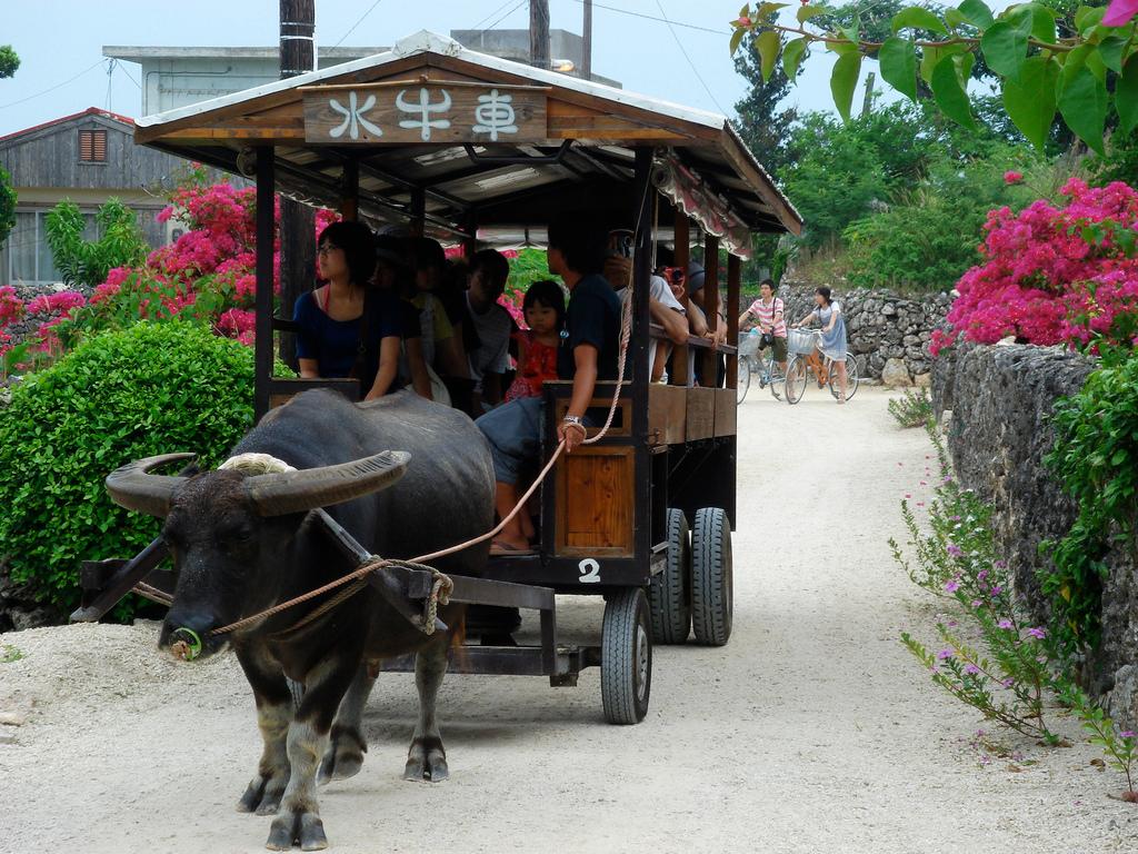
Taketomi
Taketomi is a small coral island close to Ishigaki, best known for its preserved village of red-tiled houses, stone walls and pale sandy lanes. It is a place for walking slowly, noticing roof-top shisa guardians and learning how an inhabited landscape is cared for.
Get to know the place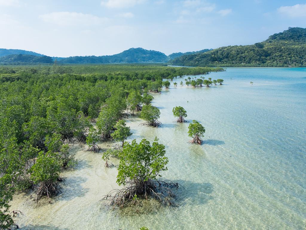 Iriomote Island overview
Ohara (Iriomote Island)
Ohara is Iriomote’s southeastern passenger gateway, beside the lower Nakama River and within reach of the island’s eastern communities. It is a useful starting point for mangrove boat trips, a visit towards Yubu and a slower look at the forest-and-village landscape. This is a different arrival from Uehara in the north.
Get to know the place
Ishigaki
Ishigaki is the Yaeyama Islands’ main arrival hub, but it deserves more than a night between flights and boats. A developed southern city gives way to reefs, agricultural scenery, wooded hills and long coastal drives. The island can support both practical ferry connections and a slower stay of its own.
Get to know the placePhoto credits4
- Area image: at Mount Ufu-daki in Kohamajima, Taketomi Town, Okinawa Prefecture , Japan . — local overview of Kohama.Ufu-daki Kohamajima Okinawa Japan01s3s4440. Author: 663highland. Credit: Own work. License: CC BY 2.5 (https://creativecommons.org/licenses/by/2.5). Source: https://commons.wikimedia.org/wiki/File:Ufu-daki_Kohamajima_Okinawa_Japan01s3s4440.jpgCropped to fit the display.
- Depicts: TaketomiFlickr user: Ken@Okinawa Okinawa, Japan https://www.flickr.com/people/trektrack/Wikimedia CommonsCC BY-SA 2.0JP-47 Taketomi Water-buffalo-taxi. Author: Flickr user: Ken@Okinawa Okinawa, Japan https://www.flickr.com/people/trektrack/. Credit: Flickr: https://www.flickr.com/photos/trektrack/2835574036/. License: CC BY-SA 2.0 (https://creativecommons.org/licenses/by-sa/2.0). Source: https://commons.wikimedia.org/wiki/File:JP-47_Taketomi_Water-buffalo-taxi.jpgCropped to fit the display.
- Area image: Iriomote Island — Iriomote Island overviewMangrove swamp, Iriomote Island, Okinawa, Japan. Author: Anagounagi. Credit: Own work. License: CC BY-SA 4.0 (https://creativecommons.org/licenses/by-sa/4.0). Source: https://commons.wikimedia.org/wiki/File:Mangrove_swamp,_Iriomote_Island,_Okinawa,_Japan.jpgCropped to fit the display.
- Depicts: IshigakiIshigaki-Cave08s5s4592. Author: 663highland. Credit: Own work. License: CC BY 2.5 (https://creativecommons.org/licenses/by/2.5). Source: https://commons.wikimedia.org/wiki/File:Ishigaki-Cave08s5s4592.jpgCropped to fit the display.
