
Vietnam.
Vietnam stretches from northern mountains and the Red River Delta to the tropical Mekong waterways and southern islands. Hanoi and Ho Chi Minh City provide very different urban introductions, while the central coast links historic towns, beach cities and access to the highlands.
Photo credits1
- Depicts: Vietnam
A little closer to Vietnam
Geography, regions and practical details from the country guide. Go straight to a chapter, or browse every destination below.
Go straight to the destinationsVietnam stretches from northern mountains and the Red River Delta to the tropical Mekong waterways and southern islands. Hanoi and Ho Chi Minh City provide very different urban introductions, while the central coast links historic towns, beach cities and access to the highlands.
Choose a regional rhythm before booking: a short trip works better with a city and nearby countryside or islands than with daily cross-country moves. For a sea-focused journey, distinguish the Gulf of Thailand islands around Phu Quoc and Nam Du from Con Dao and the south-central coast; their ports and weather patterns are different.
Land, rivers and coasts
The country’s long north–south shape creates substantial differences in landscape and climate. Northern limestone scenery, mountain valleys and the Red River plain contrast with the narrower central coastal corridor. In the south, the Mekong Delta is a network of cultivated land, settlements and waterways, with coastal gateways serving offshore islands. A distance that looks short on a country map can still require a long road or rail journey.
Choosing a region
Hanoi and the northern region suit urban heritage combined with limestone bays or mountain travel. Hue and Hoi An introduce distinct central Vietnamese histories; Nha Trang and the Phan Thiet–Mui Ne coast add beach-focused stays. Ho Chi Minh City is a useful southern city base, while Chau Doc, Ha Tien and Rach Gia open routes through the delta. Use a separate island stay for Phu Quoc, Nam Du, Phu Quy or Con Dao rather than treating all as interchangeable day trips.
Language and everyday exchanges
Vietnamese is the official language, with regional pronunciation differences and a writing system that uses tone marks. Minority communities also maintain their own languages, including Khmer in parts of the Mekong Delta. Save addresses and place names in Vietnamese for drivers; similar-looking island names can refer to very different places. Xin chao is a useful greeting and cam on expresses thanks; a translation app helps away from established visitor areas.
Money and payments
The currency is the Vietnamese dong, abbreviated VND. Cards are useful at larger accommodation and travel businesses, while cash remains important for markets, street food and smaller islands. Count the zeros carefully and check notes before handing them over. Carry a mixture of smaller denominations, and review bank charges and conversion choices when withdrawing cash rather than relying on an old published exchange rate.
Homes, temples and Tet
Wear modest clothing in temples and follow the local practice for removing shoes. Ask before photographing people, especially during worship or within a family home, and keep disagreements calm and private. Tet, the Lunar New Year, is a major period of family reunion: transport demand rises and individual businesses may close. Book essential journeys ahead and confirm the opening arrangements of restaurants and sights you particularly want to visit.
A regional food journey
Pho and banh mi are useful starting points, but regional dishes add much more variety. Central Vietnam offers bun bo Hue, cao lau and small rice-based dishes; the south brings com tam, fresh rolls and delta noodle soups. Coastal meals often focus on fish and squid, while Phu Quoc is associated with pepper and fish sauce. Tell cooks about allergies directly: broth, paste and dipping sauce may contain seafood even when it is not obvious from the dish name.
Matching the trip to the season
There is no single beach season for the whole country. Northern winters can be cool, especially in the mountains; central coastal destinations can receive heavy autumn rain and storms. The south remains warm, with wetter and drier periods. Choose a region first, then check local forecasts and marine notices. For island travel leave time between a weather-sensitive ferry and an international flight.
Flights, rail, roads and ferries
Domestic flights can save substantial time across the country, while rail journeys make sense when the journey itself is part of the trip. Buses and arranged transfers reach towns beyond the railway. Ferry tickets need an exact company, port and date: Tran De is separate from Soc Trang town, and Bai Vong on Phu Quoc is separate from the main tourist centre. Check baggage, terminal and transfer details for each leg.
Before departure
Check visa or exemption eligibility for your passport and complete itinerary through official immigration channels. The national e-visa system describes permissions of up to 90 days for single or multiple entry; your issued document determines the actual validity and entries. Verify names, passport details and the permitted crossing before departure. Keep offline copies of bookings and allow flexibility for storm-related ferry changes, particularly when travelling beyond the main international gateways.
Good to know before you go
Can I see the whole country in one week?
A week is better spent in one region with a city and nearby coast or countryside. Cross-country travel consumes meaningful time even when flights are available.
Is there one best month for all Vietnamese islands?
No. The Gulf of Thailand islands and the southeast or central coast have different seasonal conditions. Choose the island first and check its marine forecast.
Can I pay everywhere by card?
Keep dong for street food, markets, smaller guesthouses and island expenses. Larger businesses may accept cards, but a cash reserve remains useful.
Does an e-visa automatically give every visitor 90 days?
The system offers up to 90 days, but the actual dates and permitted entries are those on the issued visa. Check the document and your itinerary before departure.
Sources & references
These references support the guide. Confirm opening hours, access and travel services before you go.
- 01Vietnam Tourism — regions
- 02Vietnam Tourism — regional climate
- 03Vietnam Tourism — transport
- 04Vietnam Tourism — currency and payment
- 05Vietnam Tourism — etiquette
- 06Vietnam Tourism — Tet holiday
- 07Vietnam Tourism — regional dishes
- 08Vietnam National Electronic Visa System
- 09Defense Language Institute — Vietnamese cultural and language orientation
- 10Vietnam Tourism — Phu Quoc
- 11Phu Quoc Express — Tran De instructions
- 12Phu Quoc Express — routes
Find your place in Vietnam
Open the guides, get a feel for the differences between places, and find the ones that fit your plans.

Chau Doc
Chau Doc is a river town in the Mekong Delta where market life, fish farming and religious traditions meet near Cambodia. The waterfront is a useful first introduction, but the surrounding area adds Sam Mountain's temples, Cham communities and the flooded woodland of Tra Su.
Read the field guide
Con Dao
Con Dao is an archipelago whose main visitor base is Con Son. Forested slopes, coastal roads and marine habitats sit beside a profound history of imprisonment and remembrance. A worthwhile stay gives both the natural landscape and the memorial sites their own time, rather than reducing the islands to a beach escape.
Read the field guide
Ha Tien
Ha Tien occupies an unusual corner of the Mekong Delta, where limestone hills meet the Giang Thanh River and the Gulf of Thailand. Its market streets, temples and waterfront make it worth a stay even when the original reason for coming is a ferry to Phu Quoc.
Read the field guide
Ho Chi Minh City
Ho Chi Minh City brings together busy markets, modern towers, historic civic buildings and a remarkably varied food scene. The city is also widely called Saigon. Its central streets reward walking in short sections, while neighbourhoods farther out reveal different trading, religious and everyday traditions.
Read the field guide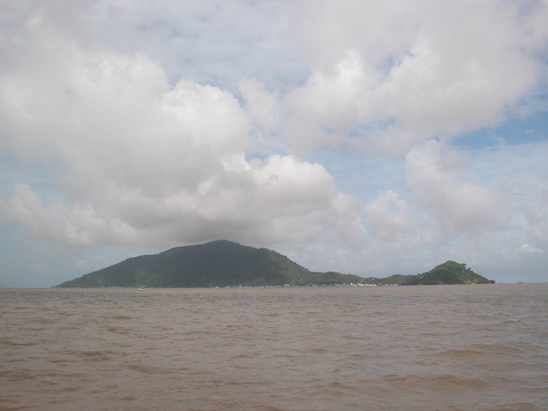 Kiên Hải island area overview
Hon Tre (Kien Hai)
Hòn Tre in Kiên Hải is a compact Gulf island reached from Rạch Giá, with a fishing settlement, rocky coastal scenery and hills planted with fruit trees and pepper. Its appeal lies in small-scale exploration: the harbour, local shrines, shaded coves and viewpoints above the sea.
Read the field guide Mainland gateway context — Tam Bảo temple, Rạch Giá
Lai Son / Hon Son Island
Hon Son rises steeply from the Gulf of Thailand between the mainland gateway of Rach Gia and the Nam Du archipelago. Also called Lai Son, it combines a working fishing settlement, palm-fringed coves and a mountainous interior that gives even a short coastal journey a changing view.
Read the field guide
Nam Du Archipelago
Nam Du is a cluster of small Gulf of Thailand islands reached from Rach Gia. The main island, Hon Lon, gives visitors a harbour village, a steep green backdrop and a coastal road; the surrounding islands turn a stay into a sequence of short boat outings rather than one continuous beach resort.
Read the field guide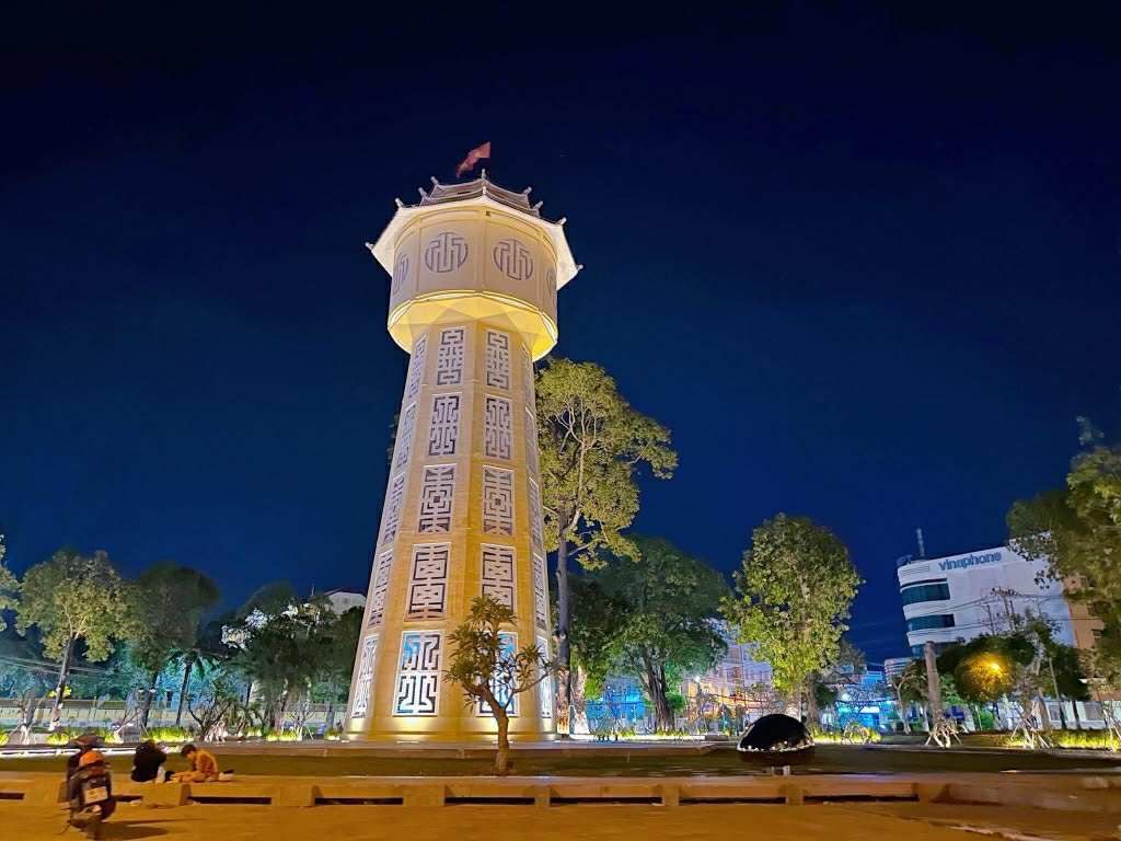
Phan Thiet (with Mui Ne)
Phan Thiet and the Mui Ne coast offer two related but distinct experiences: a working fishing city and a long holiday coastline with dunes, beaches and wind sports. The destination stretches well beyond a single walkable centre. Choosing the right base makes a larger difference than trying to fit every attraction into one day.
Read the field guide
Phu Quoc
Phu Quoc pairs broad beaches with fishing villages, pepper gardens and a heavily forested northern interior. It is a substantial island off Vietnam’s southwest coast, with resort areas spread far apart: choosing the right base matters as much as deciding which beach to visit.
Read the field guide
Phu Quy Island
Phu Quy is a small inhabited island offshore from Phan Thiet, with fishing settlements, rocky headlands, sandy bays and religious sites. Its appeal is the combination of village life and coastal exploration rather than a single large resort zone. It is a different island from Phu Quoc, despite the similar English spellings.
Read the field guideRach Gia
Rach Gia faces the Gulf of Thailand on the western side of the Mekong Delta. It is a busy mainland gateway for Phu Quoc, Hon Son and Nam Du, but its temples, food and long waterfront also reward a deliberate overnight stay between journeys.
Read the field guide Mainland stay context — Sóc Trăng city
Tran De
Tran De is a working fishing port near the Mekong’s eastern coast and a mainland departure point for Con Dao. Its canals, fishing boats and market activity give the journey an everyday delta setting, quite different from arriving through a major resort city.
Read the field guide
Vung Tau
Vung Tau is a coastal peninsula where beaches, hilltop landmarks and fishing activity share the same city. Front Beach offers an urban waterfront, while Back Beach has a longer open shoreline and a different holiday atmosphere. The mountains give the city a vertical dimension beyond its seaside promenades.
Read the field guidePhoto credits12
- Depicts: Chau DocVietnam, Chau Doc, City streets. Author: Vyacheslav Argenberg. Credit: Own work. License: CC BY 4.0 (https://creativecommons.org/licenses/by/4.0). Source: https://commons.wikimedia.org/wiki/File:Vietnam,_Chau_Doc,_City_streets.jpgCropped to fit the display.
- Depicts: Con DaoConDao park dam. Author: [Tycho] talk , http://shansov.net. Credit: Own work. License: CC BY-SA 3.0 (https://creativecommons.org/licenses/by-sa/3.0). Source: https://commons.wikimedia.org/wiki/File:ConDao_park_dam.jpgCropped to fit the display.
- Depicts: Ha TienQuang truong ha tien. Author: Trương Thành Ý. Credit: Own work. License: CC BY-SA 4.0 (https://creativecommons.org/licenses/by-sa/4.0). Source: https://commons.wikimedia.org/wiki/File:Quang_truong_ha_tien.jpgCropped to fit the display.
- Depicts: Ho Chi Minh CityHo Chi Minh City, City Hall, 2020-01 CN-03. Author: Steffen Schmitz ( more photos ). Credit: Own work. License: CC BY-SA 4.0 (https://creativecommons.org/licenses/by-sa/4.0). Source: https://commons.wikimedia.org/wiki/File:Ho_Chi_Minh_City,_City_Hall,_2020-01_CN-03.jpgCropped to fit the display.
- Area image: Kiên Hải island area — Kiên Hải island area overviewHòn Tre. Author: Nguyễn Thanh Quang. Credit: Own work. License: CC BY-SA 3.0 (https://creativecommons.org/licenses/by-sa/3.0). Source: https://commons.wikimedia.org/wiki/File:H%C3%B2n_Tre.JPGCropped to fit the display.
- Area image: Tam Bảo temple in Rạch Giá, the separate mainland gateway for Hon SonChùa Sắc Tứ Tam Bảo RG. Author: Bùi Thụy Đào Nguyên. Credit: Own work. License: CC BY-SA 4.0 (https://creativecommons.org/licenses/by-sa/4.0). Source: https://commons.wikimedia.org/wiki/File:Ch%C3%B9a_S%E1%BA%AFc_T%E1%BB%A9_Tam_B%E1%BA%A3o_RG.jpgCropped to fit the display.
- Depicts: Nam Du ArchipelagoCau cang Dao cu tron-quan Dao nam du. xa An Sơn, Huyen Kiên Hải, tỉnh Kiên Giang, Việt Nam,02-07-16-Dyt - panoramio. Author: trungydang. Credit: https://web.archive.org/web/20161103080456/http://www.panoramio.com/photo/131689933. License: CC BY 3.0 (https://creativecommons.org/licenses/by/3.0). Source: https://commons.wikimedia.org/wiki/File:Cau_cang_Dao_cu_tron-quan_Dao_nam_du._xa_An_S%C6%A1n,_Huyen_Ki%C3%AAn_H%E1%BA%A3i,_t%E1%BB%89nh_Ki%C3%AAn_Giang,_Vi%E1%BB%87t_Nam,02-07-16-Dyt_-_panoramio.jpgCropped to fit the display.
- Depicts: Phan Thiet (with Mui Ne)Tháp nước phan thiết về đêm. Author: Luongvanquyphuoc2005. Credit: Own work. License: CC BY-SA 4.0 (https://creativecommons.org/licenses/by-sa/4.0). Source: https://commons.wikimedia.org/wiki/File:Th%C3%A1p_n%C6%B0%E1%BB%9Bc_phan_thi%E1%BA%BFt_v%E1%BB%81_%C4%91%C3%AAm.jpgCropped to fit the display.
- Depicts: Phu Quoc
- Depicts: Phu Quy IslandChualinhsonphuquy. Author: Thái Nhi at vi.wikipedia. Credit: Own work Transferred from vi.wikipedia. License: Public domain (https://creativecommons.org/publicdomain/mark/1.0/). Source: https://commons.wikimedia.org/wiki/File:Chualinhsonphuquy.jpg
- Area image: Sóc Trăng city, a separate mainland stay and road-transfer option for Tran DeThành phố Sóc Trăng. IMG. Author: Huynhdat1909. Credit: Own work. License: CC BY-SA 4.0 (https://creativecommons.org/licenses/by-sa/4.0). Source: https://commons.wikimedia.org/wiki/File:Th%C3%A0nh_ph%E1%BB%91_S%C3%B3c_Tr%C4%83ng._IMG.jpgCropped to fit the display.
- Depicts: Vung TauNhìn toàn cảnh TP.VŨNG TÀU từ Cáp treo Vũng Tàu. Author: Luci nguyễn. Credit: Own work. License: CC BY-SA 4.0 (https://creativecommons.org/licenses/by-sa/4.0). Source: https://commons.wikimedia.org/wiki/File:Nh%C3%ACn_to%C3%A0n_c%E1%BA%A3nh_TP.V%C5%A8NG_T%C3%80U_t%E1%BB%AB_C%C3%A1p_treo_V%C5%A9ng_T%C3%A0u.jpgCropped to fit the display.
