
Türkiye.
Türkiye offers several different journeys: an İstanbul city break, an Aegean harbour holiday, a Mediterranean coast trip or time among the valleys of Cappadocia. Treat them as choices to combine carefully, not stops that can all fit into one short visit. A few nights in a well-chosen base leave room for neighbourhood life, regional food and archaeological or landscape excursions.
Photo credits1
One country, different starting points.
A little closer to Türkiye
Geography, regions and practical details from the country guide. Go straight to a chapter, or browse every destination below.
Go straight to the destinationsTürkiye offers several different journeys: an İstanbul city break, an Aegean harbour holiday, a Mediterranean coast trip or time among the valleys of Cappadocia. Treat them as choices to combine carefully, not stops that can all fit into one short visit. A few nights in a well-chosen base leave room for neighbourhood life, regional food and archaeological or landscape excursions.
A ferry arrival is a useful beginning for a coastal stay, but it does not remove the need to plan onward travel. Ayvalık, Çeşme and other gateways are different towns, and a Greek-island crossing is an international journey. Keep the landing harbour, accommodation and entry requirements together when shaping the itinerary.
Landscape and trip style
Türkiye spans southeastern Europe and Anatolia, with shores on the Black Sea, Aegean and Mediterranean and the Sea of Marmara between its European and Asian settings. The interior includes extensive mountains and plateaus. The seven conventional geographical regions are Marmara, Aegean, Mediterranean, Central Anatolia, Black Sea, Eastern Anatolia and Southeastern Anatolia. Coastal distances and inland relief make a regional plan more practical than judging a journey from straight-line distance.
Regions to explore
İstanbul and the Marmara region combine urban history with waterways. The Aegean coast includes İzmir, Kuşadası and Bodrum, while the Mediterranean coast offers another itinerary around places such as Antalya and Göcek. Cappadocia is an inland region of valleys and rock-cut heritage, including Göreme and Avanos; it is not one town. The Black Sea coast has a different character, with wooded mountains, villages and sights such as Sümela near Trabzon.
Language
Turkish is the official language. Save addresses in Turkish as well as in any translation, and keep letters such as ç, ş and the dotted or dotless i when copying a place name from a booking. English support varies by service and location. For a tour, transfer or accessibility request, confirm the language available rather than assuming the same arrangements throughout the country.
Money
The currency is the Turkish lira. Check the currency of an advertised hotel, excursion or ferry price before comparing it with another offer, and read card-conversion and withdrawal charges before accepting them. Use a current exchange rate for your budget instead of a fixed conversion printed in an old guide. Carry a suitable backup payment option and ask locally about card acceptance for small purchases.
Culture and food
Regional ingredients make a good introduction to the country. Aegean olive-oil cooking includes artichokes, broad beans and stuffed vine leaves; Cappadocian menus may offer mantı dumplings and testi kebab. The Black Sea has its own food and musical traditions, including the kemençe. Ask about the actual recipe when you have dietary requirements. Historic mosques are also working religious spaces: follow the specific visitor route, access signs and instructions rather than treating every building as an unrestricted museum.
When to go
Türkiye’s meteorological service distinguishes continental, Mediterranean, Marmara transitional and Black Sea climates. Seas moderate coastal areas, while mountain ranges limit that influence inland. Choose clothing for the exact region and elevation, not only the month. Spring and autumn can suit walking and archaeological visits; summer coastal plans need shade and water, while inland or mountain winter journeys need a different preparation. Check local forecasts before outdoor activities and transfers.
Getting there
Choose an airport or land gateway near the region you intend to explore. For Aegean ferries, Turyol publishes Ayvalık–Lesvos and Çeşme–Chios connections, but the actual departure date, vessel and vehicle conditions require confirmation. These are international crossings with separate entry rules on each side. Leave time for document checks and follow the carrier’s terminal instructions rather than assuming that the nearest sightseeing pier is the departure point.
Getting around
High-speed YHT services connect a defined rail network including İstanbul, Eskişehir, Ankara and Konya; they do not form a train service to every coastal town. Check the precise station and arrange any final road transfer separately. In İstanbul, Şehir Hatları lists city ferry routes, Princes’ Islands services and Bosphorus tours as distinct offerings. Match the route, pier and ticket conditions to the journey instead of assuming a sightseeing cruise and a commuter crossing are identical.
Planning your stay
The Ministry of Foreign Affairs publishes visa rules by nationality and passport type. Some visitors are exempt, some qualify for an e-Visa and others need a consular visa; eligibility should never be inferred from a ferry ticket or a previous visit. Check passport-validity requirements and your permission to return to the next country on the itinerary. For museums, religious buildings and archaeological sites, verify access and current visitor arrangements before fixing an excursion around an onward departure.
Good to know before you go
Is Cappadocia a single town?
No. It is an inland region with several towns and visitor areas, including Göreme and Avanos. Choose a specific base and plan transfers between sights.
Does a Greek-island ferry ticket replace Turkish entry permission?
No. It is an international crossing. Check the entry rules for your nationality and travel document on both sides of the journey.
Does every visitor need the same Turkish visa?
No. Rules depend on nationality, passport type and purpose of travel. Use the Turkish Ministry of Foreign Affairs guidance and the official application channel when required.
Is the currency the euro?
No. Türkiye uses the Turkish lira. An individual service may quote another currency, so check what is actually charged before paying.
Are İstanbul city ferries the same as Bosphorus sightseeing tours?
No. The operator lists different city routes, island services and tours. Check the exact pier, route and ticket conditions for the service you want.
Sources & references
These references support the guide. Confirm opening hours, access and travel services before you go.
- 01Turkish Geographical Society: geographical regions
- 02GoTürkiye: Marmara
- 03Türkiye Tourism Promotion and Development Agency: destinations
- 04GoTürkiye: Black Sea
- 05GoTürkiye: Cappadocia landscapes and towns
- 06Turkish Ministry of National Education: official language
- 07Central Bank of the Republic of Türkiye: banknotes
- 08GoTürkiye: olive-oil dishes
- 09GoTürkiye: regional gastronomy
- 10Turkish State Meteorological Service: climate types
- 11Turyol: published international ferry connections
- 12Turkish Ministry of Foreign Affairs: nationality-specific visa guidance
- 13Turkish Ministry of Foreign Affairs: general visa and passport guidance
- 14TCDD Taşımacılık: YHT routes
- 15Şehir Hatları: city, island and tour services
- 16GoTürkiye: İstanbul mosque visitor route
Find your place in Türkiye
Open the guides, get a feel for the differences between places, and find the ones that fit your plans.

Bodrum
Bodrum combines an ancient harbour town with a peninsula of beach resorts, marinas and smaller bays. The castle and old lanes give the centre substance beyond its nightlife, while the surrounding coast offers very different places to stay.
Read the field guide
Kuşadası
Kuşadası is both a lively Aegean harbour town and a useful base for the archaeology of Ephesus. Its own old streets, castle islet and waterfront deserve time alongside the famous inland excursion.
Read the field guide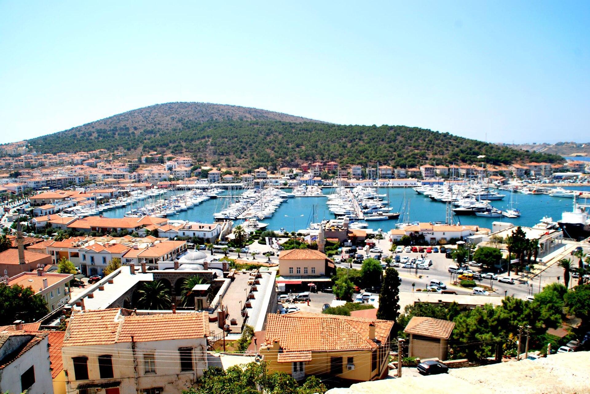
Çeşme
Çeşme is a western İzmir peninsula destination with a harbour castle, beach bays and easy access to the stone streets of Alaçatı. It works well for a trip mixing the coast, local food and a crossing to or from Chios.
Read the field guide
Marmaris
Marmaris combines a busy resort bay with an old harbour quarter, a castle museum and a pine-covered hinterland. It is a useful base for coastal holidays, boat outings and a ferry connection with Rhodes.
Read the field guide
Akçay
Akçay is a seaside base on the Gulf of Edremit, with waterfront time, local food and a choice of outings towards the Kaz Mountains. A short walk around its central shore gives a different experience from a mountain drive, an archaeological visit near Altınoluk or an international ferry journey.
Read the field guide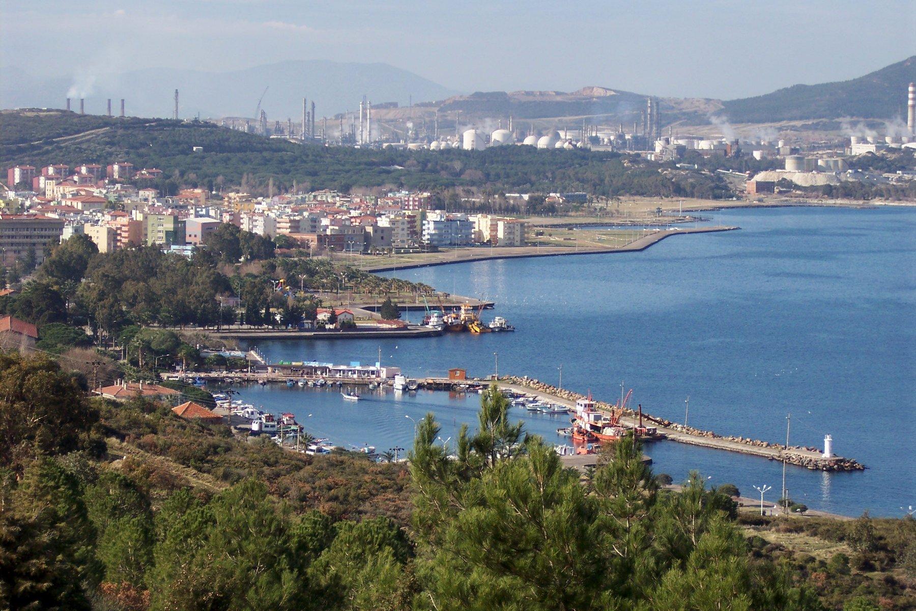
Aliağa
Aliağa brings together a working industrial coast, an everyday town and the archaeology of the ancient Aeolian cities. It offers a different visit from central İzmir: plan selected waterfront time, a nearby coastal neighbourhood and a carefully chosen heritage stop rather than expecting one continuous resort frontage.
Read the field guide Armutlu–Esenköy coast overview — İhlas Armutlu Holiday Village
Armutlu / Esenköy coast (including İhlas Holiday Village pier)
The Armutlu–Esenköy coast is a planning area for different Marmara settlements, beaches and road journeys. Esenköy and Armutlu town have their own local settings, while İhlas Armutlu Holiday Village is a specific managed property. Choose one base and one outing rather than treating this coast as one resort or one ferry landing.
Read the field guide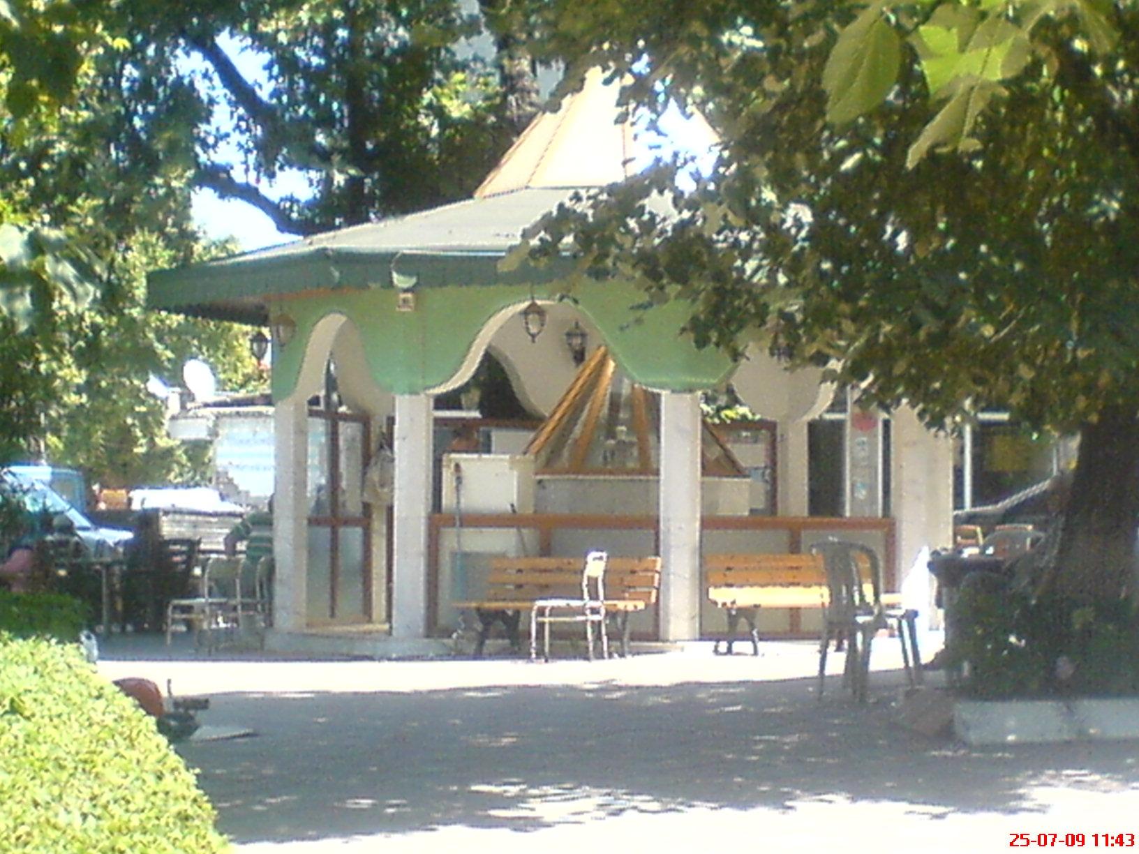 Area near Armutlu
Armutlu
Armutlu combines a coastal town, a separate thermal area and villages around the western end of the Yalova coast. Historic buildings and a shore walk can fill a town visit, while Fıstıklı, Kapaklı or an upland village gives another setting. Choose one manageable excursion rather than treating the whole district as a single resort.
Read the field guide
Avşa
Avşa, also known as Türkeli, is a holiday island in the Sea of Marmara with beaches, vineyards and different coastal neighbourhoods. Choose time in the settlement and a selected bay rather than assuming every shore is beside the ferry or that the whole island has one uniform holiday setting.
Read the field guide
Ayvalık
Ayvalık rewards a stay built around stone streets, olive culture and time on the water. Explore the mainland town before crossing by road to Cunda, also called Alibey Island, or choosing a separate beach day around Sarımsaklı. These settings offer different rhythms within the wider Ayvalık area.
Read the field guide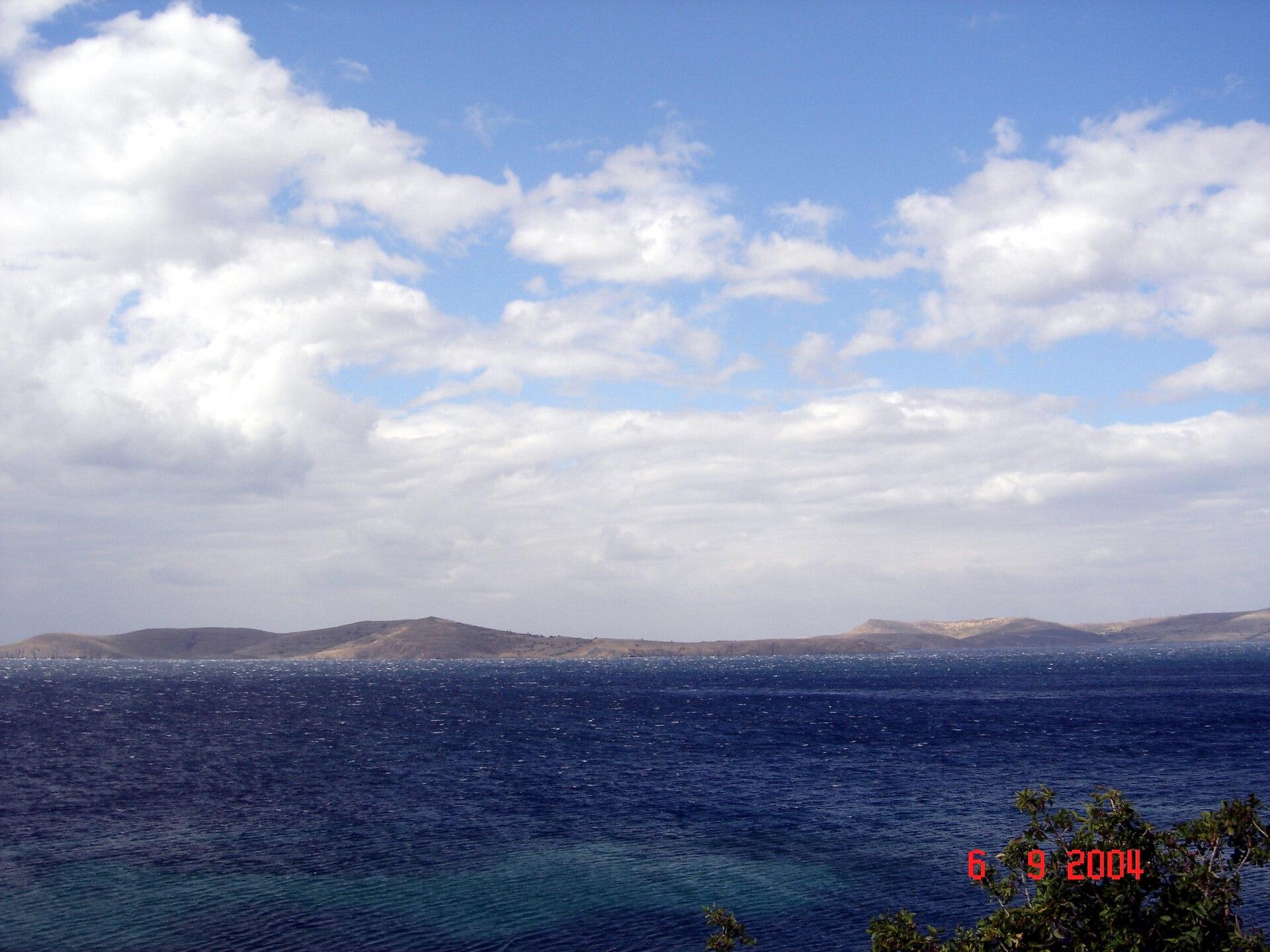 Paşalimanı Island overview
Balıklı (Paşalimanı Island)
Balıklı is a village and ferry landing on Paşalimanı Island in the Sea of Marmara. A stay here suits a slower combination of village lanes, selected shoreline and journeys to other island settlements. The approach is maritime: a district address in Erdek does not put Balıklı on the mainland road network.
Read the field guide
Bandırma
Bandırma combines a working Marmara port with a useful city base for archaeology and birdwatching. Its museum brings together finds from Daskyleion, Kyzikos and the surrounding region. Beyond the city, Kuşcenneti National Park offers a different day among lake, reeds and bird habitat.
Read the field guide
Bozcaada
Bozcaada, historically Tenedos, offers a compact island holiday shaped by vineyards, a harbour castle and lanes where Greek Orthodox and Ottoman buildings stand close together. A walk around the centre, a separate beach outing and time with a local wine producer make a more rewarding visit than racing around every coastal viewpoint.
Read the field guide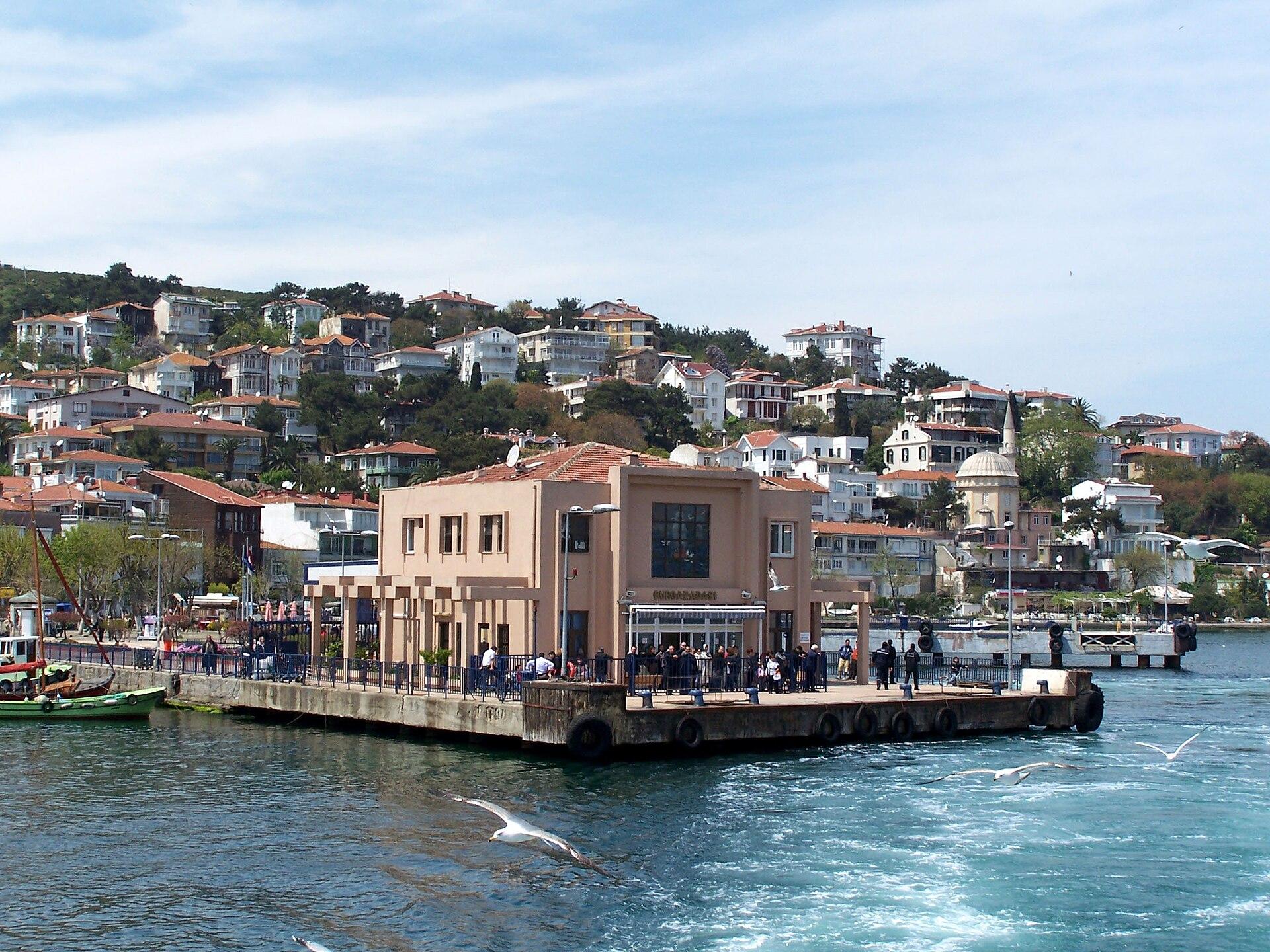
Burgazada
Burgazada, historically Antigoni, offers an island day shaped by residential streets, a wooded hill and the literary memory of Sait Faik Abasıyanık. It is one of İstanbul's inhabited Princes' Islands, with a distinct landing and its own onward routes rather than simply another district reached by road.
Read the field guide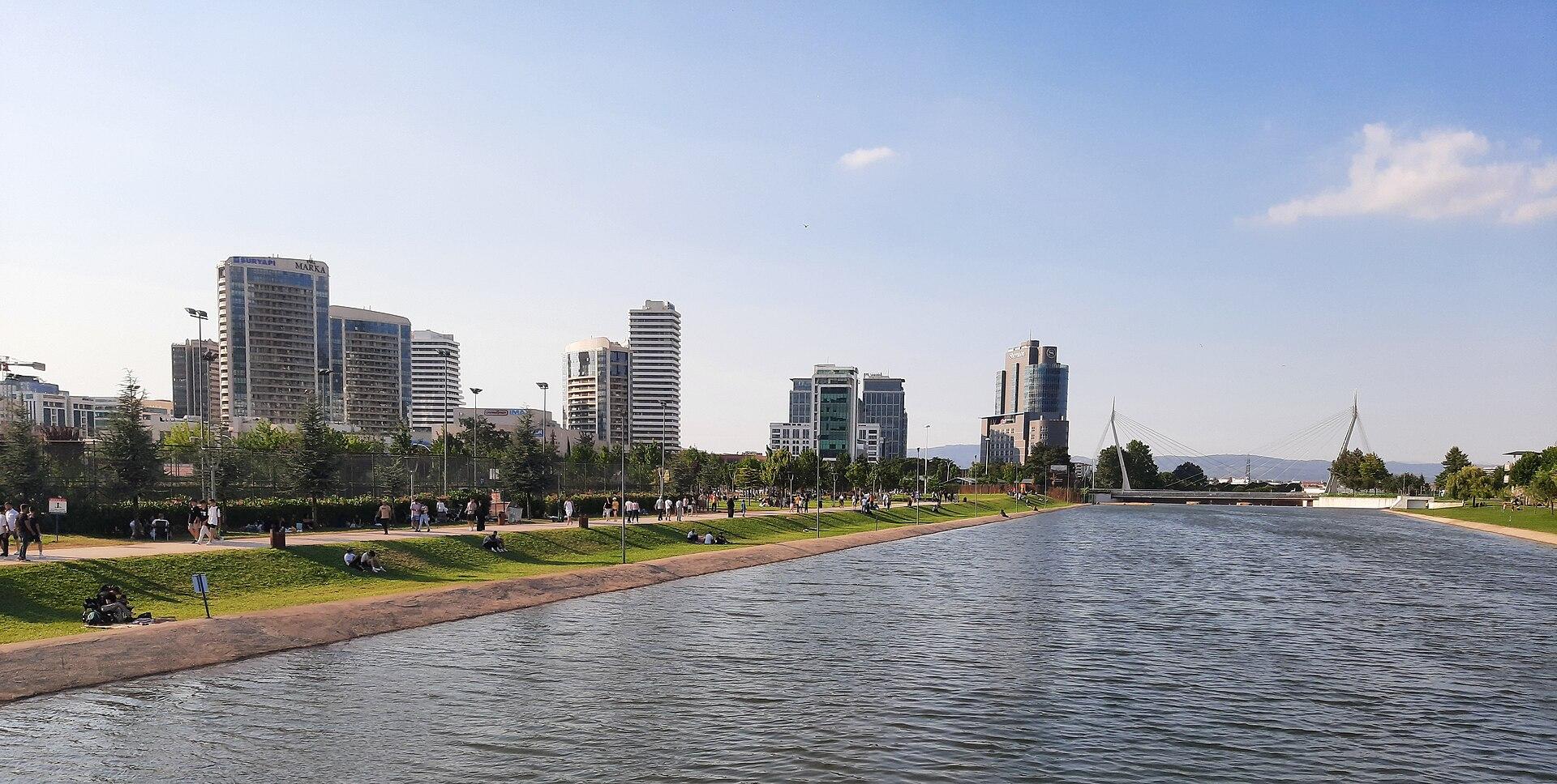
Bursa
Bursa is a city of historic trading courtyards, early Ottoman religious complexes and neighbourhoods below Uludağ. UNESCO recognises the relationship between its urban centres and the nearby village of Cumalıkızık. Give the city time for walking, architecture and food rather than treating it only as the road transfer after a Marmara crossing.
Read the field guide
Büyükada
Büyükada, historically Prinkipo, is the largest of the Princes' Islands and the administrative centre of İstanbul's island district. Its hillside streets, houses and religious heritage offer a different day from the mainland city. Plan a real island visit rather than treating it as an extension of a short harbour stop.
Read the field guide Area near Çanakkale (Kepez Port)
Çanakkale (Kepez Port)
Kepez Port is a working arrival facility in the Çanakkale area, with cruise and commercial activity rather than the same visitor setting as the city-centre waterfront. A useful visit begins with the correct arrival instructions, followed by a realistic choice of city culture, archaeology or another shore excursion.
Read the field guide
Çanakkale
Çanakkale is a Dardanelles city where a waterfront walk and an archaeological day trip make two rewarding, different plans. Start with the city and its maritime setting, then choose whether the next day belongs to Troy on the Asian side or a carefully planned crossing to the Gallipoli Peninsula.
Read the field guide
Cinarcik
Çınarcık is a Marmara coastal town with an easy starting point around Cumhuriyet Square and a wider choice of beach and forest outings. The municipality places the sea-bus pier by the square. Beyond the shore, Teşvikiye and the Erikli area offer another landscape of woodland and waterfalls.
Read the field guide
Dikili
Dikili offers an Aegean town base with a waterfront, beaches and access to the wider landscape around Bademli and Çandarlı. Its port also connects the town's identity with the ancient sites inland, but a visit to Bergama or a coastal village is a separate outing beyond the central promenade.
Read the field guide
Eceabat
Eceabat is a European-shore base for exploring the Gallipoli Peninsula with time and care. Its waterfront gives an immediate view of the Dardanelles, while a day inland can connect memorials, cemeteries and museum interpretation rather than rushing through a long list of distant sites.
Read the field guide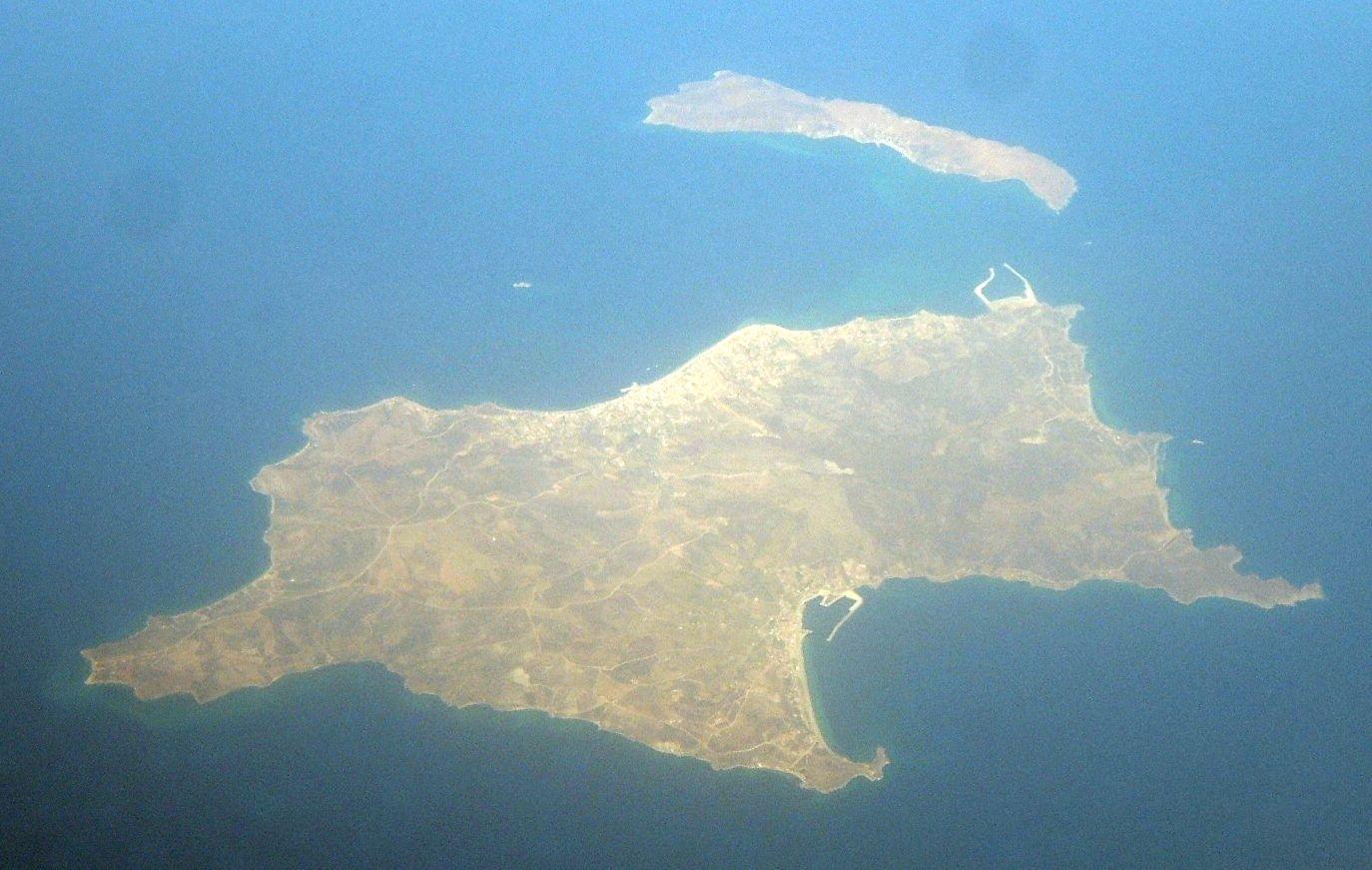 Sea of Marmara regional overview — Avşa Island
Ekinlik Island
Ekinlik is a small, inhabited island in the Sea of Marmara where village life and the shoreline shape a stay. Its community association reports local cultural gatherings, a bookshop and shared public spaces. Allow time for a waterfront walk and an unhurried meal rather than approaching it as a resort with a long list of ticketed attractions.
Read the field guide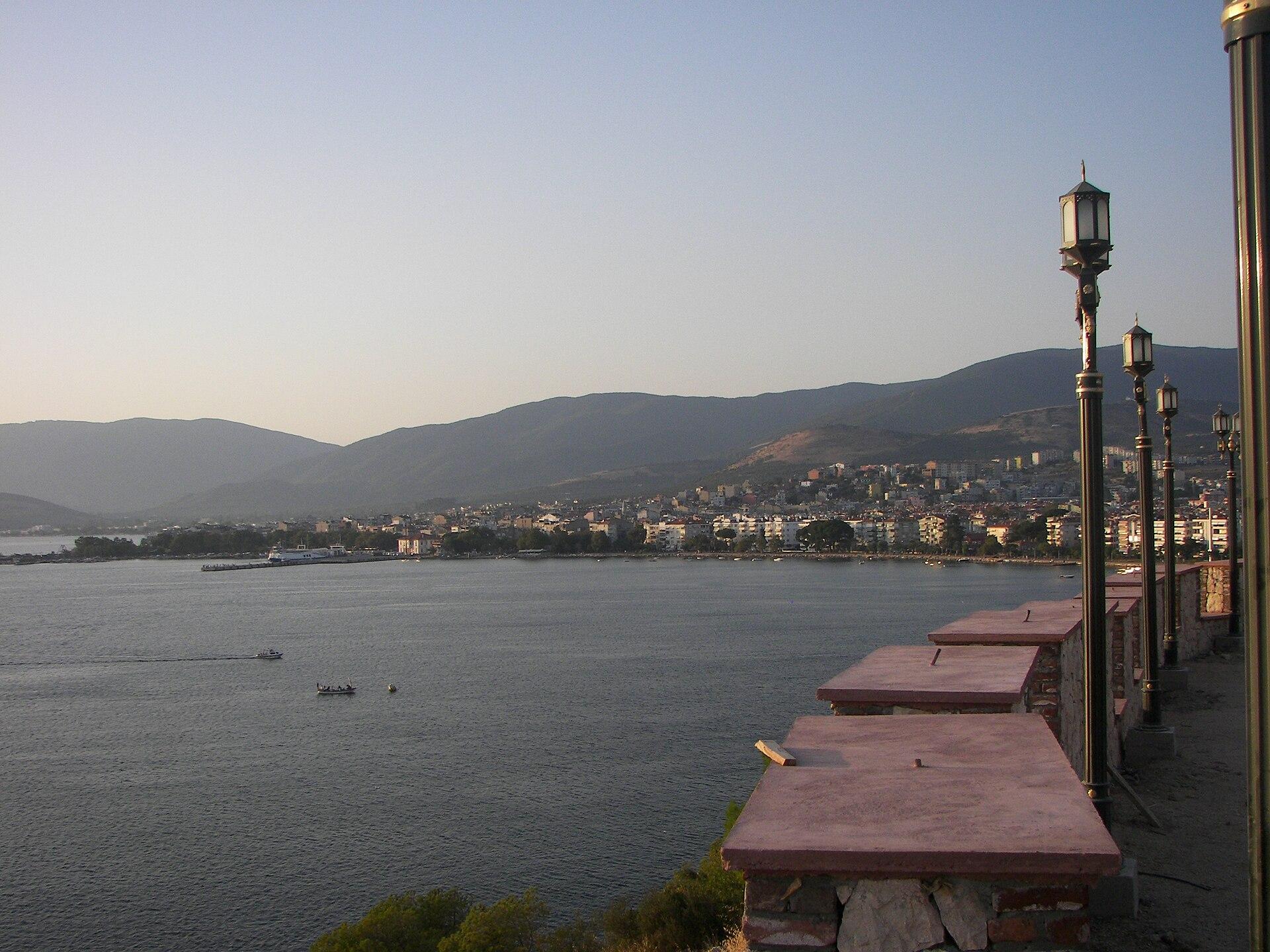
Erdek
Erdek is a mainland coastal town on the Kapıdağ peninsula, with a seafront for leisurely walks and a wider landscape of beaches, olive groves and ancient Kyzikos. Zeytinli Ada provides a small offshore landmark visible from the town's waterfront. Start with the town, then choose one longer coastal or heritage outing.
Read the field guide
Fethiye
Fethiye combines an active harbour town with Lycian rock tombs above its streets and a broad choice of coastal excursions. Spend time in the centre before heading to Çalış, Kayaköy or Ölüdeniz: these offer different settings and require separate journeys rather than one continuous waterfront stroll.
Read the field guide
Gelibolu (Gallipoli)
Gelibolu is a town on the European side of the Dardanelles, with a maritime history of its own and cultural stops around the shore. Give its streets and heritage time before setting off towards the more distant memorial landscapes commonly grouped under the name Gallipoli.
Read the field guide Geyikli area — Alexandria Troas archaeological site
Geyikli
Geyikli is the mainland side of the Bozcaada crossing, with a coastal setting in the Ezine area and its own arrival arrangements. Treat a mainland stay or beach pause as a separate choice from a visit to the island across the water.
Read the field guide
Gökçeada
Gökçeada, historically Imbros, is an island of old stone villages, agricultural landscapes and exposed Aegean shores. Its Greek heritage and present-day Turkish island life are encountered in everyday streets, food and places of worship. Give the villages time rather than treating the island as a single beach beside the ferry.
Read the field guide İzmir overview
Göztepe, İzmir
Göztepe is an İzmir neighbourhood on the southern side of the bay, suited to a local shore walk and a separate uphill visit towards Susuzdede Park. It offers another pace from the clock-tower and Kemeraltı circuit. Choose a manageable section and leave time for a meal rather than treating the entire south shore as one short promenade.
Read the field guide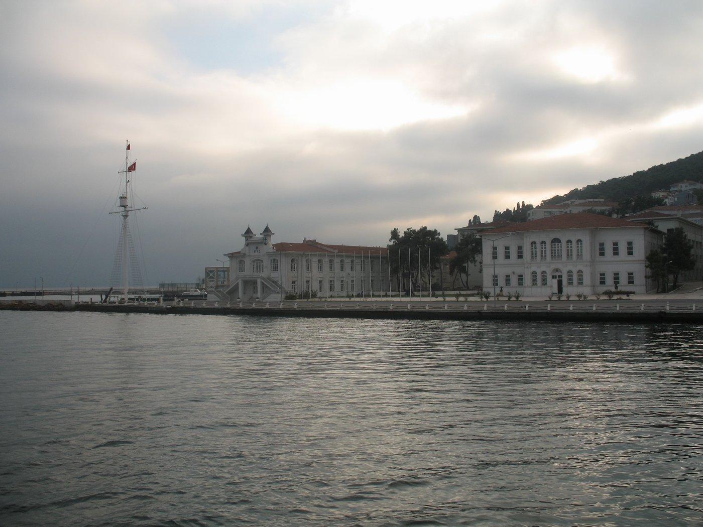
Heybeliada
Heybeliada, historically Halki, is one of İstanbul's inhabited Princes' Islands. Its wooded slopes, residential streets and religious and domestic heritage make a rewarding island day, with a different pace from the mainland. Choose a manageable walk rather than assuming every historic property is beside the ferry.
Read the field guideArea near İhlas Armutlu Tatil Köyüİhlas Armutlu Tatil Köyü
İhlas Armutlu Tatil Köyü is a particular managed timeshare property at Bozburun in Armutlu district, with apartment accommodation and coastal, pool and bathing facilities described by its owner. It is a different destination from the town centre. Start by confirming the actual guest arrangement and arrival point for your stay.
Read the field guideIstanbul
Istanbul rewards a plan built around neighbourhoods and crossings: the Historic Peninsula's imperial monuments, the Golden Horn, and another day across the water in Kadıköy. Its layered history is visible in Byzantine and Ottoman buildings, trading areas and a skyline shaped around the waterways. Choose a small set of places each day and give them time.
Read the field guideİzmir
İzmir is a bay city where a good day can move between Kemeraltı's trading streets, Konak's clock tower and the Kordon waterfront. Another journey across the bay brings a different Karşıyaka setting. Ancient Smyrna and the city's later neighbourhoods give more than one layer to explore, so choose areas that fit together rather than covering the whole province at once.
Read the field guide
Kabatepe
Kabatepe is the mainland ferry gateway to Gökçeada on the Gallipoli Peninsula. Its port is a practical departure point, while the surrounding Eceabat historical area offers a separate programme of interpretation centres, memorials and coastal landscapes.
Read the field guide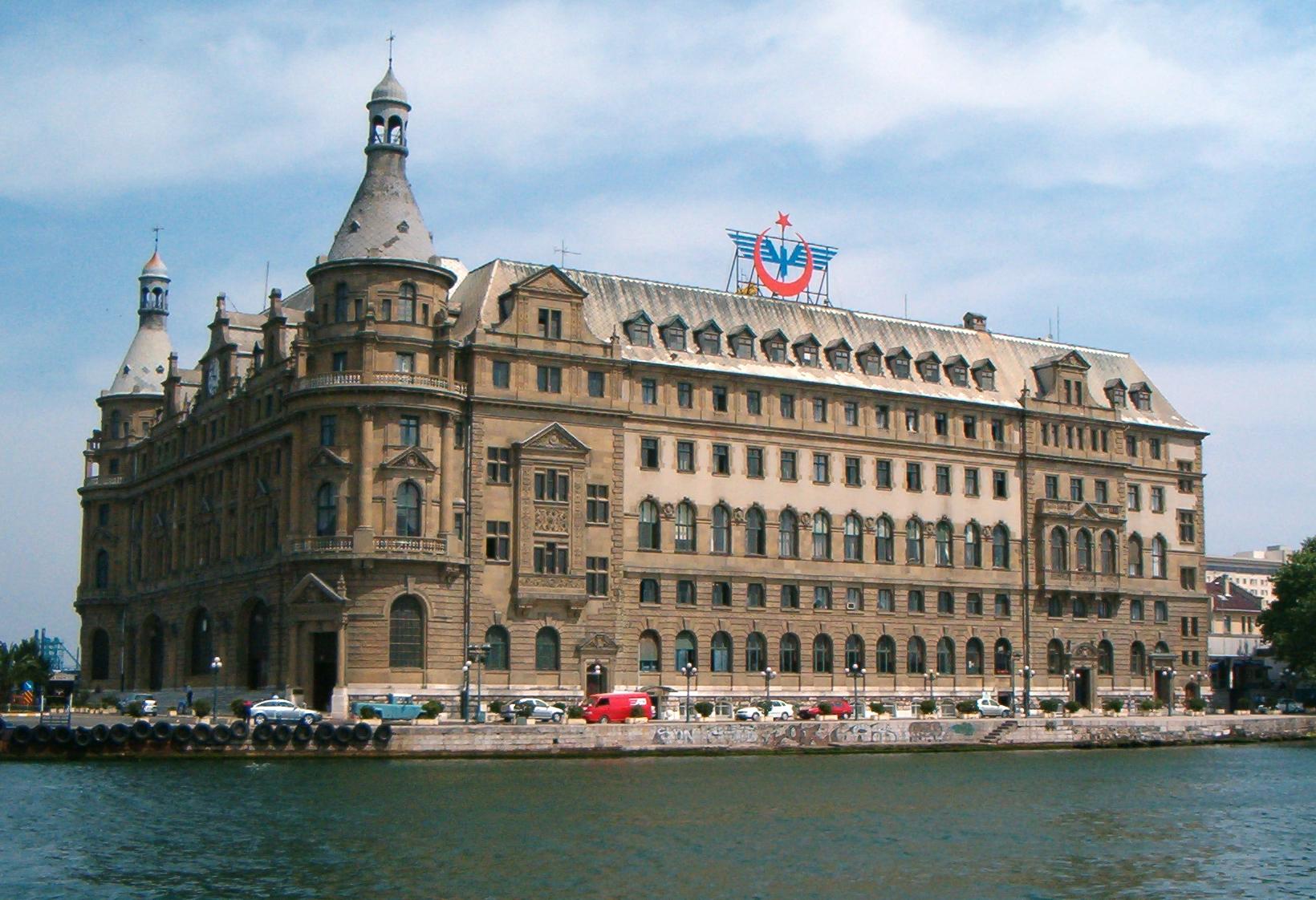
Kadıköy
Kadıköy offers an Asian-side Istanbul day of market streets, food, Moda's shore and distinct cultural visits. Barış Manço's house gives a personal musical-history stop, while the former gasworks at Hasanpaşa houses the Müze Gazhane cultural campus. Choose time for one area and a meal rather than rushing straight from ferry to another crossing.
Read the field guide Area near Karantina (İzmir)
Karantina (İzmir)
Karantina is an urban ferry-pier and waterfront area on İzmir's southern bay shore, beside the Mithatpaşa square. Visit for an unhurried promenade, views across the water and a neighbourhood food stop. It works well as one part of a city day rather than a separate island excursion.
Read the field guide
Karşıyaka
Karşıyaka offers a north-shore İzmir stay of waterfront walking, local streets and a different view across the bay. Bostanlı adds another coastal setting, while historical mansions and the memory of Zübeyde Hanım give the district a distinct cultural layer. Allow time for one area and a meal rather than treating it only as a ferry connection.
Read the field guide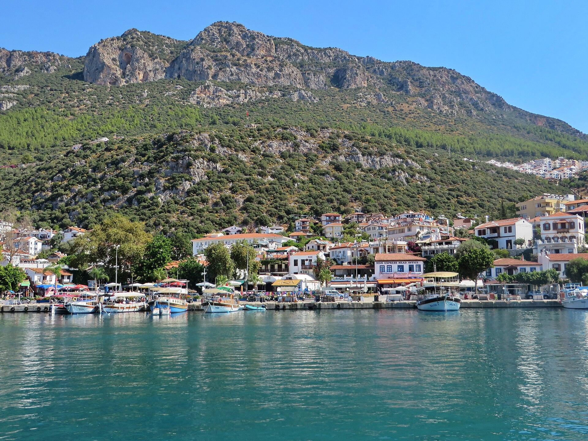
Kaş
Kaş is a harbour town on the Lycian coast where ancient Antiphellos survives among modern streets and on the peninsula. Its theatre, a striking Lycian tomb in Uzun Çarşı and a choice of coastal outings reward a stay with time on land as well as at sea.
Read the field guideKilitbahir
Kilitbahir is a small European-shore village whose castle gives the Dardanelles a tangible historical setting. A visit works best when the fortress, village streets and waterfront have their own time, with a larger Gallipoli circuit planned separately rather than squeezed into the same brief stop.
Read the field guide
Kınalıada
Kınalıada offers a smaller-scale Princes' Islands visit, with a compact settlement, a rocky island landscape and several hill settings. Give its residential streets and coast time rather than treating the island only as an intermediate ferry call on the way to somewhere larger.
Read the field guide
Konak
Konak gives a compact starting point for central İzmir: the clock tower, market streets and a bay-facing transport hub. A visit can pair Konak Square with Kemeraltı's shops and a meal before a separate heritage or waterfront outing. Choose time in the streets rather than treating the square only as a place to change transport.
Read the field guide Gemlik district overview
Kumla
Kumla is a coastal holiday area in Gemlik district on the Sea of Marmara, with a shore walk and residential streets behind it. Start with a selected beach entrance and a simple local meal. A longer stay can include another Gemlik-area outing, with the actual return arranged before leaving.
Read the field guide
Lapseki
Lapseki is an Asian-shore Dardanelles stop with a town waterfront, a history reaching back to Lampsakos and a surrounding fruit-growing landscape. It rewards a slower pause on a journey through the strait region rather than being treated only as a queue for the next crossing.
Read the field guide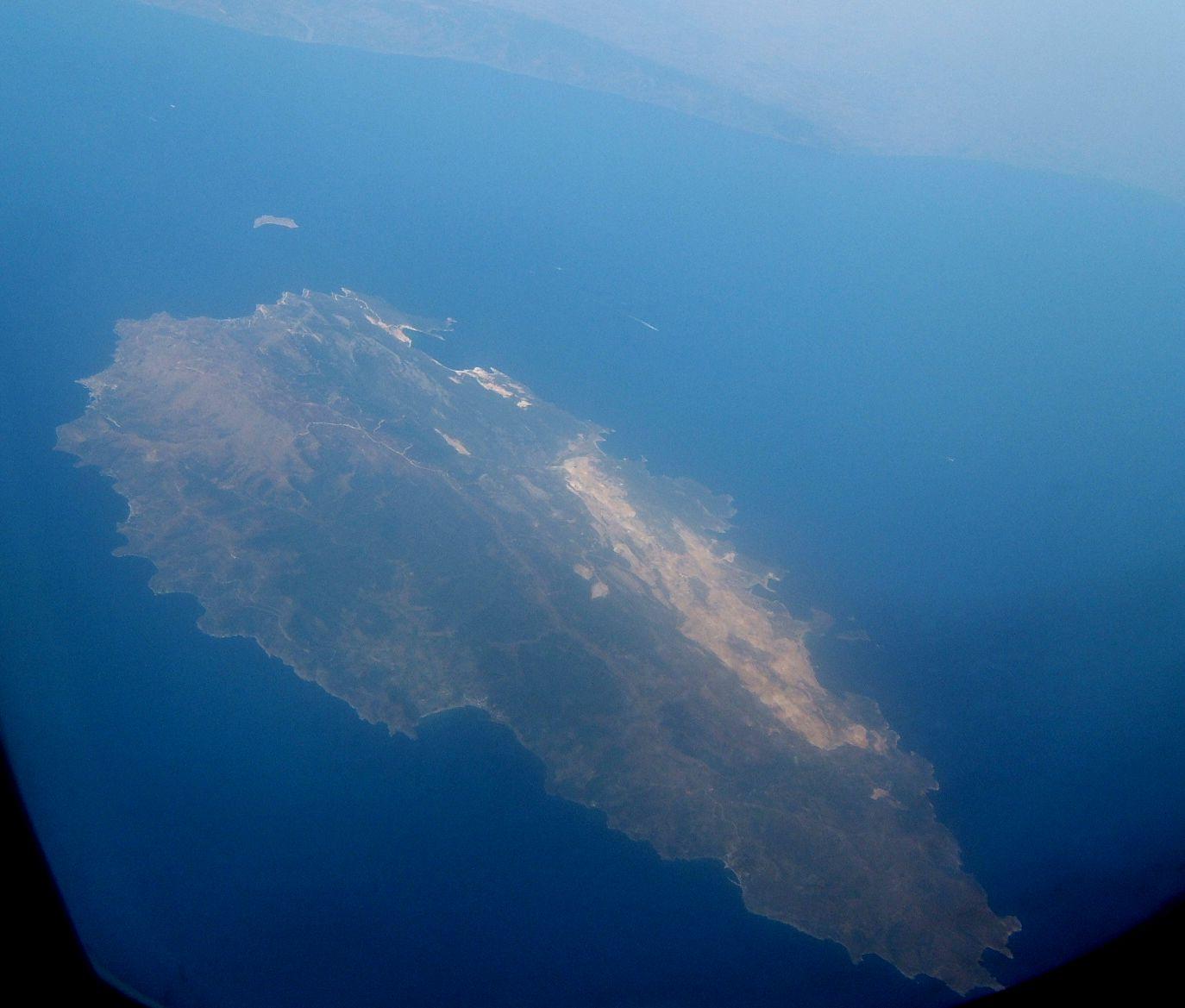
Marmara Adası
Marmara Island combines a living marble-working landscape with coastal settlements and a mountainous interior. Its stone linked it to ancient building programmes far beyond the Sea of Marmara, while a modern stay can mix town time, a selected shore and a visit towards Saraylar.
Read the field guide
Mordoğan
Mordoğan offers a coastal base on the Karaburun peninsula, with a harbour setting, distinct beaches and a small local-history collection. A village-centred visit can include Ayşe Kadın Mosque and Müesser Aktaş's ethnographic house, with a separate shore outing. Choose a few places and leave space for a relaxed meal.
Read the field guide
Mudanya
Mudanya is a coastal town where the waterfront and Armistice House Museum make a rewarding pause beside the Sea of Marmara. The house holds rooms and objects associated with the 1922 armistice. Combine it with a town walk and leave another part of the trip for Tirilye's lanes and olive-growing surroundings.
Read the field guideErdek district overview — Erdek townNarlı
Narlı is a mainland coastal settlement on the Kapıdağ peninsula in Erdek district. The regional tourism authority includes it among the area's sandy coastal places, making it an option for a quieter shore-based day or stay. Plan around the actual village and selected beach rather than the whole peninsula at once.
Read the field guide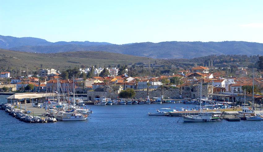
Seferihisar
Seferihisar combines a working town with Sığacık's walled streets, nearby Teos archaeology and different coastal stays. A good visit can pair a heritage outing with local food, leaving a separate part of the day for a selected beach. Choose the actual area rather than trying to cover town, marina and every shore together.
Read the field guide
Urla
Urla combines an inland town of shops and cultural stops with the separate İskele shore and Klazomenai's archaeology. Its olive-growing surroundings and Aegean food traditions give a reason to slow down over a meal. Choose time in the town or shore before adding another peninsula destination.
Read the field guide
Yalova
Yalova combines a Marmara waterfront with a distinctive house museum and green excursions beyond the city. Yürüyen Köşk, the Walking Mansion, takes its name from the building's 1930 move to preserve a plane tree. Allow time for the house and waterfront before choosing one separate garden or thermal-area outing.
Read the field guidePhoto credits45
- Depicts: Bodrum
- Depicts: KuşadasıKuşadası Overlook. Author: jpitha. Credit: https://www.flickr.com/photos/jpitha/8466996978. License: CC BY-SA 2.0 (https://creativecommons.org/licenses/by-sa/2.0). Source: https://commons.wikimedia.org/wiki/File:Ku%C5%9Fadas%C4%B1_Overlook.jpgCropped to fit the display.
- Depicts: ÇeşmeCesme Marina. Author: Irfan Parlar. Credit: Own work. License: CC BY-SA 4.0 (https://creativecommons.org/licenses/by-sa/4.0). Source: https://commons.wikimedia.org/wiki/File:Cesme_Marina.jpgCropped to fit the display.
- Depicts: Marmaris
- Depicts: Akçay
- Depicts: AliağaAliağa - www.alto.org.tr - panoramio. Author: aokaratekin. Credit: https://web.archive.org/web/20161010000741/http://www.panoramio.com/photo/3703994. License: CC BY-SA 3.0 (https://creativecommons.org/licenses/by-sa/3.0). Source: https://commons.wikimedia.org/wiki/File:Alia%C4%9Fa_-_www.alto.org.tr_-_panoramio.jpgCropped to fit the display.
- Area image: İhlas Armutlu Holiday Village, a named component of the Armutlu–Esenköy coast guideİhlas Armutlu Tatil Köyü Panorama. Author: İhlasarmutlucom. Credit: Own work. License: CC BY-SA 4.0 (https://creativecommons.org/licenses/by-sa/4.0). Source: https://commons.wikimedia.org/wiki/File:%C4%B0hlas_Armutlu_Tatil_K%C3%B6y%C3%BC_Panorama.jpgCropped to fit the display.
- Area image: armutlu tarihi minare by emir — Area near ArmutluArmutlu tarihi minare by emir - panoramio. Author: seaside_34. Credit: https://web.archive.org/web/20161014025956/http://www.panoramio.com/photo/29051300. License: CC BY-SA 3.0 (https://creativecommons.org/licenses/by-sa/3.0). Source: https://commons.wikimedia.org/wiki/File:Armutlu_tarihi_minare_by_emir_-_panoramio.jpgCropped to fit the display.
- Depicts: AvşaAVŞA - panoramio. Author: Avşa. Credit: https://web.archive.org/web/20161022000328/http://www.panoramio.com/photo/57212837. License: CC BY 3.0 (https://creativecommons.org/licenses/by/3.0). Source: https://commons.wikimedia.org/wiki/File:AV%C5%9EA_-_panoramio.jpgCropped to fit the display.
- Depicts: Ayvalık
- Area image: Paşalimanı Island — Paşalimanı Island overviewPasalimani. Author: -- Erk 00:41, 13 Haziran 2007 (UTC). Credit: -- Erk 00:41, 13 Haziran 2007 (UTC). License: CC BY-SA 3.0 (https://creativecommons.org/licenses/by-sa/3.0). Source: https://commons.wikimedia.org/wiki/File:Pasalimani.JPGCropped to fit the display.
- Depicts: BandırmaCumhuriyet Meydanı–IMG 6306. Author: Kızıl. Credit: Own work. License: CC BY-SA 4.0 (https://creativecommons.org/licenses/by-sa/4.0). Source: https://commons.wikimedia.org/wiki/File:Cumhuriyet_Meydan%C4%B1%E2%80%93IMG_6306.jpgCropped to fit the display.
- Depicts: Bozcaada
- Depicts: BurgazadaAdalar 5517. Author: User:Darwinek. Credit: Own work. License: CC BY-SA 3.0 (https://creativecommons.org/licenses/by-sa/3.0). Source: https://commons.wikimedia.org/wiki/File:Adalar_5517.jpgCropped to fit the display.
- Depicts: BursaBursa image. Author: Metuboy. Credit: Own work. License: CC BY-SA 4.0 (https://creativecommons.org/licenses/by-sa/4.0). Source: https://commons.wikimedia.org/wiki/File:Bursa_image.jpgCropped to fit the display.
- Depicts: BüyükadaBuyukadaMainSquare. Author: Metuboy. Credit: Own work. License: CC BY-SA 4.0 (https://creativecommons.org/licenses/by-sa/4.0). Source: https://commons.wikimedia.org/wiki/File:BuyukadaMainSquare.jpgCropped to fit the display.
- Area image: Çanakkale City Museum — Area near Çanakkale (Kepez Port)Çanakkale Kent Müzesi. Author: Kızıldeniz. Credit: Own work. License: CC BY-SA 4.0 (https://creativecommons.org/licenses/by-sa/4.0). Source: https://commons.wikimedia.org/wiki/File:%C3%87anakkale_Kent_M%C3%BCzesi.jpgCropped to fit the display.
- Depicts: Çanakkale
- Depicts: CinarcikÇınarcık - panoramio (57). Author: M. PINARCI. Credit: https://web.archive.org/web/20161030130924/http://www.panoramio.com/photo/93155005. License: CC BY-SA 3.0 (https://creativecommons.org/licenses/by-sa/3.0). Source: https://commons.wikimedia.org/wiki/File:%C3%87%C4%B1narc%C4%B1k_-_panoramio_(57).jpgCropped to fit the display.
- Depicts: DikiliDikili beach looking towards Lesbos island. Author: Tomhannen. Credit: Own work. License: CC BY-SA 4.0 (https://creativecommons.org/licenses/by-sa/4.0). Source: https://commons.wikimedia.org/wiki/File:Dikili_beach_looking_towards_Lesbos_island.jpgCropped to fit the display.
- Depicts: EceabatEceabat Kilitbahir Fortress. Author: Julian Nyča. Credit: Own work. License: CC BY-SA 4.0 (https://creativecommons.org/licenses/by-sa/4.0). Source: https://commons.wikimedia.org/wiki/File:Eceabat_Kilitbahir_Fortress.JPGCropped to fit the display.
- Area image: Avşa Island in the Sea of MarmaraAvsa island aerial view. Author: Toksave. Credit: Own work. License: CC BY-SA 3.0 (https://creativecommons.org/licenses/by-sa/3.0). Source: https://commons.wikimedia.org/wiki/File:Avsa_island_aerial_view.jpgCropped to fit the display.
- Depicts: ErdekErdek. Author: Ozgur1000. Credit: Own work. License: CC BY-SA 3.0 (https://creativecommons.org/licenses/by-sa/3.0). Source: https://commons.wikimedia.org/wiki/File:Erdek.jpgCropped to fit the display.
- Depicts: FethiyeFethiye Town in Daylight (cropped). Author: Alexander Annenkov from Moscow, Russia. Credit: Fethie Town in Daylight. License: CC BY 2.0 (https://creativecommons.org/licenses/by/2.0). Source: https://commons.wikimedia.org/wiki/File:Fethiye_Town_in_Daylight_(cropped).jpgCropped to fit the display.
- Depicts: Gelibolu (Gallipoli)Gelibolu - panoramio (12). Author: Aziz Akbiyik. Credit: https://web.archive.org/web/20161027220955/http://www.panoramio.com/photo/95303755. License: CC BY-SA 3.0 (https://creativecommons.org/licenses/by-sa/3.0). Source: https://commons.wikimedia.org/wiki/File:Gelibolu_-_panoramio_(12).jpgCropped to fit the display.
- Area image: Thermal-bath ruins at Alexandria TroasPanorama alexandriatroas. Author: Horacio36. Credit: Own work. License: CC BY-SA 3.0 (https://creativecommons.org/licenses/by-sa/3.0). Source: https://commons.wikimedia.org/wiki/File:Panorama_alexandriatroas.jpgCropped to fit the display.
- Depicts: GökçeadaGökçeada Manzarası. Author: SahinBasaran. Credit: Own work. License: CC BY-SA 4.0 (https://creativecommons.org/licenses/by-sa/4.0). Source: https://commons.wikimedia.org/wiki/File:G%C3%B6k%C3%A7eada_Manzaras%C4%B1.jpgCropped to fit the display.
- Area image: İzmir — İzmir overviewCumhuriyet Square. Author: Michael ksk. Credit: Nikon CoolPix S3. License: CC BY-SA 3.0 (https://creativecommons.org/licenses/by-sa/3.0). Source: https://commons.wikimedia.org/wiki/File:Cumhuriyet_Square.jpgCropped to fit the display.
- Depicts: HeybeliadaHeybeliada Island, Naval Cadet School. Author: CrniBombarder!!!. Credit: Own work. License: Public domain (https://creativecommons.org/publicdomain/mark/1.0/). Source: https://commons.wikimedia.org/wiki/File:Heybeliada_Island,_Naval_Cadet_School.jpg
- Depicts: Istanbul
- Depicts: KabatepeKabatepe Müzesi. Author: Unknown author. License: Public domain (https://creativecommons.org/publicdomain/mark/1.0/). Source: https://commons.wikimedia.org/wiki/File:Kabatepe_M%C3%BCzesi.jpg
- Depicts: KadıköyHaydarpasa train station (cropped). Author: Starliner. Credit: Own work. License: CC BY-SA 3.0 (https://creativecommons.org/licenses/by-sa/3.0/). Source: https://commons.wikimedia.org/wiki/File:Haydarpasa_train_station_(cropped).jpgCropped to fit the display.
- Area image: 15 July Square in Izmir. — Area near Karantina (İzmir)15 July Square Izmir. Author: Btian P. Dorsam. Credit: Own work. License: CC BY-SA 4.0 (https://creativecommons.org/licenses/by-sa/4.0). Source: https://commons.wikimedia.org/wiki/File:15_July_Square_Izmir.jpgCropped to fit the display.
- Depicts: KarşıyakaSoğukkuyu Karşıyaka İZMİR - panoramio (4). Author: by rock. Credit: https://web.archive.org/web/20161025200444/http://www.panoramio.com/photo/77461744. License: CC BY 3.0 (https://creativecommons.org/licenses/by/3.0). Source: https://commons.wikimedia.org/wiki/File:So%C4%9Fukkuyu_Kar%C5%9F%C4%B1yaka_%C4%B0ZM%C4%B0R_-_panoramio_(4).jpgCropped to fit the display.
- Depicts: KaşView Kas. Author: Luc Coekaerts. Credit: Flickr. License: CC0 (https://creativecommons.org/publicdomain/zero/1.0/). Source: https://commons.wikimedia.org/wiki/File:View_Kas.jpg
- Depicts: KınalıadaIstanbul (TR), Kınalıada -- 2024 -- 0499. Author: Anil Öztas. Credit: Own work , anil-oeztas.de. License: CC BY 4.0 (https://creativecommons.org/licenses/by/4.0). Source: https://commons.wikimedia.org/wiki/File:Istanbul_(TR),_K%C4%B1nal%C4%B1ada_--_2024_--_0499.jpgCropped to fit the display.
- Depicts: Konak
- Area image: Gemlik district — Gemlik district overviewGemlik limanı gemlik bursa - panoramio. Author: Mustafa DUMAN. Credit: https://web.archive.org/web/20161101104411/http://www.panoramio.com/photo/118329850. License: CC BY 3.0 (https://creativecommons.org/licenses/by/3.0). Source: https://commons.wikimedia.org/wiki/File:Gemlik_liman%C4%B1_gemlik_bursa_-_panoramio.jpgCropped to fit the display.
- Depicts: LapsekiLapseki havadan. Author: ibrahim Kıroğlu. Credit: Own work. License: CC BY-SA 4.0 (https://creativecommons.org/licenses/by-sa/4.0). Source: https://commons.wikimedia.org/wiki/File:Lapseki_havadan.jpgCropped to fit the display.
- Depicts: Marmara AdasıMarmara Island aerial view. Author: Toksave. Credit: Own work. License: CC BY-SA 3.0 (https://creativecommons.org/licenses/by-sa/3.0). Source: https://commons.wikimedia.org/wiki/File:Marmara_Island_aerial_view.jpgCropped to fit the display.
- Depicts: MordoğanMordoğan1. Author: The original uploader was Atacameño at Turkish Wikipedia .. Credit: Transferred from tr.wikipedia to Commons.. License: CC BY-SA 3.0 (https://creativecommons.org/licenses/by-sa/3.0/). Source: https://commons.wikimedia.org/wiki/File:Mordo%C4%9Fan1.jpgCropped to fit the display.
- Depicts: Mudanya20240618 Tirilye Çarşı Çeşmesi 1. Author: Basak. Credit: Own work. License: CC0 (https://creativecommons.org/publicdomain/zero/1.0/). Source: https://commons.wikimedia.org/wiki/File:20240618_Tirilye_%C3%87ar%C5%9F%C4%B1_%C3%87e%C5%9Fmesi_1.jpg
- Depicts: SeferihisarSığacık. Author: Equolaizer. Credit: Own work. License: CC BY-SA 3.0 (https://creativecommons.org/licenses/by-sa/3.0). Source: https://commons.wikimedia.org/wiki/File:S%C4%B1%C4%9Fac%C4%B1k.jpgCropped to fit the display.
- Depicts: Urla35430 Balıklıova-Urla-İzmir, Turkey - panoramio (11). Author: Bir_Ege_Hikayesi ©. Credit: https://web.archive.org/web/20161023174544/http://www.panoramio.com/photo/55469796. License: CC BY 3.0 (https://creativecommons.org/licenses/by/3.0). Source: https://commons.wikimedia.org/wiki/File:35430_Bal%C4%B1kl%C4%B1ova-Urla-%C4%B0zmir,_Turkey_-_panoramio_(11).jpgCropped to fit the display.
- Depicts: YalovaUmuttur Yalova. Author: E-92. Credit: Own work. License: CC BY-SA 4.0 (https://creativecommons.org/licenses/by-sa/4.0). Source: https://commons.wikimedia.org/wiki/File:Umuttur_Yalova.JPGCropped to fit the display.
