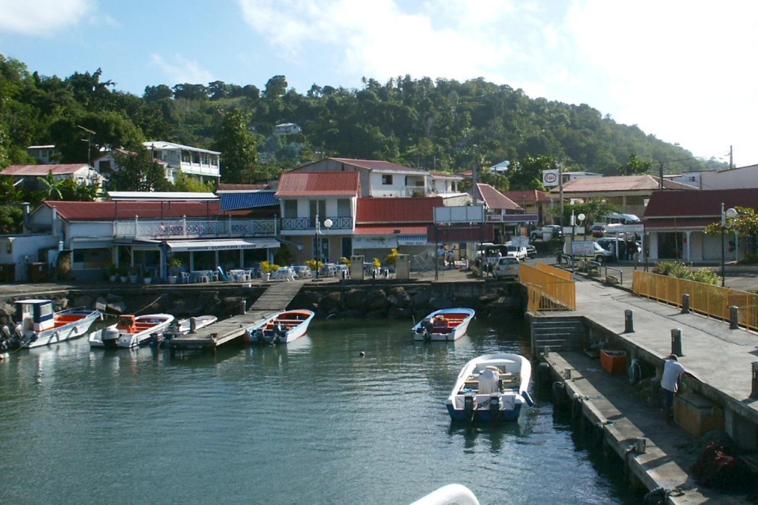
Trois-Rivières.
Trois-Rivières lies on the southern coast of Basse-Terre island and is an important ferry gateway to Les Saintes. It also has its own archaeological heritage and volcanic shoreline, so it can reward a deliberate mainland visit before or after a crossing.
Photo credits1
- Depicts: Trois-RivièresGuadeloupe06. Author: Rcdut. Credit: Own work. License: CC BY-SA 3.0 (https://creativecommons.org/licenses/by-sa/3.0). Source: https://commons.wikimedia.org/wiki/File:Guadeloupe06.JPGCropped to fit the display.
Make your way to Trois-Rivières
Choose a tool and your dates to check the options for your trip.
More ways to explore
- Country
- Guadeloupe
- Currency
- EUR
- Time zone
- America/Guadeloupe
Trois-Rivières lies on the southern coast of Basse-Terre island and is an important ferry gateway to Les Saintes. It also has its own archaeological heritage and volcanic shoreline, so it can reward a deliberate mainland visit before or after a crossing.
Separate the ferry waterfront, the town and the beach in your plan. A short connection may leave time only for boarding, while a longer stay allows the engraved-rock park and a coastal outing. The town is not the same place as Trois-Îlets in Martinique.
When to go
The generally drier January–April period can suit combining a crossing with heritage and coast. June–November is wetter, and rainfall can change the character of a coastal path. Check the forecast and ferry information even in the drier season. The town’s short position relative to Les Saintes does not make the crossing independent of sea conditions.
Getting there
CTM DEHER gives Bord de Mer in Trois-Rivières as a boarding and ticket location. FRS also publishes departures here for Terre-de-Haut and Terre-de-Bas, with the latter reached via Terre-de-Haut on its published route. Choose the correct island and verify the service on the actual date.
From Guadeloupe’s international airport, PTP, continue by road to Trois-Rivières. Allow for that mainland journey and the operator’s check-in instructions before judging whether a flight and ferry can be combined.
Getting around
Link nearby harbour-area stops on foot when time and conditions allow. The beach, accommodation on the slopes and wider southern coast may need a taxi or rental vehicle. Agree collection and return details before leaving the terminal. If taking a coastal trail, carry water and keep the full return route in mind rather than measuring only the outward distance.
Local food
Use a town or market stop to explore Guadeloupean produce and Creole cooking. Fish dishes and colombo are regional options to look for, depending on the menu. Arrange a meal before committing to a long walk or a late return from Les Saintes. A small port visit works better when food, supplies and the actual boarding deadline are considered together.
What to see
The Parc Archéologique des Roches Gravées preserves Indigenous petroglyphs among volcanic rocks and vegetation in the Bord de Mer area. It provides a view of Guadeloupe before European colonisation. Confirm present visit arrangements and leave the carvings untouched.
The town’s market and its coastal setting offer a different stop from the busy ferry boarding process. The municipal heritage route also describes coastal paths and historic remains around Grande Pointe. Treat an extended coast walk as its own activity with suitable footwear, rather than a last-minute detour before sailing.
Towns and neighbourhoods
Bord de Mer is the key reference for the passenger departure and archaeological park area. The town centre is a separate stop, and Grande-Anse beach lies farther along the coast. The surrounding slopes and southern Basse-Terre road corridor make exact addresses useful. Ask whether a lodging is near the quay, in the village or higher inland before assuming an easy walk with luggage.
Coast and outdoors
Grande-Anse is a long black-sand beach in Trois-Rivières with views toward Les Saintes. Its exposed waves and strong currents make it a place for coastal scenery rather than an assumed swimming stop; the tourism committee specifically advises against swimming. The name also occurs elsewhere in Guadeloupe, so save the Trois-Rivières location rather than navigating to another Grande-Anse.
Where to stay
A lodging near Bord de Mer is convenient for an early Les Saintes departure. A village or hillside base can suit a longer southern Basse-Terre stay, with more attention to road access. Compare the actual route to the quay, parking arrangements and meal options. Do not choose solely from the commune name when a timed ferry departure is central to the trip.
Useful before you go
Use the quay and island specified by your ferry company. Carry the requested travel documents and keep the return reservation available. At the archaeological park, follow access instructions and protect the carved rocks. Grande-Anse’s surf and currents are a reason to enjoy its scenery from shore. Guadeloupe uses the euro; confirm payment methods for local transport before setting out.
Good to know before you go
Is Grande-Anse a recommended swimming stop?
The tourism committee advises against swimming at the Trois-Rivières beach because of strong currents and waves.
What is the main cultural site?
The engraved-rock archaeological park, preserving Indigenous petroglyphs in the Bord de Mer area.
Do all ferries go to the same island?
No. Check Terre-de-Haut versus Terre-de-Bas and any intermediate stop on the chosen service.
Is this Trois-Îlets in Martinique?
No. Trois-Rivières is on Basse-Terre island in Guadeloupe.
Sources & references
These references support the guide. Confirm opening hours, access and travel services before you go.
- 01Guadeloupe public authority, tourism office or operator
- 02Guadeloupe public authority, tourism office or operator
- 03Guadeloupe public authority, tourism office or operator
- 04Guadeloupe public authority, tourism office or operator
- 05Guadeloupe public authority, tourism office or operator
- 06Guadeloupe public authority, tourism office or operator
- 07Guadeloupe public authority, tourism office or operator
- 08Guadeloupe public authority, tourism office or operator
- 09Guadeloupe public authority, tourism office or operator
Where could the journey go next?
More guides in Guadeloupe. Compare the places and check actual connections before combining stops.

Basse-Terre
Basse-Terre is Guadeloupe’s administrative capital, a coastal city on the much larger volcanic island of the same name. Its fort, market and public buildings offer a focused introduction to local history, distinct from the island’s rainforest and mountain excursions.
Get to know the place
Terre-de-Haut
Terre-de-Haut is the best-known inhabited island of Les Saintes, with a village wrapped around a broad bay and Fort Napoléon on the hill above it. The harbour, colourful houses and beaches make a compact island visit, but the terrain becomes steep away from the waterfront.
Get to know the place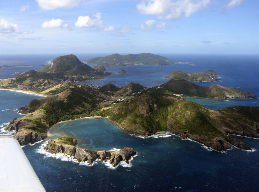 Area overview: Les Saintes
Terre-de-Bas
Terre-de-Bas is the western inhabited island of Les Saintes, south of Guadeloupe’s main islands. Its villages, pottery remains and hilly walking routes offer a different visit from the busier harbour and fort circuit on neighbouring Terre-de-Haut.
Get to know the place
Pointe-à-Pitre
Pointe-à-Pitre is Guadeloupe’s commercial and cultural city on Grande-Terre, with markets, historic streets and a working waterfront. It is a useful introduction to urban Creole life and a transport gateway, rather than a beach resort.
Get to know the placePhoto credits4
- Depicts: Basse-TerreMonts Caraïbes depuis le Fort Louis Delgrès à Basse-Terre. Author: Daniel Jolivet. Credit: https://www.flickr.com/photos/sybarite48/5611245400/. License: CC BY 2.0 (https://creativecommons.org/licenses/by/2.0). Source: https://commons.wikimedia.org/wiki/File:Monts_Cara%C3%AFbes_depuis_le_Fort_Louis_Delgr%C3%A8s_%C3%A0_Basse-Terre.jpgCropped to fit the display.
- Depicts: Terre-de-HautEglise de Terre-de-Haut. Author: UHF. Credit: Own work. License: CC BY-SA 3.0 (https://creativecommons.org/licenses/by-sa/3.0). Source: https://commons.wikimedia.org/wiki/File:Eglise_de_Terre-de-Haut.jpgCropped to fit the display.
- Area image: Les Saintes — Area overview: Les SaintesLes Saintes vues avion. Author: Original uploader was Vilars at fr.wikipedia. Credit: Transferred from fr.wikipedia ; transferred to Commons by User:Bloody-libu using CommonsHelper .. License: CC BY-SA 1.0 (https://creativecommons.org/licenses/by-sa/1.0). Source: https://commons.wikimedia.org/wiki/File:Les_Saintes_vues_avion.jpgCropped to fit the display.
- Depicts: Pointe-à-PitrePointe-à-Pitre. Author: Zivax. Credit: Own work. License: CC BY-SA 3.0 (https://creativecommons.org/licenses/by-sa/3.0). Source: https://commons.wikimedia.org/wiki/File:Pointe-%C3%A0-Pitre.JPGCropped to fit the display.
