
Terre-de-Haut.
Terre-de-Haut is the best-known inhabited island of Les Saintes, with a village wrapped around a broad bay and Fort Napoléon on the hill above it. The harbour, colourful houses and beaches make a compact island visit, but the terrain becomes steep away from the waterfront.
Photo credits1
- Depicts: Terre-de-HautEglise de Terre-de-Haut. Author: UHF. Credit: Own work. License: CC BY-SA 3.0 (https://creativecommons.org/licenses/by-sa/3.0). Source: https://commons.wikimedia.org/wiki/File:Eglise_de_Terre-de-Haut.jpgCropped to fit the display.
Make your way to Terre-de-Haut
Choose a tool and your dates to check the options for your trip.
More ways to explore
- Country
- Guadeloupe
- Currency
- EUR
- Time zone
- America/Guadeloupe
Terre-de-Haut is the best-known inhabited island of Les Saintes, with a village wrapped around a broad bay and Fort Napoléon on the hill above it. The harbour, colourful houses and beaches make a compact island visit, but the terrain becomes steep away from the waterfront.
A day can combine village life, the fort and one beach without rushing. An overnight stay allows time for a longer walk or a quieter evening after the excursion boats leave. Neighbouring Terre-de-Bas and Îlet à Cabrit are separate islands, requiring another boat journey.
When to go
January to April is generally the drier part of Guadeloupe’s tropical year; June to November is wetter according to Météo-France. Fort and hill walks remain exposed to heat even outside the wetter period. Plan water activities with the day’s wind and sea state in mind. The season can suggest a style of visit, but it cannot guarantee a crossing or a clear view.
Getting there
CTM DEHER serves Les Saintes from Trois-Rivières and Basse-Terre. FRS publishes a Trois-Rivières route to Terre-de-Haut, with some journeys continuing toward Terre-de-Bas. Check the service and the island shown on your ticket, particularly when combining separate bookings.
The usual international-air journey through Guadeloupe requires a road transfer from the airport to the mainland ferry port, followed by the sea crossing. Do not plan a tight flight-to-boat connection based only on the short distance across the water.
Getting around
Walk the village and nearby streets, then assess hills and distance for a longer outing. The tourism committee lists bicycle, scooter and electric-cart rentals; confirm availability and any requirements with the provider. Small vehicles help with distances but do not remove steep approaches or the need to park considerately. A water taxi or another boat is needed for the neighbouring islands.
Local food
Tourment d’amour is the pastry strongly associated with Les Saintes, traditionally featuring coconut filling. It makes a useful local snack while exploring the village. Fish, accras and Creole cooking provide more substantial options. Ask what is available that day and arrange a meal around your activities rather than assuming a particular restaurant or menu will be available after a long walk.
What to see
Fort Napoléon brings together a nineteenth-century fortress, a museum and a garden of cacti and other plants, with views over the bay. Allow time for the uphill approach and confirm current admission arrangements before setting out.
In the village, look at the colourful houses, the church of Notre-Dame-de-l’Assomption and the seaside cemetery. These are part of a living community with fishing traditions, not simply a resort backdrop. Îlet à Cabrit has remains associated with the bay’s defensive and penal history, but visiting it requires a separate organised sea outing.
Towns and neighbourhoods
The village and harbour form the practical centre for arrival, meals and supplies. Fort Napoléon is uphill from that centre, while the Chameau high ground is another walking objective. Pompierre and Pain de Sucre are distinct beach areas, not neighbouring sections of the ferry quay. Choose a manageable circuit and allow for slopes before agreeing a vehicle rental or setting out on foot.
Coast and outdoors
Pain de Sucre lies below its distinctive rocky headland and is known for snorkelling when conditions permit. Pompierre provides a different palm-framed setting, and Anse Crawen offers another natural cove. None should be described as guaranteed calm or suitable for every swimmer. Check local water conditions, and leave yourself enough time to return from the beach before the boat’s check-in deadline.
Where to stay
The village is convenient for the harbour, meals and basic supplies. Accommodation toward Pompierre offers a different coastal setting, while other hillside or bay properties require closer attention to their access route. Check gradients and luggage arrangements, not just straight-line distance. Staying overnight gives the fort, beaches and village more breathing room than an itinerary tied to a single afternoon return.
Useful before you go
Confirm the fort’s current visiting hours and your boat’s boarding deadline before planning the order of the day. Bring water for exposed walks and check how a small provider accepts payment; Guadeloupe uses the euro. Keep the islands’ names distinct when booking transport. Leave marine life undisturbed and stay within suitable, locally advised swimming and walking areas.
Good to know before you go
Can the main highlights fit into a day?
A village walk, the fort and one beach can make a focused day, provided the actual sailing and visit times allow it.
Is Terre-de-Bas part of the same island?
No. It is a separate inhabited island in Les Saintes and needs a sea crossing.
What food is particularly associated with Les Saintes?
Tourment d’amour, the small pastry traditionally made with coconut filling.
Is the fort beside the ferry quay?
It is on a hill above the village. Allow for the climb or arrange local transport and check current access.
Sources & references
These references support the guide. Confirm opening hours, access and travel services before you go.
- 01Local authority, tourism committee or ferry operator
- 02Local authority, tourism committee or ferry operator
- 03Local authority, tourism committee or ferry operator
- 04Local authority, tourism committee or ferry operator
- 05Local authority, tourism committee or ferry operator
- 06Local authority, tourism committee or ferry operator
Where could the journey go next?
More guides in Guadeloupe. Compare the places and check actual connections before combining stops.
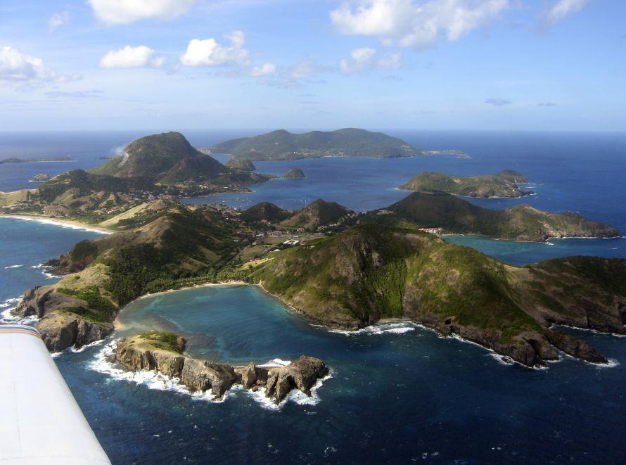 Area overview: Les Saintes
Terre-de-Bas
Terre-de-Bas is the western inhabited island of Les Saintes, south of Guadeloupe’s main islands. Its villages, pottery remains and hilly walking routes offer a different visit from the busier harbour and fort circuit on neighbouring Terre-de-Haut.
Get to know the place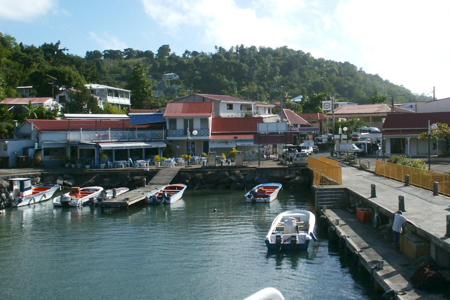
Trois-Rivières
Trois-Rivières lies on the southern coast of Basse-Terre island and is an important ferry gateway to Les Saintes. It also has its own archaeological heritage and volcanic shoreline, so it can reward a deliberate mainland visit before or after a crossing.
Get to know the place
Basse-Terre
Basse-Terre is Guadeloupe’s administrative capital, a coastal city on the much larger volcanic island of the same name. Its fort, market and public buildings offer a focused introduction to local history, distinct from the island’s rainforest and mountain excursions.
Get to know the place
Grand-Bourg, Marie-Galante
Grand-Bourg is a harbour town and a useful starting point for Marie-Galante, the low limestone island southeast of Guadeloupe’s main islands. Sugar-growing landscapes and plantation heritage distinguish a visit here from the volcanic mountain routes of Basse-Terre.
Get to know the placePhoto credits4
- Area image: Les Saintes — Area overview: Les SaintesLes Saintes vues avion. Author: Original uploader was Vilars at fr.wikipedia. Credit: Transferred from fr.wikipedia ; transferred to Commons by User:Bloody-libu using CommonsHelper .. License: CC BY-SA 1.0 (https://creativecommons.org/licenses/by-sa/1.0). Source: https://commons.wikimedia.org/wiki/File:Les_Saintes_vues_avion.jpgCropped to fit the display.
- Depicts: Trois-RivièresGuadeloupe06. Author: Rcdut. Credit: Own work. License: CC BY-SA 3.0 (https://creativecommons.org/licenses/by-sa/3.0). Source: https://commons.wikimedia.org/wiki/File:Guadeloupe06.JPGCropped to fit the display.
- Depicts: Basse-TerreMonts Caraïbes depuis le Fort Louis Delgrès à Basse-Terre. Author: Daniel Jolivet. Credit: https://www.flickr.com/photos/sybarite48/5611245400/. License: CC BY 2.0 (https://creativecommons.org/licenses/by/2.0). Source: https://commons.wikimedia.org/wiki/File:Monts_Cara%C3%AFbes_depuis_le_Fort_Louis_Delgr%C3%A8s_%C3%A0_Basse-Terre.jpgCropped to fit the display.
- Depicts: Grand-Bourg, Marie-GalanteMarie-Galante. Ma case chez Madame Chéri (1895) / [photogr.] A. S[alles]. Author: Salles, André (1860-1929). Photographe. Credit: Bibliothèque nationale de France. License: Public domain (https://creativecommons.org/publicdomain/mark/1.0/). Source: https://commons.wikimedia.org/wiki/File:Marie-Galante._Ma_case_chez_Madame_Ch%C3%A9ri_(1895)_-_(photogr.)_A._S(alles)_-_btv1b53185929z_(1_of_3).jpg
