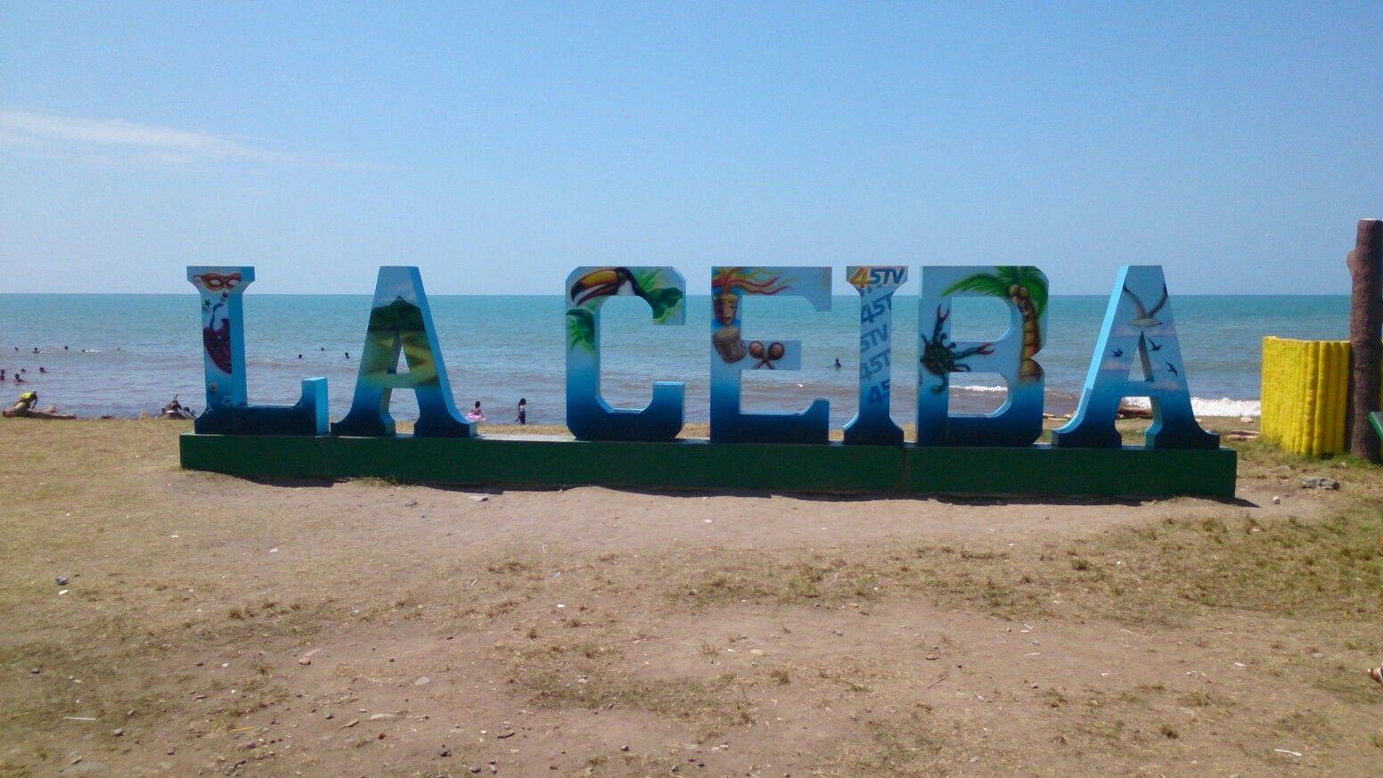
La Ceiba.
La Ceiba combines an urban Caribbean waterfront with access to Pico Bonito National Park and the Cangrejal River valley. The mountains of Nombre de Dios rise behind a city shaped by the banana trade. Its useful role as a transport base need not be the whole visit: allow time for rainforest scenery, river activities and the coastal communities nearby.
Photo credits1
- Depicts: La CeibaLetras de La Ceiba. Author: InterCoined. Credit: https://intercoined.com/school-locations/honduras/la-ceiba/. License: CC BY-SA 4.0 (https://creativecommons.org/licenses/by-sa/4.0). Source: https://commons.wikimedia.org/wiki/File:Letras_de_La_Ceiba.jpgCropped to fit the display.
Make your way to La Ceiba
Choose a tool and your dates to check the options for your trip.
More ways to explore
- Country
- Honduras
- Currency
- HNL
- Time zone
- America/Tegucigalpa
La Ceiba combines an urban Caribbean waterfront with access to Pico Bonito National Park and the Cangrejal River valley. The mountains of Nombre de Dios rise behind a city shaped by the banana trade. Its useful role as a transport base need not be the whole visit: allow time for rainforest scenery, river activities and the coastal communities nearby.
It is the mainland gateway for ferries to Roatán and Utila, so a stay can pair nature activities with island connections. Choose between a city hotel for practical transport and a lodge in the Cangrejal valley for a more immersive forest setting. They are different bases, and a valley address needs a planned transfer to the passenger port.
When to go
La Ceiba is warm and rainy, with particularly heavy average rainfall in October–December and a decline after January in the city's documented climate profile. That is a broad pattern, not a forecast. Leave flexibility for ferry changes and outdoor plans. Whitewater routes also change with river level, so check conditions even in a relatively drier period.
Getting there
Golosón Airport (LCE) serves La Ceiba; verify the flight route and date with the airline. Galaxy Wave's La Ceiba terminal is beside the municipal Cabotage Dock in the east of the city. Dream Ferries also identifies the Cabotage Dock for island departures. Confirm the company entrance and check-in requirements, allowing a separate transfer from the airport or road arrival point.
Getting around
Arrange a reliable taxi or lodge transfer for the port, airport and valley. Confirm the fare and exact pickup before departure. An organised excursion can combine transport with the appropriate river or forest guide. Avoid building a tight same-day connection between a rafting trip and the last island boat; weather and roads can alter both stages.
Local food
Try a baleada: a wheat-flour tortilla with mashed beans and cheese, often with added cream, egg, avocado or meat. La Ceiba has a strong association with this everyday Honduran food. In Garífuna coastal communities, explore local seafood and coconut-based cooking with hosts. Ask about the ingredients and the day's availability rather than relying on a fixed menu or an invented restaurant rating.
What to see
Pico Bonito offers forest walks and birdwatching, with a recognised visitor access in the Cangrejal basin. El Bejuco waterfall is a guided hiking option; ask about the trail and conditions. The Cangrejal also has whitewater rafting, with different sections and difficulty levels. Choose a route with the operator according to experience and river conditions, not just the shortest advertised duration.
Towns and neighbourhoods
Central La Ceiba provides urban services, while the valley road toward Yaruca leads to riverside lodges and adventure operators around El Naranjo. Sambo Creek, east along the coast, is a Garífuna community and a departure area for Cayos Cochinos outings. The Cabotage Dock is a separate transport destination in eastern La Ceiba; a central hotel is not necessarily beside your ferry.
Coast and outdoors
Paseo de los Ceibeños is an urban beachside public space, distinct from a reef excursion offshore. For Cayos Cochinos, arrange a boat with a reputable operator and confirm the departure point, protected-area arrangements and return. Wind and rain can cancel the outing. Ask locally about swimming conditions; a waterfront view alone does not establish safe bathing.
Where to stay
Choose a city property with suitable security and an arranged port transfer for a short ferry stopover. The Cangrejal valley suits a stay focused on rafting, waterfalls and forest, with meals and transport checked in advance. Sambo Creek offers a coastal community setting. Compare the exact location with your activities, rather than choosing solely on the label La Ceiba.
Useful before you go
Official Canadian advice identifies significant violent-crime concerns in La Ceiba. Use reputable operators and accommodation with good security, and arrange transport rather than wandering unfamiliar areas after dark. For excursions, carry water, insect repellent, rain protection and suitable footwear. Confirm the safety briefing and equipment for river activities, and follow cancellation decisions when conditions deteriorate.
Good to know before you go
Are the island ferries at the central waterfront promenade?
Use your operator’s Cabotage Dock terminal in eastern La Ceiba. Do not confuse the passenger port with the city’s leisure waterfront.
Should I stay in the city or Cangrejal valley?
The city is practical for ferry logistics; the valley is better placed for rainforest and river activities. Arrange transfers for either.
Is Cangrejal rafting the same for every participant?
No. River sections differ in difficulty and suitability changes with conditions. Discuss experience and requirements with the operator.
Can I count on a Cayos Cochinos departure every day?
No. It is a weather-dependent excursion. Confirm the sea conditions, departure point and return before committing to onward travel.
Sources & references
These references support the guide. Confirm opening hours, access and travel services before you go.
- 01Honduras tourism: Pico Bonito visitor access
- 02Omega Tours: actual river and waterfall activities
- 03Omega Tours: Cangrejal valley lodge location
- 04Visita Atlantida: Sambo Creek coastal community and boat access
- 05Visita Atlantida: La Ceiba geography and banana history
- 06Visita Atlantida: first-hand Paseo de los Ceibenos account
- 07Visita Atlantida: baleada ingredients
- 08La Ceiba project environmental profile hosted by World Bank
- 09Galaxy Wave: exact La Ceiba and Roatan terminals
- 10Dream Ferries: routes and terminal locations
- 11SAN airport operator: Goloson LCE identification
- 12Government of Canada: La Ceiba, transport and outdoor advice
Where could the journey go next?
More guides in Honduras. Compare the places and check actual connections before combining stops.

Utila
Utila lies at the western end of Honduras’s Bay Islands, with a small-island rhythm centred on diving, waterfront accommodation and boat connections. Its reefs offer varied underwater terrain, but you do not have to spend the whole stay underwater: forest, mangroves and conservation projects reveal another side of the island.
Get to know the place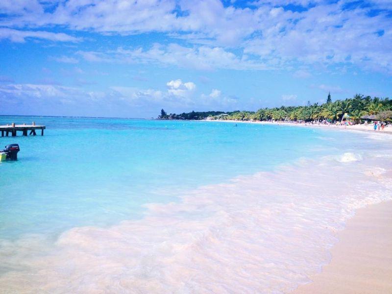
Roatán
Roatán stretches through the Bay Islands off Honduras, with a hilly interior and communities along a reef-fringed coast. Its west offers two distinct holiday settings: the waterfront village of West End and the resort beach of West Bay. Choose your base around the kind of days you want, from diving and village meals to a beachfront stay.
Get to know the placePhoto credits2
- Depicts: UtilaRoad Near Munchies, Utila, Honduras. Author: Hoffryan at English Wikipedia. Credit: Transferred from en.wikipedia to Commons.. License: Public domain (https://creativecommons.org/publicdomain/mark/1.0/). Source: https://commons.wikimedia.org/wiki/File:Road_Near_Munchies,_Utila,_Honduras.jpg
- Depicts: RoatánWestbay2106. Author: Westbrowncanada. Credit: Roatan. License: CC BY-SA 3.0 (https://creativecommons.org/licenses/by-sa/3.0). Source: https://commons.wikimedia.org/wiki/File:Westbay2106.jpgCropped to fit the display.
