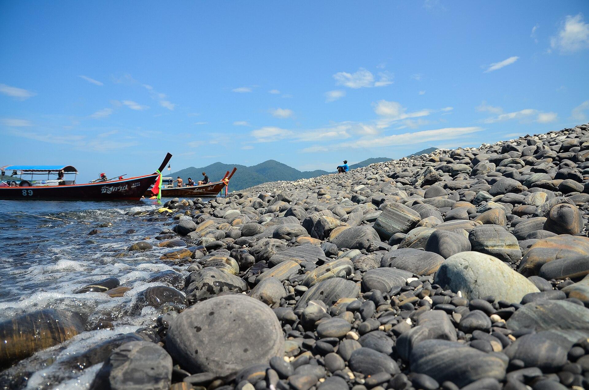
Koh Bulon Lae.
Koh Bulon Lae, also written Bulon Le, is a small inhabited island off Satun with sandy eastern beaches, forest and a quiet bungalow scene. Its scale rewards unhurried walking and time by the water. The experience is quite different from a large resort town with roads, shopping streets and organised nightlife.
Photo credits1
- Area image: Tarutao National Park, Satun provinceTaRuTao11. Author: Toey19863. Credit: Own work. License: CC BY-SA 4.0 (https://creativecommons.org/licenses/by-sa/4.0). Source: https://commons.wikimedia.org/wiki/File:TaRuTao11.jpgCropped to fit the display.
Make your way to Koh Bulon Lae
Choose a tool and your dates to check the options for your trip.
More ways to explore
- Country
- Thailand
- Currency
- THB
- Time zone
- Asia/Bangkok
Koh Bulon Lae, also written Bulon Le, is a small inhabited island off Satun with sandy eastern beaches, forest and a quiet bungalow scene. Its scale rewards unhurried walking and time by the water. The experience is quite different from a large resort town with roads, shopping streets and organised nightlife.
This guide concerns Bulon Lae itself. Bulon Don and Bulon Maiphai are neighbouring islands with their own landscapes and communities, not interchangeable names for the same landing. When choosing accommodation, consider both the beach you want and the physical journey from boat to room.
When to go
Bulon’s boat-based holiday depends on Andaman weather, with more difficult marine conditions during the southwest monsoon. Check accommodation operation, boat availability and current park restrictions for your actual dates. The resort’s October update is useful recent information, but neither a website timetable nor a general dry-season description guarantees a particular departure.
Getting there
Pak Bara is the documented mainland boat gateway. From Trang or Hat Yai, arrange the road journey there and the island boat as connected parts of the plan. Bulonhill explains that passengers transfer from the speedboat to a longtail for beach access. Ask whether this last leg is included and describe any mobility or heavy-luggage needs before booking.
Getting around
Walking is central to the stay. When rough conditions require arrival at Panka Bay, Bulonhill describes a walk over the hill and a separate luggage arrangement for its guests. Confirm what your own host provides. Wear suitable footwear for the cross-island path and take a torch for an evening return, rather than expecting a vehicle waiting at a conventional terminal.
Local food
Meal plans need a little attention on a small island. Bulonhill’s page, dated October 2026, says its own restaurant currently serves breakfast only and points to nearby restaurants for lunch and dinner. Confirm the arrangement again for your stay and ask hosts where to eat that evening. Do not assume every bungalow business provides a full daily meal service.
What to see
The island’s eastern shore and forested western part provide its main contrast. Mango Bay is another local outing described by the island accommodation source. For a wider excursion, TAT’s brochure distinguishes Bulon Don’s Urak Lawoi community and the nearby Hin Khao reef area. Any such trip needs a local operator and a return plan suited to the day’s sea.
Towns and neighbourhoods
The white-sand eastern coast is the best-known visitor frontage. Panka Bay is a separate landing alternative when conditions prevent boats using that side, while Panka Yai also appears in TAT’s sunset suggestions. Ask for the specific bay name rather than treating every “Bulon” drop-off as a short, level walk to your bungalow.
Coast and outdoors
Spend time on the eastern sand and explore another bay on foot when the path and weather permit. The local resort identifies reefs off the Bulone and Pansand areas, but that does not guarantee safe entry at every tide. Get advice before snorkelling, float clear of coral and keep away from boat approaches. Leave small shore animals undisturbed.
Where to stay
Choose between a beach-front setting and bungalows slightly inland or uphill, paying attention to steps and the last walk. Bulonhill, behind the Bulone area, is one documented example of the latter. Check electricity hours, ventilation and Wi-Fi location with the actual property: its generator and restaurant-only internet arrangements are specific to that accommodation, not universal island rules.
Useful before you go
Bring a torch, cash, essential medicines and a power bank from the mainland. Bulonhill explicitly states that its bungalow groundwater is not drinking water, so clarify drinking-water provision wherever you stay. Keep luggage manageable for the small-boat transfer, and agree your departure the previous day instead of depending on an open ticket without reconfirmation.
Good to know before you go
Is Bulon Lae the same as Bulon Don?
No. They are different islands; specify Bulon Lae or Bulon Le for this guide.
Does the speedboat go directly to a pier?
The local accommodation describes a longtail transfer from the speedboat to the beach.
Can weather change the landing?
Yes. Panka Bay is a documented alternative, with a hill walk that may affect luggage and mobility plans.
Will my bungalow include all meals?
Check directly. Bulonhill currently advertises breakfast only, with other restaurants for later meals.
Is electricity available all day everywhere?
Facilities vary by property. Ask about power, cooling, drinking water and internet before choosing a room.
Sources & references
These references support the guide. Confirm opening hours, access and travel services before you go.
- 01First-party October 2026: east beaches, Mango Bay and island setting
- 02First-party October 2026: Pak Bara approach, longtail beach transfer and Panka alternative; times/prices not promised
- 03First-party October 2026: breakfast-only operation and nearby lunch/dinner alternatives
- 04First-party October 2026: property-specific generator, non-drinking groundwater and Wi-Fi limits
- 05TAT overseas-office brochure: Bulon Le, White Sand Beach, Panka Yai and distinct neighbouring Bulon islands; old prices excluded
- 06TAT overseas-office Satun brochure, indexed text reviewed: Bulon reefs and Mu Ko Phetra context; full fetch timed out
- 07TAT: monsoon and marine safety context, not old closure rules
Where could the journey go next?
More guides in Thailand. Compare the places and check actual connections before combining stops.
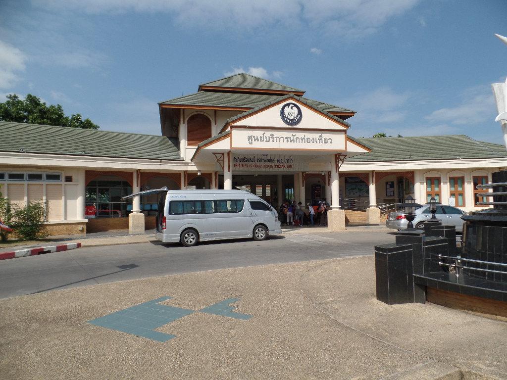
Pak Bara
Pak Bara is a mainland coastal base in La-ngu district, best known for boats toward Koh Lipe. It is worth separating the road transfer, company check-in and sea crossing in your plans. The island’s beaches and coral trips are onward experiences, not attractions inside this departure town.
Get to know the place
Koh Lipe
Koh Lipe is a small inhabited island in Satun’s southern Andaman archipelago, with beach accommodation, reef outings and a lively Walking Street. It is a base for visiting nearby islands, rather than a place where every attraction in Tarutao National Park can be reached on foot.
Get to know the place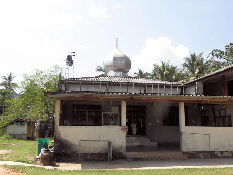
Koh Libong
Koh Libong is Trang’s largest island, with fishing settlements, rubber plantations, mangroves and shallow seagrass waters. Its character comes from that inhabited coastal landscape as much as from a beach. A visit suits travellers interested in village life, slow journeys and the habitat of the dugong.
Get to know the place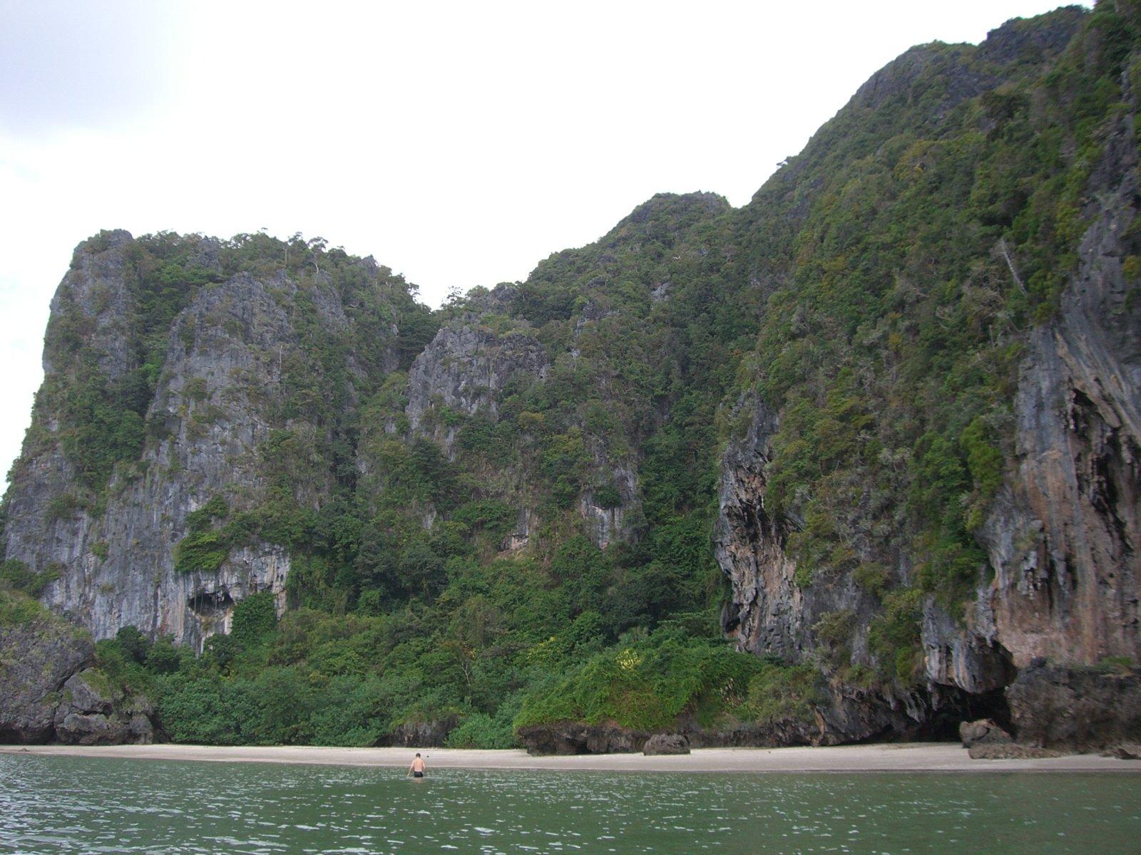 Area near Hat Yao Pier (Trang)
Hat Yao Pier (Trang)
Hat Yao Pier is a mainland departure point on the Trang coast, near the long beach of the same name in the Ban Chao Mai area. This guide covers the pier and a useful coastal stop before or after a crossing. It is distinct from Koh Libong, the island reached across the water, and from other Thai beaches called Hat Yao.
Get to know the placePhoto credits4
- Depicts: Pak BaraPak Bara Ferry Pier. Author: Seligne. Credit: Own work. License: CC BY-SA 4.0 (https://creativecommons.org/licenses/by-sa/4.0). Source: https://commons.wikimedia.org/wiki/File:Pak_Bara_Ferry_Pier.JPGCropped to fit the display.
- Depicts: Koh LipeKoh Lipe island coast. Author: VascoPlanet World Photography. Credit: Thailand island images. License: CC BY 3.0 (https://creativecommons.org/licenses/by/3.0). Source: https://commons.wikimedia.org/wiki/File:Koh_Lipe_island_coast.jpgCropped to fit the display.
- Depicts: Koh LibongMosque in Koh Libong. Author: Hanumann. Credit: https://www.flickr.com/photos/40883475@N00/5428856970/. License: CC BY 2.0 (https://creativecommons.org/licenses/by/2.0). Source: https://commons.wikimedia.org/wiki/File:Mosque_in_Koh_Libong.jpgCropped to fit the display.
- Area image: Hat Chai Mao beach, Kantang district , Trang province, Thailand — Area near Hat Yao Pier (Trang)Hat Chai Mao beach, Kantang, Trang, Thailand (Hat Apo, by zhaffsky, Flickr ID 3565756415). Author: S Z. Credit: https://www.flickr.com/photos/zhaffsky/3565756415/. License: CC BY-SA 2.0 (https://creativecommons.org/licenses/by-sa/2.0). Source: https://commons.wikimedia.org/wiki/File:Hat_Chai_Mao_beach,_Kantang,_Trang,_Thailand_(Hat_Apo,_by_zhaffsky,_Flickr_ID_3565756415).jpgCropped to fit the display.
